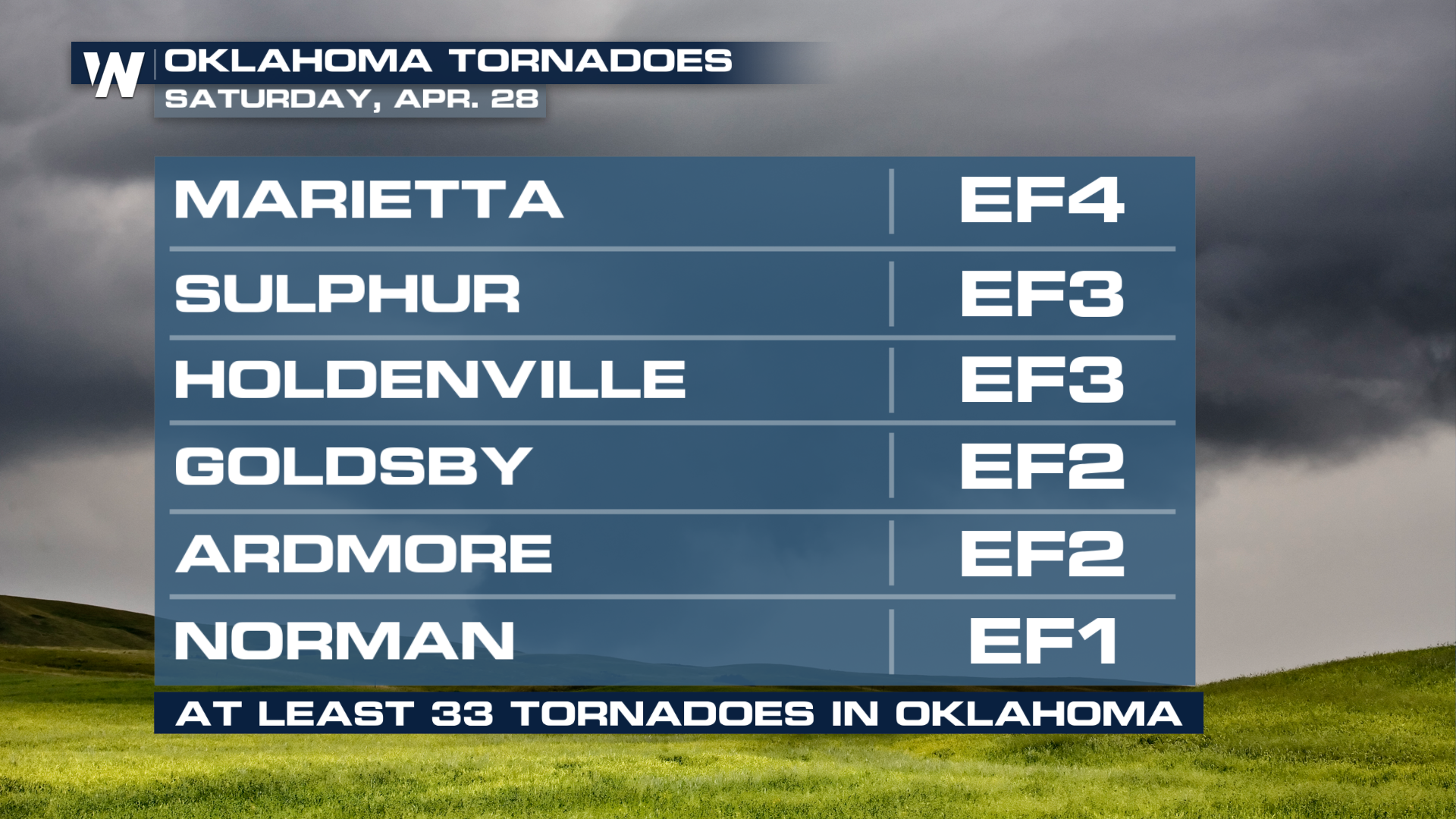
At Least 33 Tornadoes Reported in Oklahoma this Weekend

UPDATE: The National Weather Service out of Norman, Oklahoma, has upgraded the rating of the Marietta tornado to EF-4 with estimated peak winds of 165-170 mph, a path length of 27 miles, and a path width of 900 yards. Unfortunately, this tornado brought at least one fatality to Love County. This tornado developed southwest of Marietta and moved north-northeast over I-25 before moving into Marietta towards Lake Murray and Dickson.
Here's a look at the destruction our field corresponded Brandon Clement observed upon daylight on Sunday.
The town of Sulphur, OK also took a direct hit from a destructive tornado on Saturday night, with a rating of at least EF3. According to the NWS, estimated peak winds were 160-165 mph, path length was 7.5 miles, and width was 440 yards. Our Field Correspondent, Brandon Clement, took this video earlier in the day:
Related articles: Destructive Tornadoes Tear Through Plains Friday and Severe Weather Threat Makes it to the Gulf Coast
According to the National Weather Service, at least 33 tornadoes have been confirmed from Saturday in Oklahoma alone.
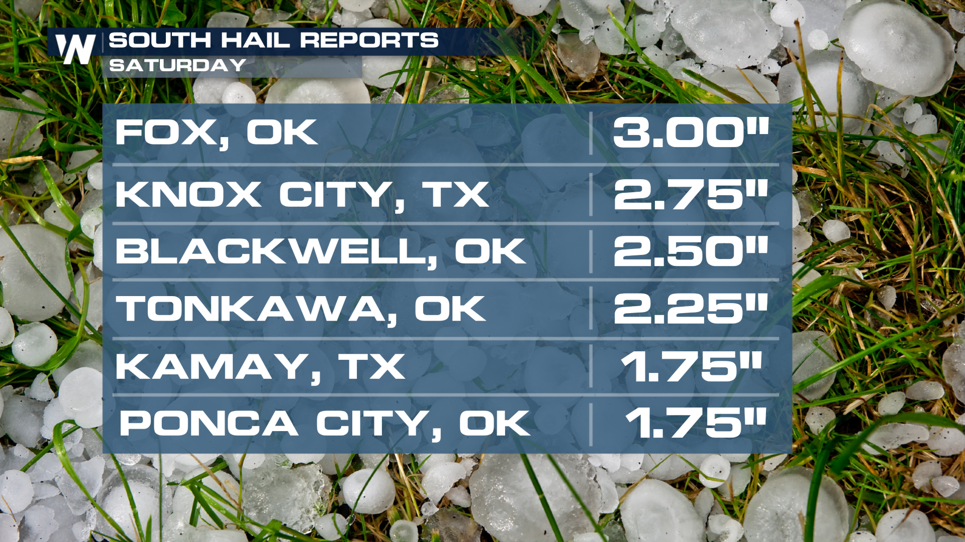
 The hail was large and damaging, along with the strong wind gusts and the confirmed tornadoes that touched down. About teacup-sized hail fell in Fox, OK on Saturday, and we're sure that hailstones that large will easily cause damage.
 This is a terrifying view of a tornado touching down in the rural area of Kendall, KS. You can easily see its wide base on the ground, along with much of the dust and debris that was picked up.


