More Rain & Snow for the West Coast

Additional snowfall is moving through California and Oregon through Wednesday and winter weather alerts remain in effect for both states and into Idaho for low visibility and accumulating snow leading to storm totals of up to a foot. In addition to the snow, bands of rain will bring quick downpours to the coast and valleys, and isolated thunderstorms are possible too.
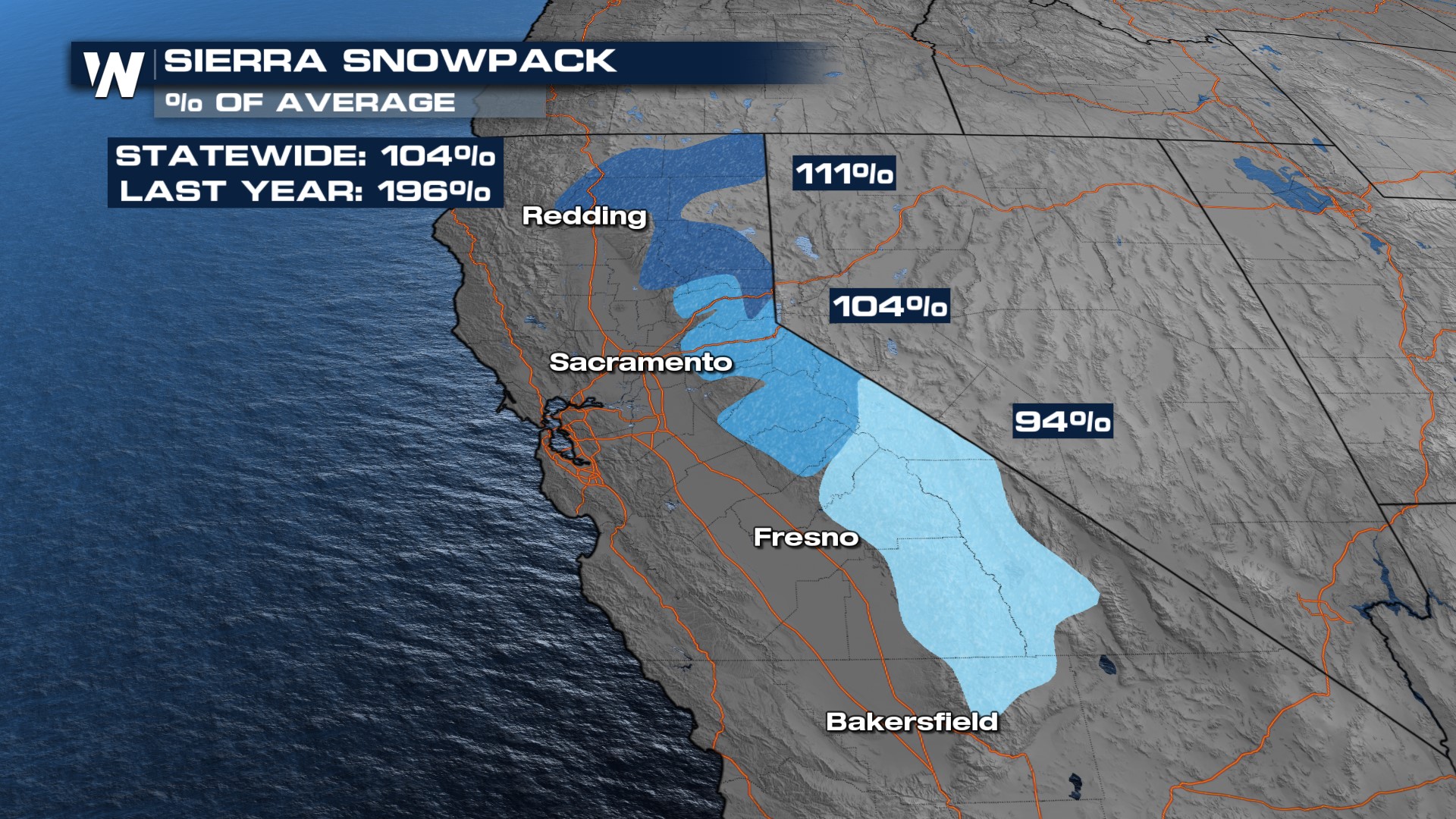
Snowfall totals could be up to a foot but it won't be anything like we saw over the weekend. The highest snowfall totals will be for the southern Cascades. Meanwhile, the coastal regions will see more meaningful precipitation as heavy rain, upwards of 4" isolated along the coast through Wednesday. The recent snowfall has been beneficial - the snowpack in the central and northern Sierra is now over 100% of normal!
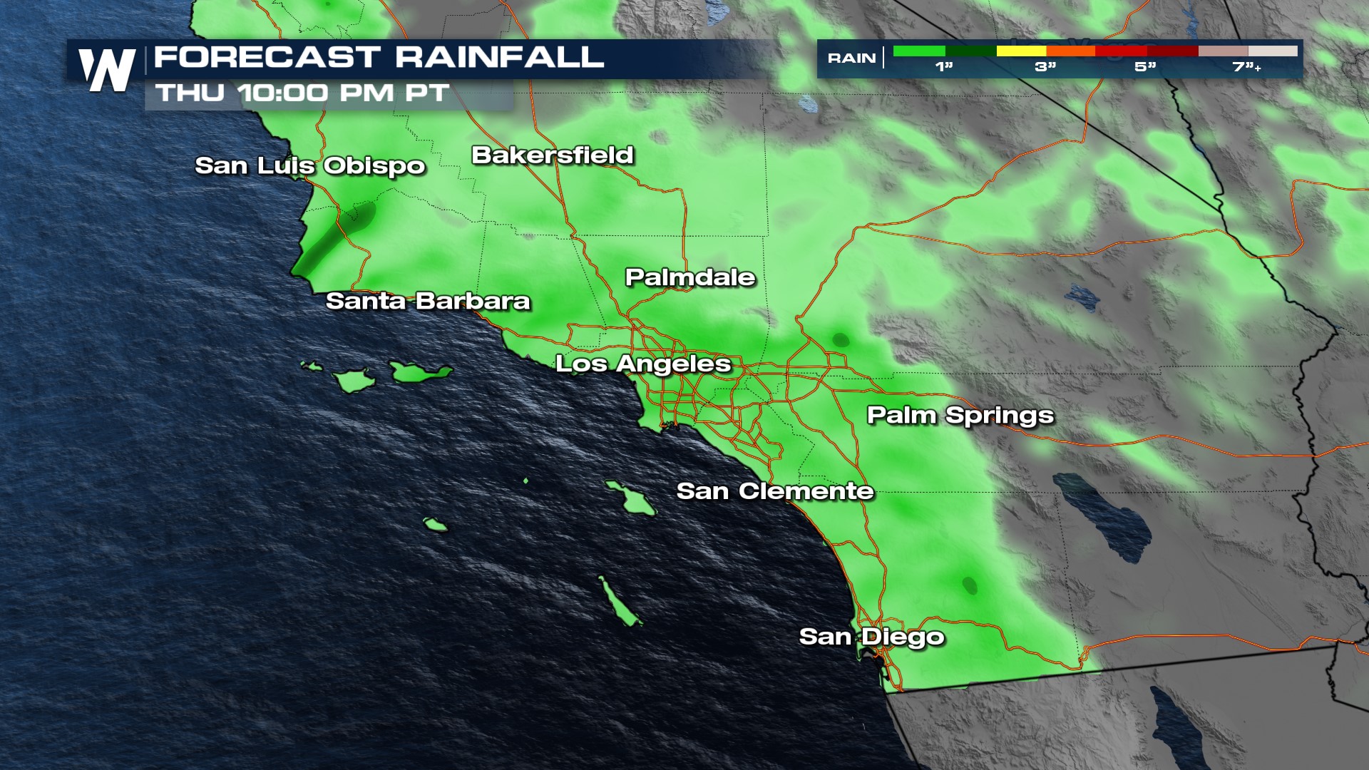
 Another low-pressure system will slide onto the West Coast but will favor southern California with showers, storms, and new rainfall on Wednesday. The steady rain continues through Thursday around a cold front. This won't be an atmospheric river but instead a quick-moving storm system that could produce a quick 1-2" of rainfall.
Expect higher rainfall totals in the foothills and valleys. Pay attention to weather alerts, especially if you live in or near the desert. There's a chance for some pockets of rain/storms to produce enough of a downpour to warrant flooding concerns.