Tornado and Damaging Wind Threat in the Deep South
Special Stories
18 Apr 2019 10:15 AM
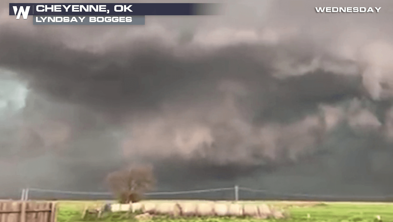
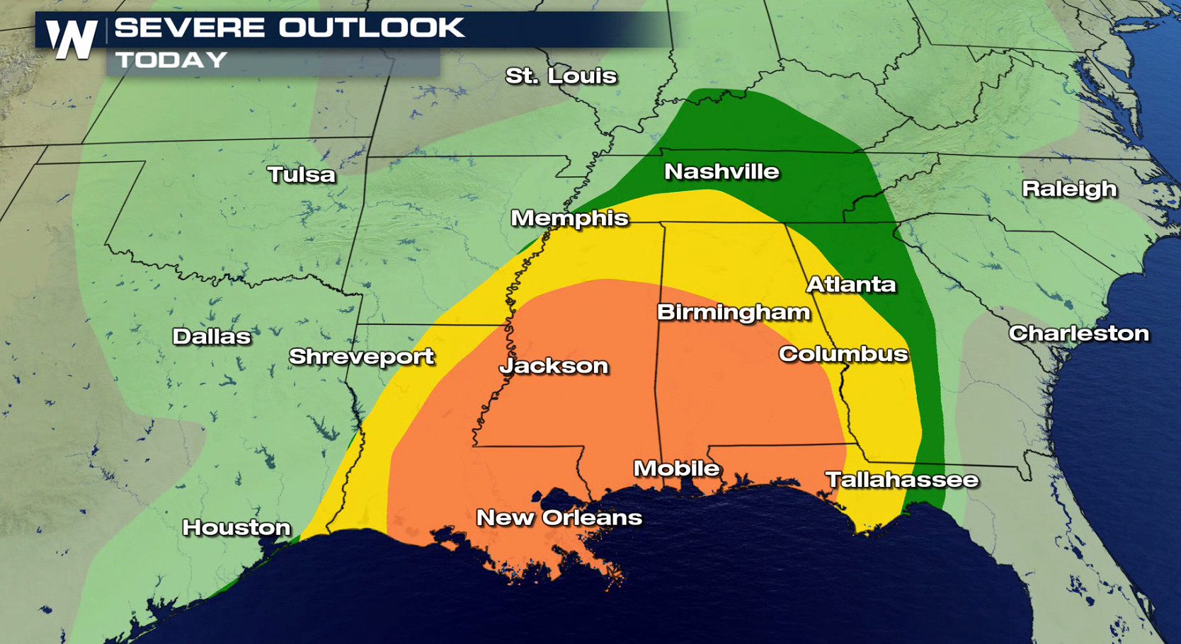
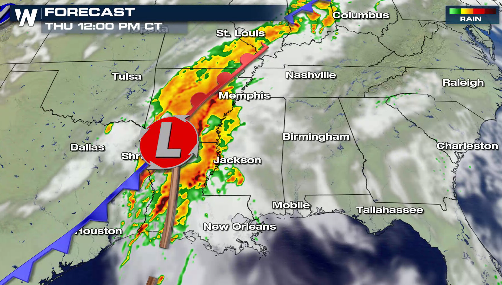
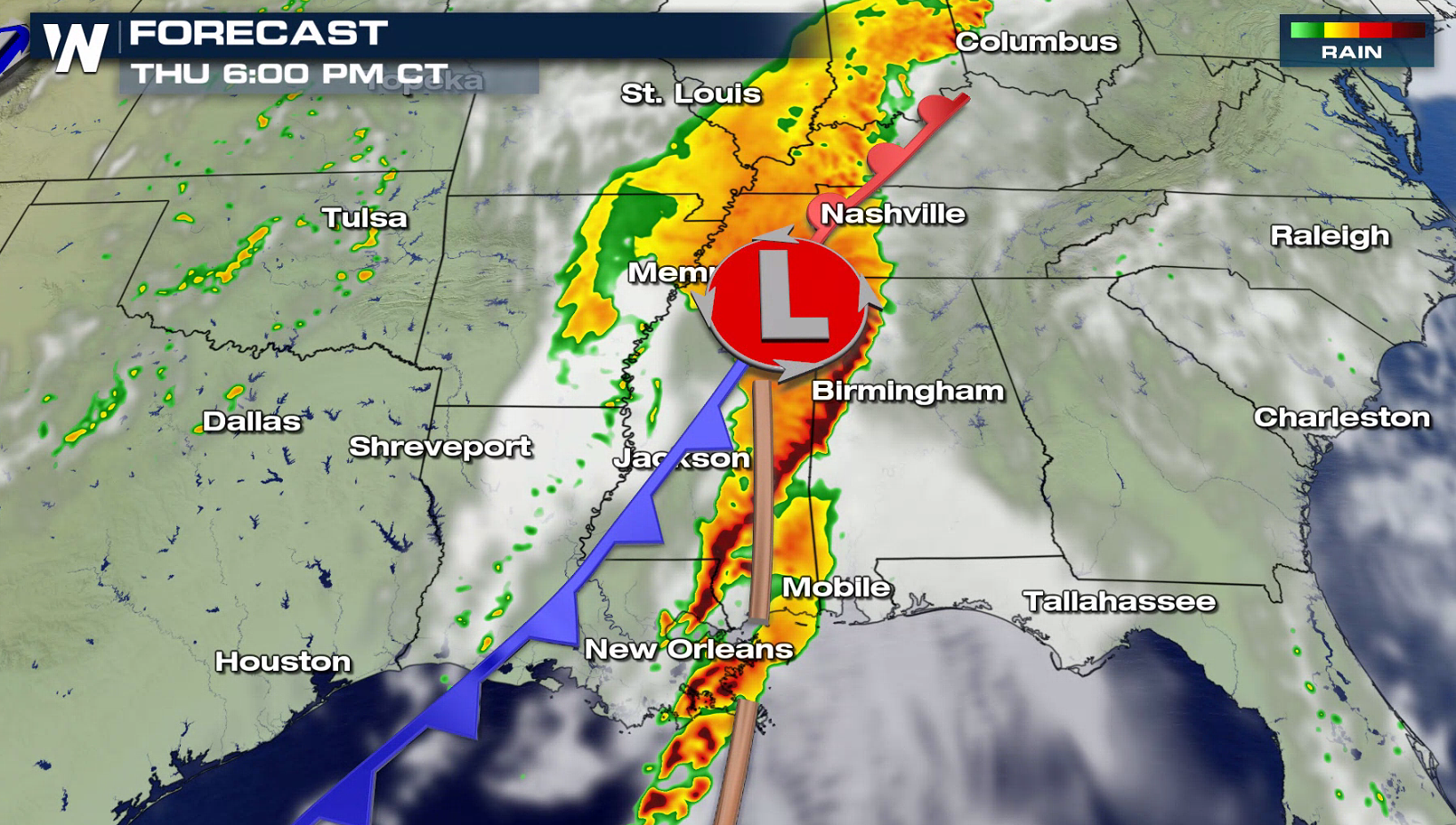
A widespread area of the Deep South and Tennessee Valley will have the potential to see severe thunderstorms today (Thursday). From the Ohio River to the Gulf of Mexico, large hail, damaging winds, and tornadoes are possible. The risk is enhanced from Louisiana to the Florida Panhandle.
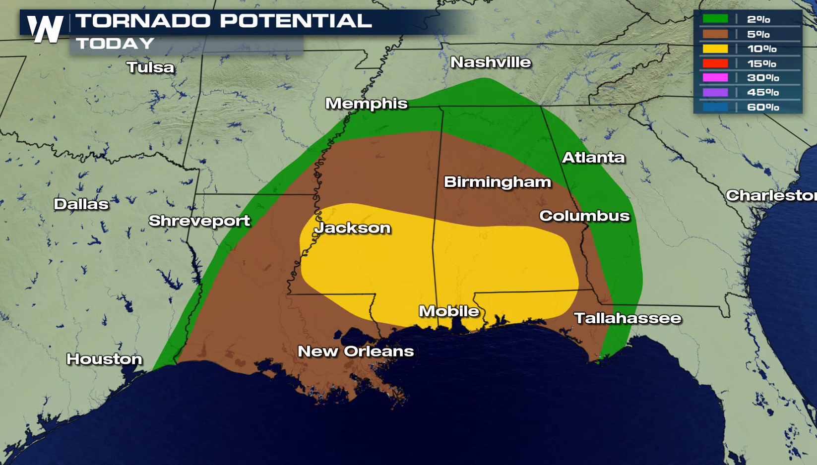
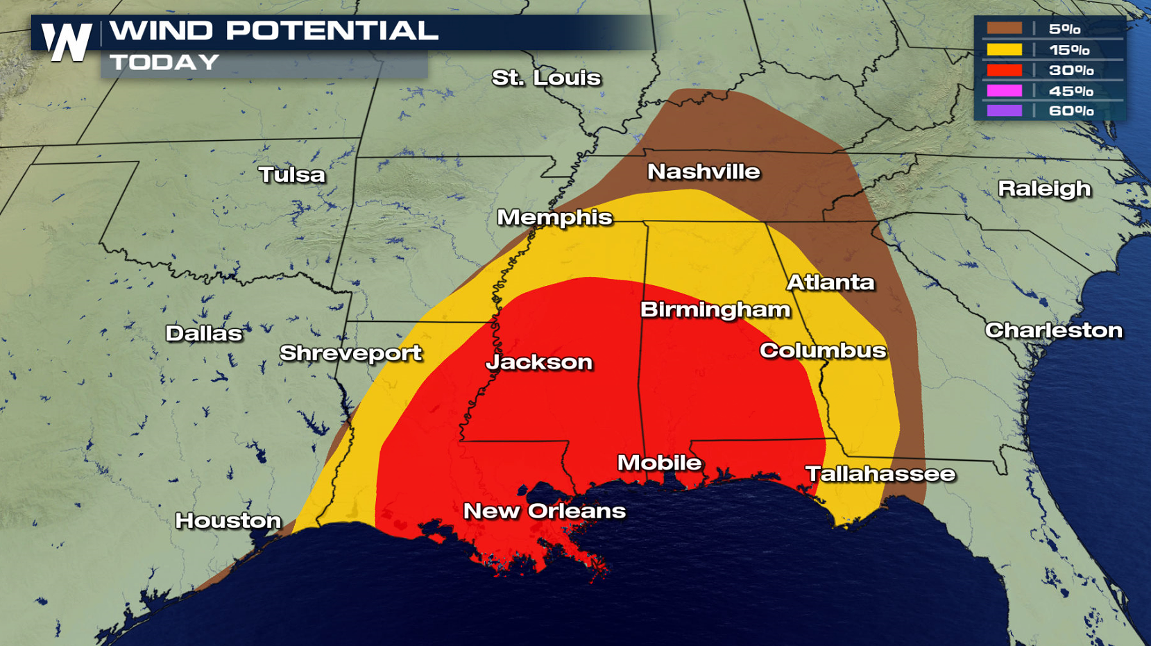 A potent Jet Stream will dig into the region, providing strong upper level support for severe storms. A southerly wind flow from the Gulf of Mexico will push warmth and humidity northward. Increasing instability will help to create and sustain severe thunderstorm development, especially in the afternoon and evening. Wind shear will be present, with surface winds from the southeast and winds aloft turning to the southwest. This will support severe thunderstorms, including tornadoes.
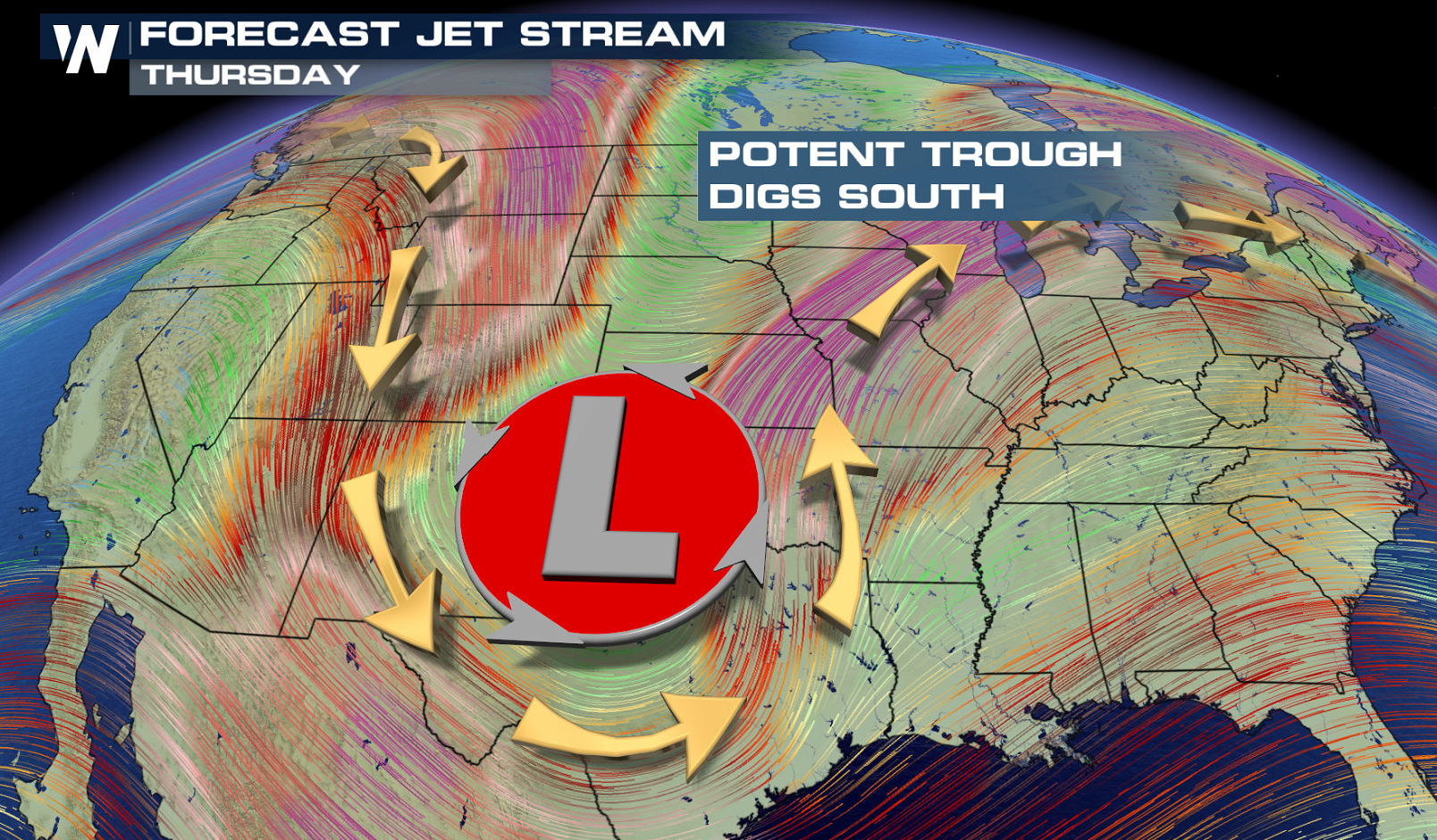
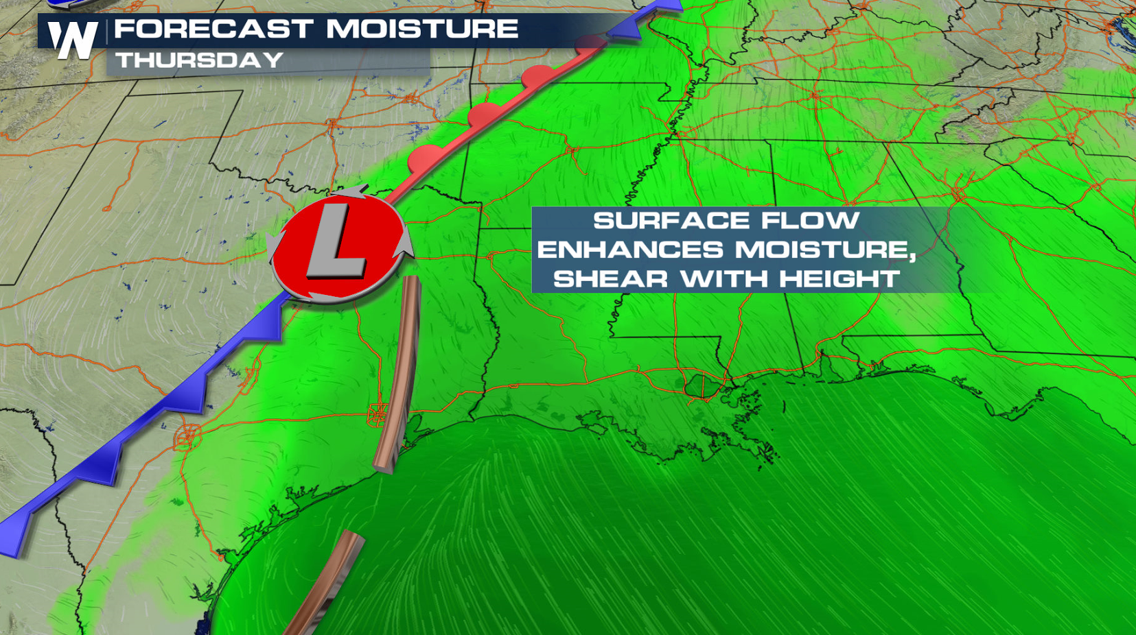
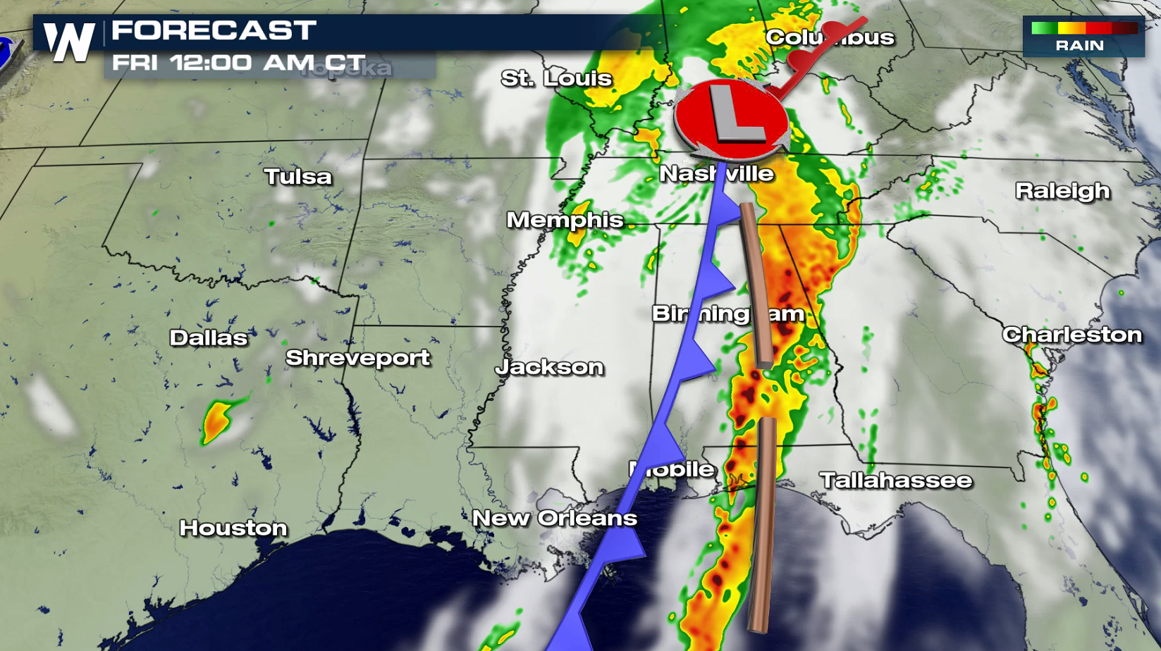
 The focus area for thunderstorm development will be along a cold front northward to the low pressure center. On-going storms are already intense. Additional severe storms will develop throughout the day, staying strong into the overnight.
 Have a severe weather plan in place, in case you need to take shelter if threatening storms approach your area. Be sure to check back with WeatherNation on-air and online if you are in the severe weather risk areas.
For WeatherNation: Meteorologist Mace Michaels
Have a severe weather plan in place, in case you need to take shelter if threatening storms approach your area. Be sure to check back with WeatherNation on-air and online if you are in the severe weather risk areas.
For WeatherNation: Meteorologist Mace Michaels
A potent Jet Stream will dig into the region, providing strong upper level support for severe storms. A southerly wind flow from the Gulf of Mexico will push warmth and humidity northward. Increasing instability will help to create and sustain severe thunderstorm development, especially in the afternoon and evening. Wind shear will be present, with surface winds from the southeast and winds aloft turning to the southwest. This will support severe thunderstorms, including tornadoes.
The focus area for thunderstorm development will be along a cold front northward to the low pressure center. On-going storms are already intense. Additional severe storms will develop throughout the day, staying strong into the overnight.
Have a severe weather plan in place, in case you need to take shelter if threatening storms approach your area. Be sure to check back with WeatherNation on-air and online if you are in the severe weather risk areas.
For WeatherNation: Meteorologist Mace MichaelsAll Weather News
More
Severe Threat Marches East This Afternoon
UPPER MIDWEST - Through Monday, dangerous tor
28 Jul 2026 4:25 PM

Tropics: Fausto Heads towards Hawaii; Genevieve Cat 4 Hurricane
PacificTropical Storm Fausto continues to tra
28 Jul 2026 4:20 PM


Southeast Flood Risk Lingers Near Stalled Front
A stalled boundary over the Southeast will ke
25 Jul 2026 10:55 AM

Another Round of Storms Targets the Northeast
Tuesday brought severe weather again across p
23 Jul 2026 1:15 AM

Another Round of Severe Weather for the Upper Midwest and Great Lakes
The upper-level low train continues to keep t
21 Jul 2026 1:45 AM