Intense Heat Fuels Strong Storms on the East Coast

news image
Top Stories
6 Jul 2024 11:00 PM

Severe weather continues for the Northeast Saturday, after storms troubled the Mod-Atlantic for days. An EF-1 tornado was confirmed the afternoon of the Fourth of July in west Louisville, KY with max winds of 95 mph as it was on the ground for half a mile. There is a marginal risk of severe weather Saturday.

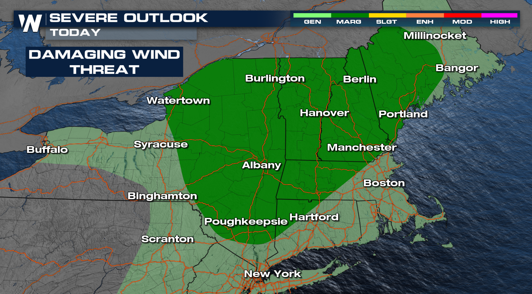
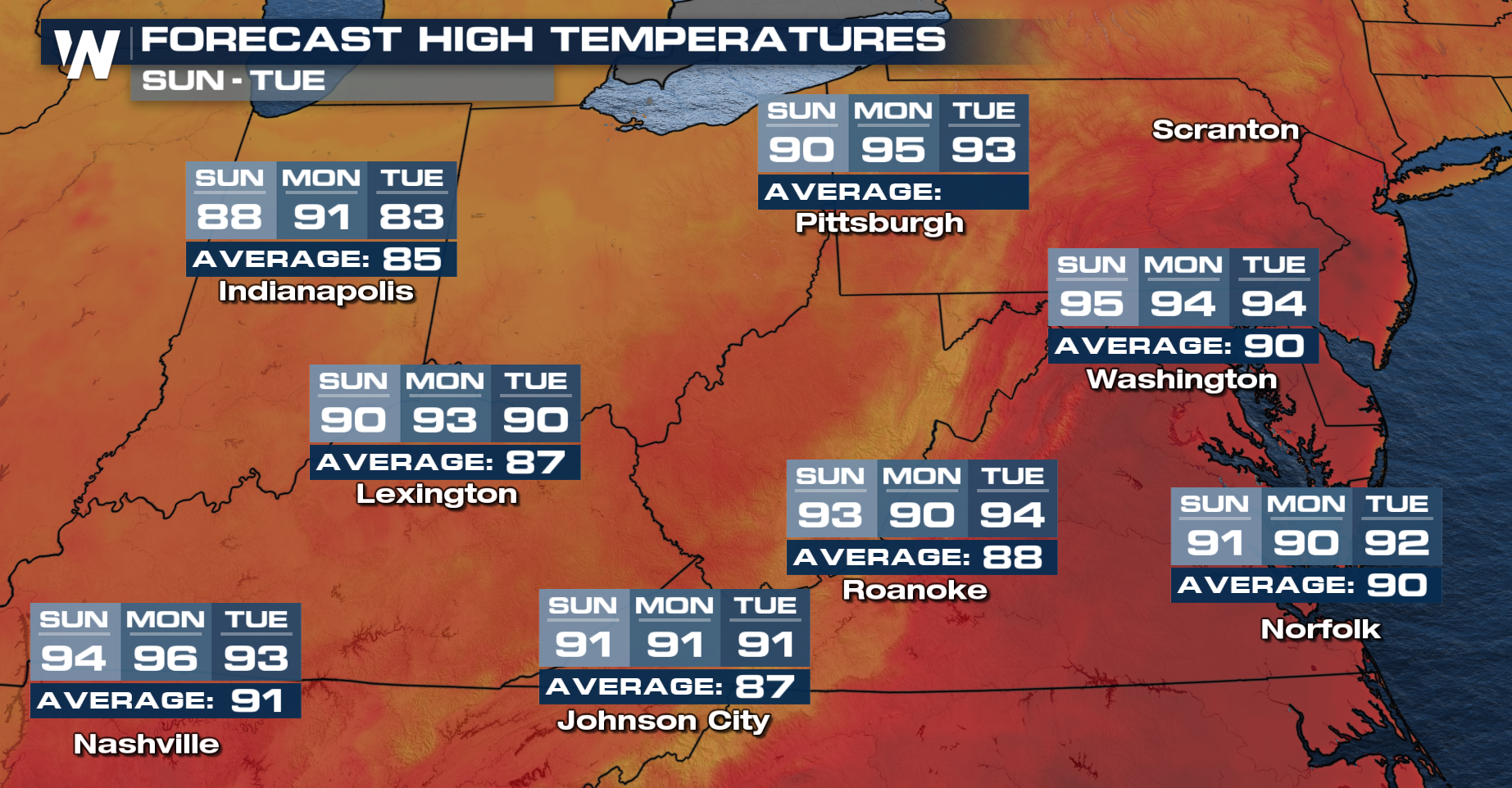
For the rest of this evening, thunderstorms will be widely scattered across the Northeast and New England! The biggest risk will likely be damaging winds. After midnight, thunderstorms will quickly fall apart and drier air should move in. The intense heat will come to an end following the front especially in the Mid Atlantic but temperatures will only just fall into the upper 80s and lower 90s.

Make sure to tune into WeaterNation for more details.

All Weather News
More
Hail Pummels Missouri, Texas; Back for More Overnight

Hail Pummels Missouri, Texas; Back for More Overnight

Severe storms have been numerous this week, a

30 Apr 2026 1:20 AM
Cooler Air Sweeps from the Plains to the Northeast

Cooler Air Sweeps from the Plains to the Northeast

A trough of low pressure will keep things coo

30 Apr 2026 1:10 AM
Cut-off Low Increases Rain and Snow Chances Out West

Cut-off Low Increases Rain and Snow Chances Out West

We have a rather wet pattern ahead for a lot

30 Apr 2026 12:15 AM
Late Week Heavy Rain & Storms for Texas

Late Week Heavy Rain & Storms for Texas

Rainfall & ForecastWhile much of the stat

30 Apr 2026 12:15 AM
A Look Back at Moderate Risks This Week

A Look Back at Moderate Risks This Week

MONDAYSevere storms erupted across the Midwes

29 Apr 2026 5:35 PM
West Staying Active this Week

West Staying Active this Week

WEST - Another upper-level low is set to move

28 Apr 2026 2:00 AM
Southeast Rain Brings Relief, But Drought and Wildfire Threats Persist

Southeast Rain Brings Relief, But Drought and Wildfire Threats Persist

Rounds of rain are set to return to the South

28 Apr 2026 1:50 AM