National Hurricane Center to Test New "Cone of Uncertainty" in 2024

The National Hurricane Center is deploying changes for an experimental Hurricane Forecast "Cone of Uncertainty" for the 2024 season. This year, instead of highlighting the cone of uncertainty over land (i.e. the center track and the potential forecast uncertainty), all alerts issued by the NHC and National Weather Service offices will be visible instead.
The goal of the reimagined cone is to communicate the threats a tropical system can bring outside of its direct center. Hurricane-force winds and tropical-storm-force winds can extend miles away from a storm's center, outside of the cone of uncertainty.
 Above: new cone of uncertainty that emphasizes impacts rather than center of the storm
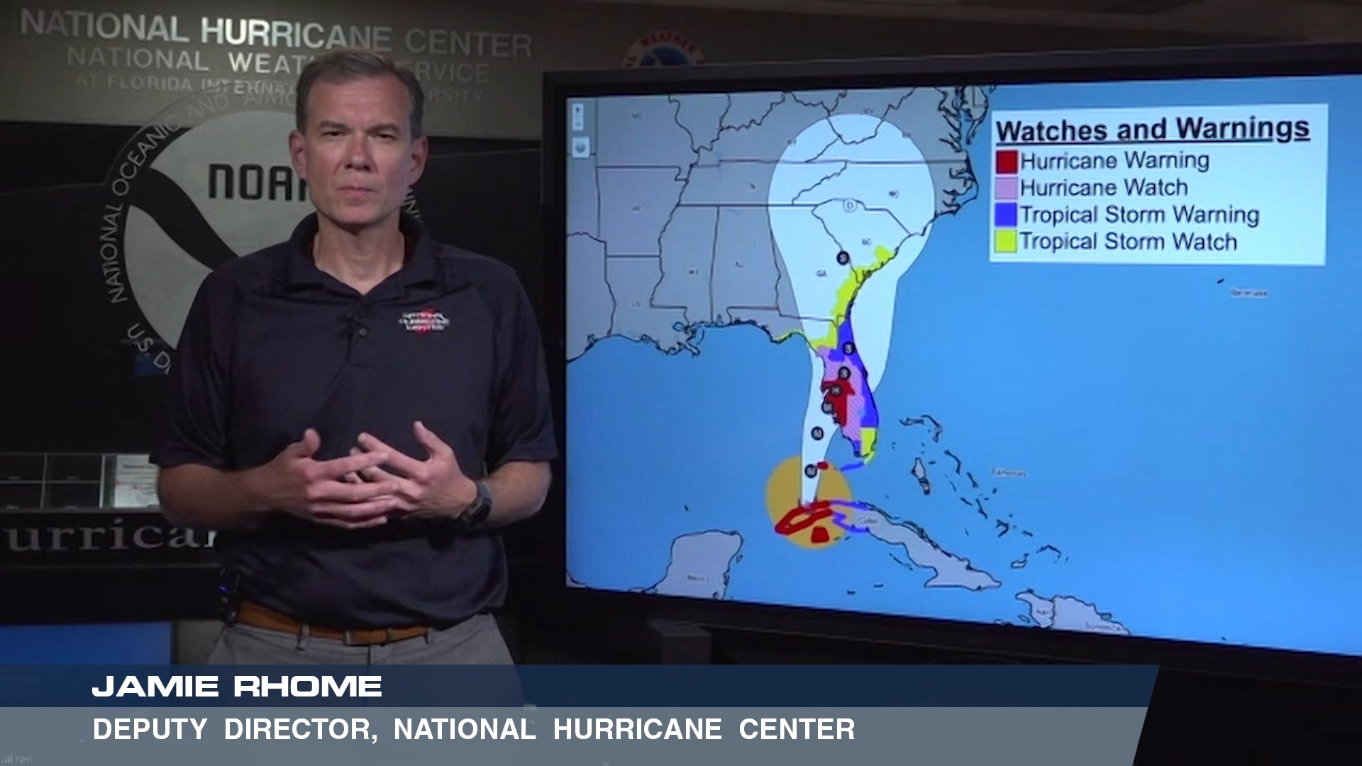
The current "Cone of Uncertainty" product focuses on the center of the storm, and not the risks outside of the center or eye. The cone of uncertainty can lead to the "containment effect" where people believe areas outside the cone are safe and inside the cone are at risk, according to a study done by researchers at Colorado State University. This product will be experimental and will be tested to see how it is perceived by the public. Deputy Director Jamie Rhome and the team at the National Hurricane Center have been researching and testing this format for the past few years.
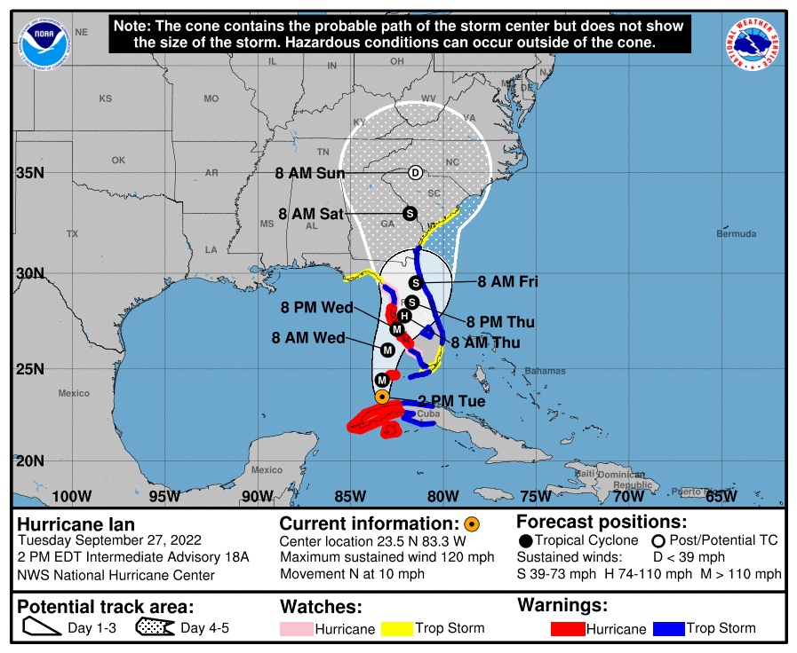
Above: cone of uncertainty during Hurricane Ian
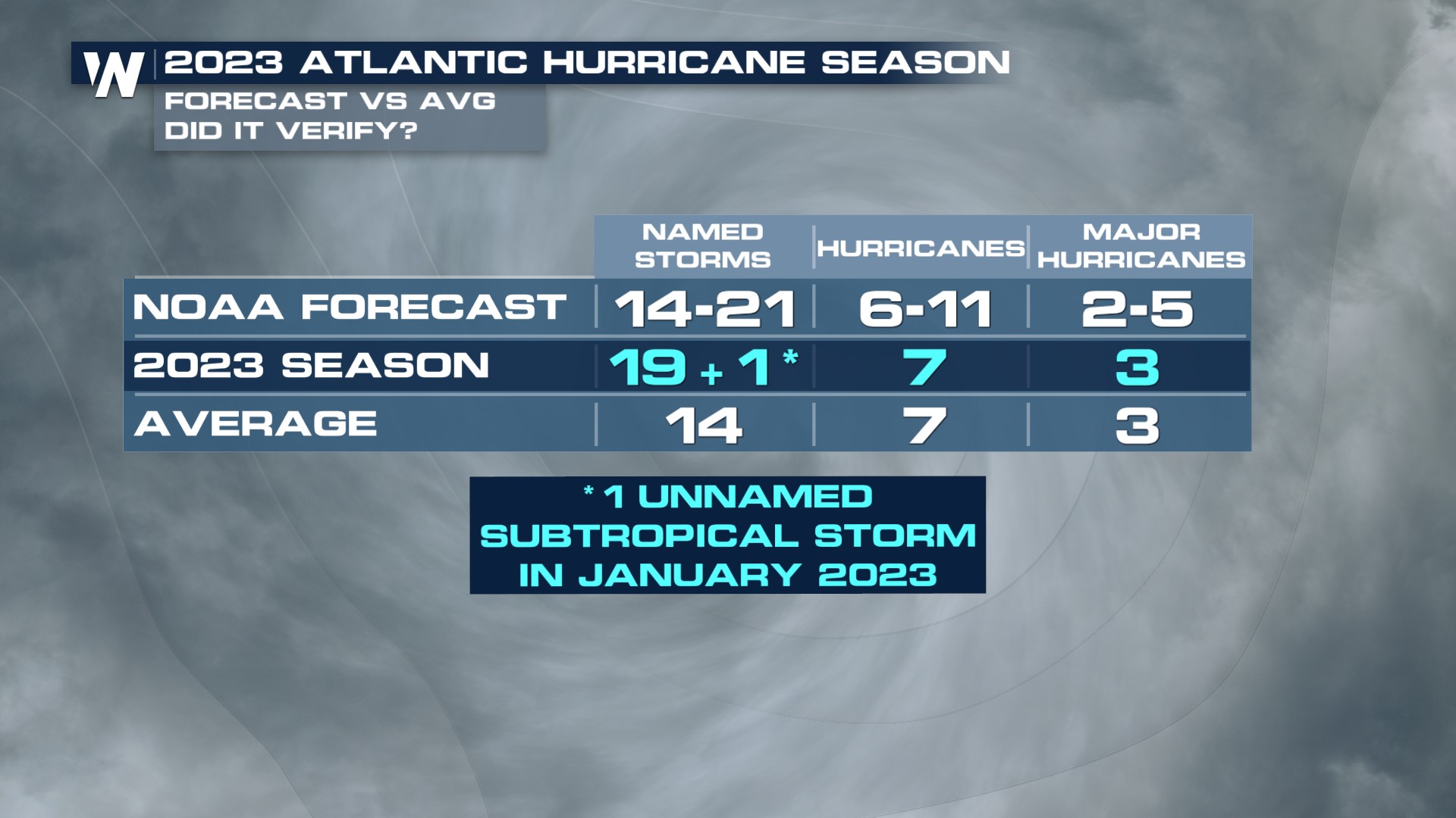
Hurricane season begins on June 1 every year. Last year we had 19 named storms (and one unnamed sub-tropical storm in January), seven hurricanes and three major hurricanes. An average season has 14 named storms, seven hurricanes and three major hurricanes.
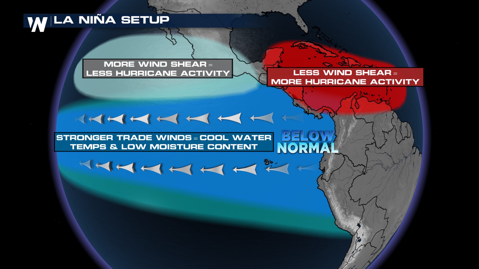
 This year we could see the return of La Niña conditions in time for the tropical season. According to the Climate Prediction Center [CPC], there is a 73% chance of ENSO Neutral conditions in April - June of 2024 before "most models indicate a transition to La Niña around July-September 2024." La Niña typically leads to above-average activity in the Atlantic Hurricane basin. Recent seasons under La Niña influence included 2020-2022.
 The list of hurricane names is retired every 6 years so this year's names will look familiar from the 2018 season except the "F" and "M" named storms which have been changed from Florence and Michael to Francine and Milton after those names were retired due to the destructive impacts of the storms.
 The official forecast for the number of named storms will be released in May ahead of Hurricane Season. As a reminder, these forecasts are only for the number of expected storms, not for where they make landfall, which is why it is increasingly important that you have multiple ways to get alerts during the tropical season and prepare ahead of time.


