NOAA Researcher Studies How to Improve Tornado Information to Save Lives
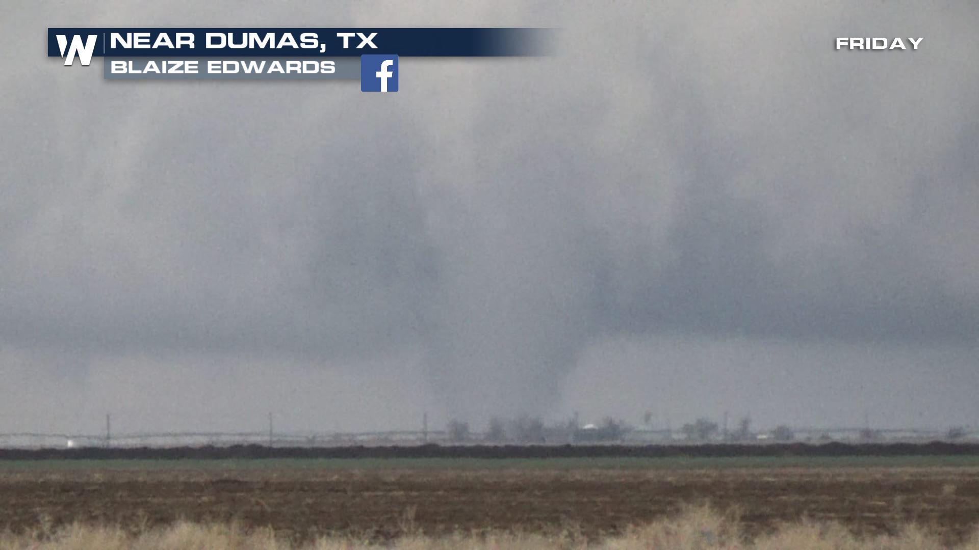
This scenario played out in southeast Alabama about a month ago, when a devastating tornado killed 23 people and injured numerous others, before ending its path in Georgia. The storm system was well forecast — as NOAA’s Storm Prediction Center predicted an elevated risk of severe storms days in advance and local NWS forecasters provided timely warnings.
Kim Klockow-McClain wants to know why that storm system — which included winds that reached 170 mph and rated 4, with 5 being the worst, on the Enhanced Fujita tornado-rating scale— was so deadly. She is a societal impacts researcher at the University of Oklahoma Cooperative Institute for Mesoscale Meteorological Studies. Her work supports NOAA’s National Severe Storms Laboratory to improve tools used by NOAA National Weather Service forecasters. How are weather messages working?
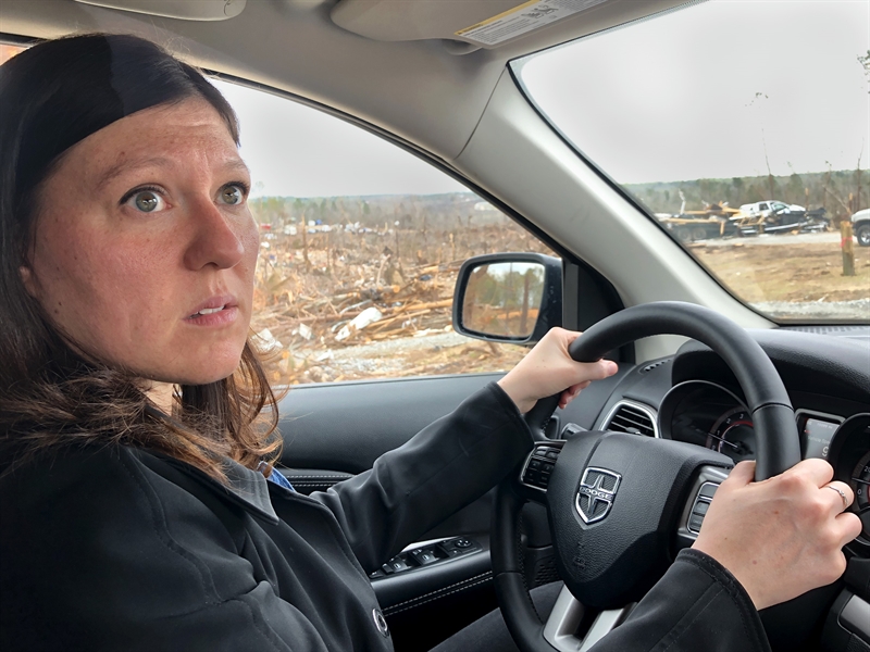 [Kim Klockow-McClain encounters damage in the area of Alabama that experienced deadly tornadoes in early March. She recently visited 10 public safety officials and communicators who were affected by the March tornado in Alabama and Georgia. Her three-day trip is part of her research through the Verification of the Origins of Rotation in Tornadoes EXperiment-Southeast, or VORTEX-SE. Credit: NOAA]
Klockow-McClain studies how the messages coming from emergency management agencies, broadcast meteorologists and NWS forecasters may serve the needs of people living in manufactured and mobile homes, or whether further collective activities may need to be undertaken. She is also researching actions taken by those living in mobile or manufactured housing, known to be more vulnerable to tornadoes, when a tornado watch or warning is issued.
“When talking to all of the vested parties — emergency management agencies, broadcast meteorologists, forecasters and the public — you see places of great opportunity and gaps,” Klockow-McClain said. “Researchers can provide the best forecasting tools to our partners, but if people don’t use them, can’t use them and don’t want them for reasons we don’t understand — that helps no one. We have to understand how the public responds and how our partners interact.”
She recently visited 10 public safety officials and communicators who were affected by the March tornado in Alabama and Georgia. Her three-day trip is part of her research through VORTEX-Southeast.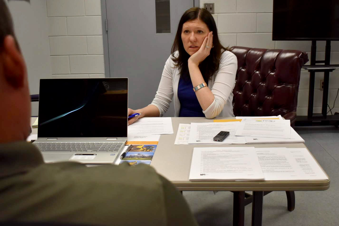 [Kim Klockow-McClain interviews a resident of the area of Alabama that experienced deadly tornadoes in early March to learn more about what kind of information is most effective at saving lives and property. Credit: Emily Summars, NOAA, Univ of Oklahoma]
The Verification of the Origins of Rotation in Tornadoes EXperiment-Southeast, or VORTEX-SE, brings together meteorologists, researchers and social scientists to collaborate on research looking at the storms and conditions that produce tornadoes in the Southeast United States.
VORTEX-SE is an effort to understand how environmental factors characteristic of the southeastern U.S. affect the formation, intensity, structure, and path of tornadoes in this region. The research will also determine the best methods for communicating the forecast uncertainty related to these events to the public and evaluate public response.
Better understanding the needs of specific communities in the southeast is the first step toward reducing tornado deaths in that area of the United States. Klockow-McClain’s research is aimed at generating a diagnosis that could ultimately lead to an effective treatment. Importantly, this approach considers the entire weather enterprise - emergency managers, broadcasters, and forecasters - leveraging the energy and enthusiasm of the growing effort to create integrated warning teams that adopt comprehensive solutions.
Edited for WeatherNation by Meteorologist Mace Michaels
[Kim Klockow-McClain interviews a resident of the area of Alabama that experienced deadly tornadoes in early March to learn more about what kind of information is most effective at saving lives and property. Credit: Emily Summars, NOAA, Univ of Oklahoma]
The Verification of the Origins of Rotation in Tornadoes EXperiment-Southeast, or VORTEX-SE, brings together meteorologists, researchers and social scientists to collaborate on research looking at the storms and conditions that produce tornadoes in the Southeast United States.
VORTEX-SE is an effort to understand how environmental factors characteristic of the southeastern U.S. affect the formation, intensity, structure, and path of tornadoes in this region. The research will also determine the best methods for communicating the forecast uncertainty related to these events to the public and evaluate public response.
Better understanding the needs of specific communities in the southeast is the first step toward reducing tornado deaths in that area of the United States. Klockow-McClain’s research is aimed at generating a diagnosis that could ultimately lead to an effective treatment. Importantly, this approach considers the entire weather enterprise - emergency managers, broadcasters, and forecasters - leveraging the energy and enthusiasm of the growing effort to create integrated warning teams that adopt comprehensive solutions.
Edited for WeatherNation by Meteorologist Mace Michaels


