NOAA Spring Outlook: Warm for All, Wet for Southeast
It is officially spring, and signs of the season are here! This includes the official spring outlook released by forecasters at NOAA’s Climate Prediction Center and the National Water Center.
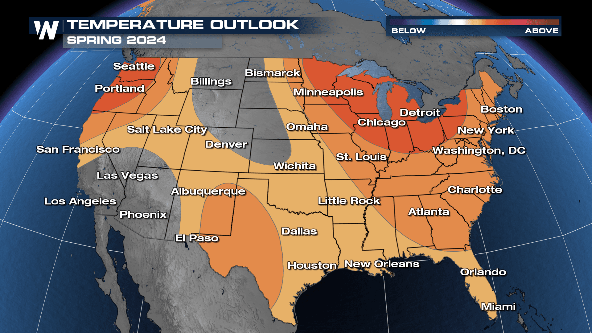
For many, it has already felt like spring thanks to the warmest winter on record for the contiguous United States. The official forecast shows a continuation of that pattern with much of the country expecting warmer than average temperatures into the summer months. There is higher confidence in the Pacific Northwest and Great Lakes.
After the winter season was the third wettest on average for the U.S., wetter conditions will continue into the spring for the Southeast, Central Plains, and Mid-Atlantic. 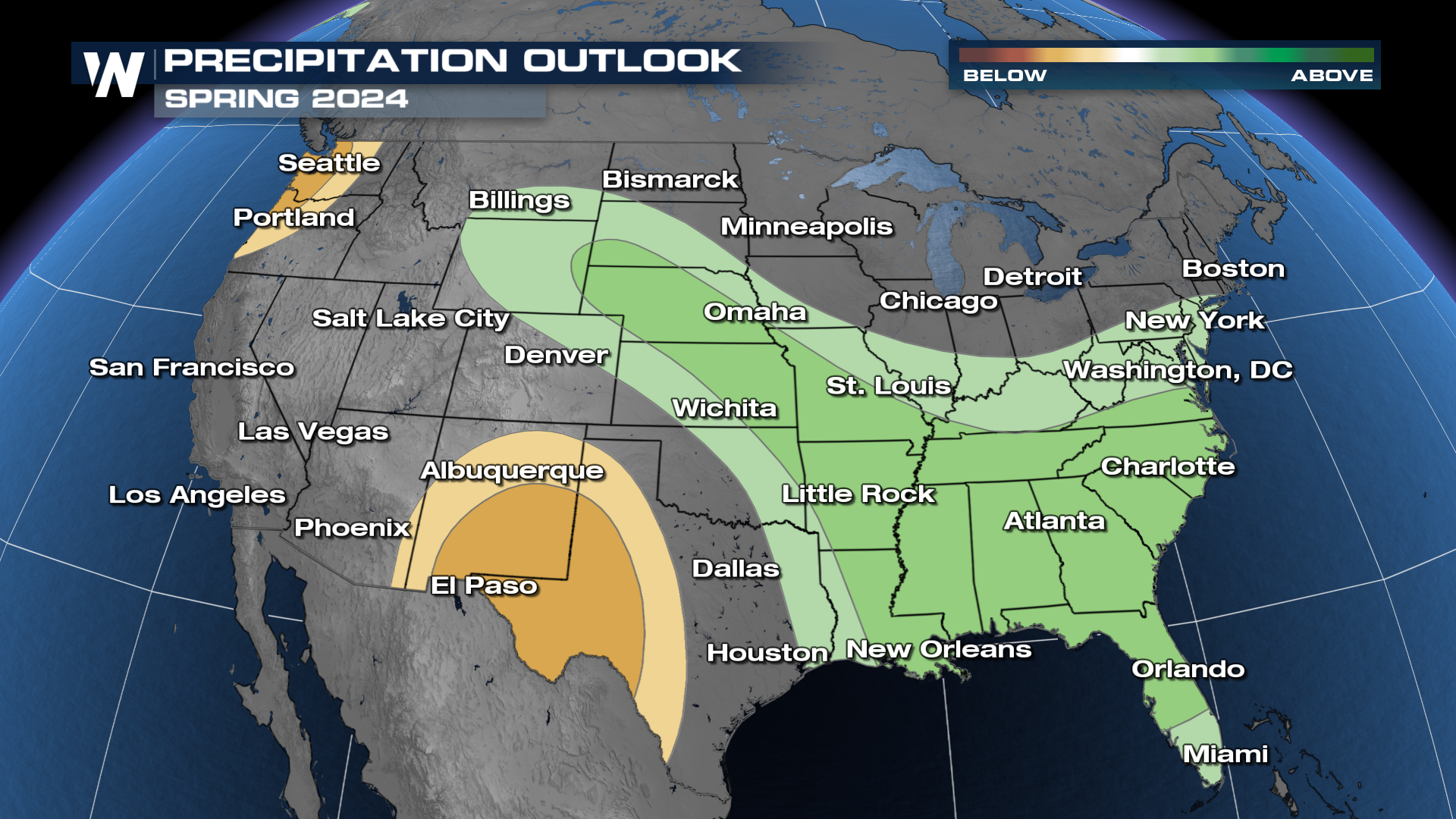 West Texas and New Mexico should be on the lookout for drier-than-average conditions, potentially leading to worsening drought. The Pacific Northwest also has a better chance of seeing below-average precipitation.
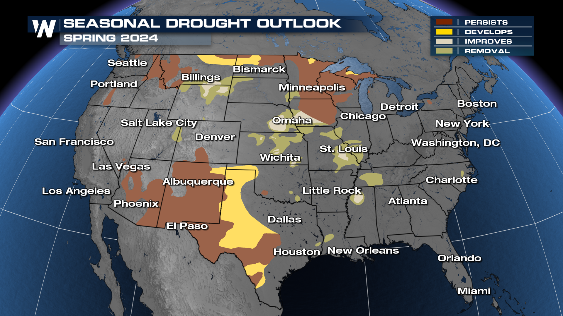
Because of the warm winter, there is hardly any snowpack coverage, meaning persistent or worsening drought in the High Plains and Great Lakes. The continued wet pattern for the central U.S. should continue the pattern of drought improvement in the Mississippi and Missouri Valley states.
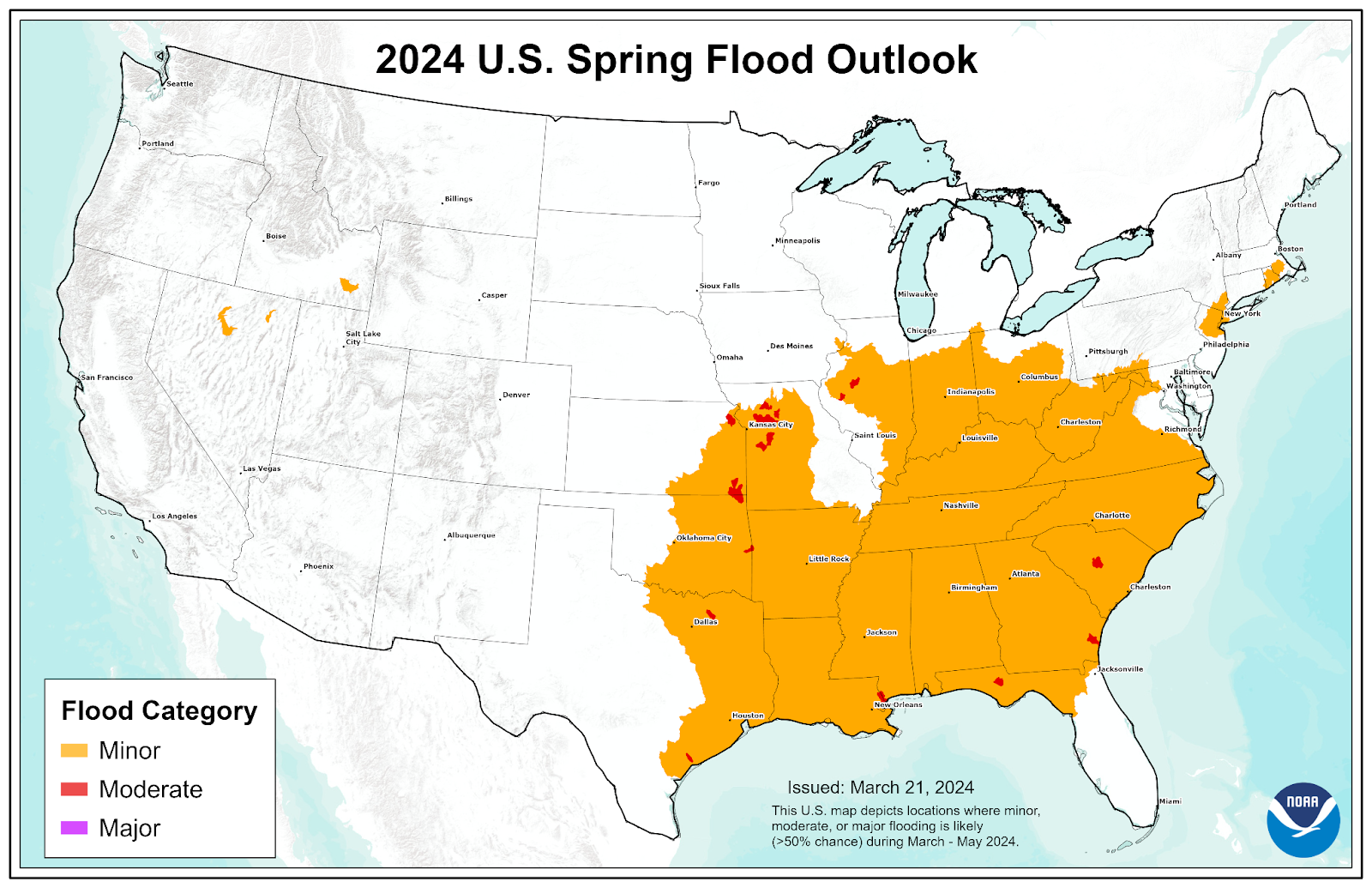
 The potential for significant Spring flooding is low due to winter warmth and limited snowpack. However, flood-prone areas of the Midwest and South should still be on the lookout for minor to moderate flooding.
“This is the first Spring Outlook since 2021 with no population expected to be impacted by major flooding. Of growing concern will be the potentially low flows on the Mississippi River this summer into fall due to well-below snowpack and precipitation in most of the Northern Plains and Midwest. This could have potential impacts on those navigation and commercial interests that depend on water from the Mississippi River.” - Ed Clark, director, NOAA’s National Water Center.
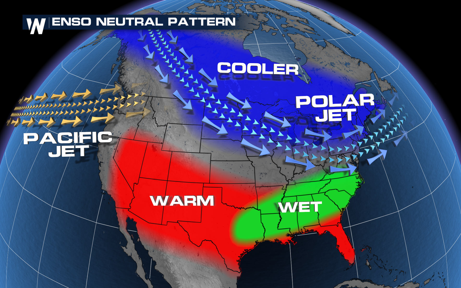
The impacts of a strong winter El Nino will continue into Spring and be one of the driving forces behind this spring's forecast. However, a transition to ENSO-neutral conditions is expected by the summer. Both patterns favor warmer conditions for much of the country, and wetter conditions across the southern half of the U.S.
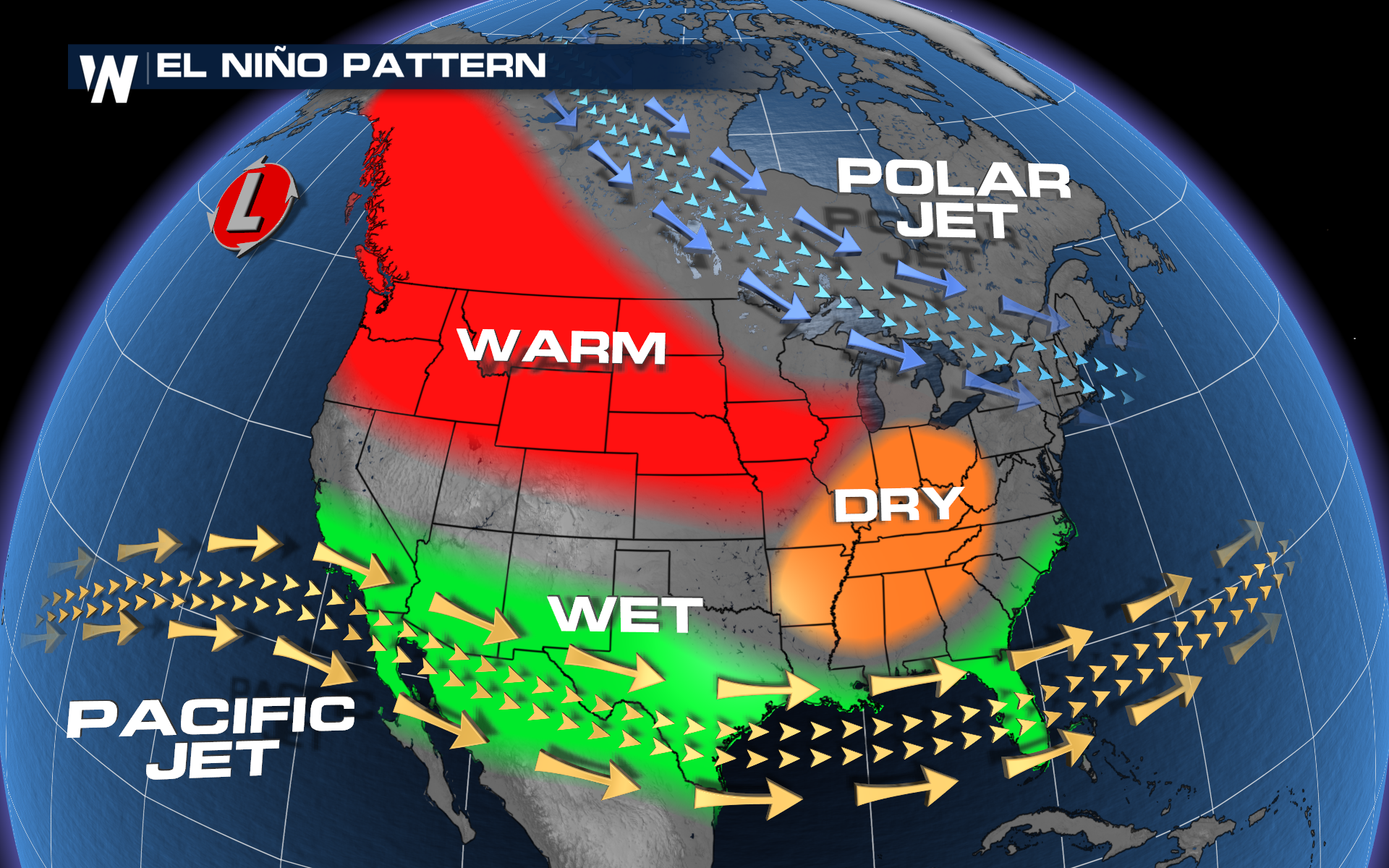
“Our scientists at the Climate Prediction Center observed one of the strongest El Nino events on record during the winter of 2023-2024, but a quick transition to La Nina — the cool phase of ENSO — is possible as early as the first part of summer.” -Jon Gottschalck, chief of the Operational Prediction Branch from NOAA’s Climate Prediction Center.
It’s important to remember these are probabilistic forecasts. Day-to-day variability will happen. What this outlook does not tell us, is what many people might want to know… such as exact rainfall amounts or precisely where spring storms could occur. Stay with WeatherNation for daily updates on your forecast.


