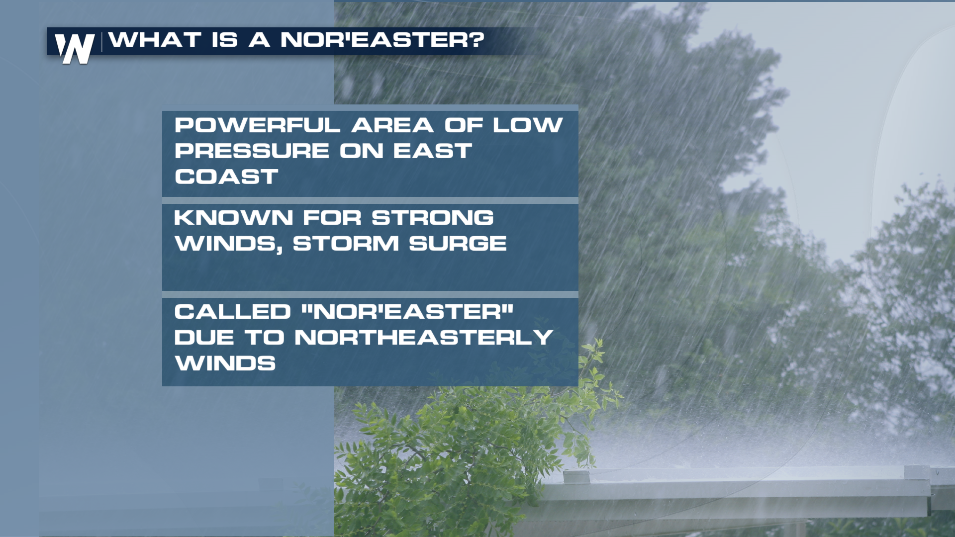
Nor'easter Blows Into New England Tonight

Yep you read that right. We've got a nor'easter setting sights on the northeast. Folks that are from the area know these storms well: high winds, big waves, and HEAVY SNOW! Well, we're not expecting snow this time around, but a cold rain is likely.
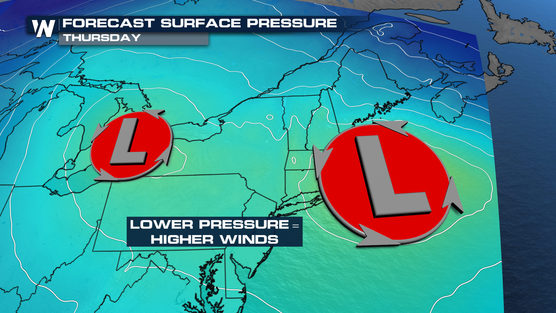
SETUP
A slow-moving low will get overtaken by a secondary ripple of energy late tonight into Thursday. That secondary ripple will light the fuse of our nor'easter. As the system deepens, winds will strengthen, drawing down cooler air and feeding the system even more.
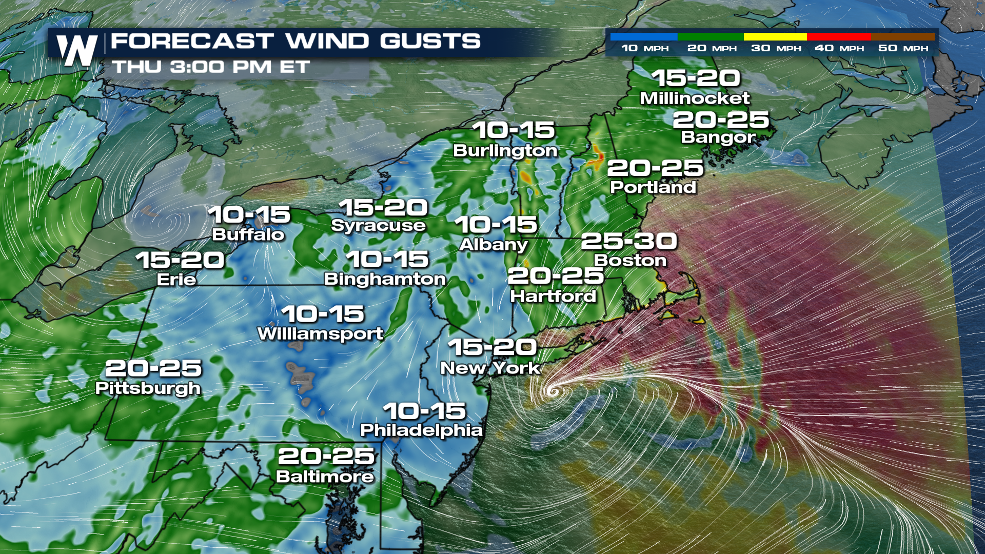
WINDS
Regardless of time of the time of year, you can't have a nor'easter without some winds. Gusts are expected to reach 40-50 mph in eastern Massachusetts tonight through Thursday!
RAIN
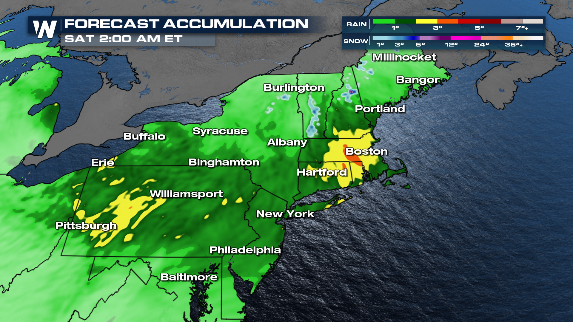
Unlike many systems like this, it's not cold enough to be talking about snow. But we've got a driving rain headed our way. A couple of inches will be possible, coming in sideways! The belt of heaviest rainfall looks to be through the state of Pennsylvania into southern New England, where up to 4 inches of rain will be possible.
 POWER OUTAGES
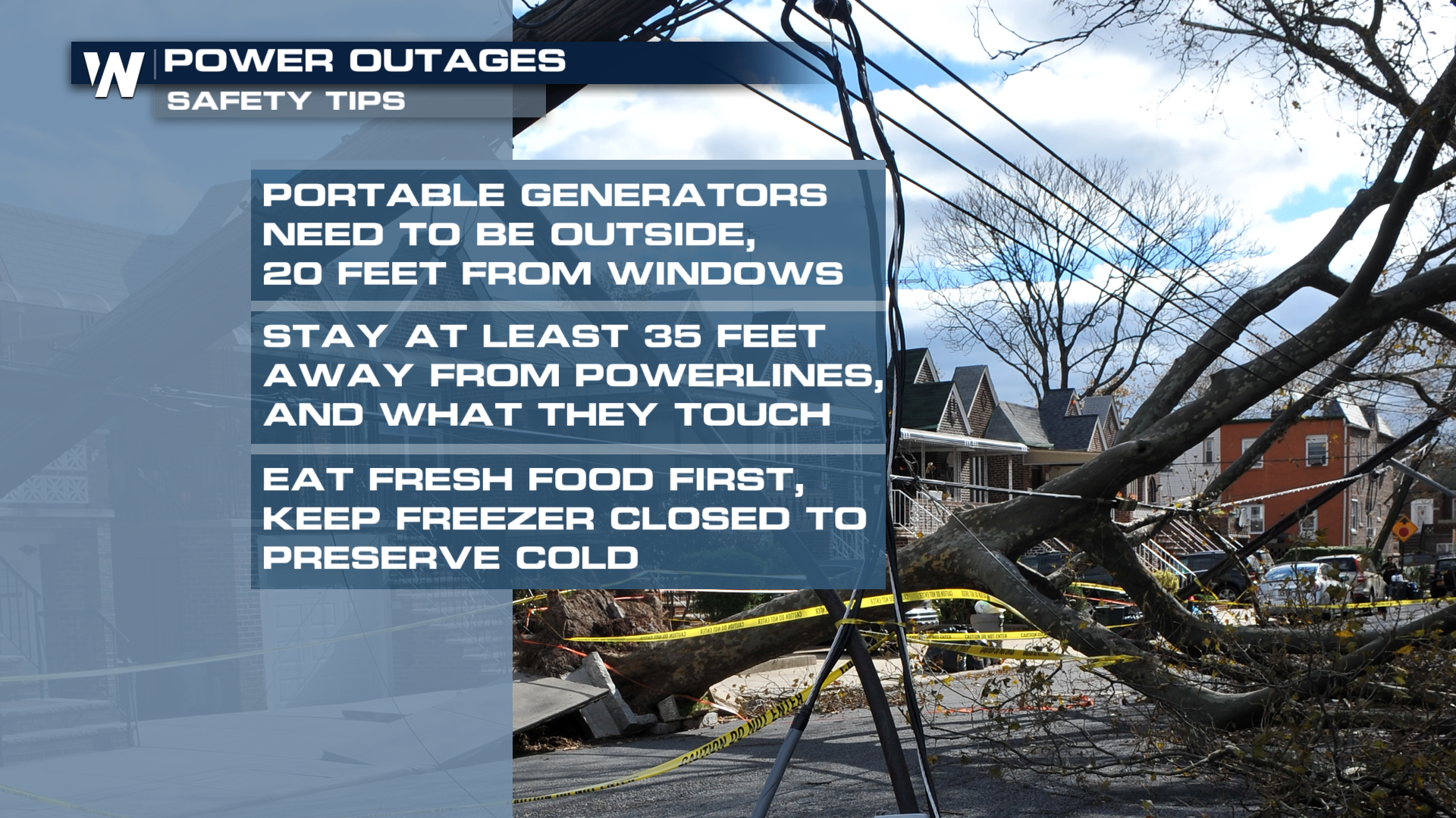
With saturated soils and high winds, the perfect recipe for some scattered power outages will take shape with this system. As always, if you need to fire up a generator, make sure to do it 20 feet away from your home.