Cleanup Underway in the South Following Hurricane Beryl

Beryl officially made landfall as a category 1 hurricane around 4 AM CDT Monday, July 8th near Matagorda, TX with 80 mph sustained winds. The moisture is moving north and east and bringing heavy rainfall and severe storms to the Midwest and Northeast through midweek. The most widespread threat of Beryl was torrential rainfall, with many cities in South Texas receiving 5-10 inches of rain, and localized amounts over 15", including over a foot in Houston.
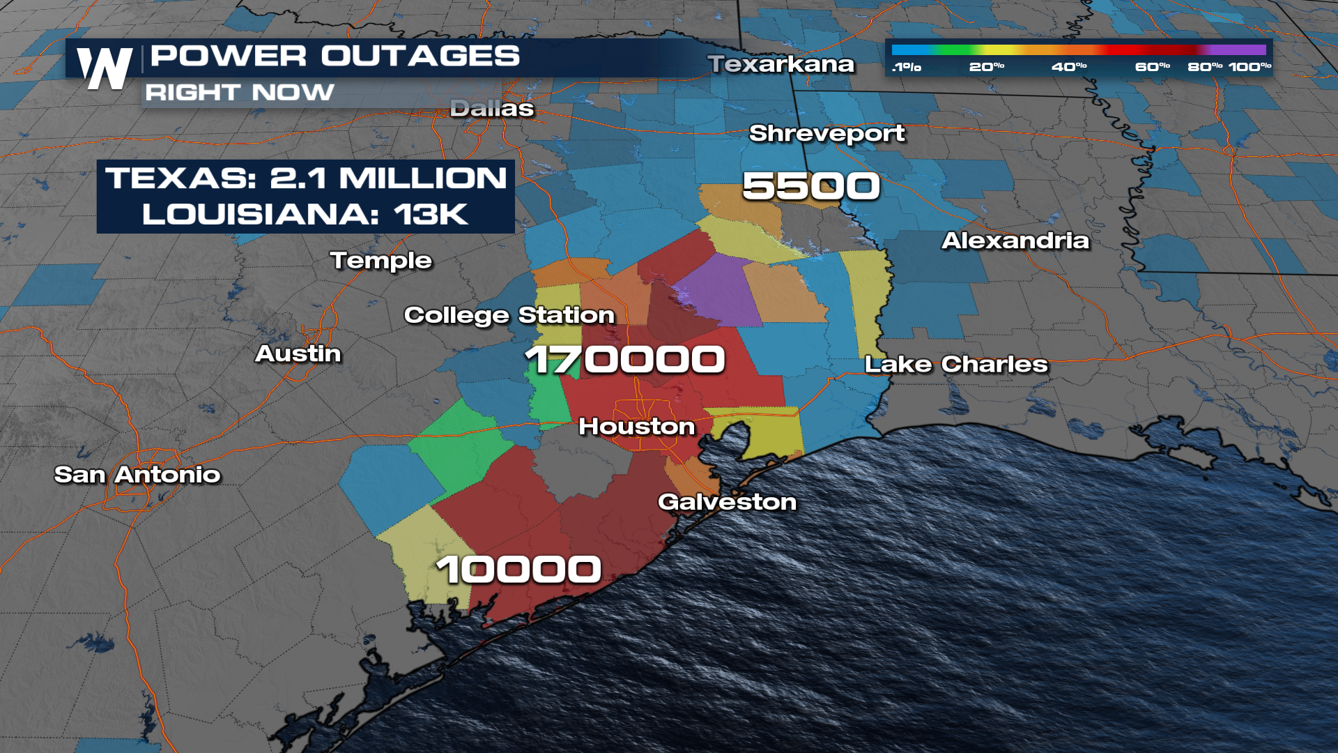
Sadly, the storm was deadly with multiple fatalities, including a Houston Police Officer who drowned in his vehicle on his way to work and a man who died after a tree fell onto his home. Additional storm fatalities occurred during previous landfills of the storm. Wind gusts over 90 mph in Freeport and near Matagorda Bay led to numerous power outages: at the height of the storm Monday, 2.7 million customers in Texas were without power including large portions of the Houston metro and surrounding areas.
 Storm surge in Texas was on the order of 4-6' along the coast, including in Galveston. Storm surge warnings were in effect at the time to account for the risk from Beryl.
Additionally, outer rain bands produced not only heavy rainfall but also numerous tornadoes in Louisiana and East Texas on Monday. Storm surveys in the coming days will help determine the strength of the tornadoes when they touched down. In fact, the National Weather Service in Shreveport, LA issued 67 tornado warnings - the most ever by a single National Weather Service office in July. Nearly 20 were "confirmed" meaning a storm spotter saw a tornado or there was a debris ball visible on radar. This tornado damage in Jasper, TX was caused by an EF-2 on Monday.
Hurricane Beryl made landfall on the Yucatan Peninsula early Friday morning northeast of Tulum as a CAT 2 Hurricane with sustained winds of 110 mph. Beryl smashed Jamaica with powerful winds and surge on Wednesday as a CAT 4 storm. Beryl made its first landfall Monday at 11:10 am AST in the far eastern Caribbean, hitting Carriacou Island at category 4 storm strength with 150 mph sustained winds. This follows the storm reaching category 5 status late Monday night, July 1st. It was the earliest category 5 on record in the Atlantic Basin, beating out "Emily" in 2005 which became a category 5 in mid-July.
Ocean temperatures are contributing to the threat of an above-average tropical season with ocean heat content much above normal in the Atlantic in 2024. As a reminder, 2024 is expected to be above average for tropical activity due to a La Nina forming during the peak of hurricane season in September. It only takes one storm to impact you and the time to prepare is before the storm hits!


