Plains Severe Weather Chances This Week
Special Stories
29 Jul 2020 8:30 AM
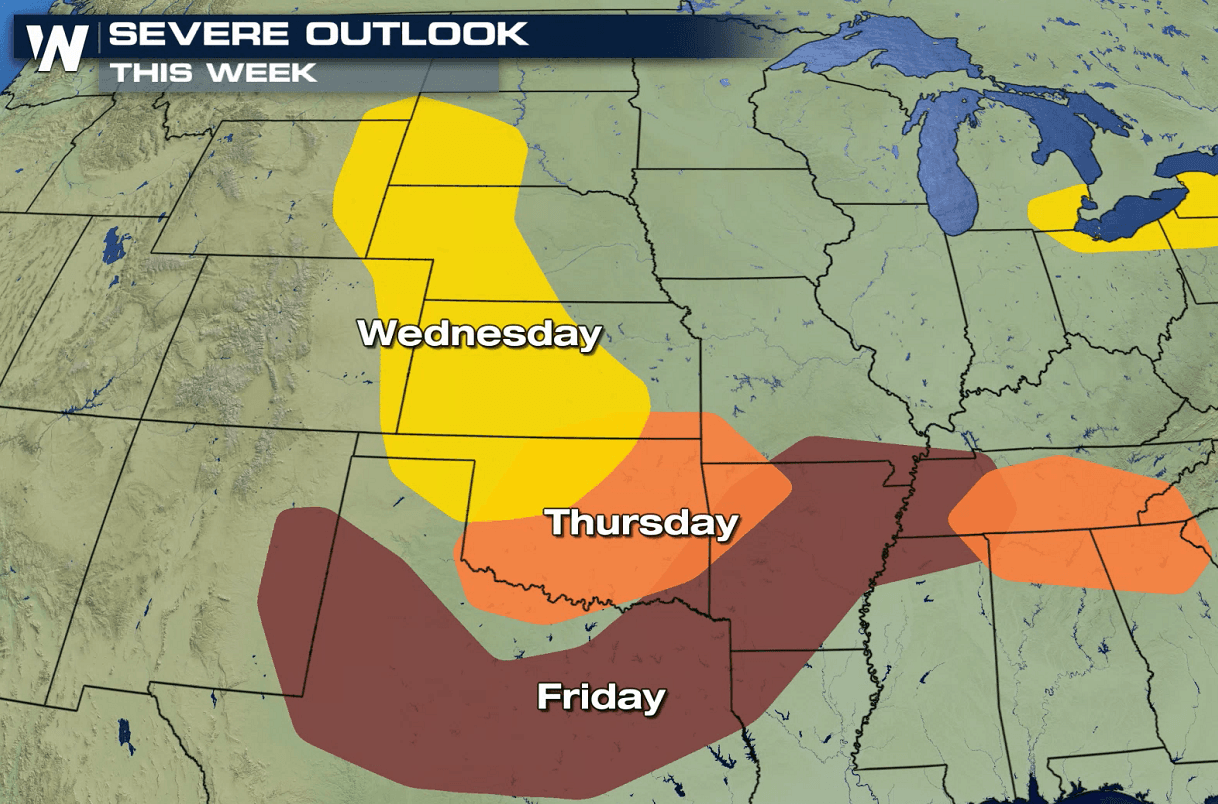
An active weather pattern for the rest of this week will bring the threat for severe thunderstorms to the Plains. The Storm Prediction Center (SPC) has issued outlooks for today (Wednesday) through Friday highlighting a few areas where severe storms are possible. Below we will break down the risk areas for each day:
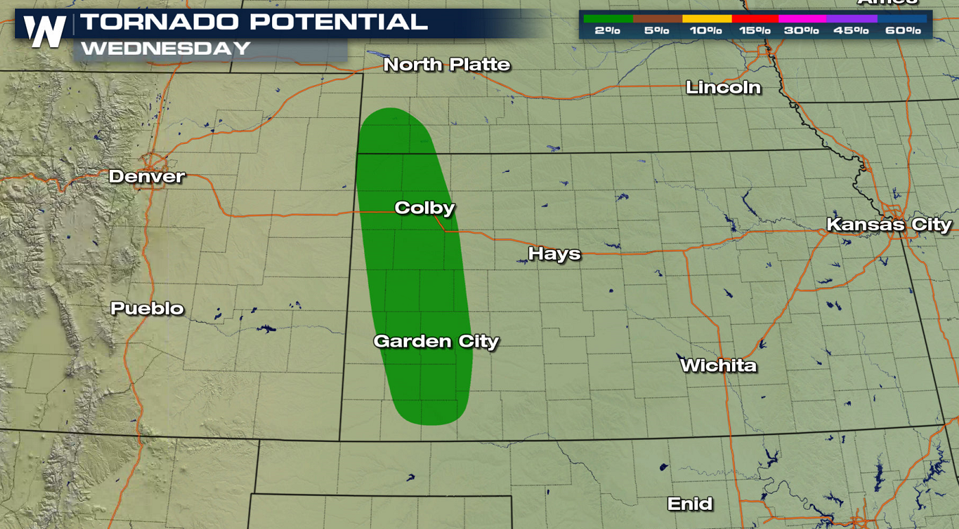
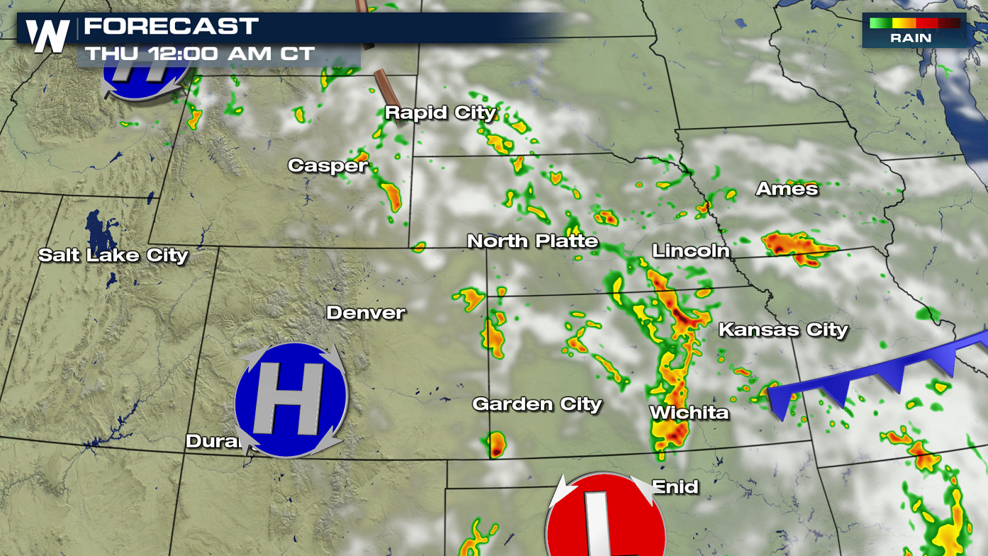
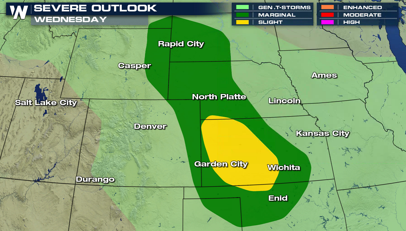 The most likely locations where atmospheric dynamics will come together to bring in chances for severe thunderstorms today (Wednesday) extends from South Dakota to Oklahoma. There is a slight risk (level 2 on a scale of 1 to 5) that includes western and central Kansas. Large hail and strong wind gusts are the main threats, with isolated tornadoes possible in western Kansas.
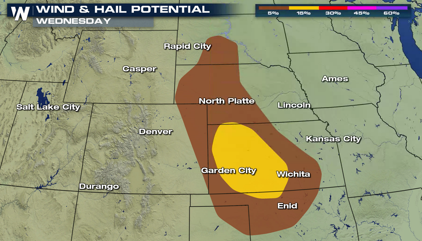
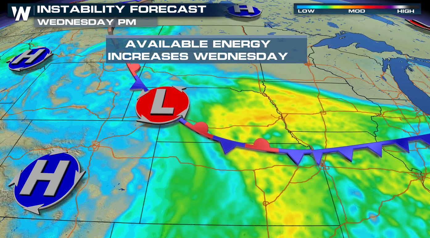
 There are a few dynamic factors to consider with this set-up. With daytime heating and more energy to work with, we look at our CAPE values. CAPE is also known as Convective Available Potential Energy. It is a measure of how much energy there is in the atmosphere. As temperatures heat up throughout the day, the CAPE values increase. Typically, anything over 1000 J/kg of CAPE (the measurement of energy) can be favorable for thunderstorm development. The yellow shades on the image below show us areas that have more energy to help with storm development.
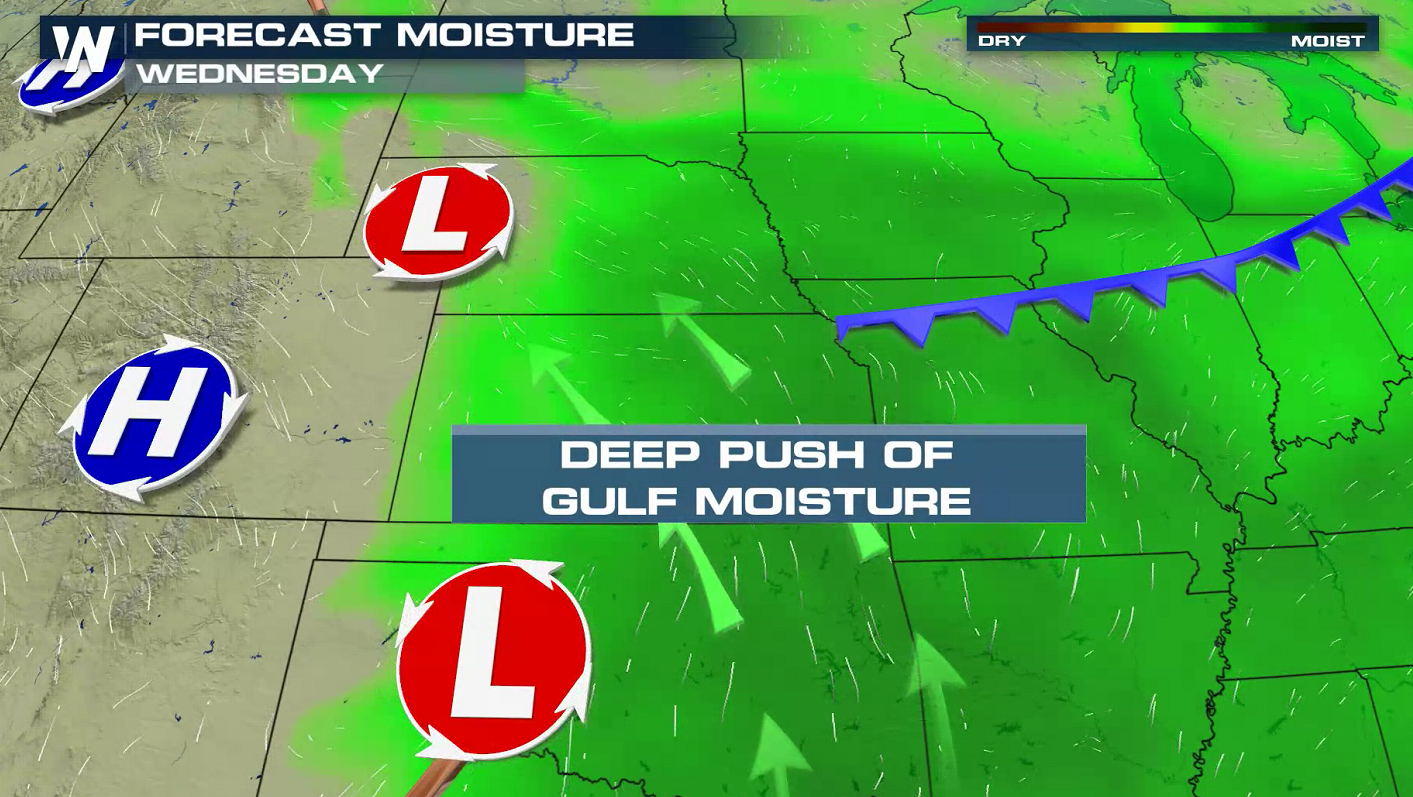
 Moisture is also needed to fuel storms. Throughout the day, low level moisture begins to increase. This in combination with orographic forcing (in this case, the Black Hill Mountains) should help support more organized thunderstorms in the same area the SPC has highlighted the marginal risk.
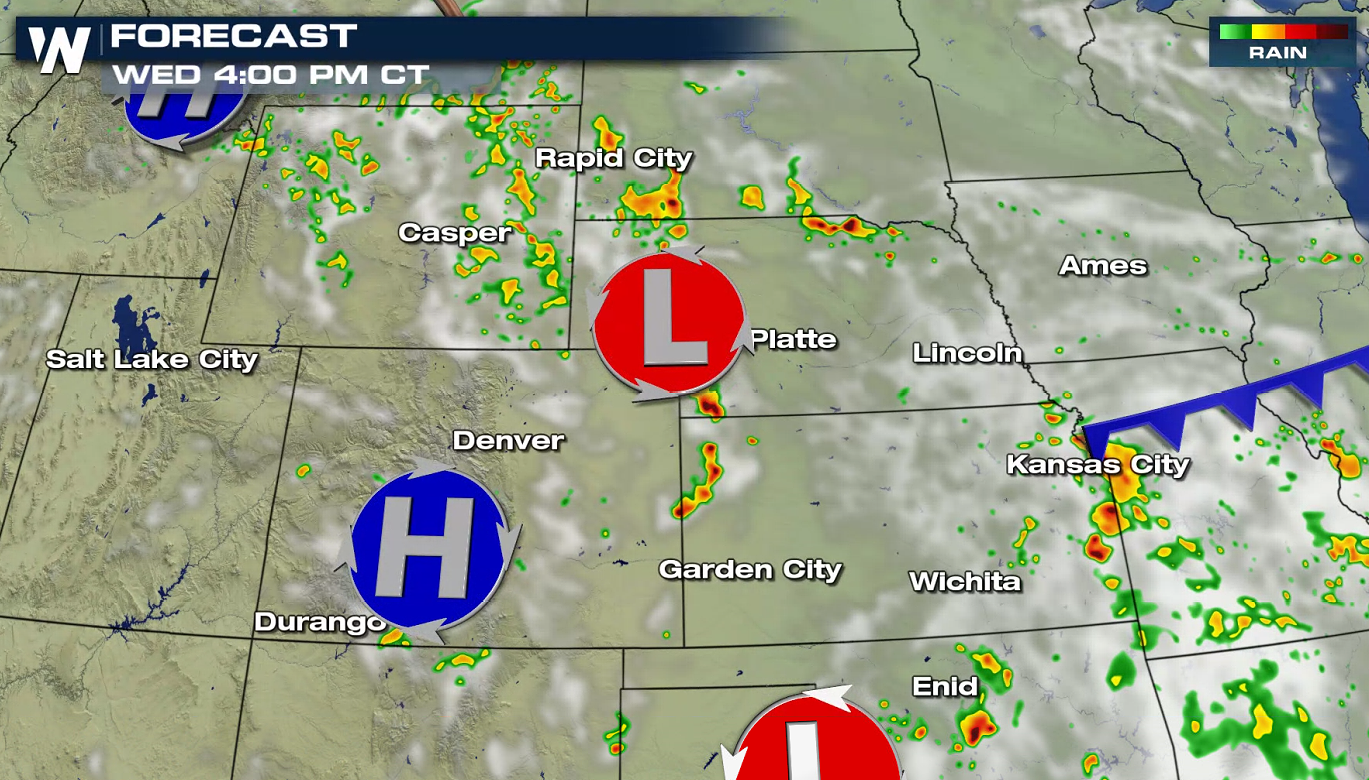
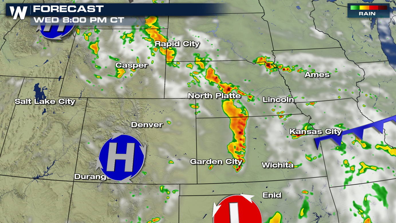
 All of these dynamic factors are important to bring storms. Forecast guidance also shows that thunderstorms will begin during the afternoon and continue through the evening.

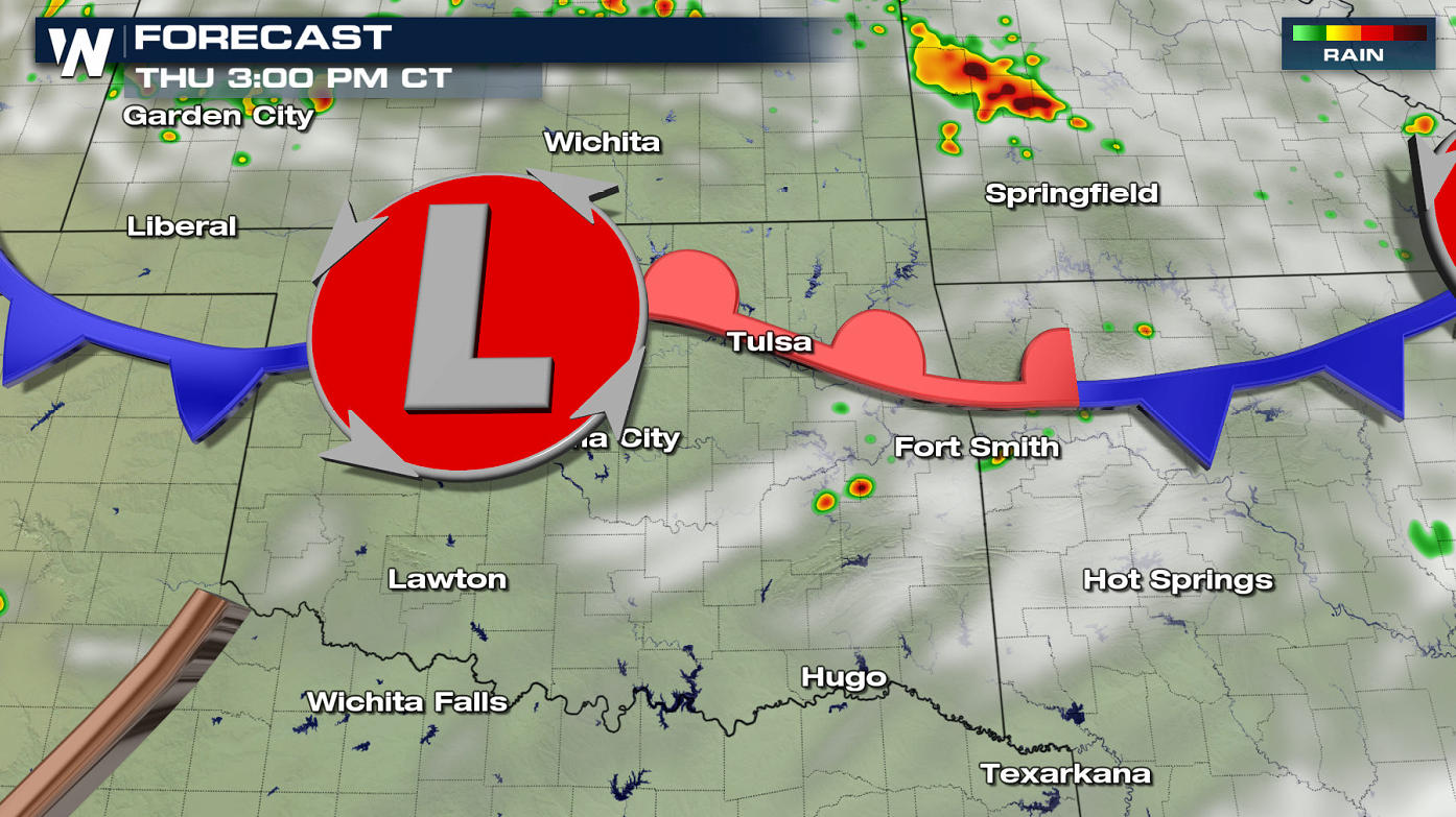
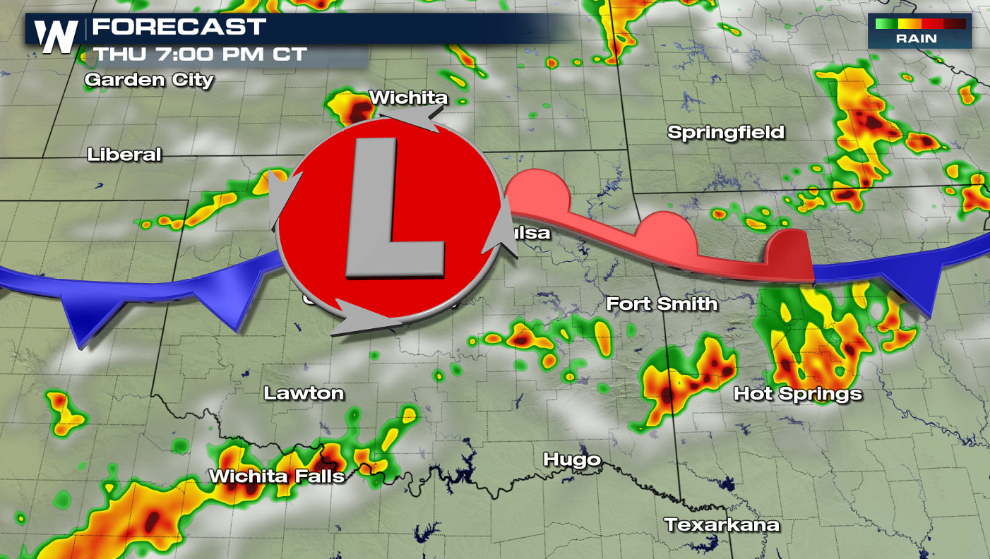
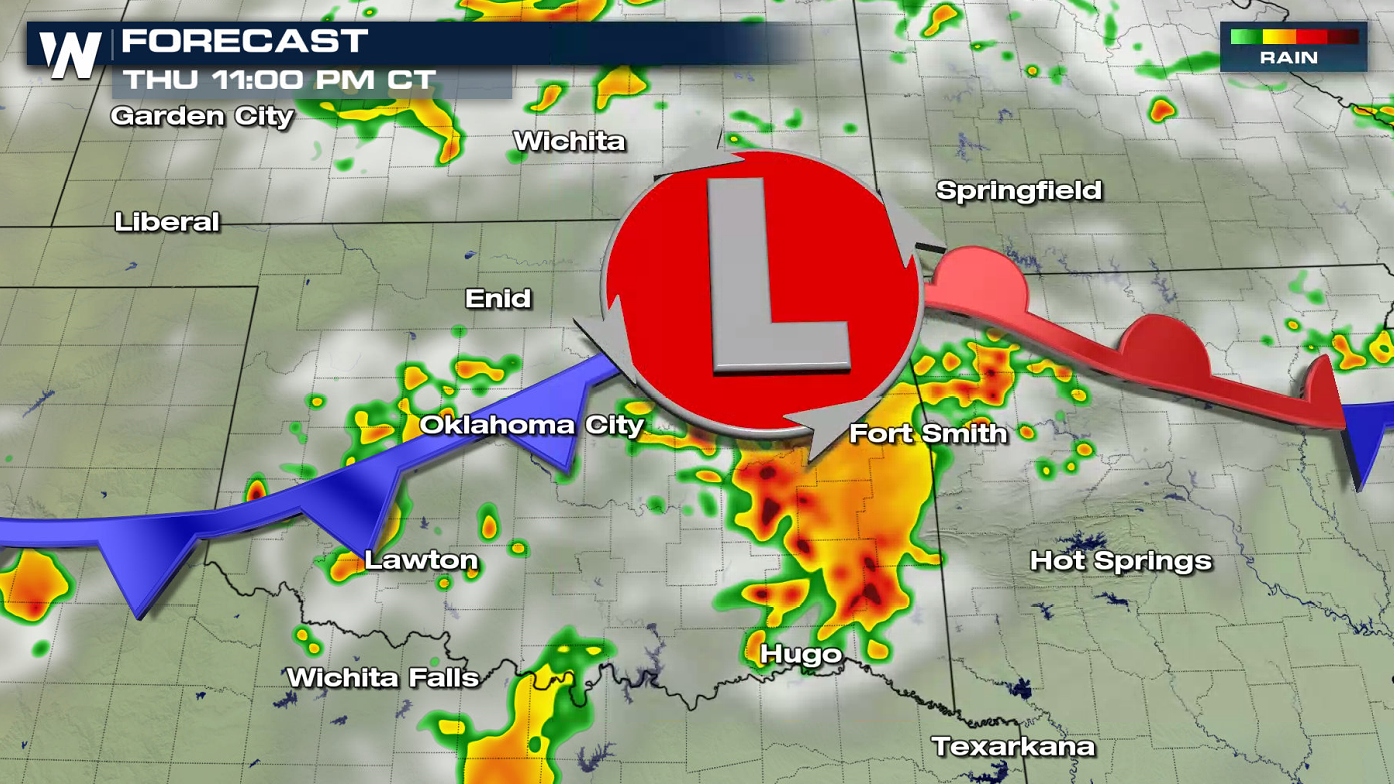
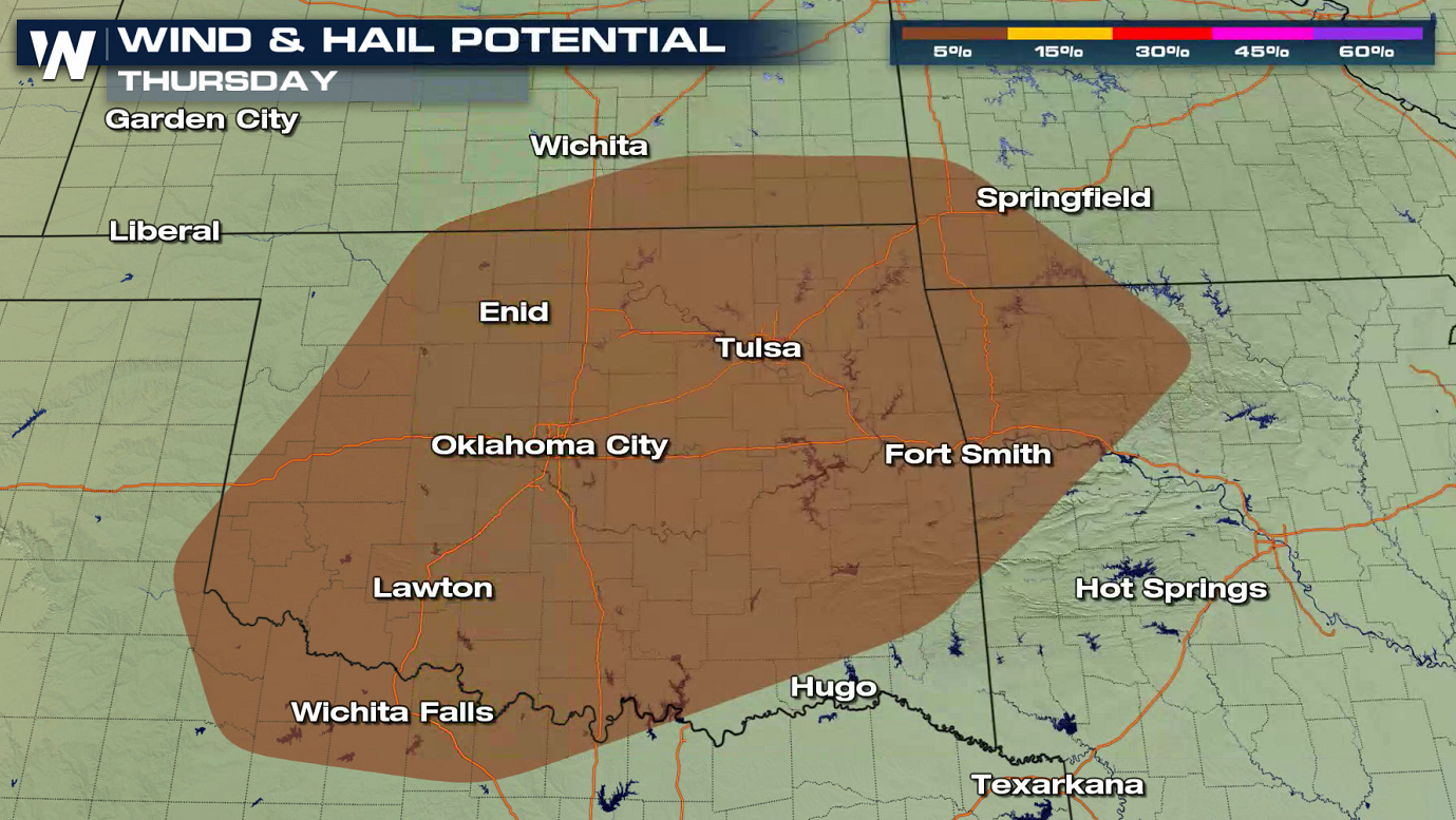 On Thursday, there is a marginal risk for severe thunderstorms from southwestern areas of Missouri to the Red River of the South. Development will be focused along a front over the region with a low pressure center moving slowly eastward. Once again, storms will develop in the late afternoon and continue into the evening.
 Keep checking in with WeatherNation for the latest updates on this developing forecast.
WEDNESDAY
The most likely locations where atmospheric dynamics will come together to bring in chances for severe thunderstorms today (Wednesday) extends from South Dakota to Oklahoma. There is a slight risk (level 2 on a scale of 1 to 5) that includes western and central Kansas. Large hail and strong wind gusts are the main threats, with isolated tornadoes possible in western Kansas.
There are a few dynamic factors to consider with this set-up. With daytime heating and more energy to work with, we look at our CAPE values. CAPE is also known as Convective Available Potential Energy. It is a measure of how much energy there is in the atmosphere. As temperatures heat up throughout the day, the CAPE values increase. Typically, anything over 1000 J/kg of CAPE (the measurement of energy) can be favorable for thunderstorm development. The yellow shades on the image below show us areas that have more energy to help with storm development.
Moisture is also needed to fuel storms. Throughout the day, low level moisture begins to increase. This in combination with orographic forcing (in this case, the Black Hill Mountains) should help support more organized thunderstorms in the same area the SPC has highlighted the marginal risk.
All of these dynamic factors are important to bring storms. Forecast guidance also shows that thunderstorms will begin during the afternoon and continue through the evening.
THURSDAY
On Thursday, there is a marginal risk for severe thunderstorms from southwestern areas of Missouri to the Red River of the South. Development will be focused along a front over the region with a low pressure center moving slowly eastward. Once again, storms will develop in the late afternoon and continue into the evening.
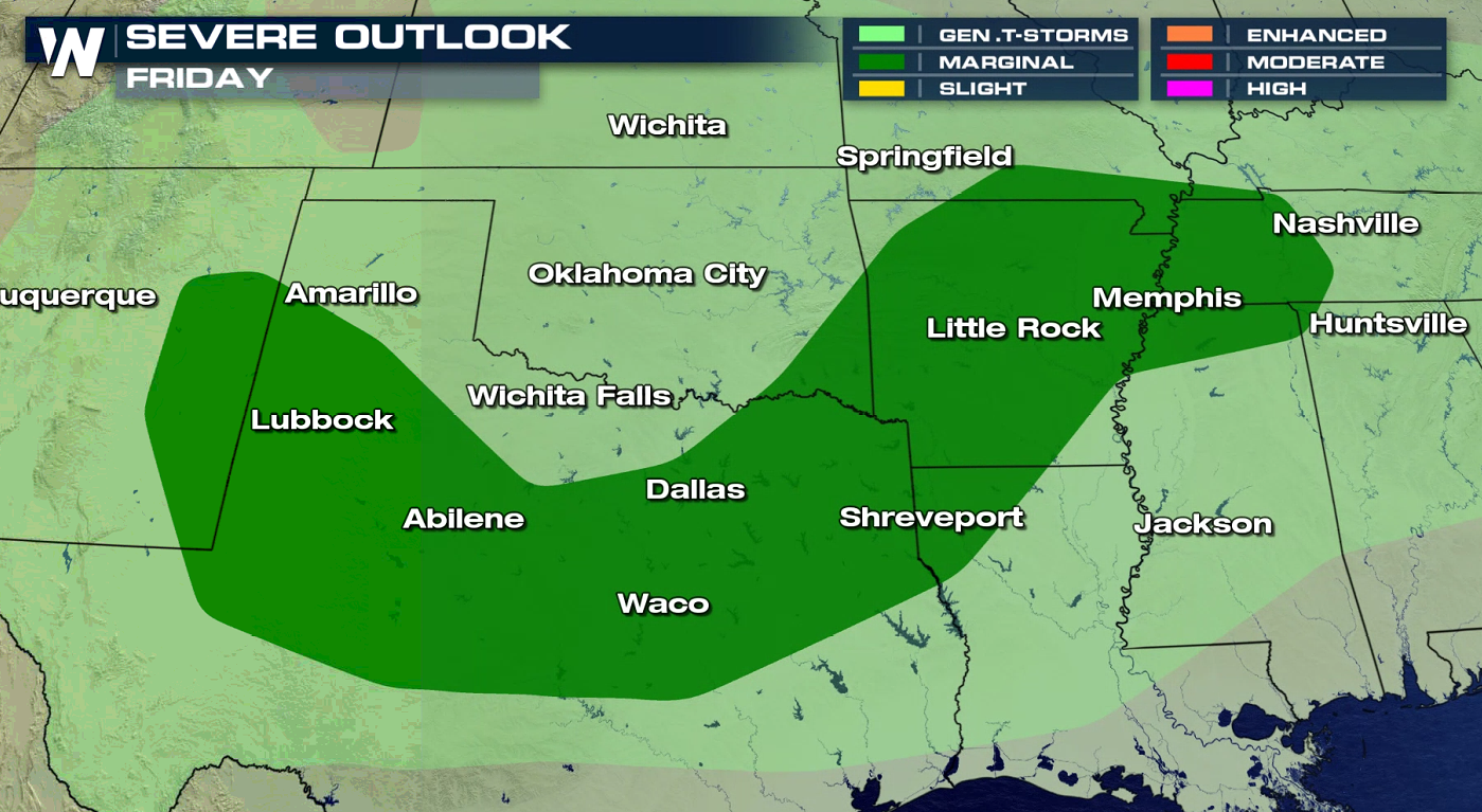
FRIDAY
As the front pushes slightly to the east and south, the threat for severe weather will extend from the Lower Mississippi Valley into Texas. Strong wind gusts and isolated tornadoes are the main concerns.
Keep checking in with WeatherNation for the latest updates on this developing forecast.All Weather News
More
More Storms for the East Through Monday
The threat for flooding rain continues across
3 Aug 2026 6:00 PM


After Reaching Category 5, Genevieve Weakens in the Pacific
PacificGenevieve formed last Friday south of
3 Aug 2026 12:30 AM

Flooding, Severe Storms Target the Midwest Again
After an active week of storms across the nor
1 Aug 2026 1:40 AM

Flooding Risk Increases as Heavy Rain Targets the Tri-State Area
Tuesday, heavy rainfall moved across the Nort
30 Jul 2026 12:25 AM