Severe Weather Threat Continues in the Midwest

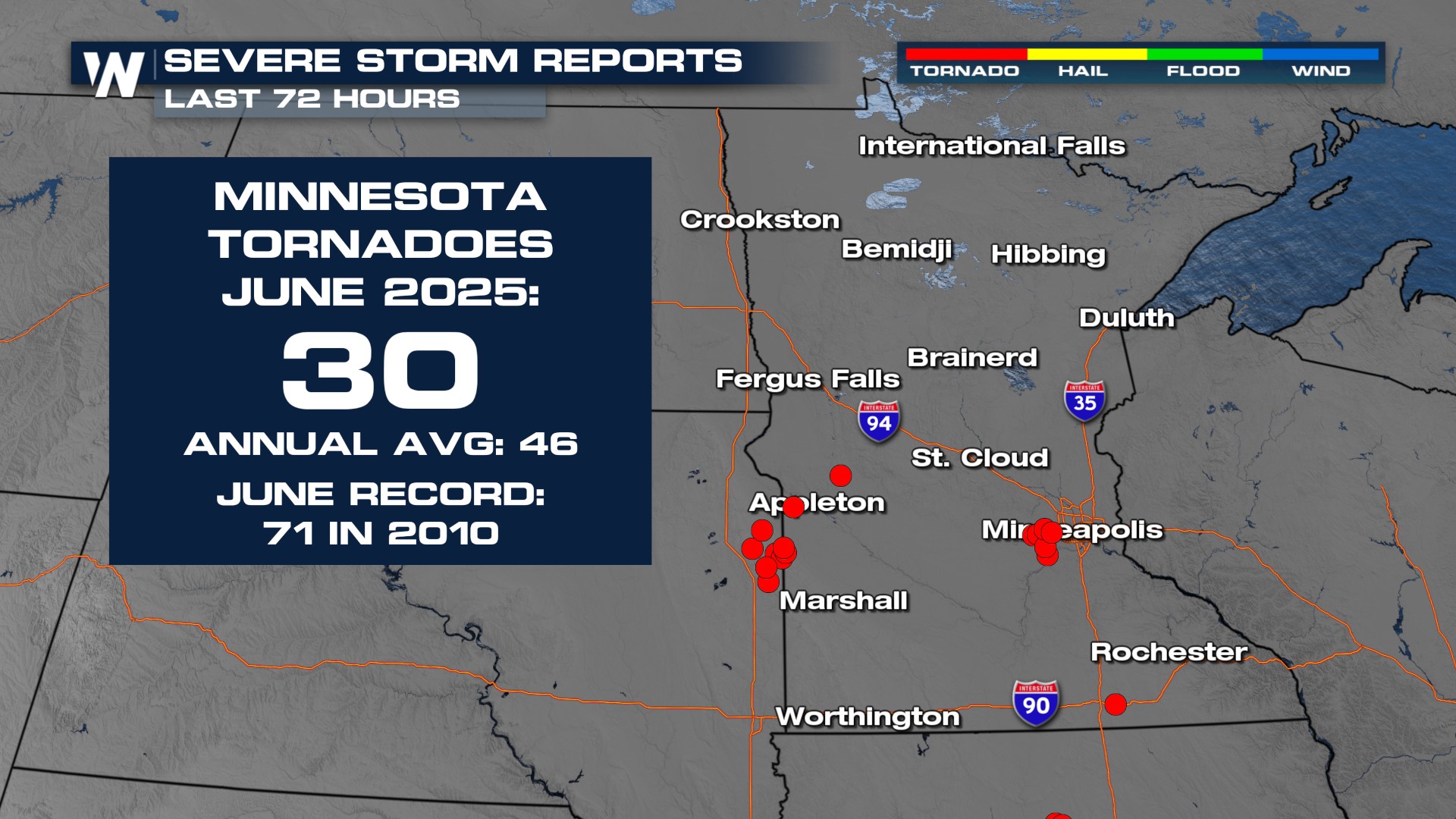
It has been an active, severe season across the Midwest! Multiple rounds of severe storms have been moving across the Midwest these last few days, with multiple tornadoes touching down on consecutive nights. The incredible stretch of severe weather has been adding up this month. We've seen 65% of our annual number of tornadoes in just one month!
Outlooks
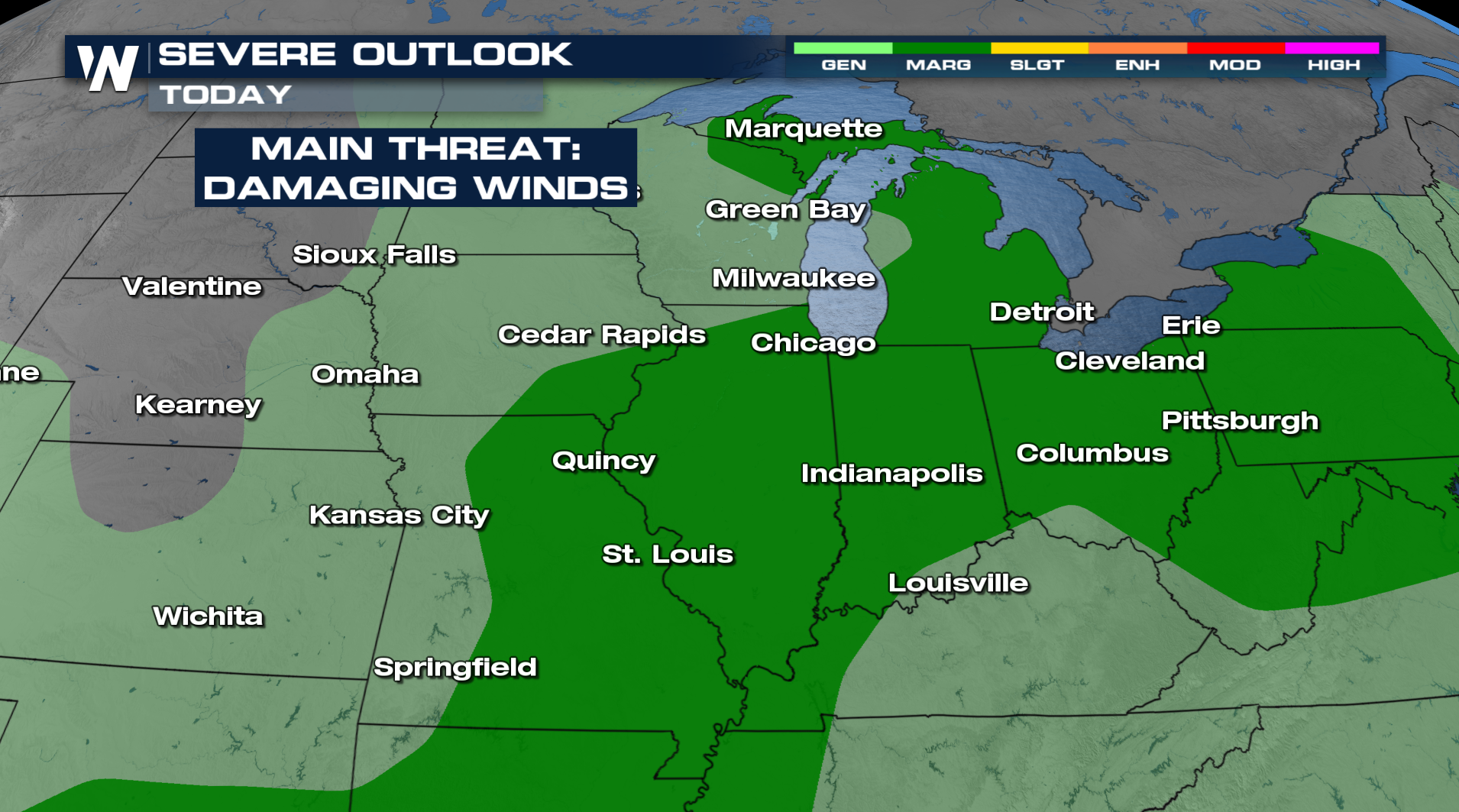
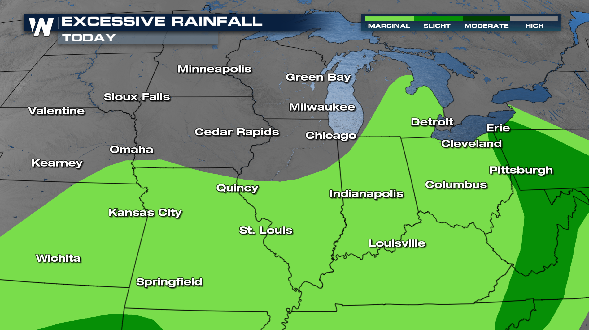
As a frontal boundary moves east, the threat shifts right along with it. Today we have the chance to see strong to severe storms. Damaging winds will be the main threat with any storms that do develop. There is also an excessive rainfall outlook across portions of the Midwest, meaning isolated flooding will be possible.
TIMING
As the cold front moves eastward, it will be the trigger mechanism for additional thunderstorm development over the next couple of days! Damaging winds will be the primary concern. Heavy rain will be possible too.
Make sure to tune into WeatherNation for all the latest updates.


