Storm Overview: Who All Is At Risk This Week?

Multi-Day Severe Storm Set-Up
We continue to see the busy April pattern from Texas to the Great Lakes. A huge trough will swing through, bringing a severe threat risk on Tuesday and Wednesday. All severe threats will be possible, including damaging winds, large hail, and tornadoes. Heavy rainfall will also be embedded in some storms, raising concerns about flooding. Make sure to stay with us for the latest updates and shifts in the forecast.
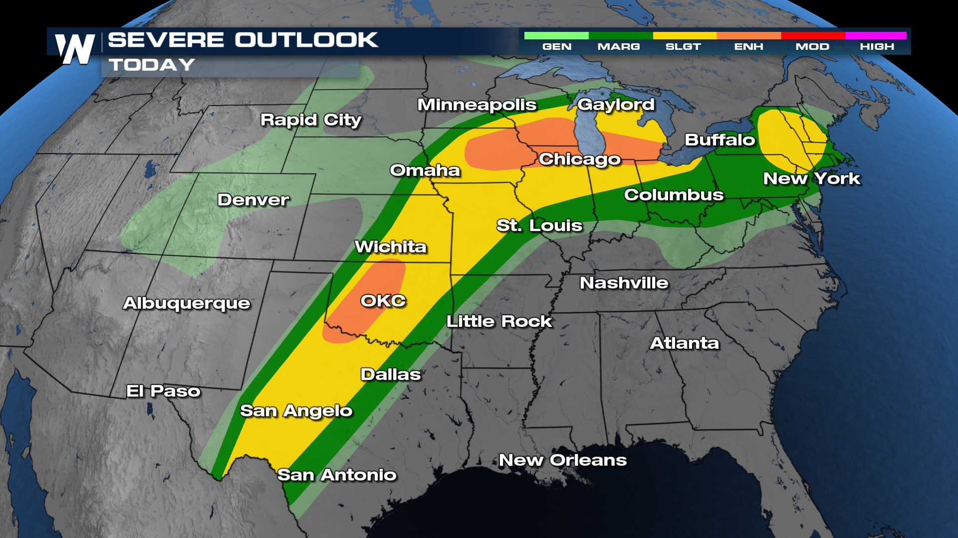
An ENHANCED (level 3 out of 5) risk for severe weather is in place on Tuesday. The outlook even expands a SLIGHT (level 2 out of 5) risk out into the northeast.
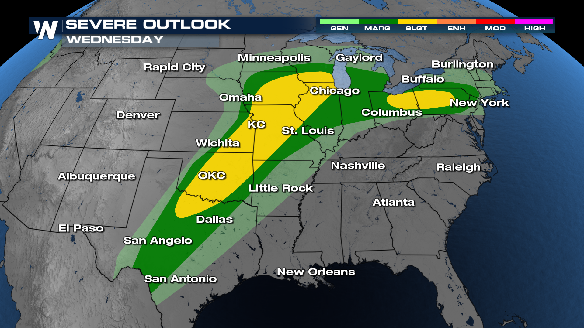
Similarly, on Wednesday, we'll have another outlook where two hot spots for severe weather are highlighted. At this point, however, a SLIGHT (level 2 out of 5) risk for severe weather is issued.
Daytime heating will help to spark up thunderstorms on Tuesday and Wednesday afternoon. Some storms will remain strong into the evening and nighttime hours, so make sure to have multiple ways to get alerts.
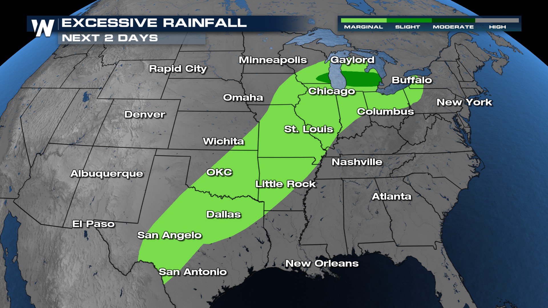
In addition to severe storm hazards (wind, hail, and tornadoes), heavy rainfall rates are expected to lead to flash flood potential. It doesn't appear to be a high-end flooding threat, but as the forecast draws closer, we will keep you updated!
For a deep dive into the north and south sides of this severe threat, visit the following articles on our website!
North Side
South Side


