Plains to Mid Atlantic Severe Weather Threat This Week
Special Stories
30 Apr 2019 3:18 AM
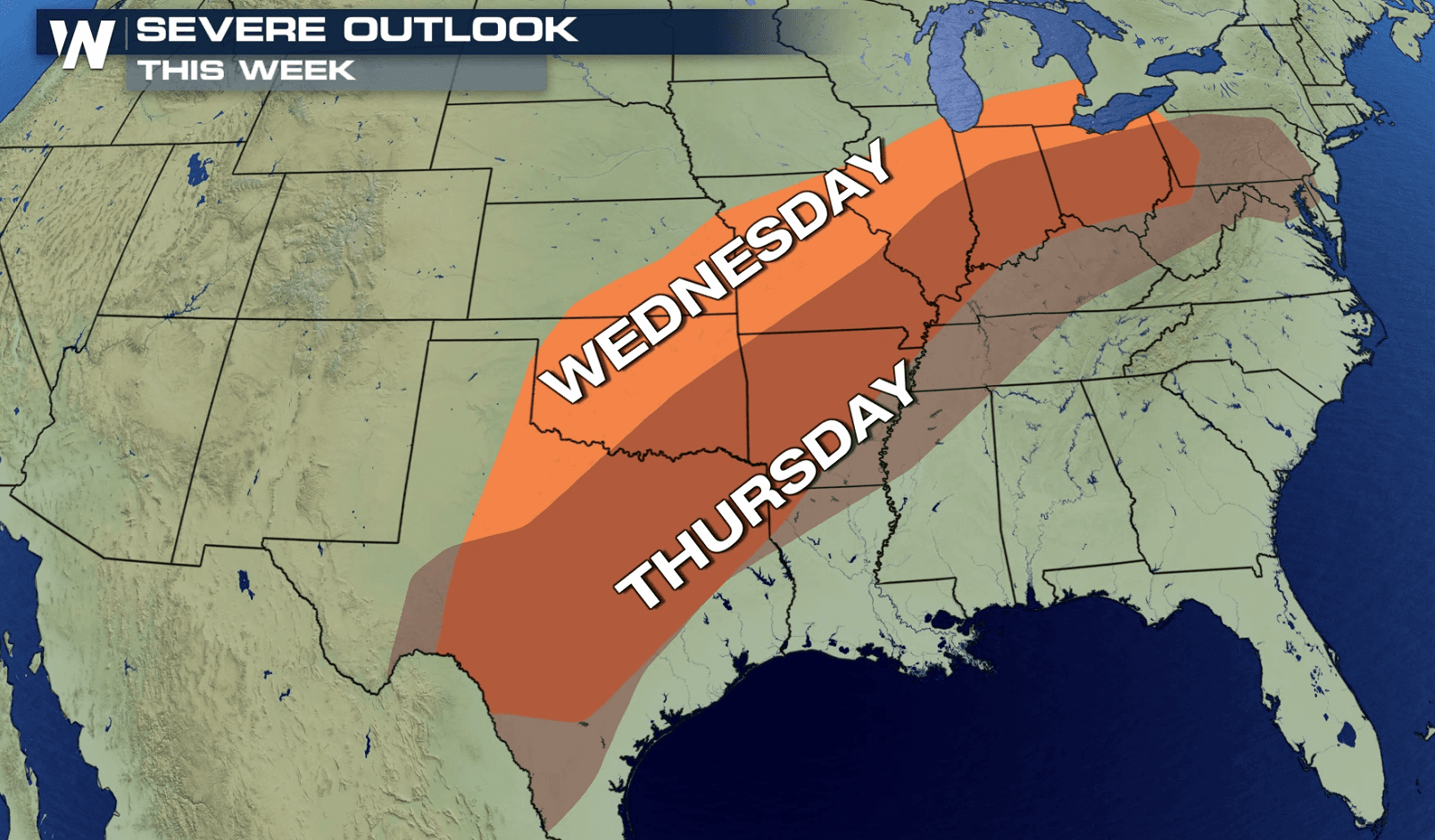
An active severe weather pattern is likely to continue this week, focused across the Plains and Ohio Valley. Severe thunderstorms are likely today in the mid section of the nation. The risk continues on Wednesday and Thursday from Maryland to Texas.
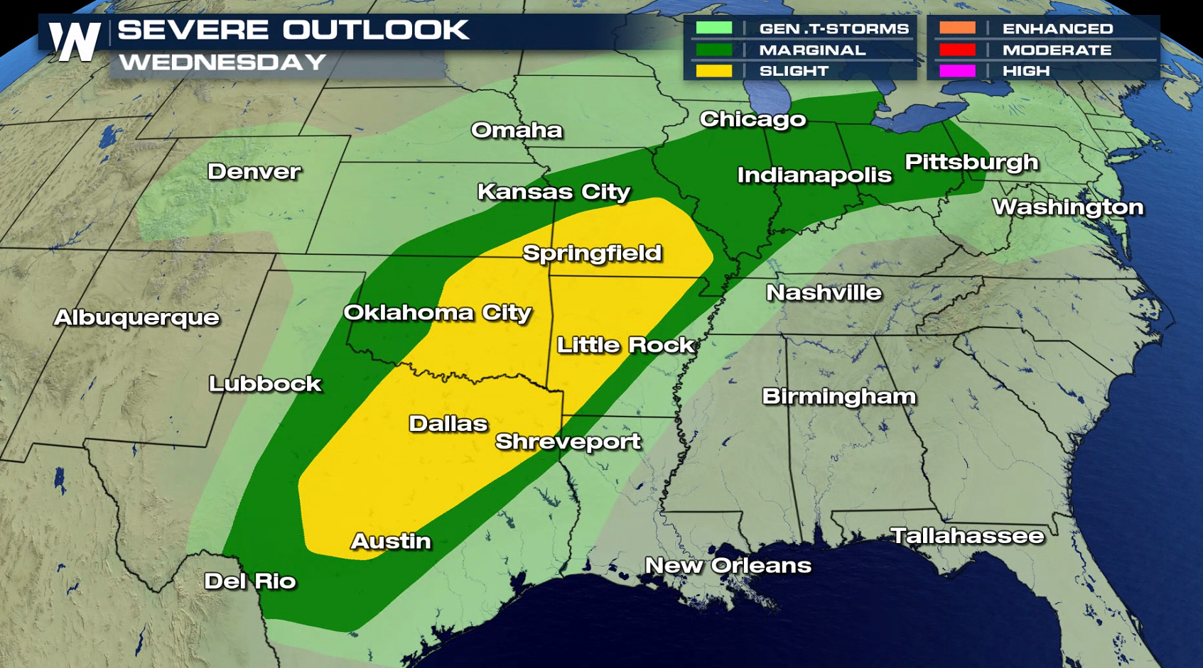
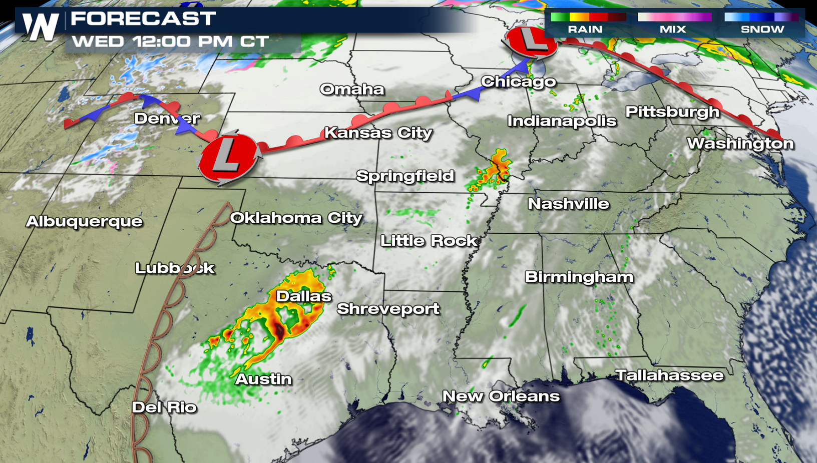
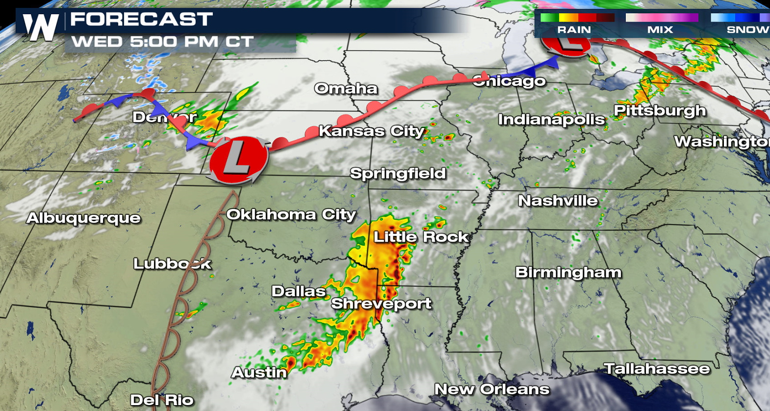
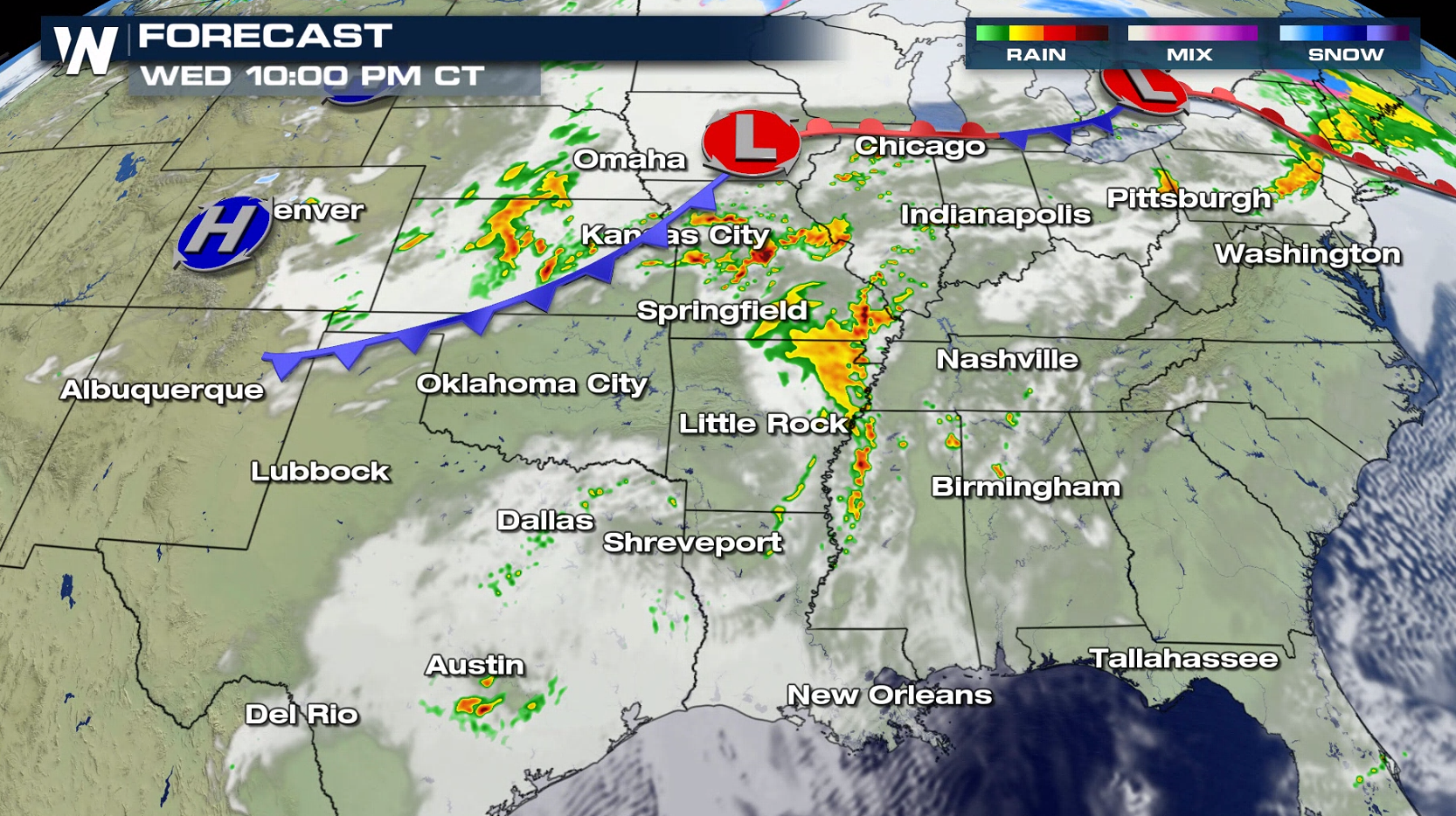
 Instability and Jet Stream energy is forecast to be slightly less on Wednesday when compared to today (Tuesday). A few severe storms will likely form near the dry line in the afternoon and evening hours, pushing from north Texas to the Arklatex. Along the front in the central Plains, isolated severe cells may form in the early evening.
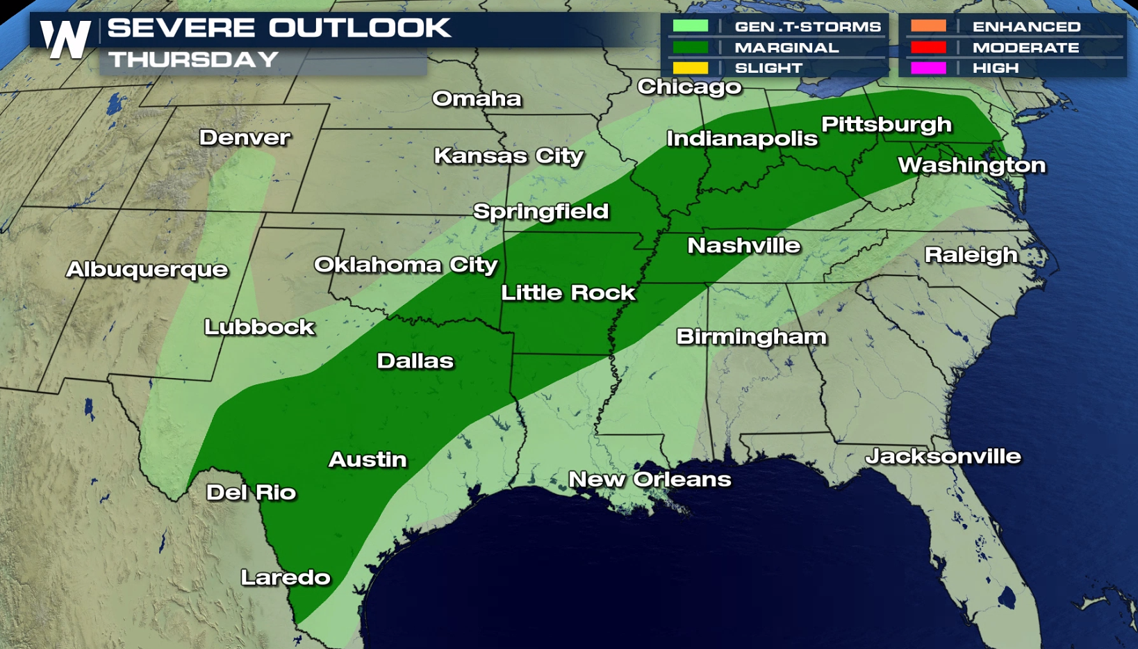
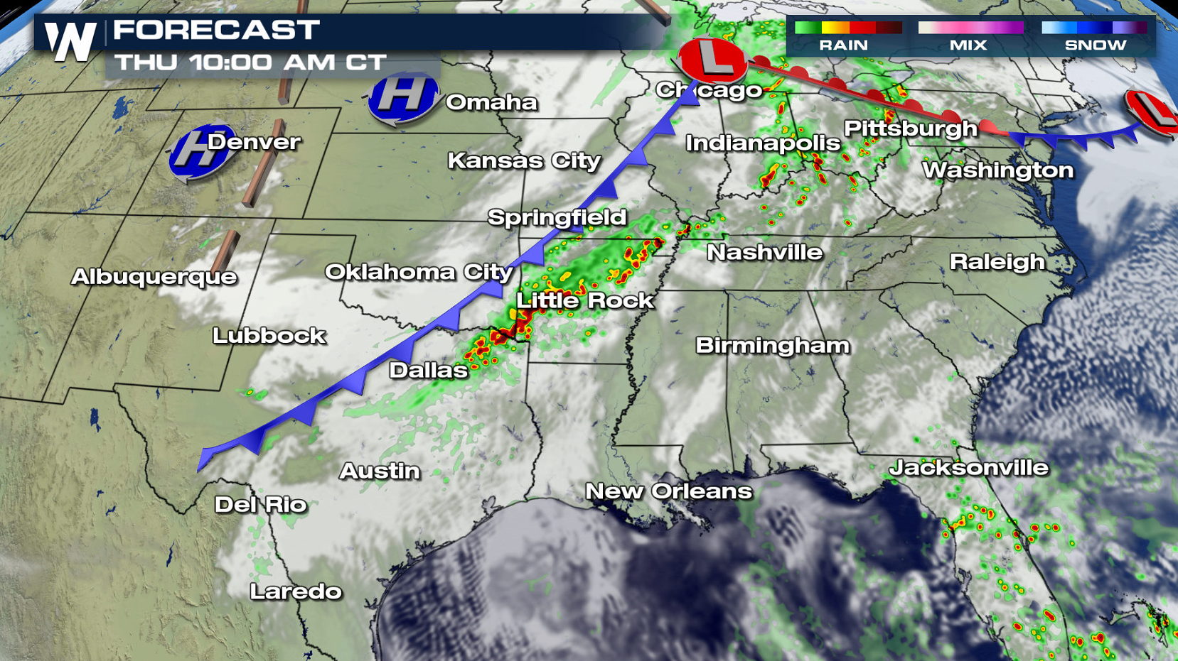
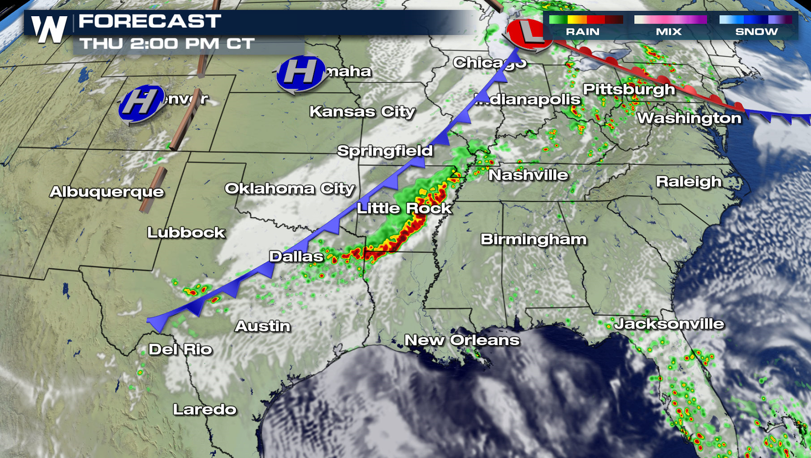
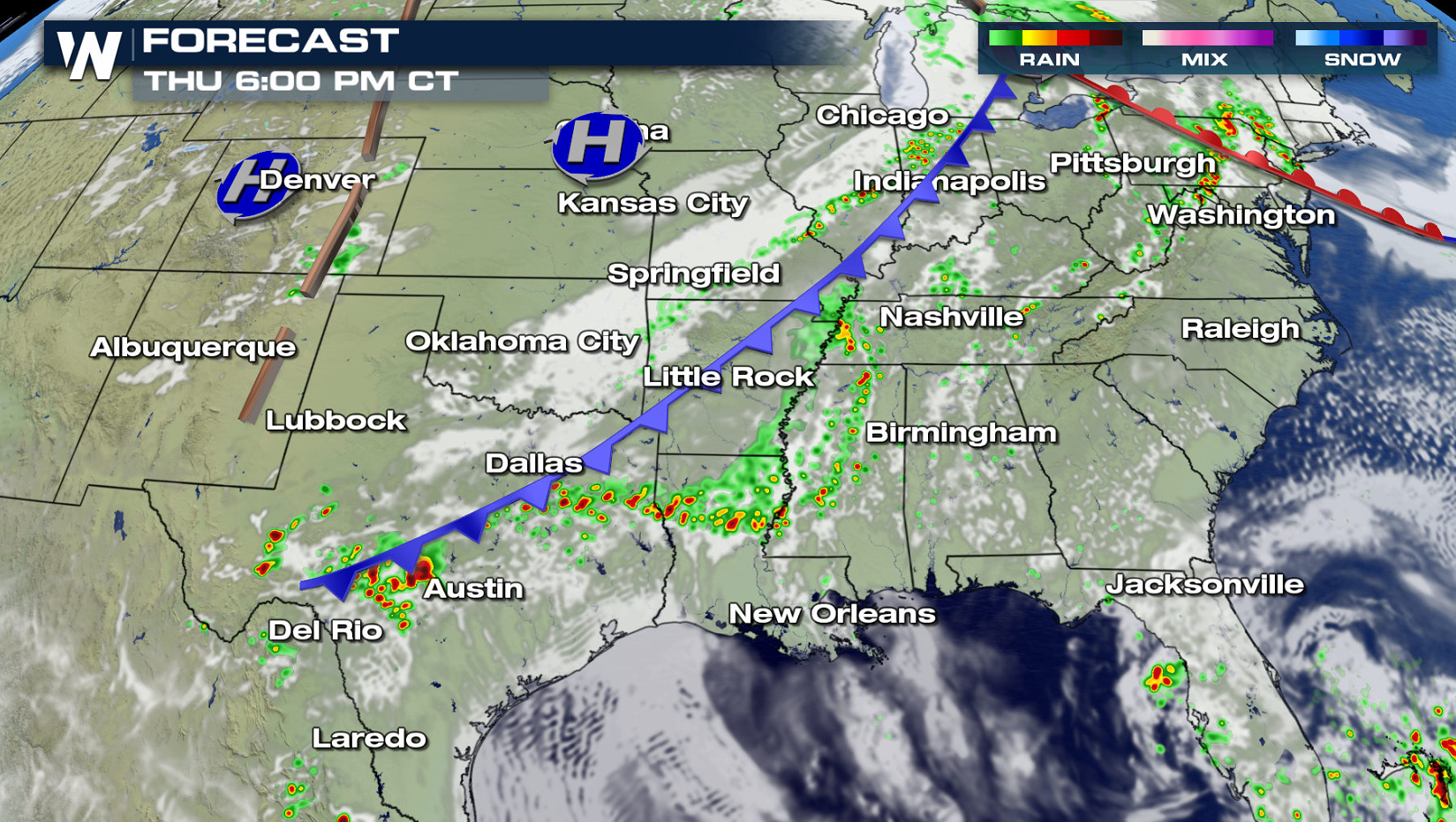
 Storms will likely be on-going Thursday morning ahead of a cold front from the Great Lakes to Texas. Humidity is expected to be high ahead of the front, but lower instability due to cloud cover. Weak upper level energy will lead to isolated severe thunderstorms, but coverage is expected to be limited.
 Have a severe weather plan in place, in case you need to take shelter Tuesday and Wednesday if threatening storms approach your area. Be sure to check back with WeatherNation on-air and online if you are in the severe weather risk areas.
For WeatherNation: Meteorologist Mace Michaels
Have a severe weather plan in place, in case you need to take shelter Tuesday and Wednesday if threatening storms approach your area. Be sure to check back with WeatherNation on-air and online if you are in the severe weather risk areas.
For WeatherNation: Meteorologist Mace Michaels
Instability and Jet Stream energy is forecast to be slightly less on Wednesday when compared to today (Tuesday). A few severe storms will likely form near the dry line in the afternoon and evening hours, pushing from north Texas to the Arklatex. Along the front in the central Plains, isolated severe cells may form in the early evening.
Storms will likely be on-going Thursday morning ahead of a cold front from the Great Lakes to Texas. Humidity is expected to be high ahead of the front, but lower instability due to cloud cover. Weak upper level energy will lead to isolated severe thunderstorms, but coverage is expected to be limited.
Have a severe weather plan in place, in case you need to take shelter Tuesday and Wednesday if threatening storms approach your area. Be sure to check back with WeatherNation on-air and online if you are in the severe weather risk areas.
For WeatherNation: Meteorologist Mace MichaelsAll Weather News
More
Flood Risk Continues for the Mid-Atlantic on Friday
A stalled boundary over the Carolinas will ke
23 Jul 2026 11:05 PM

Tropics: Bertha Dissipates, Fausto Heads to Hawaii
BerthaBertha has now moved inland into easter
23 Jul 2026 11:00 PM

Very Hot Temperatures For the Western and Central United States
Are you over the summer heat yet? Well, more
23 Jul 2026 10:50 PM

Hot & Smoky w/ a Chance of Lightning
Conditions have been really dry out west. We'
23 Jul 2026 1:20 PM

Another Round of Storms Targets the Northeast
Tuesday brought severe weather again across p
23 Jul 2026 1:15 AM

Another Round of Severe Weather for the Upper Midwest and Great Lakes
The upper-level low train continues to keep t
21 Jul 2026 1:45 AM

Air Quality Improvements in the Forecast
Wildfires burning in Northwestern Ontario, Ca
20 Jul 2026 7:20 PM