Potential Late-Week Winter Storm for the Upper-Midwest
Top Stories
8 Dec 2020 2:00 AM
After a long stretch of dry conditions and mild temperatures in the Northern Plains and Upper Midwest, the weather pattern will become more active later this week. Computer models are pointing to the potential for significant snow in the region.
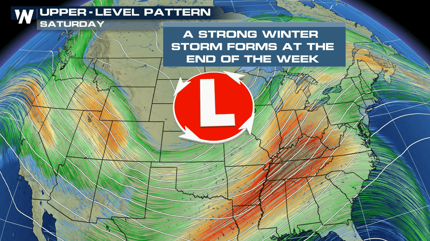
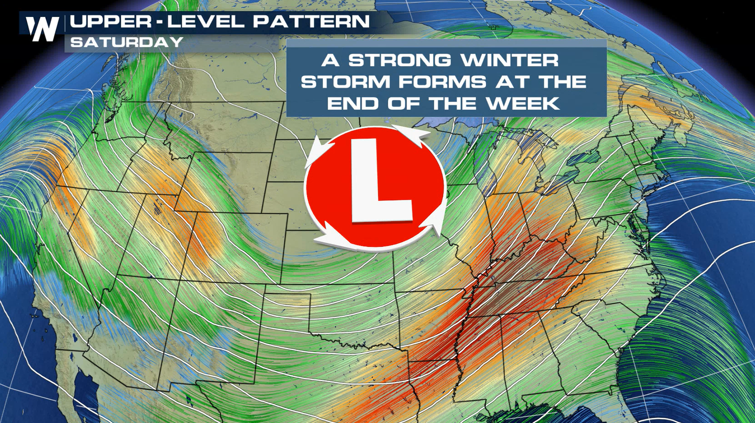
 By the end of the week, the jet stream branches will merge, forming a strong, well developed storm system.
 The temperatures are a major factor in the rain and snow forecast across the Nation this week. The latest forecast is showing heavy snow over Michigan, but heavy rain down to Chicago. If the temperatures change slightly, then we could see heavy snow in Chicago and Milwaukee. Stay tuned to this forecast!
WeatherNation will continue to update this article with the latest forecasts for the end of the week. Check back with us on-air and online for updates on this potential winter storm.
The temperatures are a major factor in the rain and snow forecast across the Nation this week. The latest forecast is showing heavy snow over Michigan, but heavy rain down to Chicago. If the temperatures change slightly, then we could see heavy snow in Chicago and Milwaukee. Stay tuned to this forecast!
WeatherNation will continue to update this article with the latest forecasts for the end of the week. Check back with us on-air and online for updates on this potential winter storm.
Jet Stream
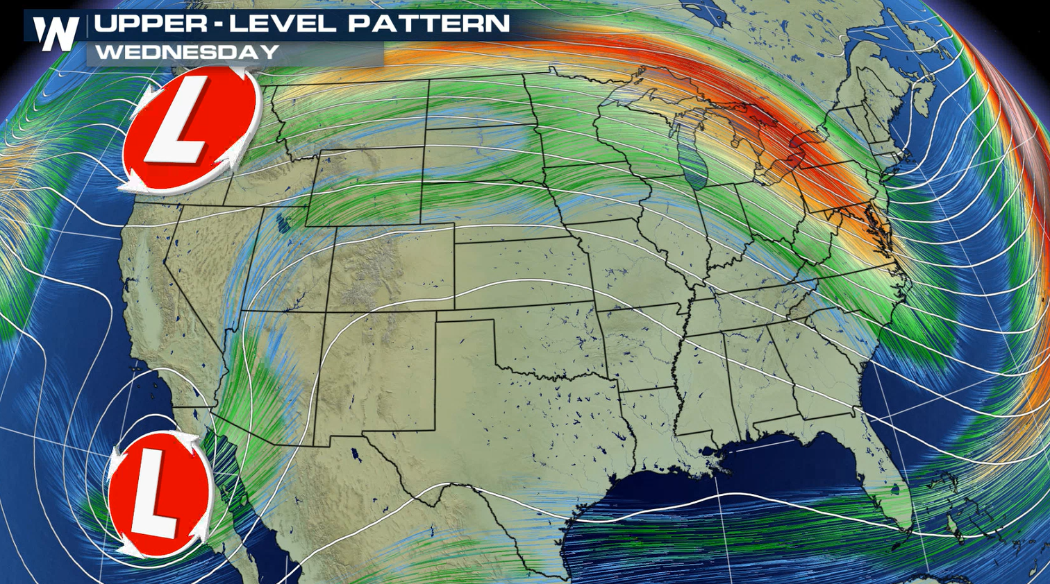
The jet stream flow is split into two branches to start this week. The northern branch is located across Southern Canada and the northern tier of the U.S., with the southern flow from the Southwest across Northern Mexico into the Southeast.
By the end of the week, the jet stream branches will merge, forming a strong, well developed storm system.
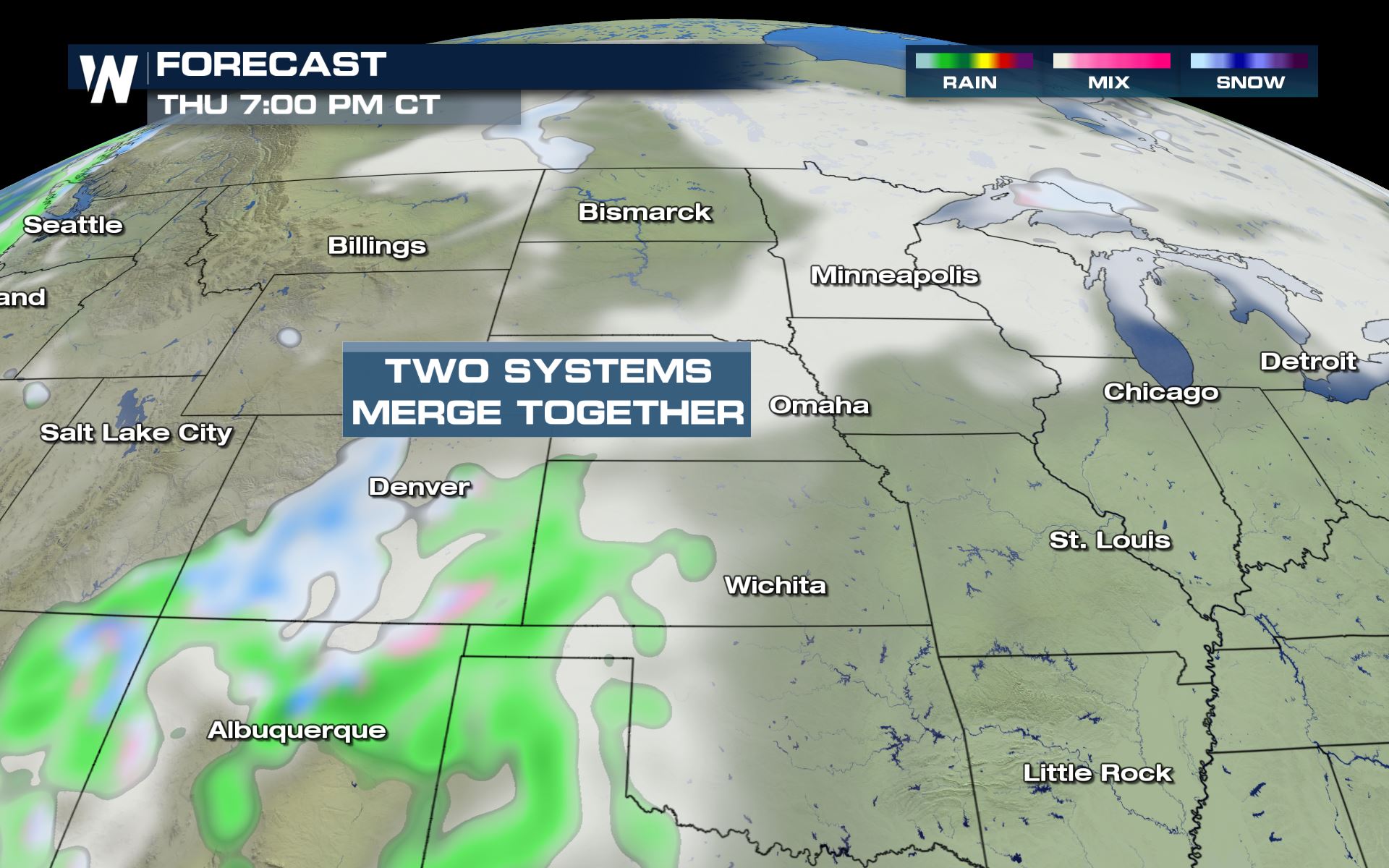
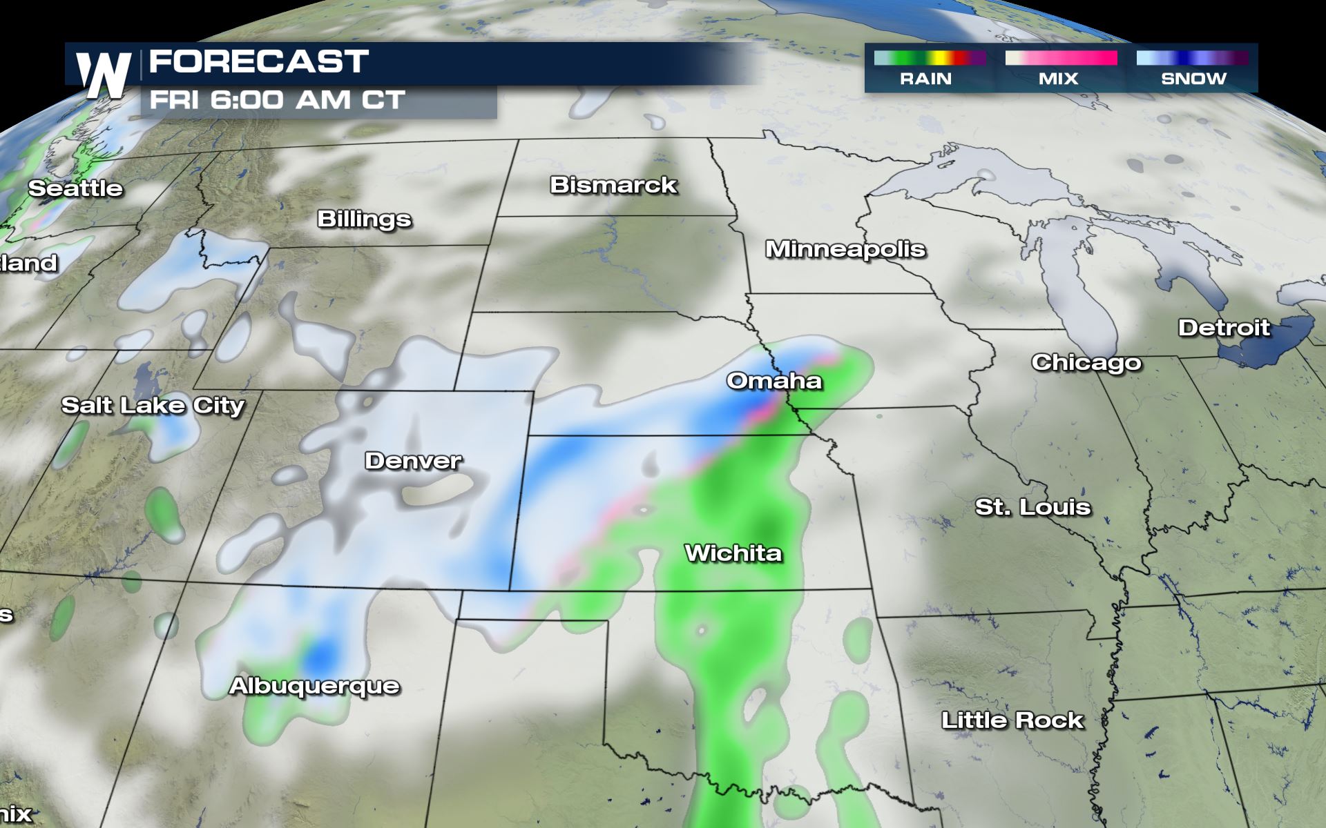
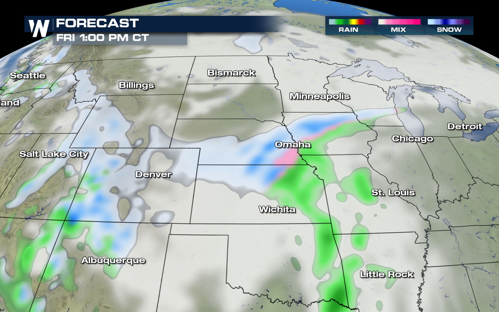
Forecast
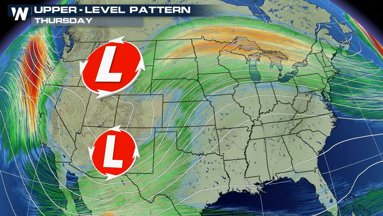
Two upper-level lows will come together this week over the plains and form a larger upper-level low over the Plains and bring widespread precipitation to the central and eventually the eastern U.S.. Here is the latest forecast.
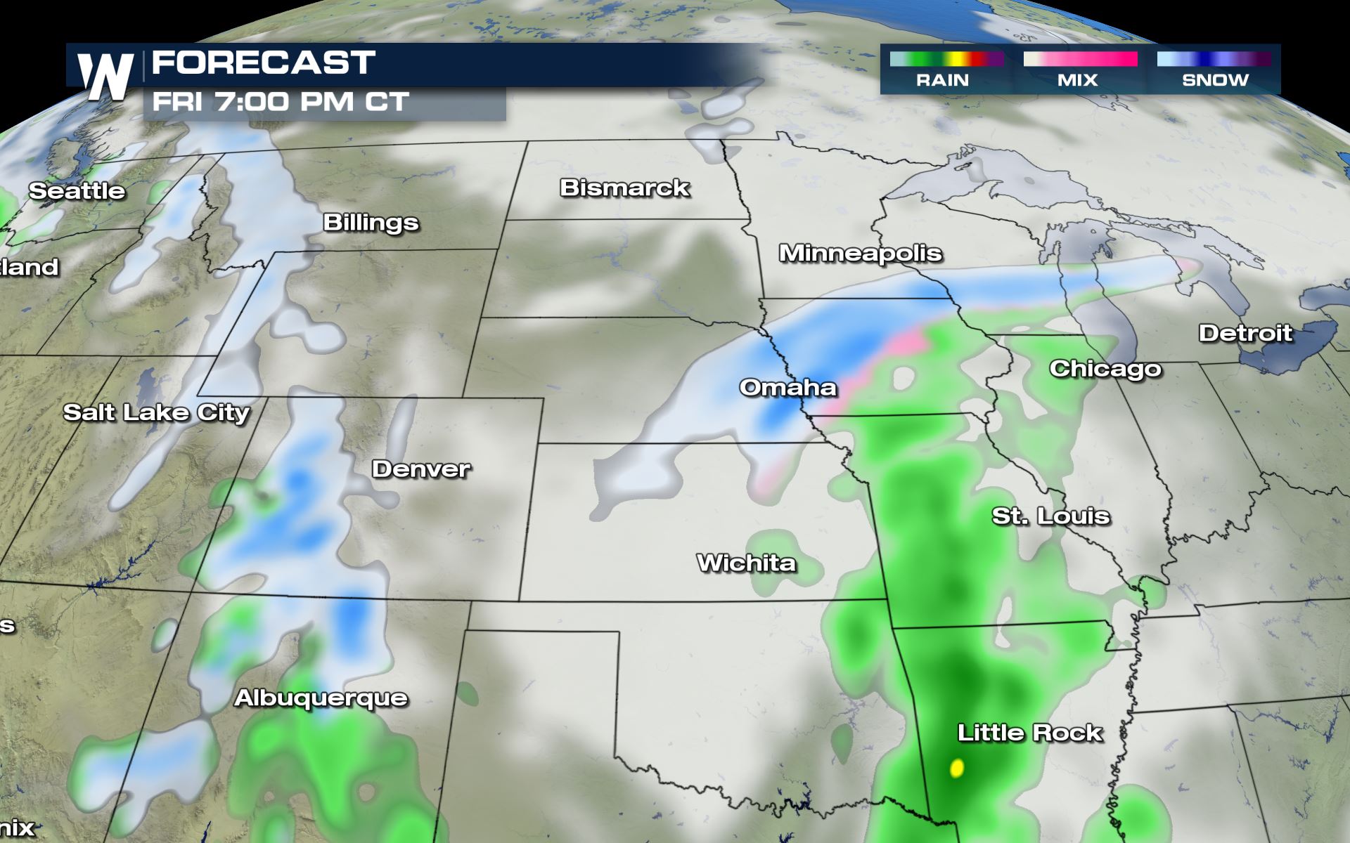
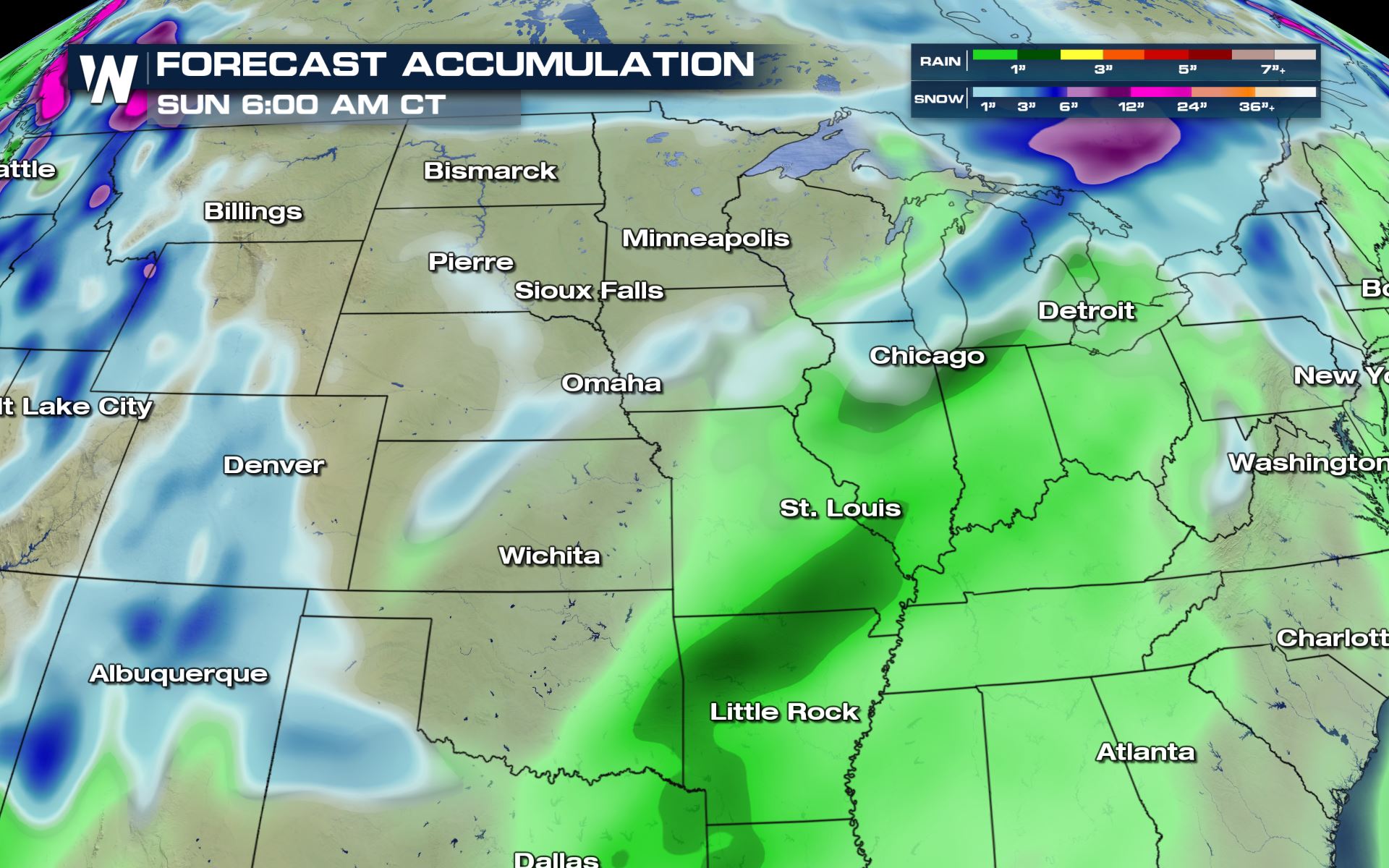
Rain and Snow Totals
The temperatures are a major factor in the rain and snow forecast across the Nation this week. The latest forecast is showing heavy snow over Michigan, but heavy rain down to Chicago. If the temperatures change slightly, then we could see heavy snow in Chicago and Milwaukee. Stay tuned to this forecast!
WeatherNation will continue to update this article with the latest forecasts for the end of the week. Check back with us on-air and online for updates on this potential winter storm.All Weather News
More
Tropics: Fausto Heads to Hawaii; Genevieve Rapidly Intensifying
Atlantic BasinBertha has dissipated after mov
27 Jul 2026 10:35 AM


Severe Storms Target the Midwest to the Northeast This Week
Extreme heat will be a big story this week ac
27 Jul 2026 9:50 AM

Southeast Flood Risk Lingers Near Stalled Front
A stalled boundary over the Southeast will ke
25 Jul 2026 10:55 AM

Another Round of Storms Targets the Northeast
Tuesday brought severe weather again across p
23 Jul 2026 1:15 AM

Another Round of Severe Weather for the Upper Midwest and Great Lakes
The upper-level low train continues to keep t
21 Jul 2026 1:45 AM