Tropical Storm Imelda Forms

Tropical Storm Imelda has officially formed with the early afternoon update from the National Hurricane Center. Tropical Storm Watches and Warnings have been issued for parts of the Bahamas and the east coast of Florida. Over the last 24 hours, models have trended toward a solution that keeps the core of the storm offshore, but that's not to say the impacts will avoid the southeast.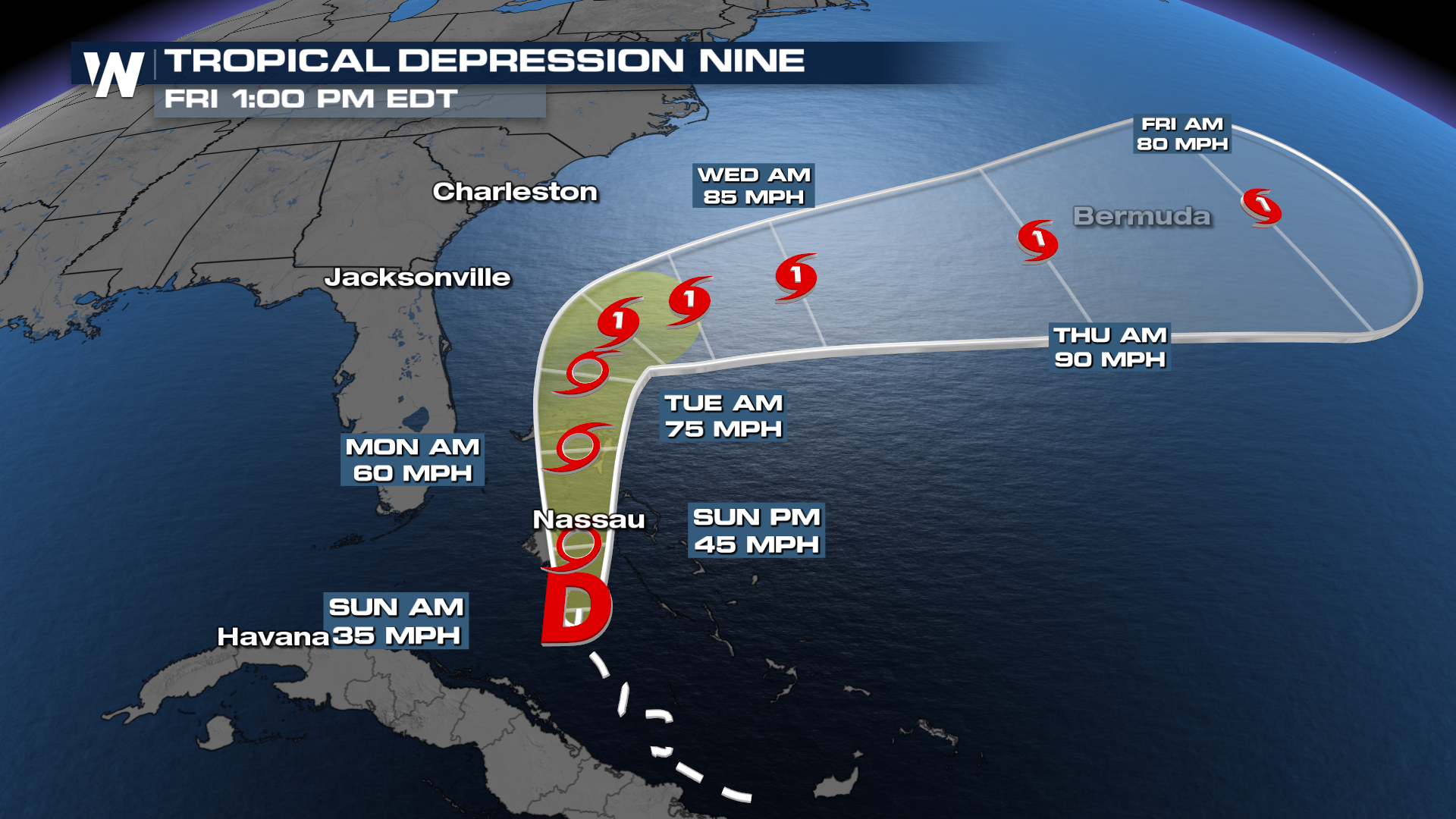
The latest forecast cone from the National Hurricane Center shows this system slowing down considerably as it approaches the coast of the Carolinas Monday into Tuesday. Given how sensitive this forecast is to multiple moving parts, now's not the time to get complacent! Don't let your guard down as coastal flooding and rip currents are likely.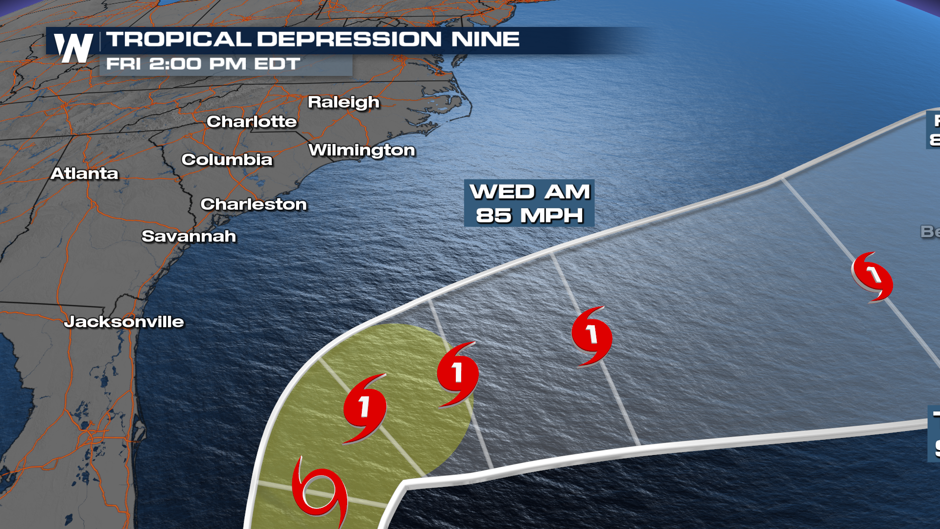
So what does this mean for the United States? If you live anywhere from Northeast Florida, Georgia, and the Carolinas you might want to start preparing for the potential for tropical impacts this week. Starting now, you should consider going over your hurricane kit and making sure you have things in the event we are looking at a tropical storm or hurricane moving towards the coast next week. This includes gassing up the car, making a grocery or hardware store trip, etc. Take time this weekend to clear your gutters and take other measures to prepare your property for flooding, which could be a significant threat.
Wind Impacts
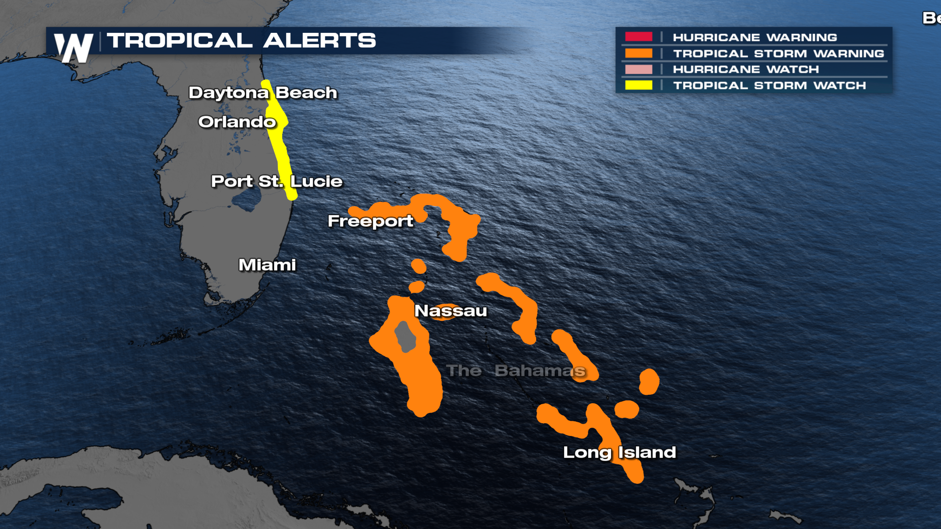
Tropical storm watches have been issued for the east coast of Florida with potentially tropical storm-force winds (39-73 mph) between Jupiter and Flagler Beach. Tropical storm warnings are in effect for many Bahamian Islands as tropical storm-force winds are expected in the next 48 hours.
Flood Potential
The more concerning threat to keep an eye on will be the heavy rain and flooding. As we look into next week, multiple inches of rain could be falling over already saturated soils from this weekend's stalled front. 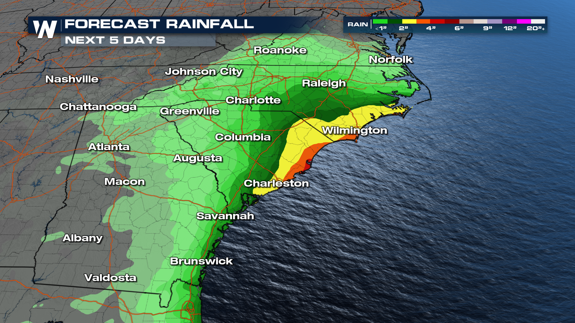 The Weather Prediction Center is already highlighting the chance for scattered flash flooding on Monday and Tuesday, with higher threat levels likely to be issued as confidence in the forecast increases.
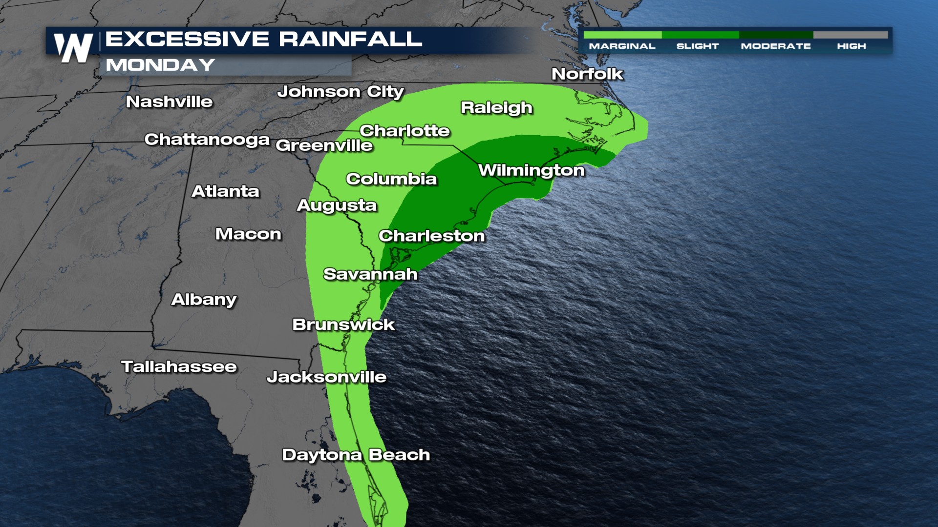
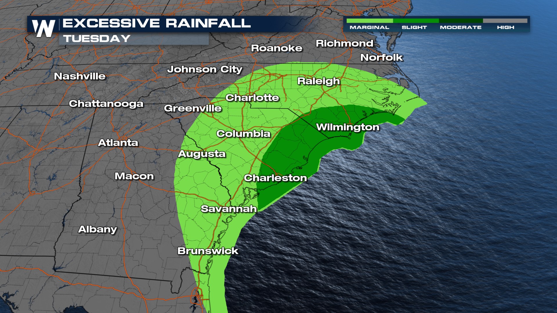 If you live in or near a flood zone in these dark green areas, consider your options for seeking higher ground or heading somewhere else to ride out the storm.


