Cold Front Increases NE Fire Danger, Light Snow Possible

A cold front has moved through the Northeast and has brought impacts. Temps remain cool and below average for Monday, but we see a bit of a warming trend moving in on Tuesday and Wednesday. Cool temps, dry conditions, and lower relative humidity have led to fire alerts into Monday morning.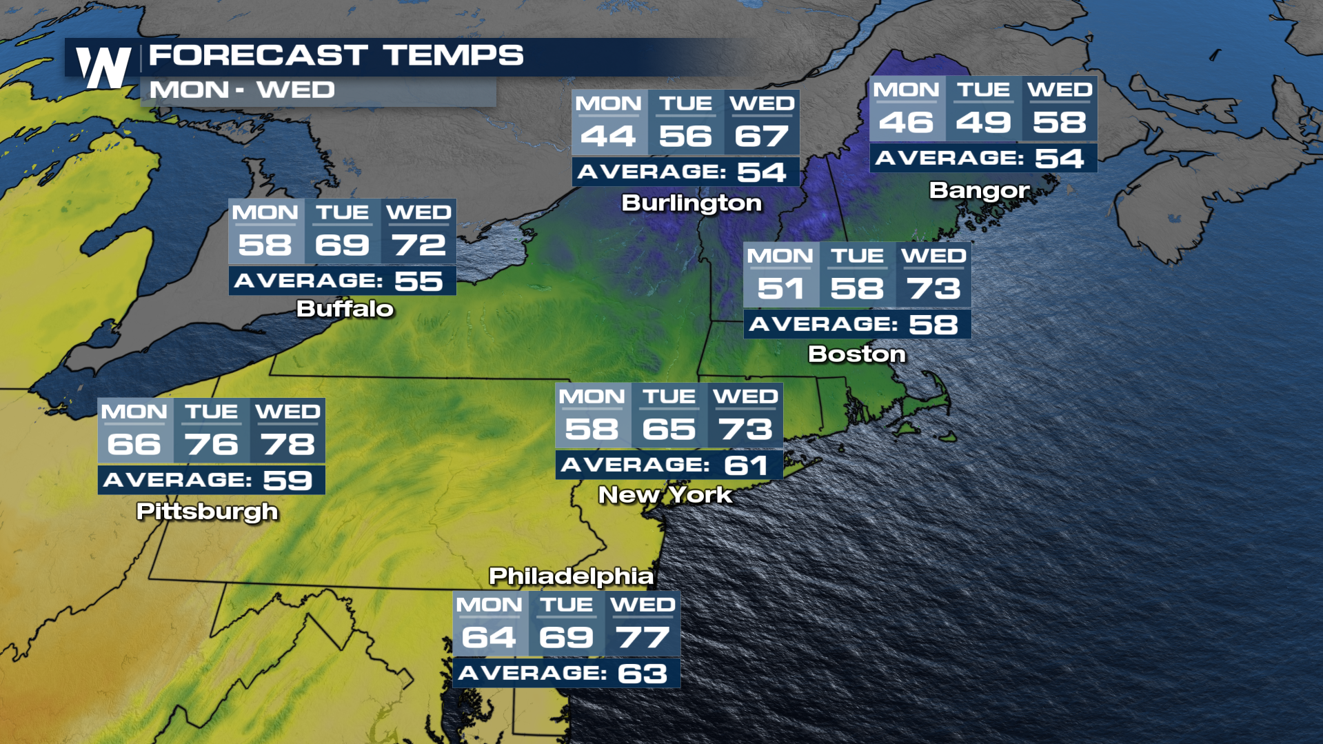 Wind gusts, accompanied by drier air, will lead to another day of high fire danger around the Mid-Atlantic and New England. Connecticut is under a state of emergency due to widespread fire conditions and several ongoing brush fires. The Governor is urging residents to avoid outdoor burning.
Fire alerts have been issued through Monday morning for portions of the Northeast. Dry weather, combined with low relative humidity and dry soils will make conditions favorable for wildfire development. Please use caution if you plan on doing any outdoor burning.

The cooler air should help to spur a few showers as moisture is picked up from the Great Lakes. Overnight, there will be limited rain and snow for portions of Northern New York, Vermont, and New Hampshire. Any light precipitation will taper off by the morning hours. Unfortunately, the precipitation won't likely be enough to benefit drought-stricken areas, which have become more widespread in recent weeks due to little or no precipitation in October. 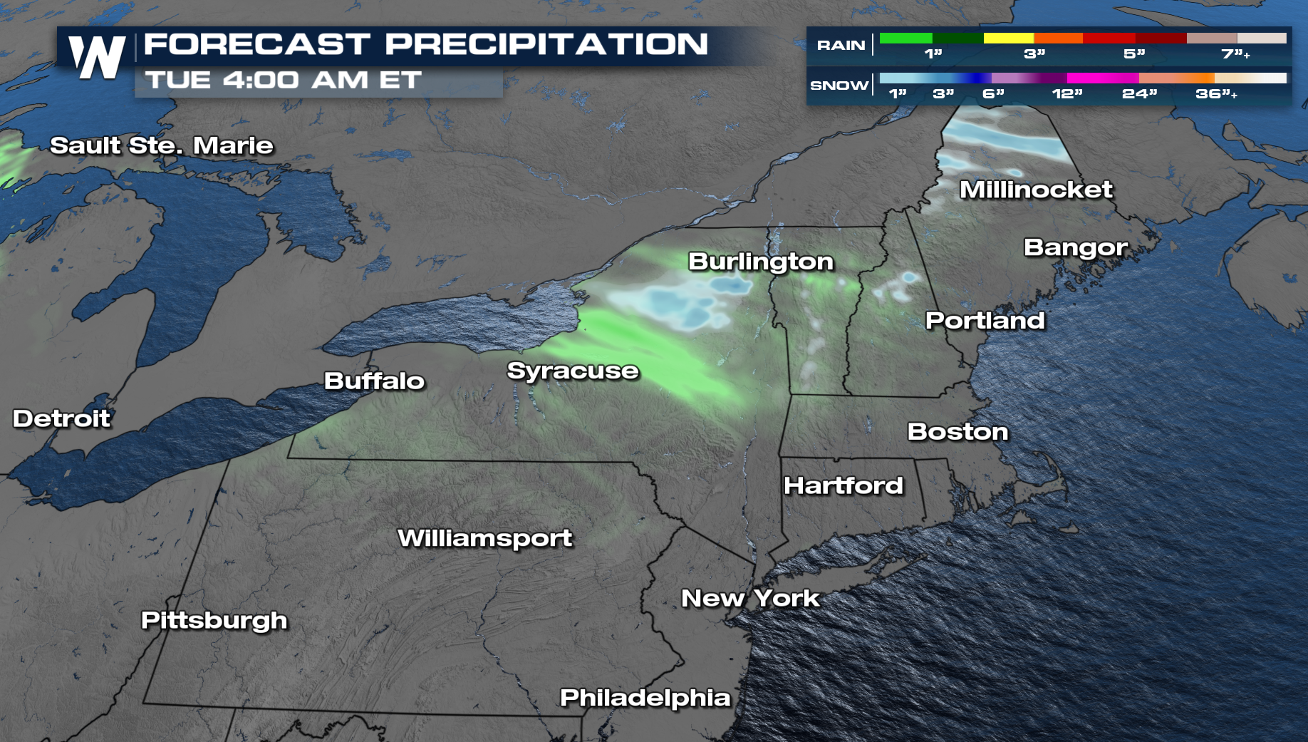 For more details on the heat, be sure to join us :10 minutes past the hour for your eastern regional forecast and 30 minutes past for your central regional forecast.


