Florida Wildfire and Storm Threat

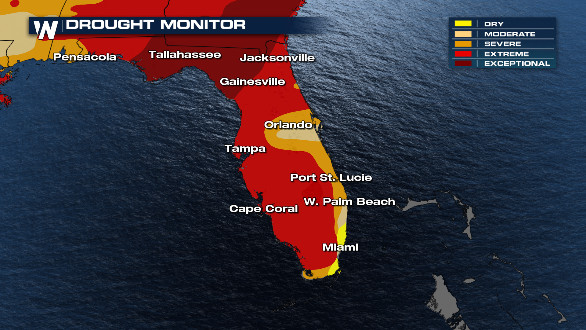
FLORIDA - On Sunday, May 11, 2026, a wildfire broke out in the Florida Everglades after weeks of extreme to exceptional drought conditions across the state. Since Sunday, the fire has burned more than 11,000 acres and is now 60% contained, according to the Florida Forest Service.
According to the Pembroke Pines Police Department, smoke from the fire caused traffic backups along U.S. 27, so drivers are encouraged to avoid the area if possible.
The state of Florida is currently 100% drought-covered, with 98% of the state experiencing conditions worse than moderate drought.
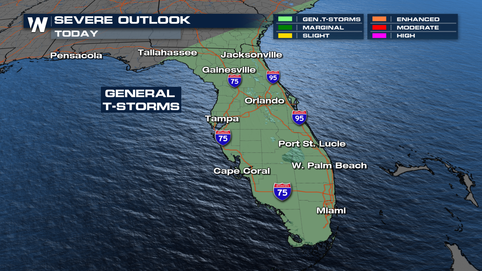
Incoming Rain and Storms
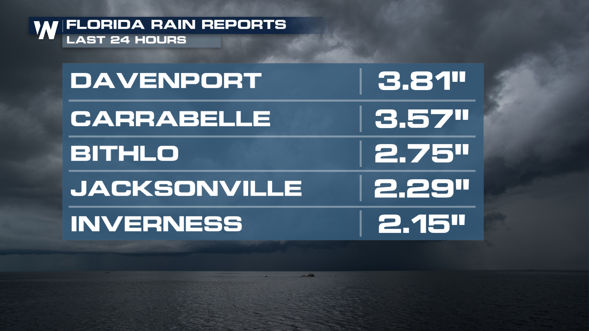
Rain chances continue this week, raising concerns about how much moisture these drought-stricken soils can handle. While any rainfall will be beneficial, heavy downpours in a short amount of time could lead to standing water and localized flash flooding. Rain totals will be more isolated Wednesday and totals will be less than Tuesday, where areas in north Florida picked up over 2".
Wednesday the severe storm threat remains low, and just general isolated thunderstorms are expected. Fingers crossed some of that rain gets down to the Everglades to help with that fire!