Messy System Moving into the Midwest

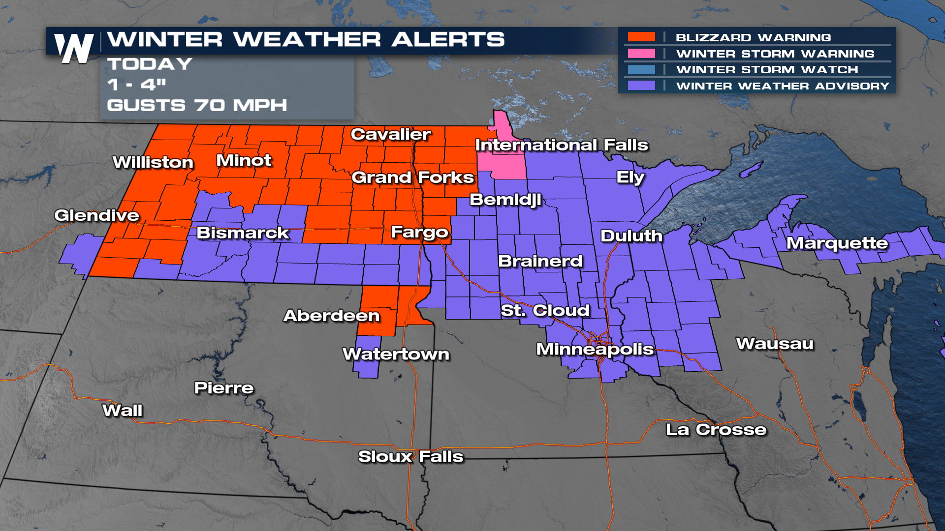
NORTHERN PLAINS - A low-pressure system originating from the northwest has moved through the plains and is now pushing into the Great Lakes. This system will move into warmer air, so models are favoring rainfall, as opposed to snowfall. There are winter alerts and blizzard warnings that remain in effect for snow and low visibility. Wind gusts can be as high as 70 mph, with an additional 1-4" of snowfall in the blizzard warning.
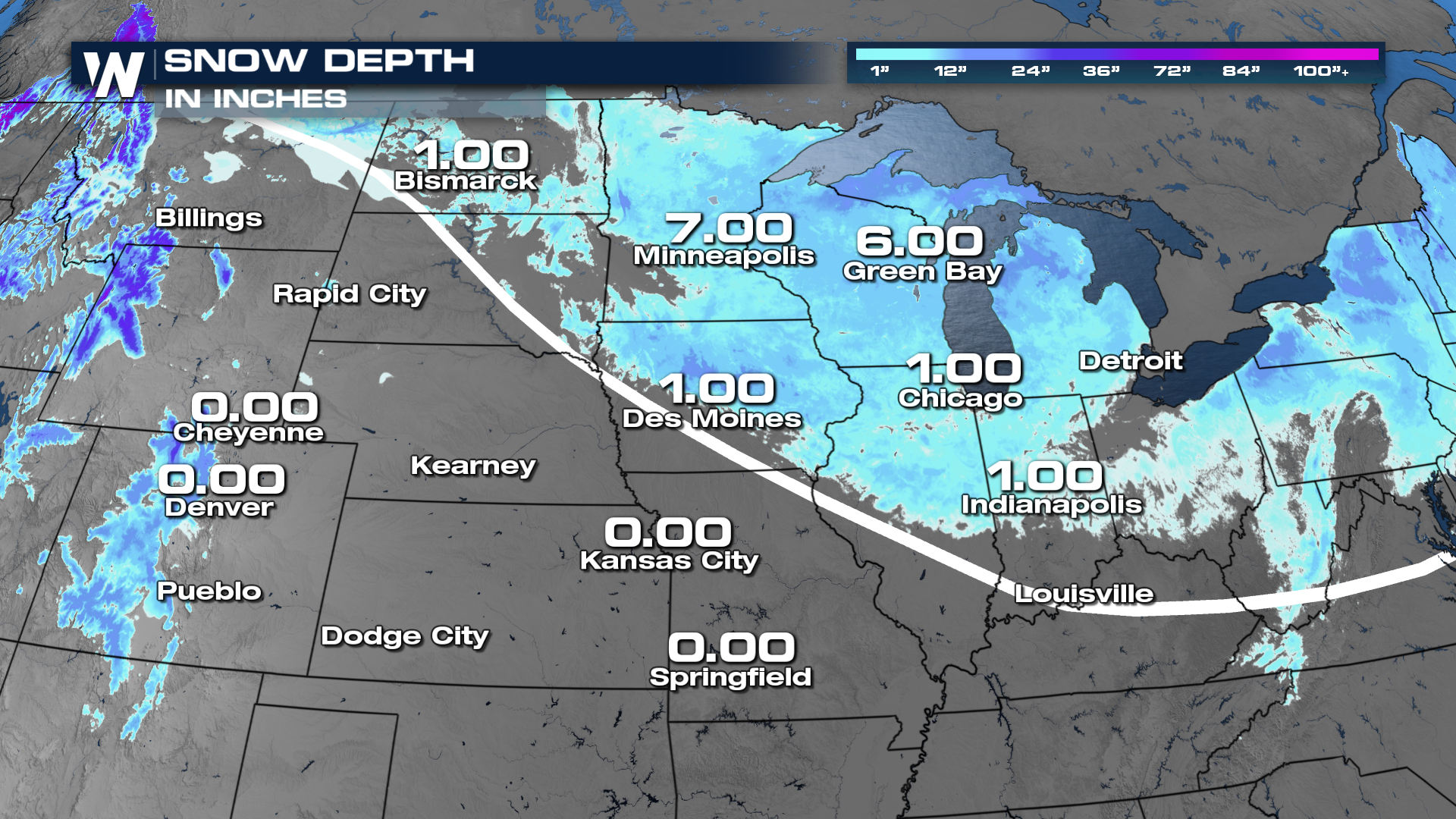
 There have been several recently clipper systems that moved into the Northern tier of the country. The systems dumped a decent amount of snowfall, whch lead to a a decent snowpack on the ground across the plains and the Great Lakes.
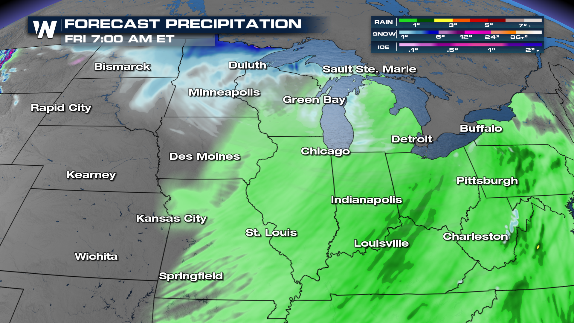
 With this next system moving in and bringing rain, this could lead to a bit of slush out there as the rain melts away the snowfall. The system moves through fast and over the Midwest and into the northeast on Thursday.
Precipitation totals will be fairly minimal because of the speed at which this system moves through.
 For some, temperatures will be impacted by this front. For instance, look at Bismarck, North Dakota, a high of 42 on Wednesday and 30 degrees cooler by Thursday with a high of 10.
For more details on this, be sure to join us on WeatherNation live! We stream 24/7.


