Recent Advancements in Doppler Radar with Dual-Pol Technology
Special Stories
19 Mar 2019 4:01 AM
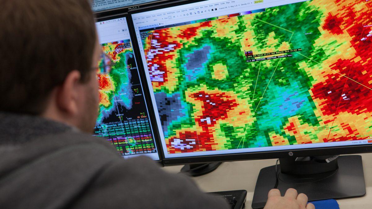
[NOAA] One of the most recent advancements in Doppler Radar technology over the last decade is dual-polarization. Polarimetric radar — and polarimetry — improves the accuracy of precipitation estimates, detects aviation hazards, can identify precipitation types, and can spot many other items such as bats or even tornado debris.
When it comes to Doppler weather radar, scientists with NOAA National Severe Storms Laboratory wrote the book, literally. Publications authored and co-authored by researchers at NSSL and the Cooperative Institute for Mesoscale Meteorological Studies expanded knowledge on radars and provided strategies used by weather forecasters today.
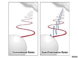
 [Difference between conventional and polarmetric radar]
After more than three decades, those scientists have done it again. A new book by CIMMS Senior Research Scientist Alexander Ryzhkov, and co-authored by NSSL Senior Scientist Dusan Zrnic, highlights dual-polarization, often called the biggest technological upgrade to Doppler radars since they were first installed. The book, “Radar Polarimetry for Weather Observations,” published by Springer Nature, offers an array of information on weather radar polarimetry.
In addition to connecting processes responsible for the development and evolution of the bulk of clouds’ physical properties, the publication also provides up-to-date polarimetric methodologies.
[Difference between conventional and polarmetric radar]
After more than three decades, those scientists have done it again. A new book by CIMMS Senior Research Scientist Alexander Ryzhkov, and co-authored by NSSL Senior Scientist Dusan Zrnic, highlights dual-polarization, often called the biggest technological upgrade to Doppler radars since they were first installed. The book, “Radar Polarimetry for Weather Observations,” published by Springer Nature, offers an array of information on weather radar polarimetry.
In addition to connecting processes responsible for the development and evolution of the bulk of clouds’ physical properties, the publication also provides up-to-date polarimetric methodologies.
 The publication will appeal to practicing radar meteorologists, hydrologists, microphysicists, and modelers who are interested in the bulk properties of hydrometeors and quantification of these with the goals to improve precipitation measurements, understanding of precipitation processes, or model forecasts.
Edited for WeatherNation by Meteorologist Mace Michaels
The publication will appeal to practicing radar meteorologists, hydrologists, microphysicists, and modelers who are interested in the bulk properties of hydrometeors and quantification of these with the goals to improve precipitation measurements, understanding of precipitation processes, or model forecasts.
Edited for WeatherNation by Meteorologist Mace Michaels
[Difference between conventional and polarmetric radar]
After more than three decades, those scientists have done it again. A new book by CIMMS Senior Research Scientist Alexander Ryzhkov, and co-authored by NSSL Senior Scientist Dusan Zrnic, highlights dual-polarization, often called the biggest technological upgrade to Doppler radars since they were first installed. The book, “Radar Polarimetry for Weather Observations,” published by Springer Nature, offers an array of information on weather radar polarimetry.
In addition to connecting processes responsible for the development and evolution of the bulk of clouds’ physical properties, the publication also provides up-to-date polarimetric methodologies.
The publication will appeal to practicing radar meteorologists, hydrologists, microphysicists, and modelers who are interested in the bulk properties of hydrometeors and quantification of these with the goals to improve precipitation measurements, understanding of precipitation processes, or model forecasts.
Edited for WeatherNation by Meteorologist Mace MichaelsAll Weather News
More

Tropics: Fausto Heads towards Hawaii; Genevieve Cat 4 Hurricane
PacificTropical Storm Fausto continues to tra
28 Jul 2026 10:30 AM

Severe Storms Target the Midwest to the Northeast
UPPER MIDWEST - Through Monday, dangerous tor
28 Jul 2026 10:25 AM

Southeast Flood Risk Lingers Near Stalled Front
A stalled boundary over the Southeast will ke
25 Jul 2026 10:55 AM

Another Round of Storms Targets the Northeast
Tuesday brought severe weather again across p
23 Jul 2026 1:15 AM

Another Round of Severe Weather for the Upper Midwest and Great Lakes
The upper-level low train continues to keep t
21 Jul 2026 1:45 AM

Air Quality Improvements in the Forecast
Wildfires burning in Northwestern Ontario, Ca
20 Jul 2026 7:20 PM