Recent Snows Boost Sierra Snowpack Above Normal
Special Stories
6 Feb 2019 2:58 PM
https://www.youtube.com/watch?v=WYN2Byr4zP8
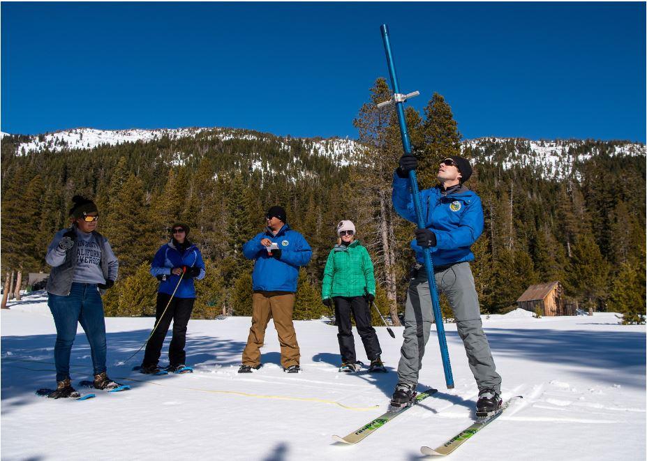
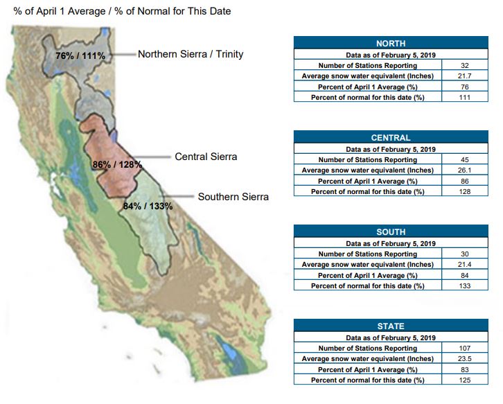
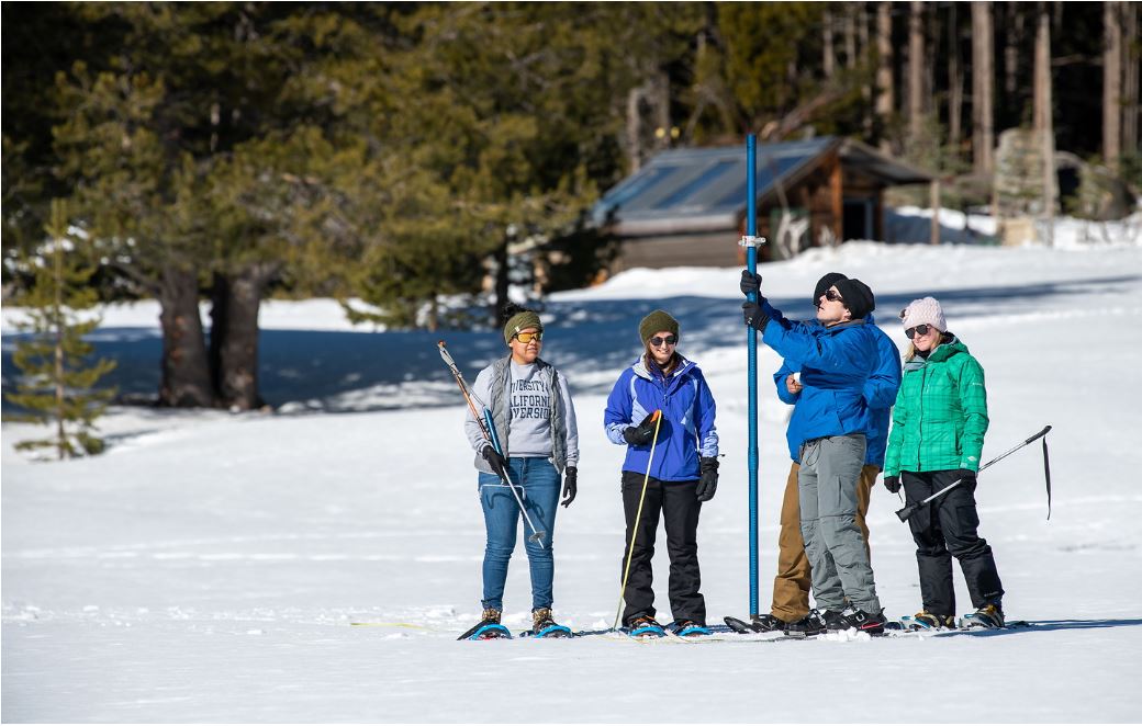
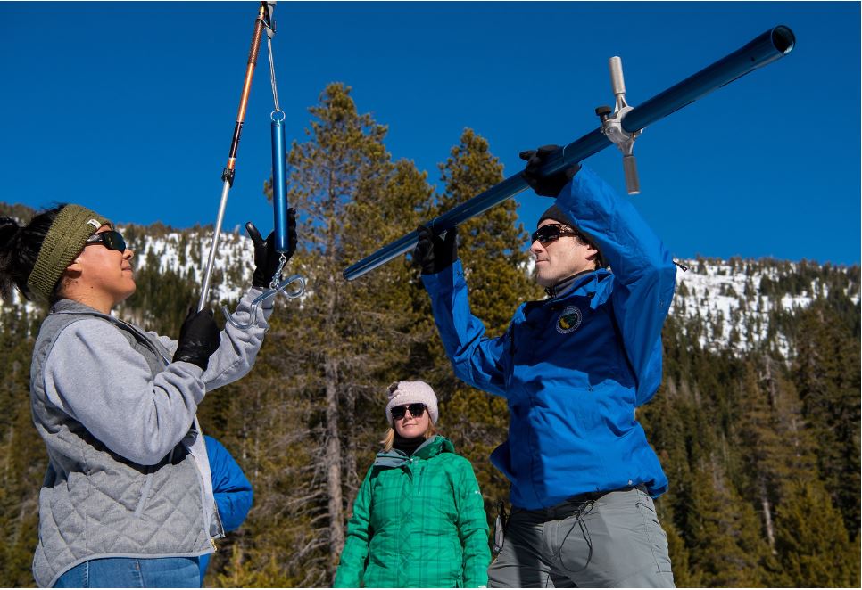
On January 31, the California Department of Water Resources (DWR) conducted their second Sierra snow survey of 2019. The manual measurements at Phillips Station recorded 50 inches of snow depth and a snow water equivalent (SWE) of 18 inches. That came in around 98 percent of average for this location. Since then, the statewide SWE has jumped from 100 to 125% of normal. Atmospheric rivers pumping in tropical moisture have helped supply powerful storms across the west. For perspective, on February 1 of last year the SWE of 2.6 inches was only 14 percent of the early-February average.
 “The snowpack across California is on par with the historical average for this time of year, thanks in no small part to an atmospheric river that brought heavy snowstorms to the Sierra Nevada. Typically, California relies on a handful of large storms like we saw earlier this year.” said DWR Director Karla Nemeth. “It’s a start, but the next two or three months will determine what it means for our reservoirs and overall water supply.”
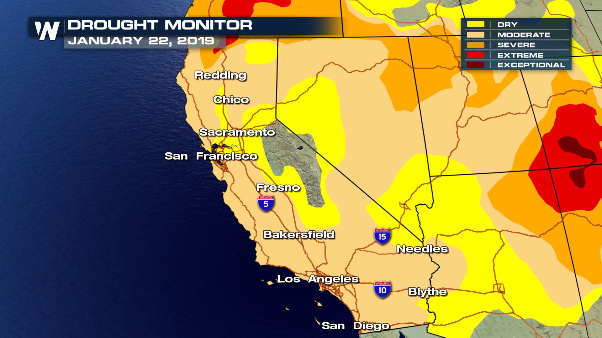
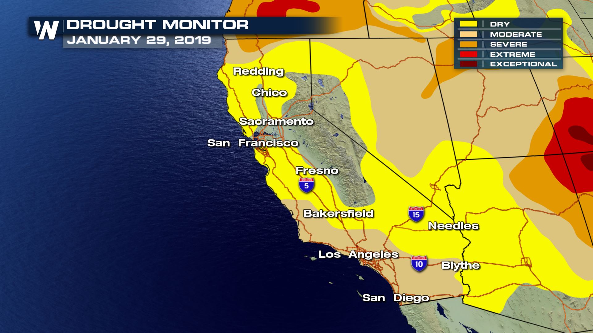
 Snowmelt in California supplies about 30 percent of the state’s water needs. Reservoirs rely on snowpack water content to receive enough snowmelt runoff to meet water demands during the summer and fall. Winter Sierra snow is also crucial for drought mitigation. Between January 22 and January 29, D0-D4 drought conditions went from 92% to 76%
 “The data we collect allows us to forecast how much snowmelt will run off into our streams and reservoirs,” said John Paasch, Chief of DWR’s Hydrology and Flood Office. “Snowpack is an important factor in determining how DWR manages California’s water resources each year to sustainably meet demands.”
 Content Courtesy of California Department of Water Resources
“The snowpack across California is on par with the historical average for this time of year, thanks in no small part to an atmospheric river that brought heavy snowstorms to the Sierra Nevada. Typically, California relies on a handful of large storms like we saw earlier this year.” said DWR Director Karla Nemeth. “It’s a start, but the next two or three months will determine what it means for our reservoirs and overall water supply.”
Snowmelt in California supplies about 30 percent of the state’s water needs. Reservoirs rely on snowpack water content to receive enough snowmelt runoff to meet water demands during the summer and fall. Winter Sierra snow is also crucial for drought mitigation. Between January 22 and January 29, D0-D4 drought conditions went from 92% to 76%
“The data we collect allows us to forecast how much snowmelt will run off into our streams and reservoirs,” said John Paasch, Chief of DWR’s Hydrology and Flood Office. “Snowpack is an important factor in determining how DWR manages California’s water resources each year to sustainably meet demands.”
Content Courtesy of California Department of Water ResourcesAll Weather News
More


More Storms for the East Sunday and Monday
A low-pressure system crashing through the Mi
2 Aug 2026 2:20 AM

After Reaching Category 5, Genevieve Weakens in the Pacific
PacificGenevieve formed on last Friday south
2 Aug 2026 1:30 AM

Flooding, Severe Storms Target the Midwest Again
After an active week of storms across the nor
1 Aug 2026 1:40 AM

Flooding Risk Increases as Heavy Rain Targets the Tri-State Area
Tuesday, heavy rainfall moved across the Nort
30 Jul 2026 12:25 AM

Severe Weather: Energy From the Midwest Now in the Southeast
UPPER MIDWEST - Through Monday, dangerous tor
29 Jul 2026 10:30 PM