Researchers Test Unmanned Aircraft for Measuring the Lower Atmosphere
Special Stories
29 May 2019 1:58 AM
[Colorado University’s TTwistor used in EPIC.]
Meteorologists are always looking for better ways to measure the lower atmosphere. This spring, researchers from NOAA’s National Severe Storms Laboratory (NSSL) joined with other research groups to test the value of airborne, mobile observing systems for observing important changes in the local environment that can spawn severe thunderstorms in a new way. EPIC, the Environmental Profiling and Initiation of Convection Field Project, deployed fixed-wing and rotary small Unmanned Aircraft Systems (UAS) earlier this month at and near the Department of Energy’s Southern Great Plains (SGP) site in Lamont, Oklahoma.
During rapidly evolving severe weather conditions, the instruments provided detailed profiles of temperature, moisture and winds to determine the potential for severe weather development. Such information has the potential to improve the accuracy of short-term weather forecasts three to six hours before weather impacts a community.
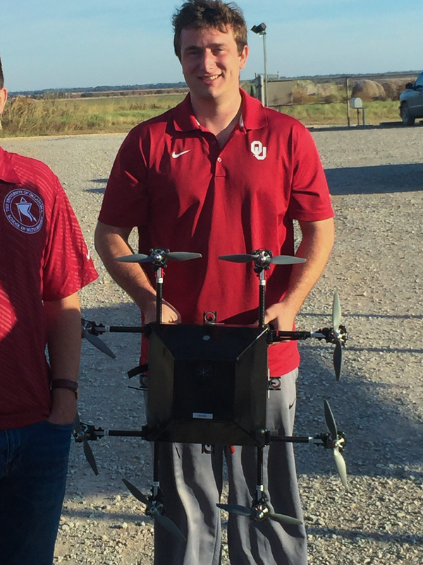
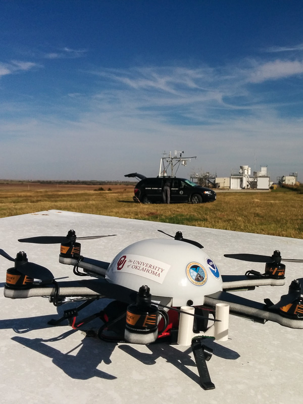
 [The University of Oklahoma’s CopterSonde rotary UAS was also used in the project]
Scientists have been testing miniaturized, high-precision, and fast-response atmospheric sensors adapted for use on the UAS. The sensors are expected to have high accuracy in the strong winds they expect to encounter in north central Oklahoma.
The data provided by the instruments is different from anything available, including satellites, radars, manned aircraft, and ground observing stations.
 [Meteodrone rotary UAS from Meteomatics]
Researchers also conducted short-duration experiments and coordinated with the National Weather Service Norman Forecast Office, who received data from the instruments in real time for evaluation.
Edited for WeatherNation by Meteorologist Mace Michaels
 [The University of Oklahoma’s CopterSonde rotary UAS was also used in the project]
Scientists have been testing miniaturized, high-precision, and fast-response atmospheric sensors adapted for use on the UAS. The sensors are expected to have high accuracy in the strong winds they expect to encounter in north central Oklahoma.
The data provided by the instruments is different from anything available, including satellites, radars, manned aircraft, and ground observing stations.
 [Meteodrone rotary UAS from Meteomatics]
Researchers also conducted short-duration experiments and coordinated with the National Weather Service Norman Forecast Office, who received data from the instruments in real time for evaluation.
Edited for WeatherNation by Meteorologist Mace Michaels
[Meteodrone rotary UAS from Meteomatics]
Researchers also conducted short-duration experiments and coordinated with the National Weather Service Norman Forecast Office, who received data from the instruments in real time for evaluation.
Edited for WeatherNation by Meteorologist Mace MichaelsAll Weather News
More