Storms Spark On The Edge Of A Heat Bubble
Special Stories
19 Aug 2020 5:00 PM
The Storm Prediction Center has issued convective outlooks for today and tomorrow (Wednesday and Thursday) across the Western U.S. from the Rocky Mountains through the Plains and down to the Southwest. We are under a marginal risk both days for severe storms to form along an upper level ridge that will continue to guide storm activity in a clockwise motion.
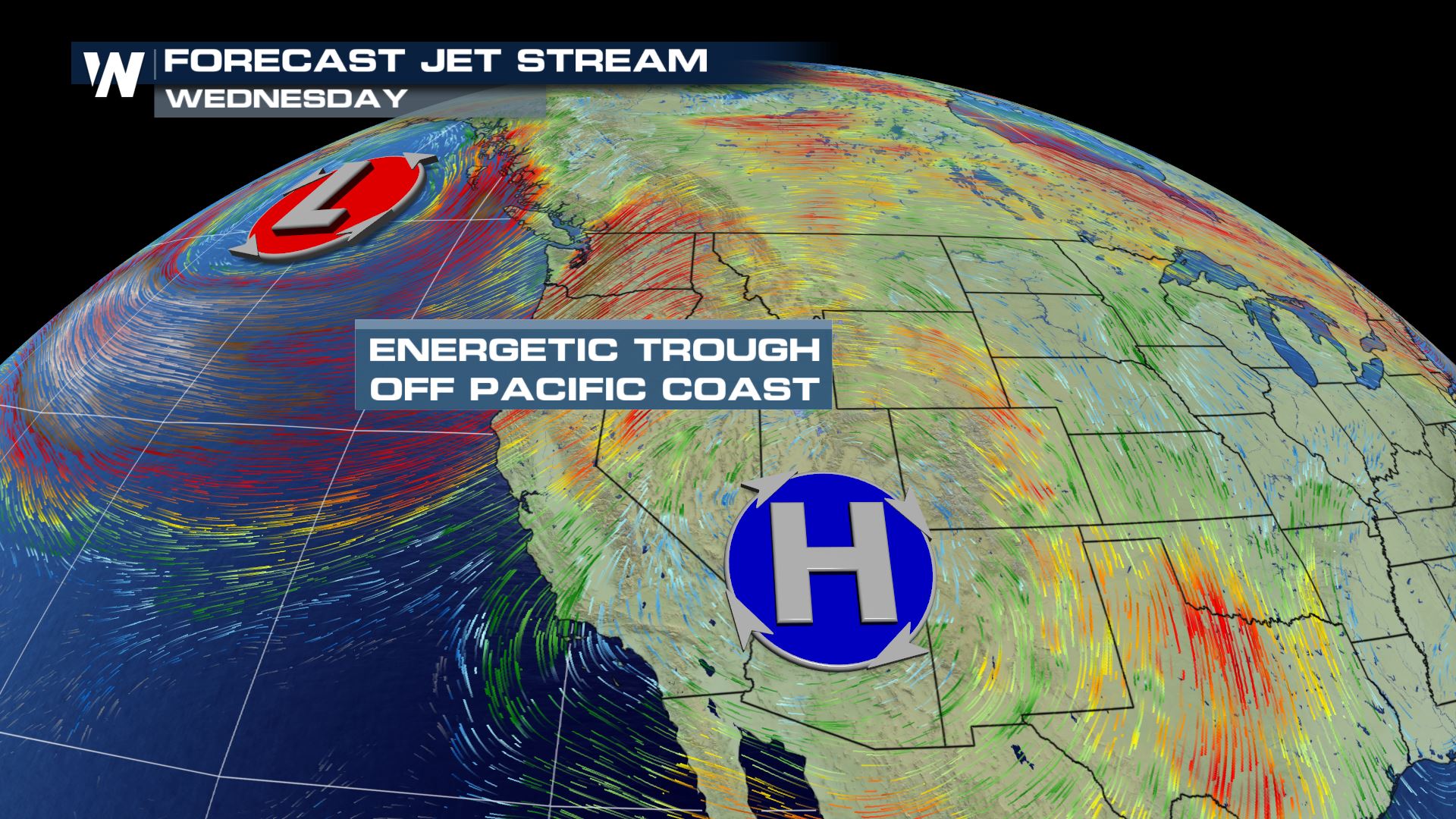
As we look into the upper dynamics of this system, a trough of low pressure over the Pacific Ocean and a ridge of high pressure over the western United States will continue to bring moisture and energy to the storm potential in the western United States.
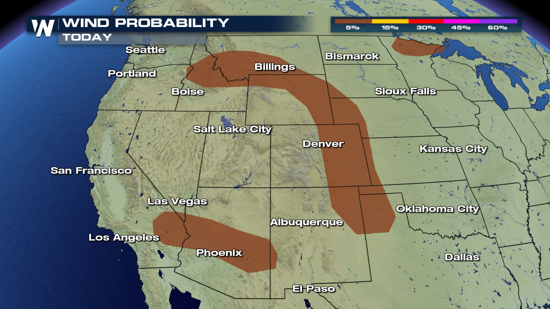
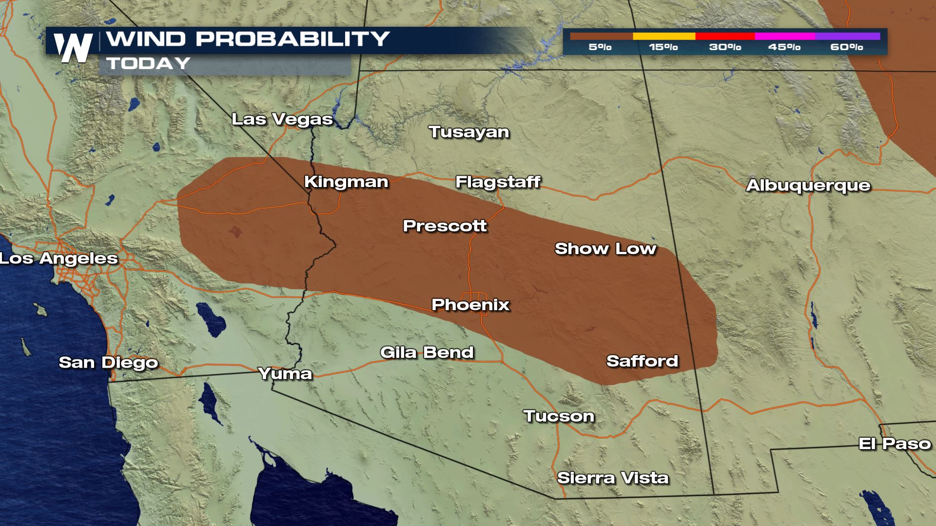
 The main threat you will need to watch out for with these storms will be the potential for strong wind. Some isolated and locally severe wind gusts will be possible. Most of the thunderstorms along this ridge will be elevated, which means their cloud-bases will be higher and this brings the potential for some some strong downburst winds too.
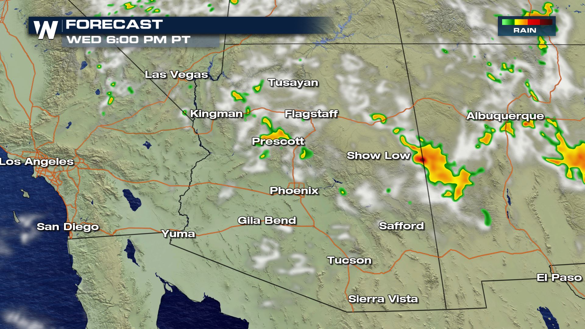
 Here's a look at some of our forecast models and what they expect from these storms. Activity will enhance throughout the afternoon and evening hours as temperatures are warmest to help initialize these storms.
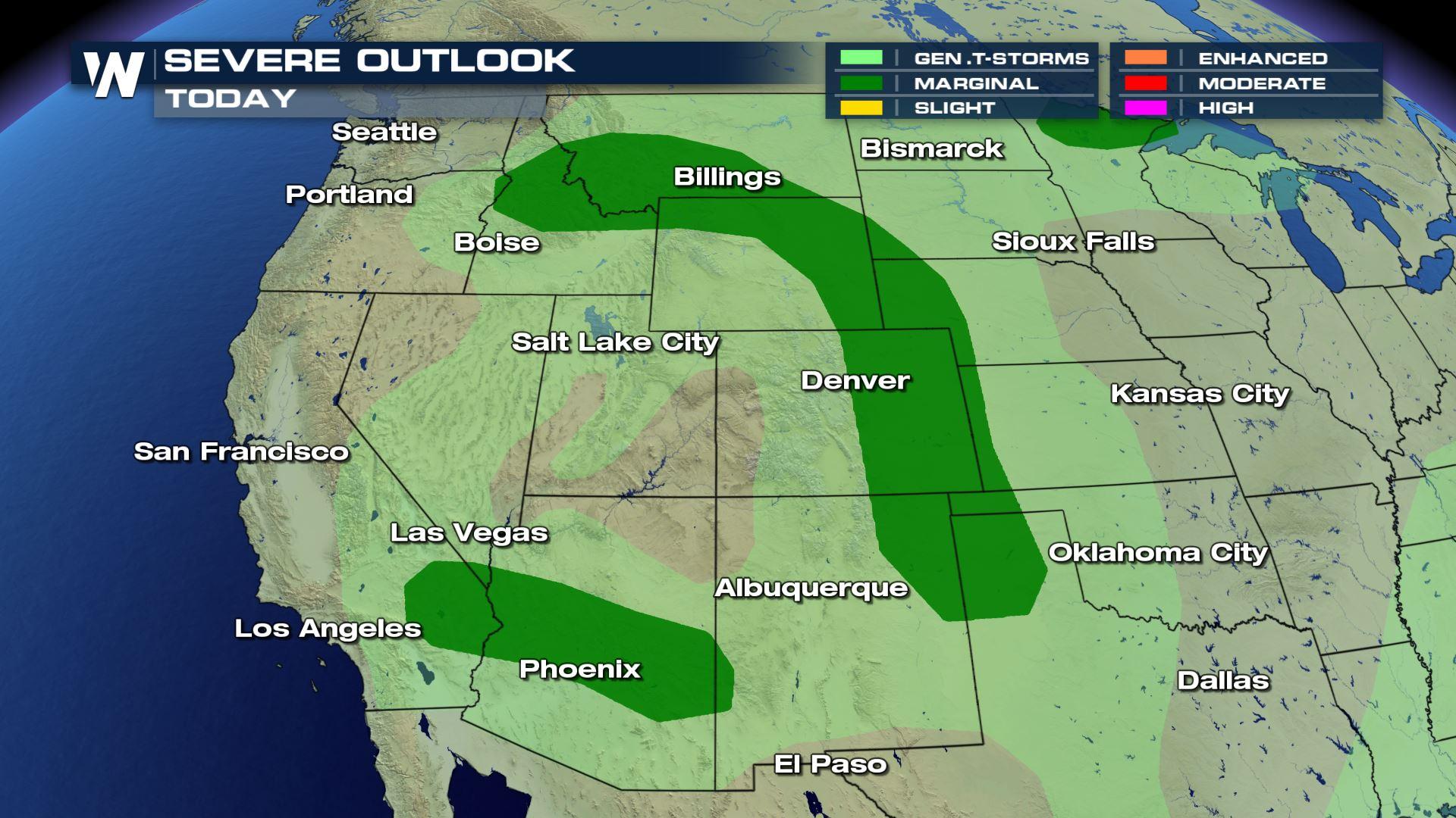
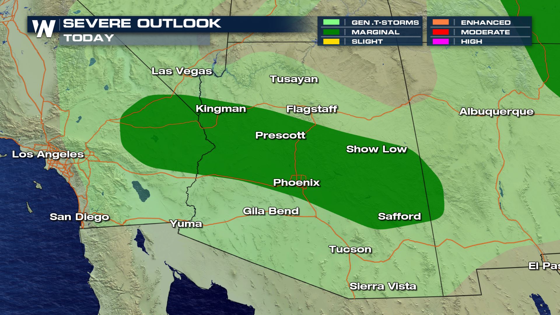
 A marginal risk (level 1 out of 5, 5 being the highest) has been issued for the severe weather outlook in parts of Arizona and southern California today. These storms this time of the year are usually wind-makers, causing dust storms but also producing very heavy rainfall. Here are the highlighted areas:
 Timing of the potentially-severe storms in parts of Arizona and southern California will be from the late afternoon and through midnight local time.
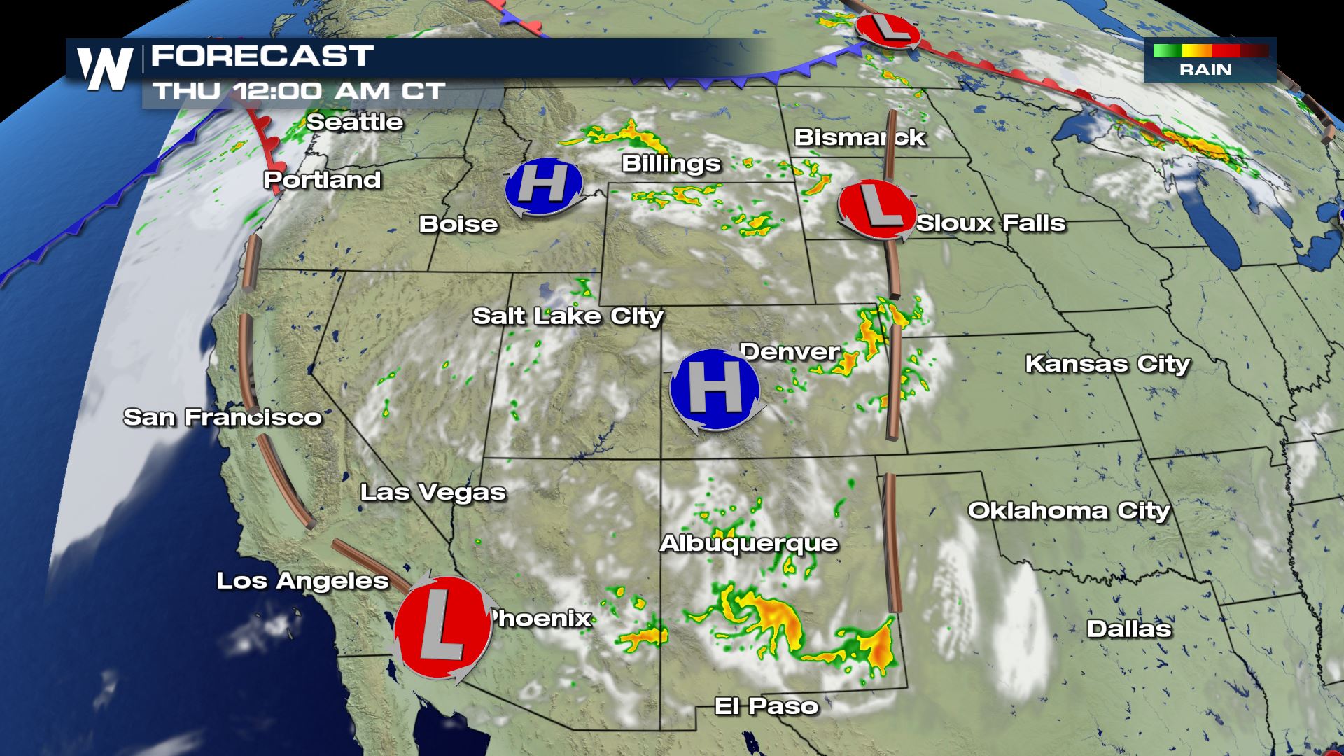
 The storm risk region will generally be the same as Wednesday, stretching from Montana to New Mexico, however a little farther to the east where more of the Plains will be included in the severe weather outlook.
Our forecast models for Thursday look fairly similar to Wednesday (besides exact location), as seen below.
The storm risk region will generally be the same as Wednesday, stretching from Montana to New Mexico, however a little farther to the east where more of the Plains will be included in the severe weather outlook.
Our forecast models for Thursday look fairly similar to Wednesday (besides exact location), as seen below.
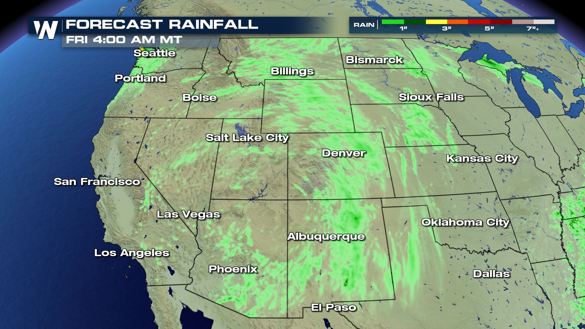
 As we have been calling these "ridge riders" or also known as the "ring of fire" storms, our forecast rainfall is not expected to be intense but it is interesting to see how they are outlined by this area of high pressure.
 For more information you can catch us online or on our streaming platforms from WeatherNation.
WEDNESDAY
We are under a marginal risk, level 1 out of 5, for severe storms from Idaho/Montana south to New Mexico/Texas, plus a couple of other discrete regions including Arizona, California, and Minnesota as seen below.
The main threat you will need to watch out for with these storms will be the potential for strong wind. Some isolated and locally severe wind gusts will be possible. Most of the thunderstorms along this ridge will be elevated, which means their cloud-bases will be higher and this brings the potential for some some strong downburst winds too.
Here's a look at some of our forecast models and what they expect from these storms. Activity will enhance throughout the afternoon and evening hours as temperatures are warmest to help initialize these storms.
A marginal risk (level 1 out of 5, 5 being the highest) has been issued for the severe weather outlook in parts of Arizona and southern California today. These storms this time of the year are usually wind-makers, causing dust storms but also producing very heavy rainfall. Here are the highlighted areas:
Timing of the potentially-severe storms in parts of Arizona and southern California will be from the late afternoon and through midnight local time.
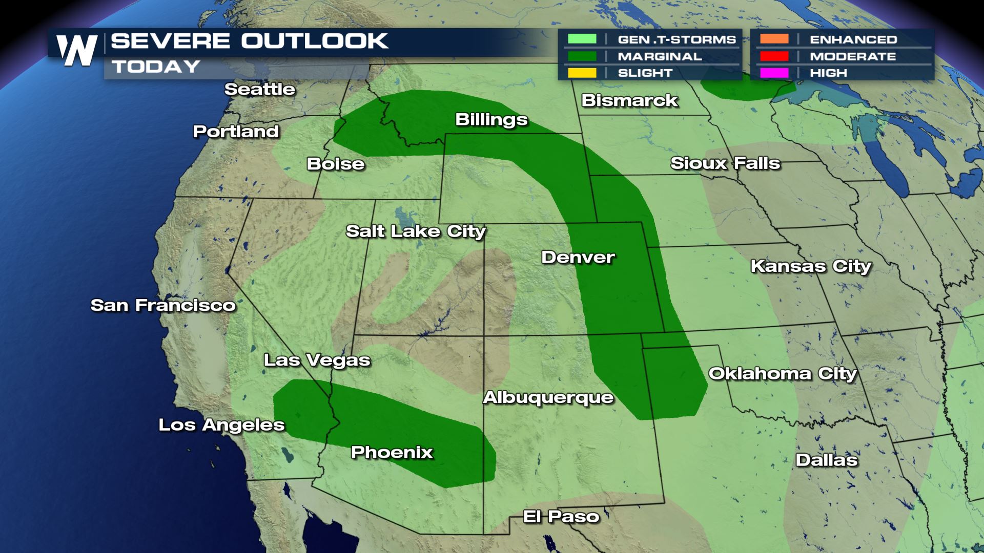
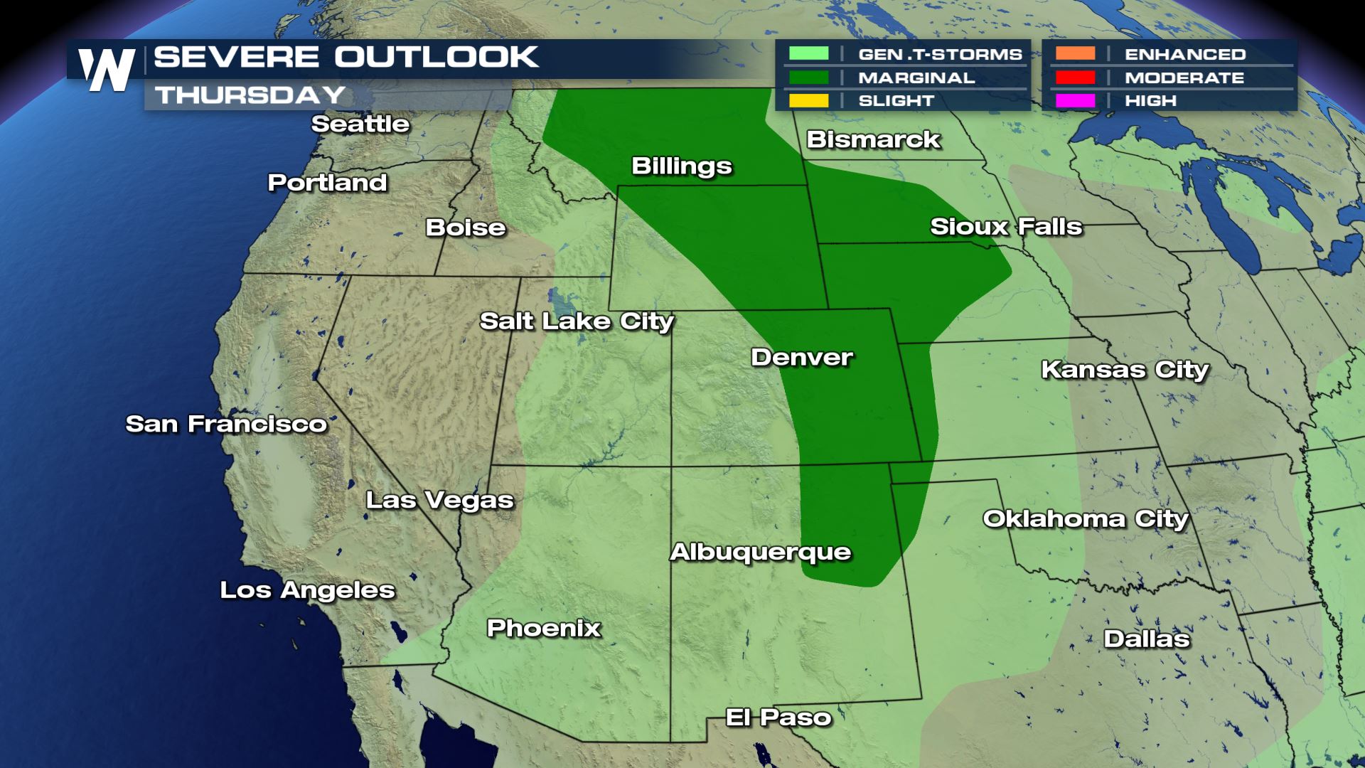
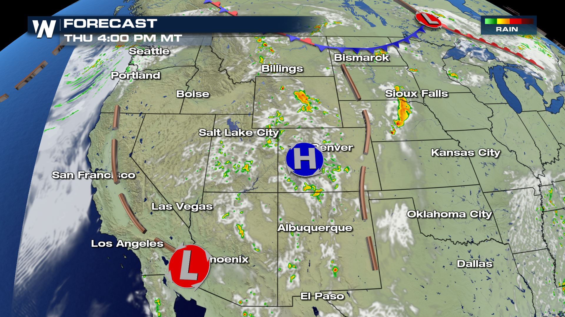
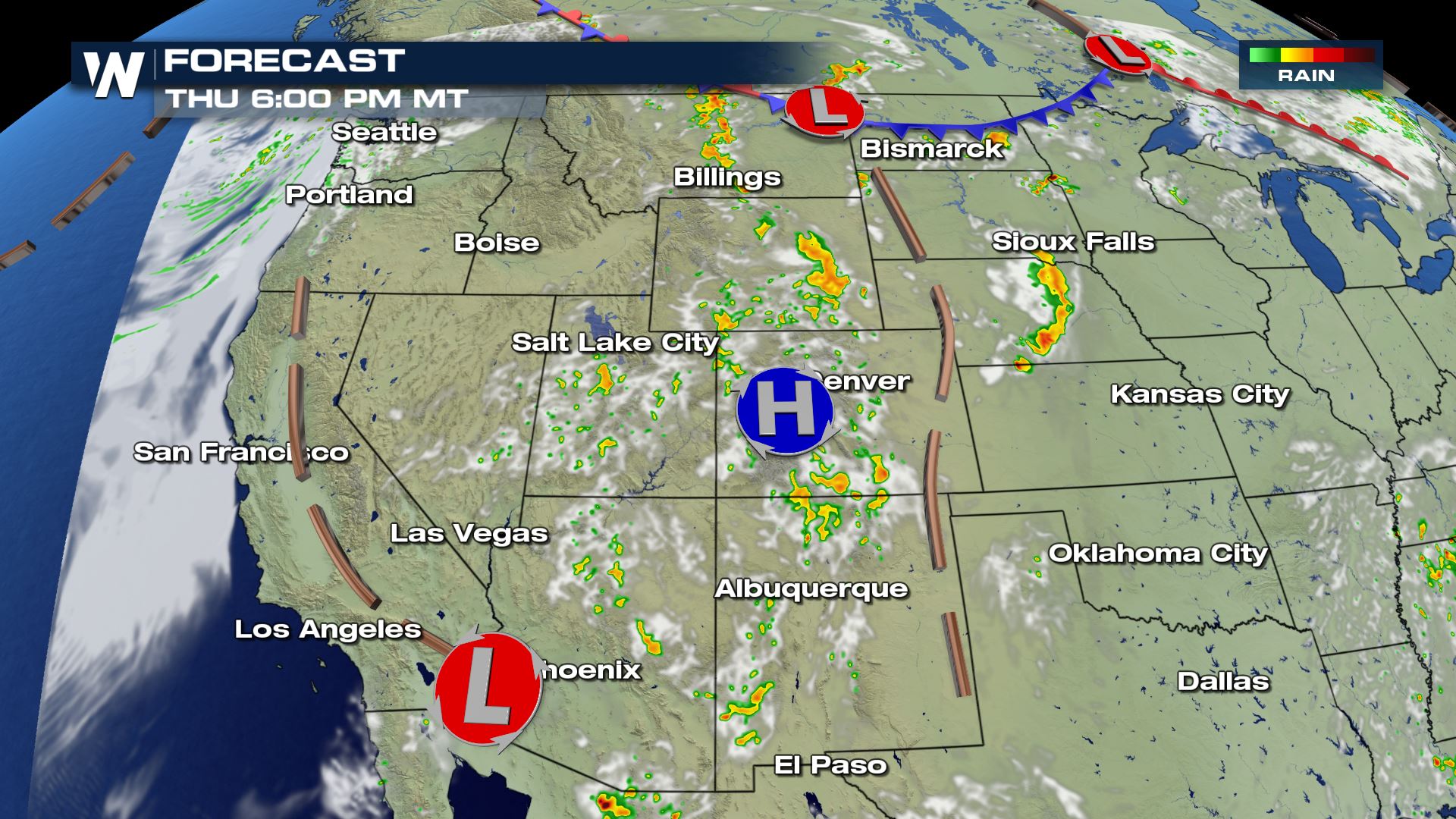
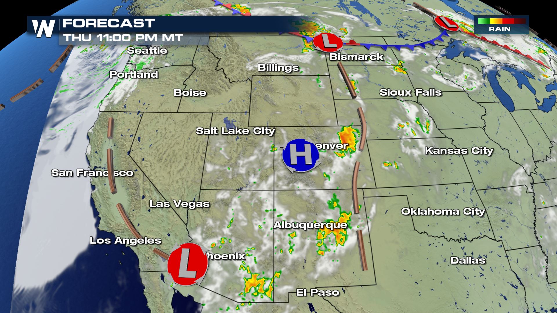
THURSDAY
Looking ahead to Thursday's outlook, these storms follow the upper level ridge and will also be enhanced throughout the afternoon and evening hours. We are under a marginal risk for Thursday, which brings the same threats just the coverage area is now following the ridge.
The storm risk region will generally be the same as Wednesday, stretching from Montana to New Mexico, however a little farther to the east where more of the Plains will be included in the severe weather outlook.
Our forecast models for Thursday look fairly similar to Wednesday (besides exact location), as seen below.
As we have been calling these "ridge riders" or also known as the "ring of fire" storms, our forecast rainfall is not expected to be intense but it is interesting to see how they are outlined by this area of high pressure.
For more information you can catch us online or on our streaming platforms from WeatherNation.All Weather News
More
Wildfire Outbreak in the Pacific Northwest
Conditions have been incredibly dry out west.
2 Aug 2026 1:30 PM

After Reaching Category 5, Genevieve Weakens in the Pacific
PacificGenevieve formed on last Friday south
2 Aug 2026 1:25 PM

More Storms for the East Sunday and Monday
A low-pressure system crashing through the Mi
2 Aug 2026 1:25 PM


Flooding, Severe Storms Target the Midwest Again
After an active week of storms across the nor
1 Aug 2026 1:40 AM

Flooding Risk Increases as Heavy Rain Targets the Tri-State Area
Tuesday, heavy rainfall moved across the Nort
30 Jul 2026 12:25 AM

Severe Weather: Energy From the Midwest Now in the Southeast
UPPER MIDWEST - Through Monday, dangerous tor
29 Jul 2026 10:30 PM