Ridge Riding Thunderstorms in the Western Plains

A ridge of high pressure has been responsible for the quiet and warm days across the central U.S., but on the western periphery of this ridge, a trough will attempt to slide in and ignite severe weather chances across the High Plains. The storms that are steered between these two upper-level systems are what we often refer to as "ridge-riding" thunderstorms.
On Thursday, another MARGINAL (level 1 out of 5) risk is issued as the cold front shifts down into eastern Colorado and western Kansas, even extending all the way into central Nebraska. All kinds of severe weather are possible.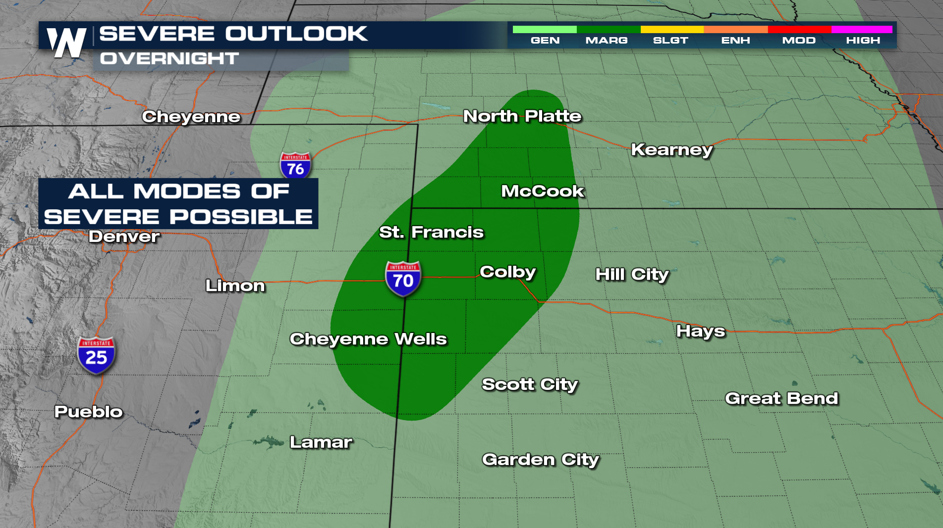
There is a small risk of tornadoes in the latest SPC advisory for Thursday. It covers cities from North Platte, NE, over to Colby, KS and as far south as Cheyenne Wells, CO. Make sure you have a way of getting notified if anything is to touch down.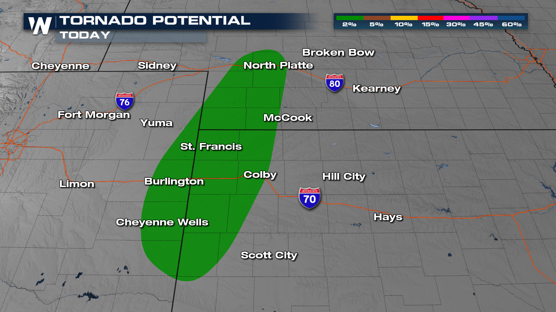
The cold front keeps pushing east into Missouri and Oklahoma for Friday. Similar to Thursday, severe potential will exist during the heating of the day but some storms could remain strong even after sunset! The biggest threat will be damaging winds.
Forecasted rainfall totals look to be highest across central Nebraska, where some may receive 1-1.5" of rainfall with isolated higher amounts.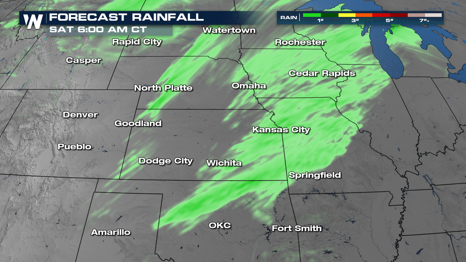
Be sure to join us at :30 past the hour to see how this will impact your temperature forecast, too!


