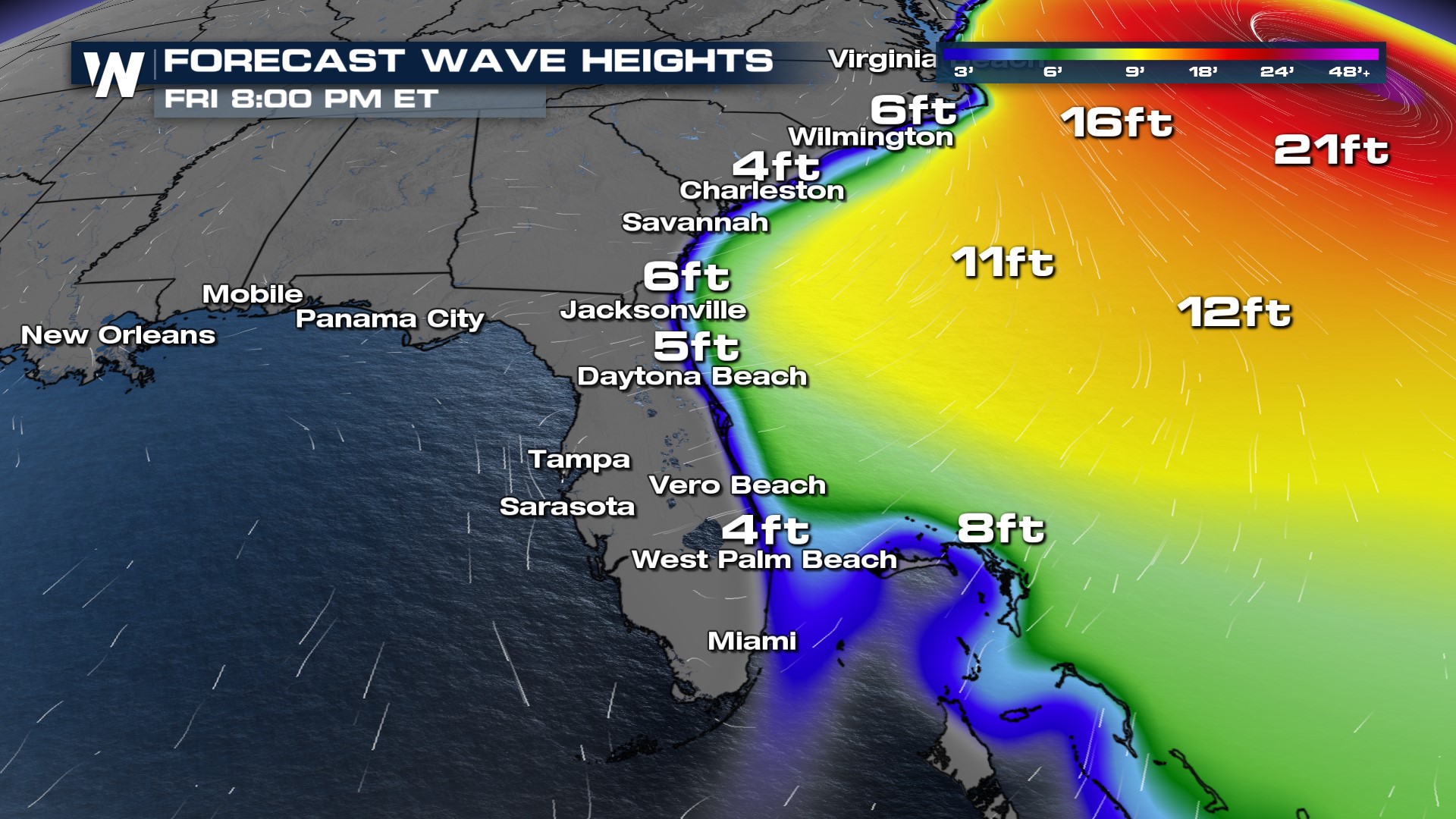
Rip Currents Risk from Hurricane Lee in the Southeast
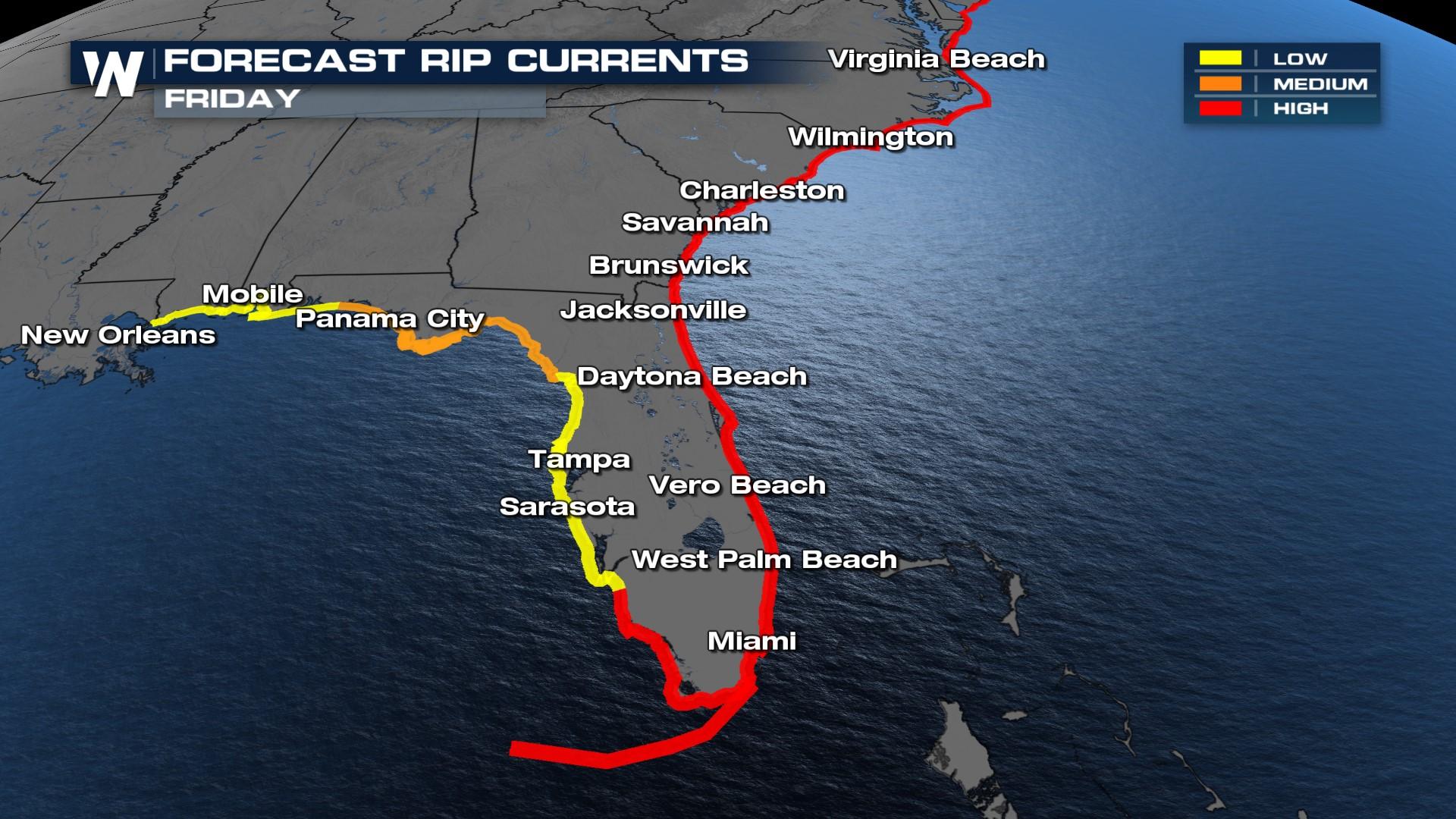
Even though Hurricane Lee is passing well offshore from the Southeast U.S. impacts will still be felt from Florida's Atlantic Coast up to the Carolinas. HIGH rip current risk is in effect both Thursday and Friday along with waves that could be up to 7' in height during the day. If you're at the beach or in a coastal community, prepare for impacts through the end of the week.
 It may not be the best beach weather though - a stalled front is keeping a lot of the Southeast cloudy and humid with shower chances each afternoon. Try not to curse the rain too much, especially along I-10 as rainfall is needed!
Temps will be slightly cooler under the influence of clouds and rain in the Southeast, with the coolest days Thursday and Friday. Heat starts to creep back up into the end of the weekend.


