Scientists Embark on Mission aimed at Improving Air Quality Forecasts
This summer, NOAA and NASA are teaming up on a massive research campaign called FIREX-AQ that will use satellites, aircraft, drones, mobile and ground stations to study smoke from wildfires and agricultural crop fires across the U.S. Hundreds of scientists will explore the chemistry of trace gases and aerosols in smoke to uncover its secrets, improve weather and air quality models, and provide better forecasts to first responders, public health and land management officials.
“We’ve pulled together an outstanding team of scientists to examine the nature of fires and smoke,” said David Fahey, director of NOAA’s Chemical Sciences Division. “Our long partnership with NASA has taken us literally around the planet and produced many major scientific discoveries. I expect this will be no different.”
https://www.youtube.com/watch?v=kX_KqKWfUSo&feature=youtu.beFrom the lab to real life
Smoke is an incredibly complex, constantly evolving mixture of gases and tiny particles that can travel thousands of miles from its source, resulting in health exposures lasting hours to weeks. Smoke reduces visibility, affects the weather and impairs air quality, aggravating asthma, bronchitis, and other lung conditions.
FIREX-AQ builds on a 2016 NOAA research project conducted at the USDA Fire Science Laboratory in Missoula, Montana, where scientists analyzed smoke from different kinds of vegetation burned at different temperatures.
“Now, we’re taking what we learned in the laboratory to large fires happening in the field where the chemistry evolves over time and distance,” said mission scientist Carsten Warneke, a CIRES researcher working at NOAA.
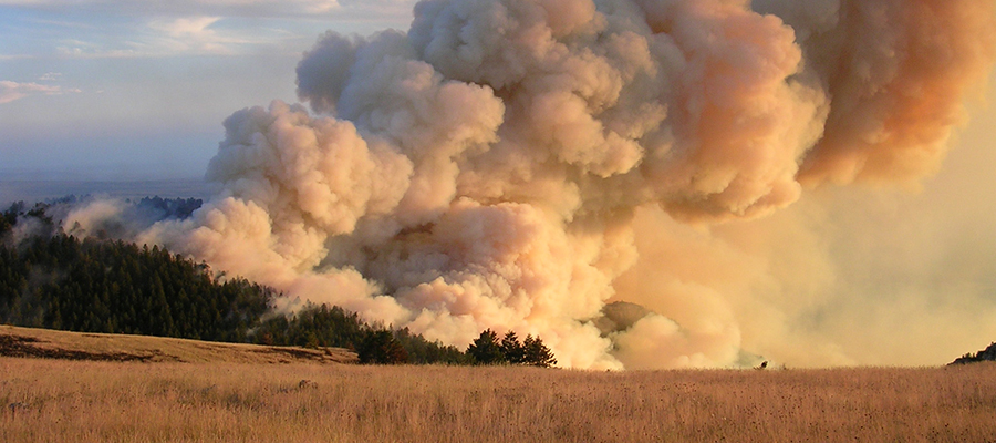
 [Smoke column of wildfire burning on Bureau of Indian Affairs land.]
Chasing smoke by air, land and space
FIREX-AQ launches July 22, when NASA’s DC-8 — packed with a highly sophisticated chemistry instruments — lifts off from Palmdale, California, for a flight to its temporary base in Boise, Idaho. For a month it will chase wildfire smoke across the west joined by two NOAA Twin Otters, flying at lower altitudes and also at night when fires smolder and smoke drains into the valleys.
From its base in Palmdale, CA, the NASA ER-2 will use remote-sensing instruments to collect measurements from much higher altitudes. Ground stations and mobile vans will observe smoke at the surface, where it matters most for public health. All these measurements will be compared with data from NOAA and NASA satellites far overhead to learn how to extract more information from what satellites see.
Later, the DC-8 will sample smoke from agricultural management fires common in southern states. Finally, scientists will study smoke from a large U.S. Forest Service prescribed burn in Utah. Then the real work begins, said NASA program manager Barry Lefer, "ultimately, the reason we want to understand complex smoke-atmosphere interactions is to provide better forecasts and longer lead times for communities downwind of fires.”
Edited for WeatherNation by Meteorologist Mace Michaels