Severe Storm Risk Continues on Monday
Special Stories
22 Jul 2018 4:04 PM
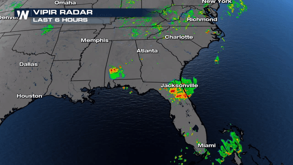
Severe storms are firing up across the I-10 corridor bringing gusty winds and some reports of hail across Alabama.
 Video below depicts marble size hail ;however, some reports were around hen egg size hail (2.00") was reported around Andalusia, AL earlier today.
https://twitter.com/WeatherNation/status/1021132672217706496
A Severe T-Storm Watch is in effect until later this evening for parts of Florida and Georgia.
Video below depicts marble size hail ;however, some reports were around hen egg size hail (2.00") was reported around Andalusia, AL earlier today.
https://twitter.com/WeatherNation/status/1021132672217706496
A Severe T-Storm Watch is in effect until later this evening for parts of Florida and Georgia.
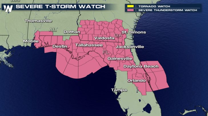 Winds in excess of 58 mph will be the main concern, especially as we shift into the late evening hours. Areas of concern will be south of I-10 and East of I-75 for the largest wind threat.
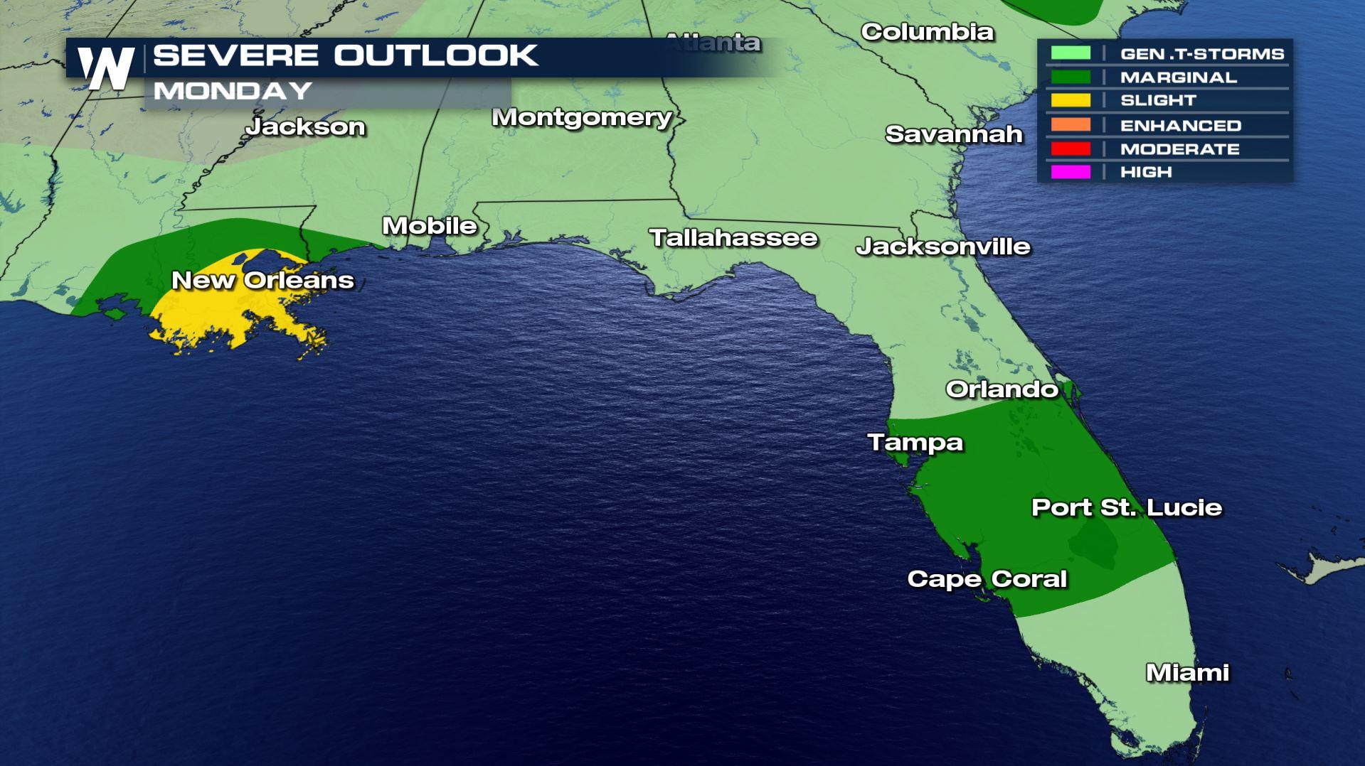
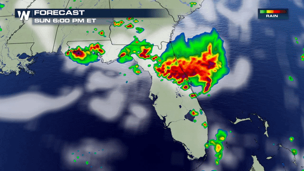 This system will generate another line of storms for parts of Central Florida and Southern Louisiana tomorrow afternoon. Damaging winds will, once again, be the main concern. Secure any outdoor items and stay weather alert!
 Meteorologist Merry Matthews
Video below depicts marble size hail ;however, some reports were around hen egg size hail (2.00") was reported around Andalusia, AL earlier today.
https://twitter.com/WeatherNation/status/1021132672217706496
A Severe T-Storm Watch is in effect until later this evening for parts of Florida and Georgia.
Winds in excess of 58 mph will be the main concern, especially as we shift into the late evening hours. Areas of concern will be south of I-10 and East of I-75 for the largest wind threat.
This system will generate another line of storms for parts of Central Florida and Southern Louisiana tomorrow afternoon. Damaging winds will, once again, be the main concern. Secure any outdoor items and stay weather alert!
Meteorologist Merry Matthews
All Weather News
More
Wildfire Outbreak in the Pacific Northwest
Conditions have been incredibly dry out west.
2 Aug 2026 1:30 PM

After Reaching Category 5, Genevieve Weakens in the Pacific
PacificGenevieve formed on last Friday south
2 Aug 2026 1:25 PM

More Storms for the East Sunday and Monday
A low-pressure system crashing through the Mi
2 Aug 2026 1:25 PM


Flooding, Severe Storms Target the Midwest Again
After an active week of storms across the nor
1 Aug 2026 1:40 AM

Flooding Risk Increases as Heavy Rain Targets the Tri-State Area
Tuesday, heavy rainfall moved across the Nort
30 Jul 2026 12:25 AM

Severe Weather: Energy From the Midwest Now in the Southeast
UPPER MIDWEST - Through Monday, dangerous tor
29 Jul 2026 10:30 PM