Severe Storms Likely for Texas This Afternoon/Tonight

Top Stories
12 Apr 2021 2:50 PM
A cold front diving south into Texas will bring increasing showers and storms with the risk of damaging winds and hail.
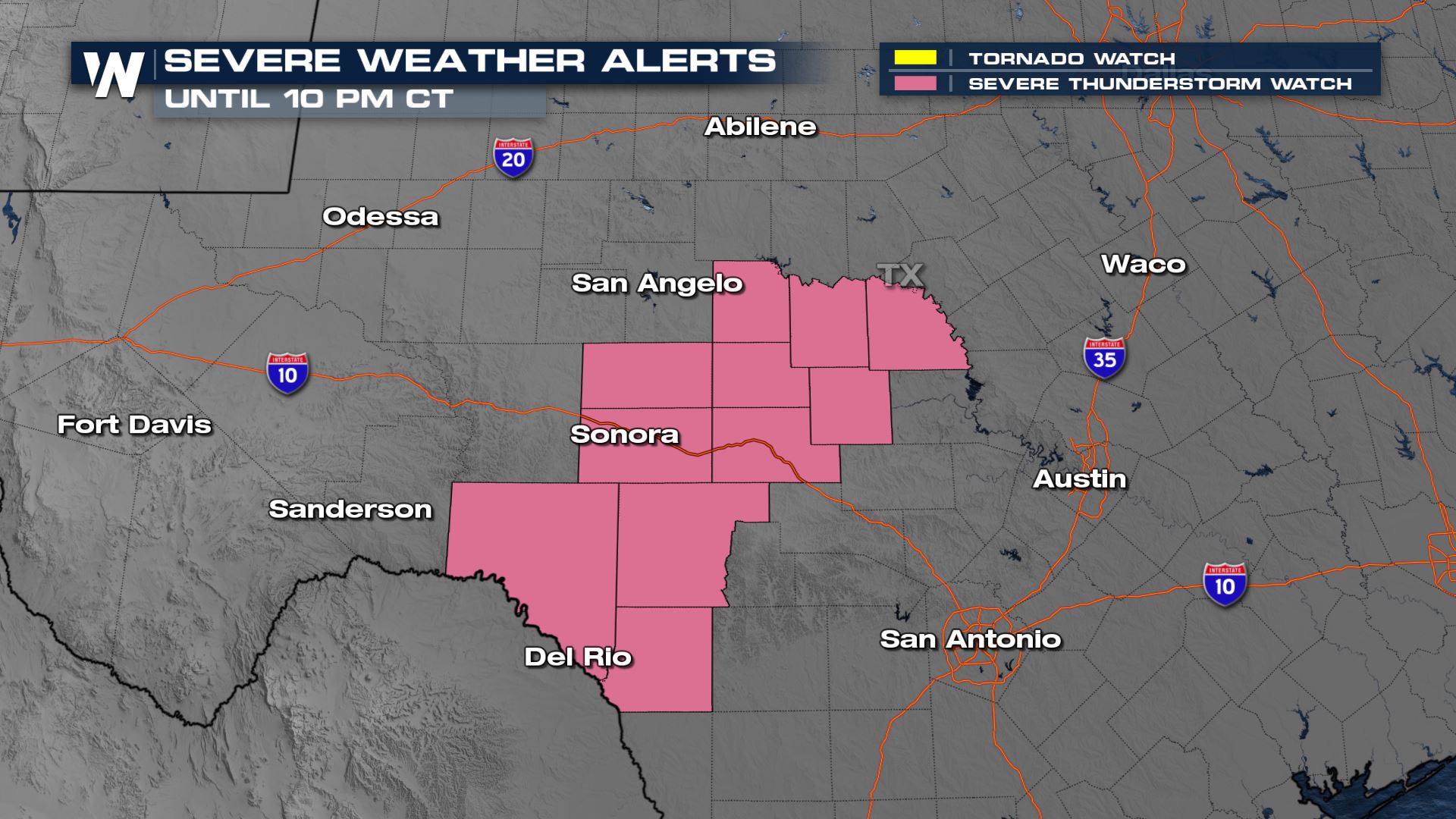
A Severe Thunderstorm Watch has been issued for southwest Texas in the Edwards Plateau until 10 PM for large hail up to 2.5" in diameter and isolated damaging winds up to 70 mph possible.
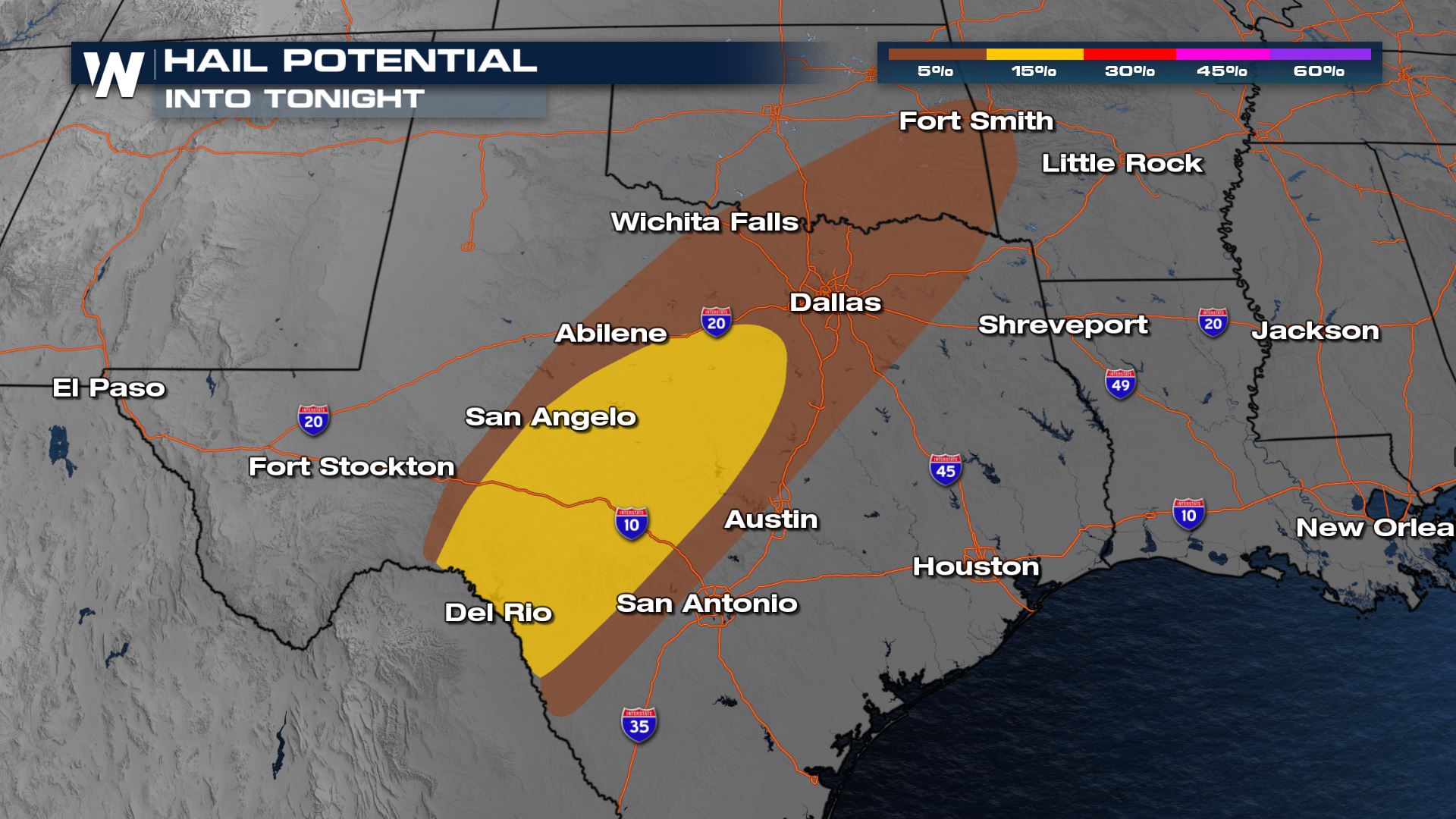 Damaging winds over 60 mph and hail great than 1" in diameter will be the severe risks to monitor across Southwest and Central Texas. Any outdoor activities in these areas will need to have a weather plan ready to go in case severe weather strikes.
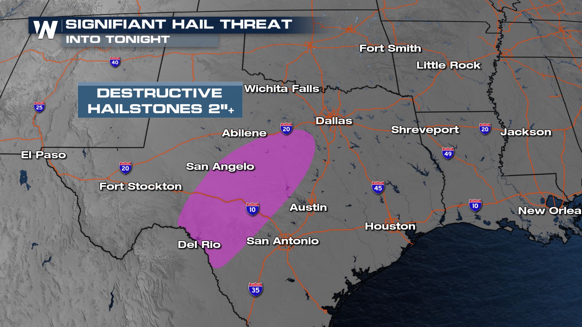
There is a threat from even larger hail, that's defined as a "hatched region" from the Storm Prediction Center where hail could form up to the size of 2" or larger in diameter, and this is where our initial watch is expected to be issued.
Damaging winds over 60 mph and hail great than 1" in diameter will be the severe risks to monitor across Southwest and Central Texas. Any outdoor activities in these areas will need to have a weather plan ready to go in case severe weather strikes.
There is a threat from even larger hail, that's defined as a "hatched region" from the Storm Prediction Center where hail could form up to the size of 2" or larger in diameter, and this is where our initial watch is expected to be issued.
 The storms should start up later this afternoon and this evening and could last well into early Tuesday morning. The initial cells that develop likely will have large hail stones before it turns more into a damaging wind event.
For more updates on today's severe weather, keep checking back with WeatherNation.
The storms should start up later this afternoon and this evening and could last well into early Tuesday morning. The initial cells that develop likely will have large hail stones before it turns more into a damaging wind event.
For more updates on today's severe weather, keep checking back with WeatherNation.
Severe Outlook
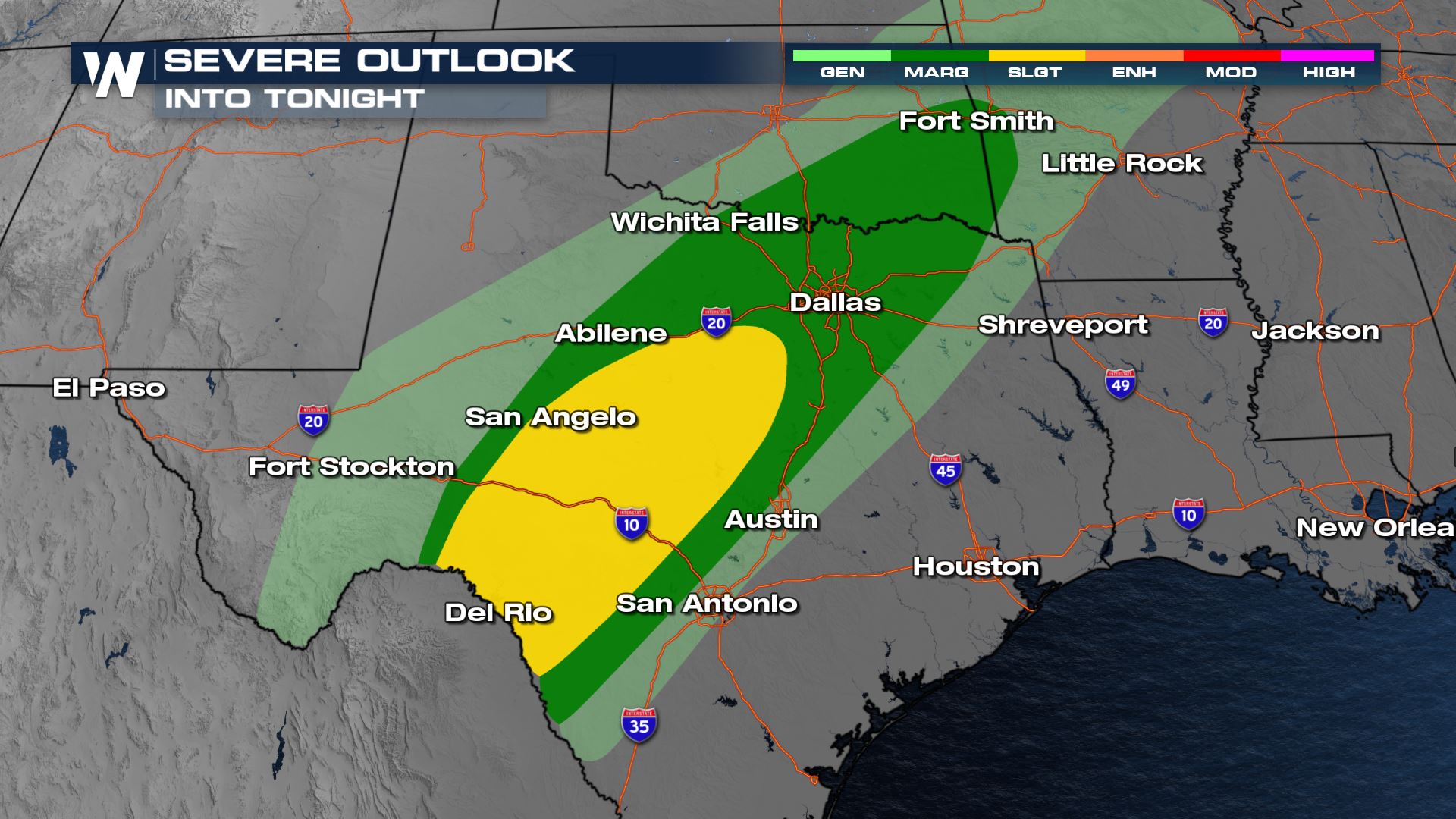
Isolated to scattered severe storms are likely this afternoon and tonight from Del Rio to Dallas, Texas. Parts of Oklahoma and Arkansas could also see some severe storms, but the higher risk will be down in Texas.
Severe Risks
Damaging winds over 60 mph and hail great than 1" in diameter will be the severe risks to monitor across Southwest and Central Texas. Any outdoor activities in these areas will need to have a weather plan ready to go in case severe weather strikes.
There is a threat from even larger hail, that's defined as a "hatched region" from the Storm Prediction Center where hail could form up to the size of 2" or larger in diameter, and this is where our initial watch is expected to be issued.
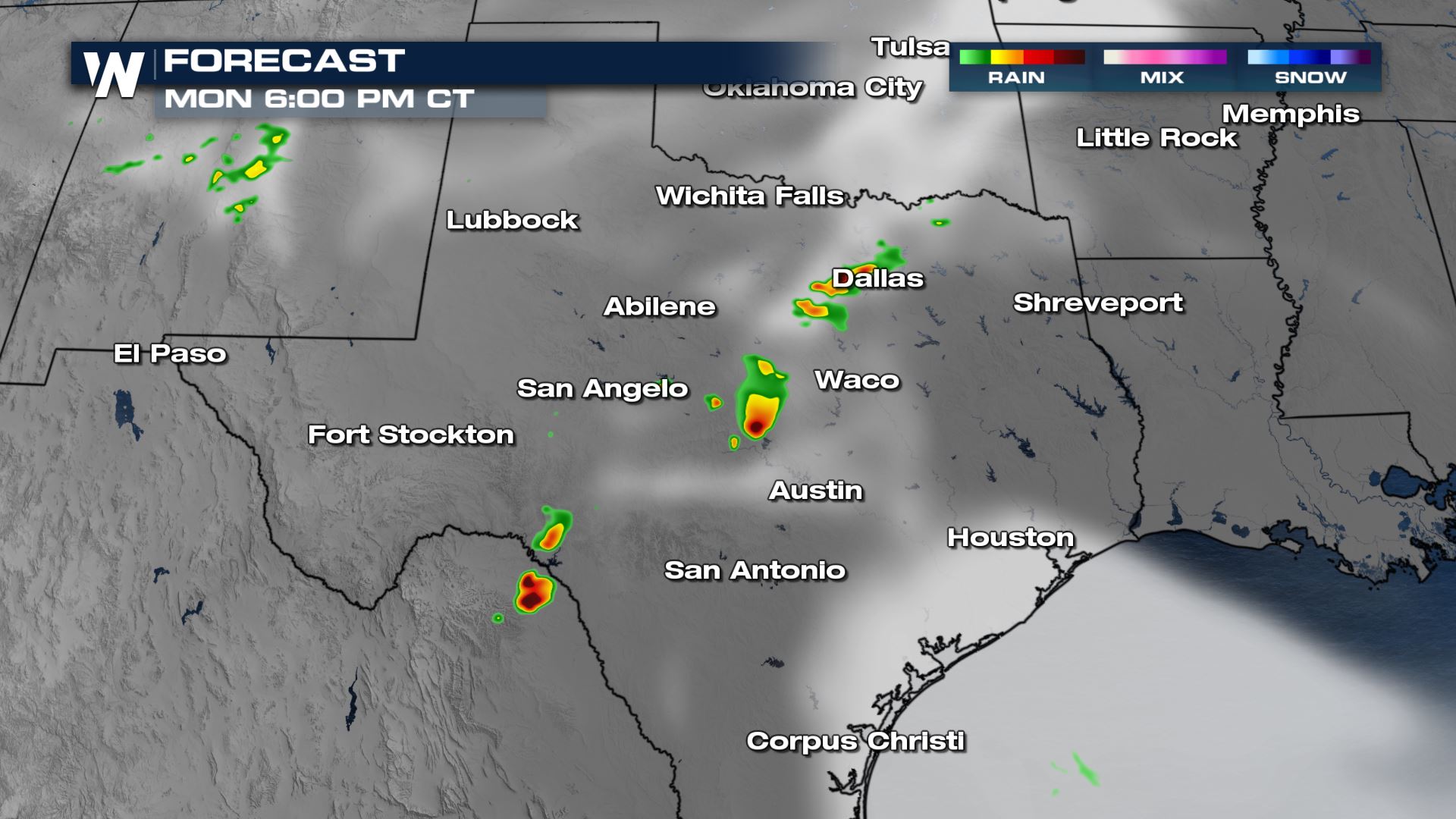
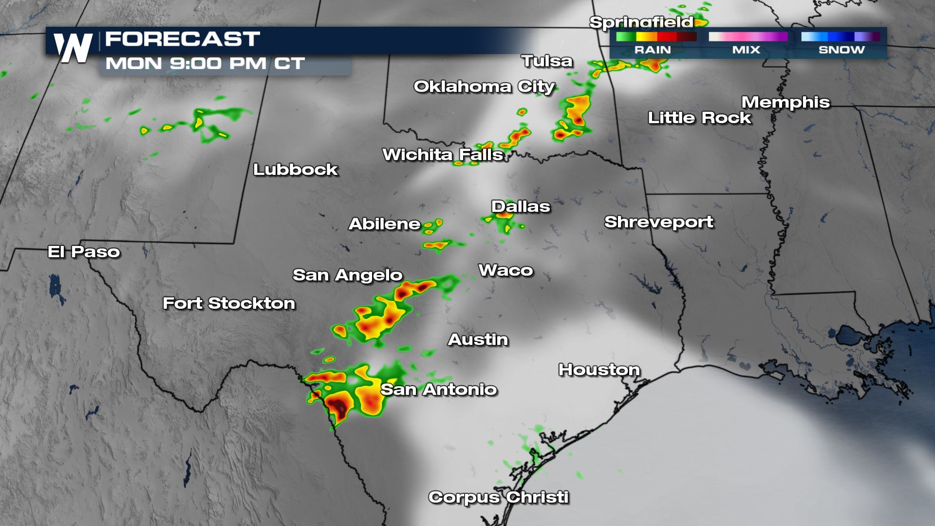
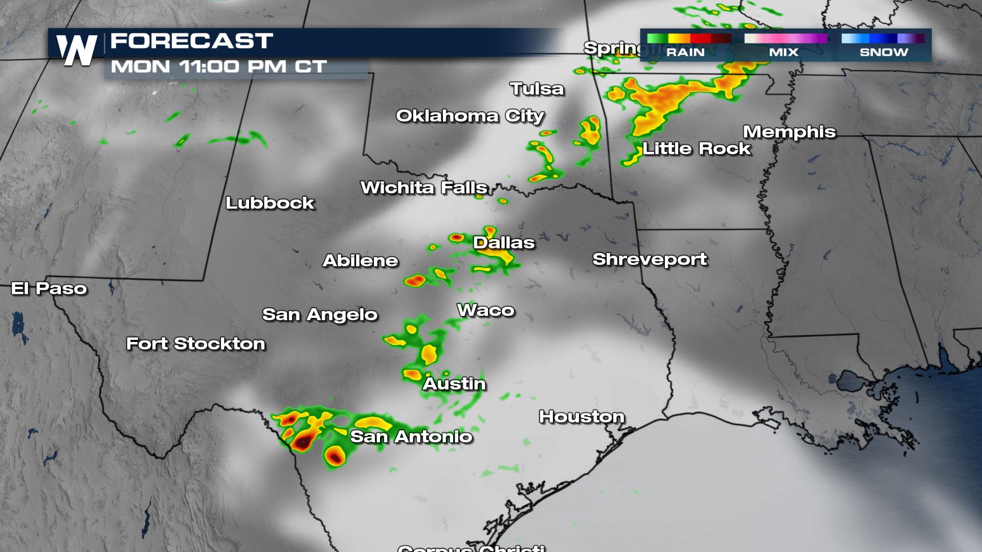
Forecast
Thunderstorms should start up late this afternoon and this evening and could last well into early Tuesday morning. The initial cells that develop likely will have large hail stones before it turns more into a damaging wind event.
The storms should start up later this afternoon and this evening and could last well into early Tuesday morning. The initial cells that develop likely will have large hail stones before it turns more into a damaging wind event.
For more updates on today's severe weather, keep checking back with WeatherNation.
All Weather News
More
Wildfire Outbreak in the Pacific Northwest
SPOKANE, WA - On Saturday, August 1st, the Ol
3 Aug 2026 1:55 AM

More Storms for the East Through Monday
A low-pressure system that moved through the
3 Aug 2026 1:50 AM


After Reaching Category 5, Genevieve Weakens in the Pacific
PacificGenevieve formed last Friday south of
3 Aug 2026 12:30 AM

Flooding, Severe Storms Target the Midwest Again
After an active week of storms across the nor
1 Aug 2026 1:40 AM

Flooding Risk Increases as Heavy Rain Targets the Tri-State Area
Tuesday, heavy rainfall moved across the Nort
30 Jul 2026 12:25 AM

Severe Weather: Energy From the Midwest Now in the Southeast
UPPER MIDWEST - Through Monday, dangerous tor
29 Jul 2026 10:30 PM