Severe Risk for the Appalachians Overnight

Top Stories
1 May 2022 7:15 PM
A trough swinging across the Great Lakes will be the focus for severe storms overnight over areas of the The Ohio River Valley.
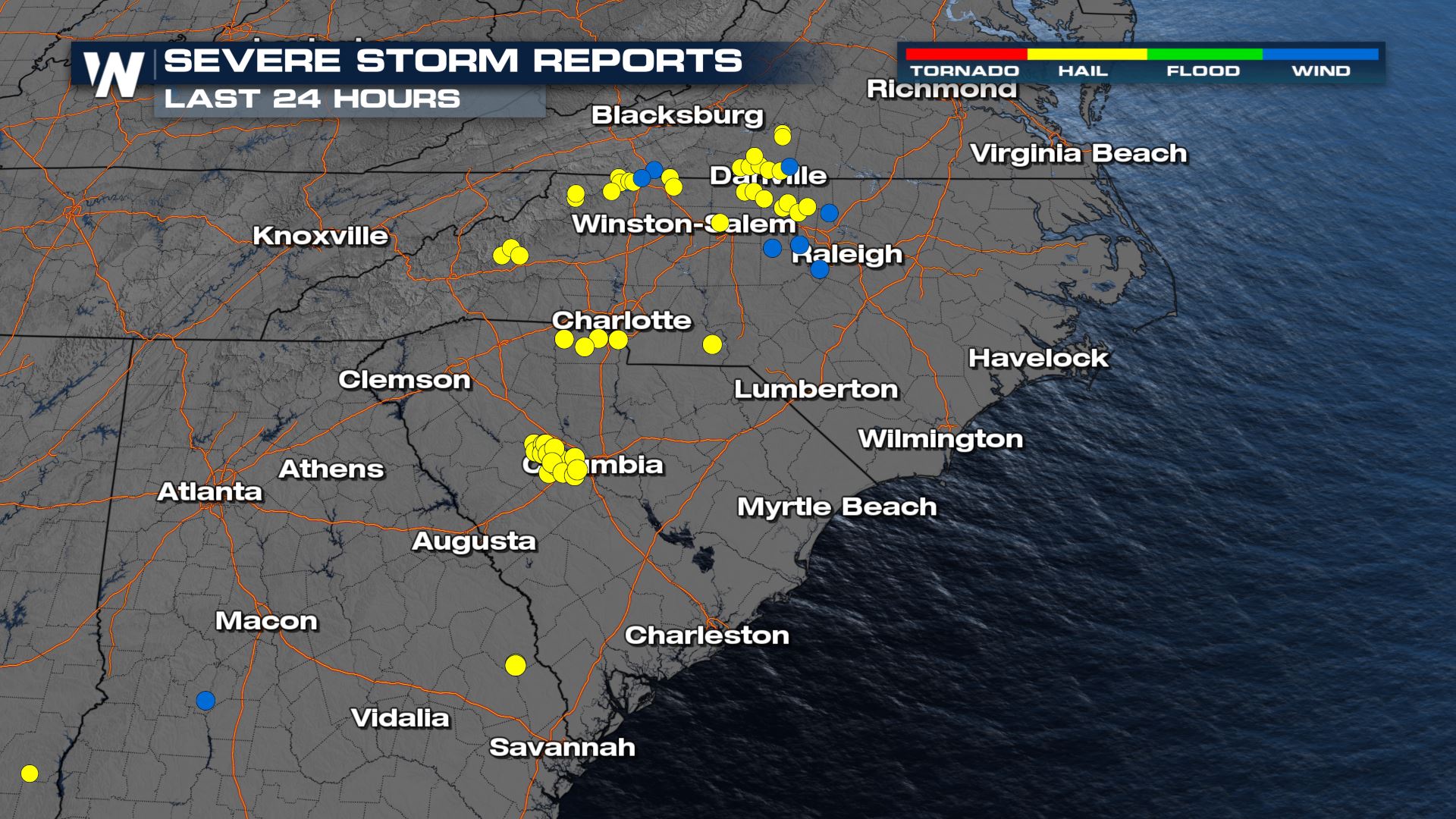
Hail reports have been up to ping pong ball in size on Sunday for parts of North Carolina. Take a look at where the severe reports were located and how large they were.
 Here is a look at the latest severe forecast.
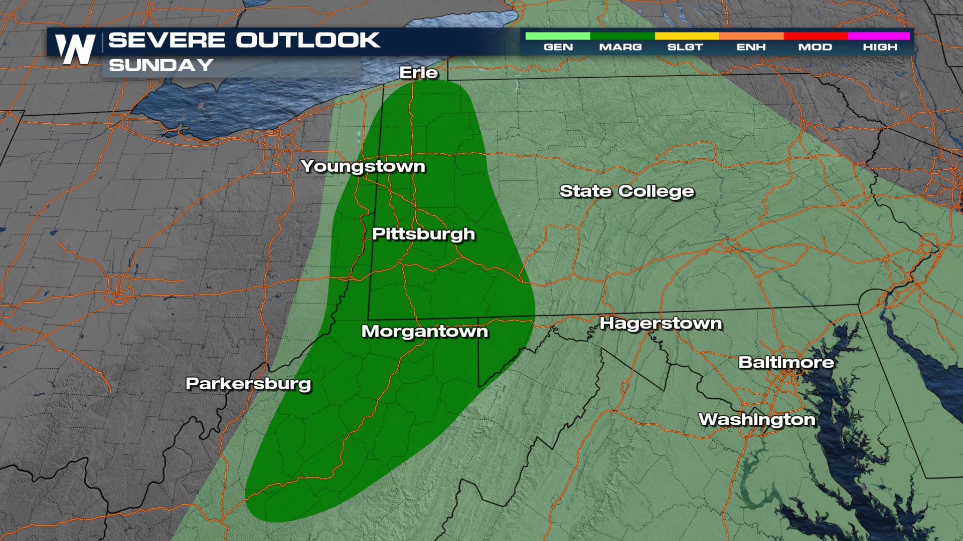 The severe risk will be ongoing throughout Sunday over the Appalachians and should keep moving east to the Atlantic Coast by tonight and tomorrow.
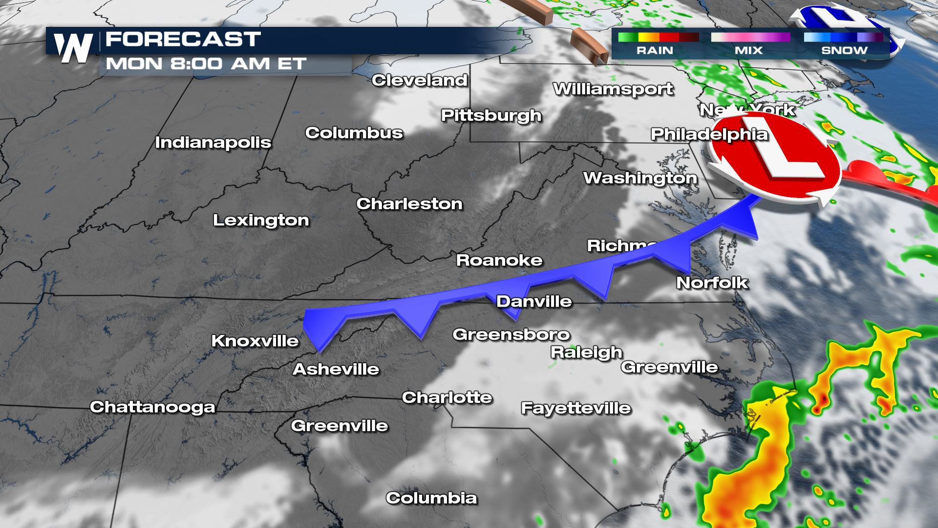
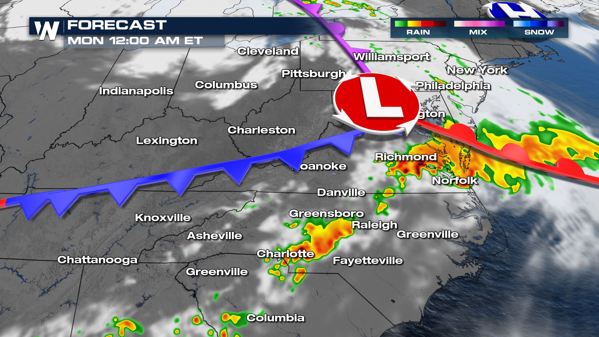 By Monday morning, storms should have moved off the coast through the Mid-Atlantic region.
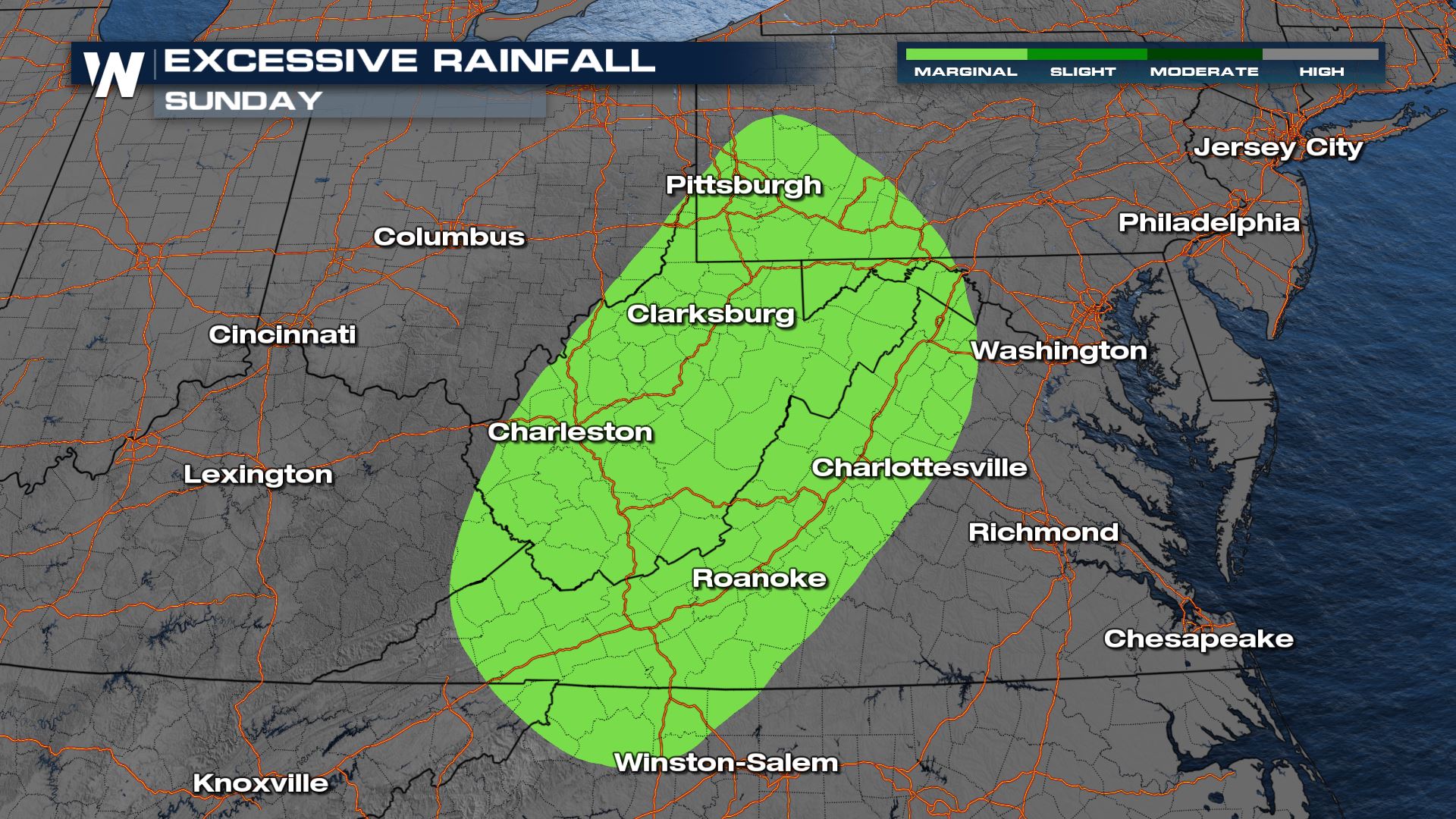
 The excessive rainfall outlook shows where flooding could be more likely with the combination of saturated soils and the heavy rain on the way.
 Stay with WeatherNation as we bring you the latest on the severe storm chances through the weekend.
Here is a look at the latest severe forecast.
Severe Outlook - Overnight
The severe risk will be ongoing throughout Sunday over the Appalachians and should keep moving east to the Atlantic Coast by tonight and tomorrow.
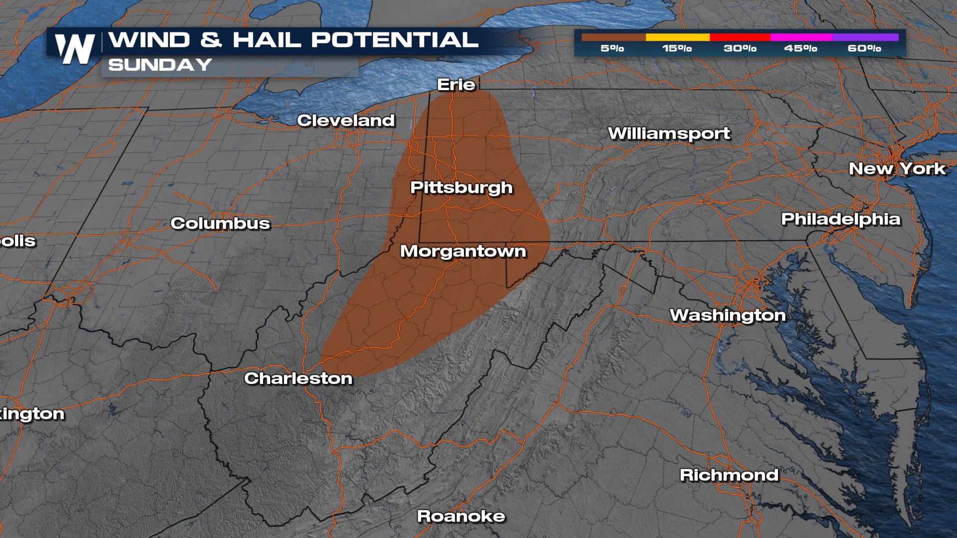
Severe Risks
Wind and Hail will be likely within any of the storms that develop through this region.
Forecast Timing
Through the overnight hours, the strongest of the storms will continue to track east along the occluded front.
By Monday morning, storms should have moved off the coast through the Mid-Atlantic region.
Accumulation
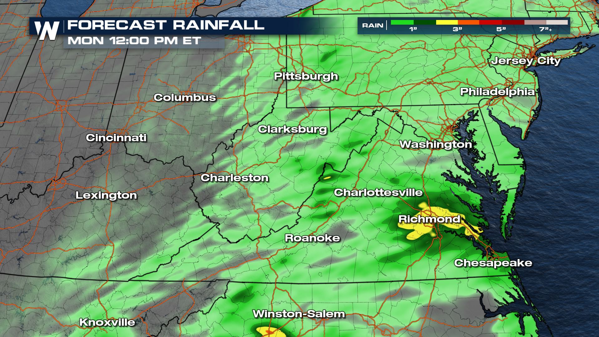
Widespread, rain looks to accumulate up to 2" - localized areas, including the Richmond location, could see 3"+ which would lead to isolated areas seeing flash flooding.
The excessive rainfall outlook shows where flooding could be more likely with the combination of saturated soils and the heavy rain on the way.
Stay with WeatherNation as we bring you the latest on the severe storm chances through the weekend.All Weather News
More
Flooding Risk Increases as Heavy Rain Targets the Tri-State Area
Tuesday, heavy rainfall moved across the Nort
30 Jul 2026 12:25 AM


Genevieve Down to a Category 2 Hurricane
PacificFausto is now a post-tropical cyclone.
30 Jul 2026 12:00 AM

Severe Weather: Energy From the Midwest Now in the Southeast
UPPER MIDWEST - Through Monday, dangerous tor
29 Jul 2026 10:30 PM


Southeast Flood Risk Lingers Near Stalled Front
A stalled boundary over the Southeast will ke
25 Jul 2026 10:55 AM

Another Round of Storms Targets the Northeast
Tuesday brought severe weather again across p
23 Jul 2026 1:15 AM