Severe Risk for the Texas South Plains Wednesday
Special Stories
20 Nov 2019 10:45 AM
All the energy that has impacted the Southwest over the past 24 hours is moving East and heading into the Lone Star State. Areas in the plains of Texas and southwest Oklahoma could see some isolated severe storms. Here is the latest on today's severe risk.
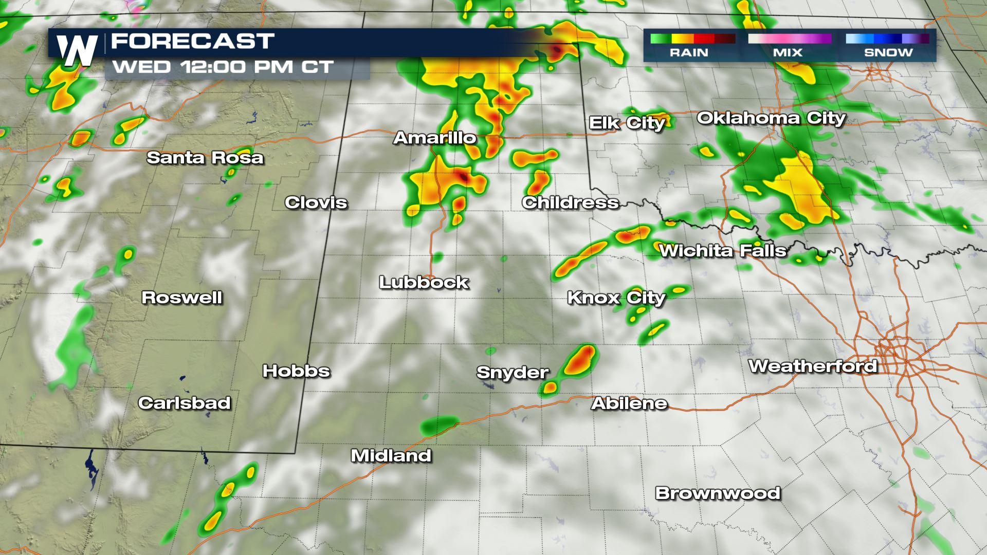
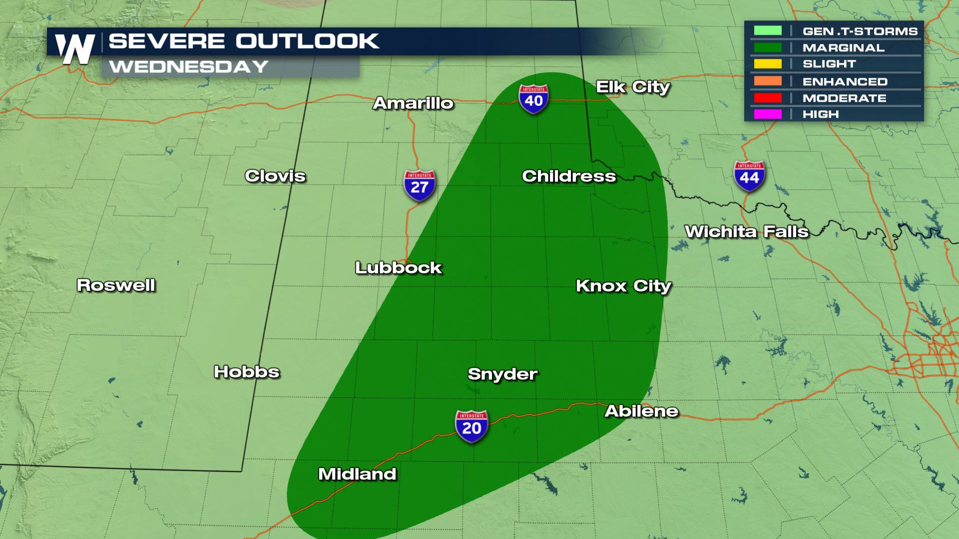 Showers and storms will be likely in a lot of areas of West Texas today, but across the South Plains there will be an increased risk for severe weather. The severe risk will be isolated into cities like Lubbock and Childress.
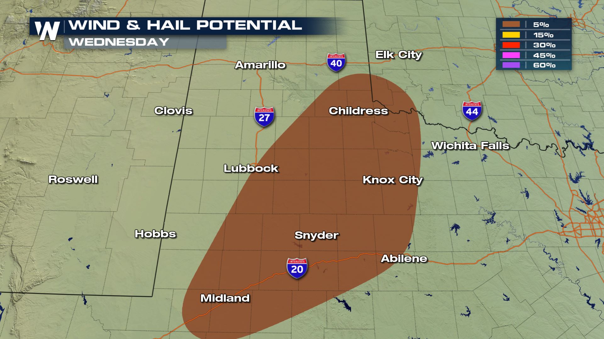 If a severe storm develops it will have large hail and damaging winds associated with it. Wind gusts up to 58 mph and quarter sized hail will be the primary risks. Thankfully the tornado risk will be very low.
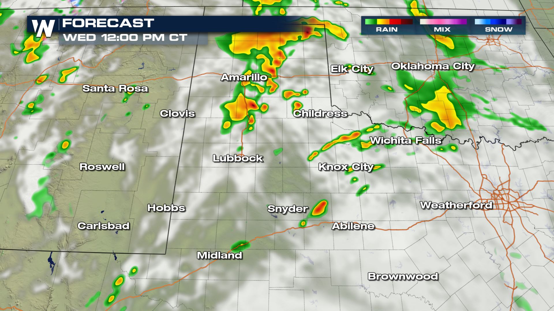
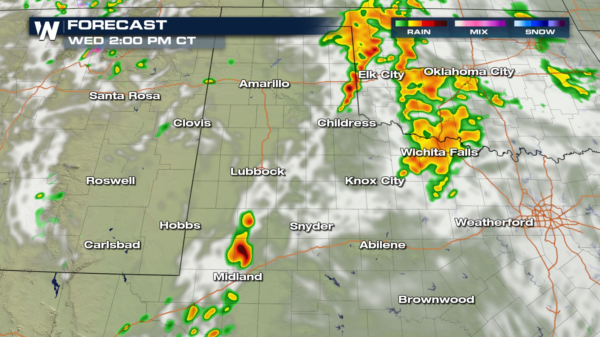
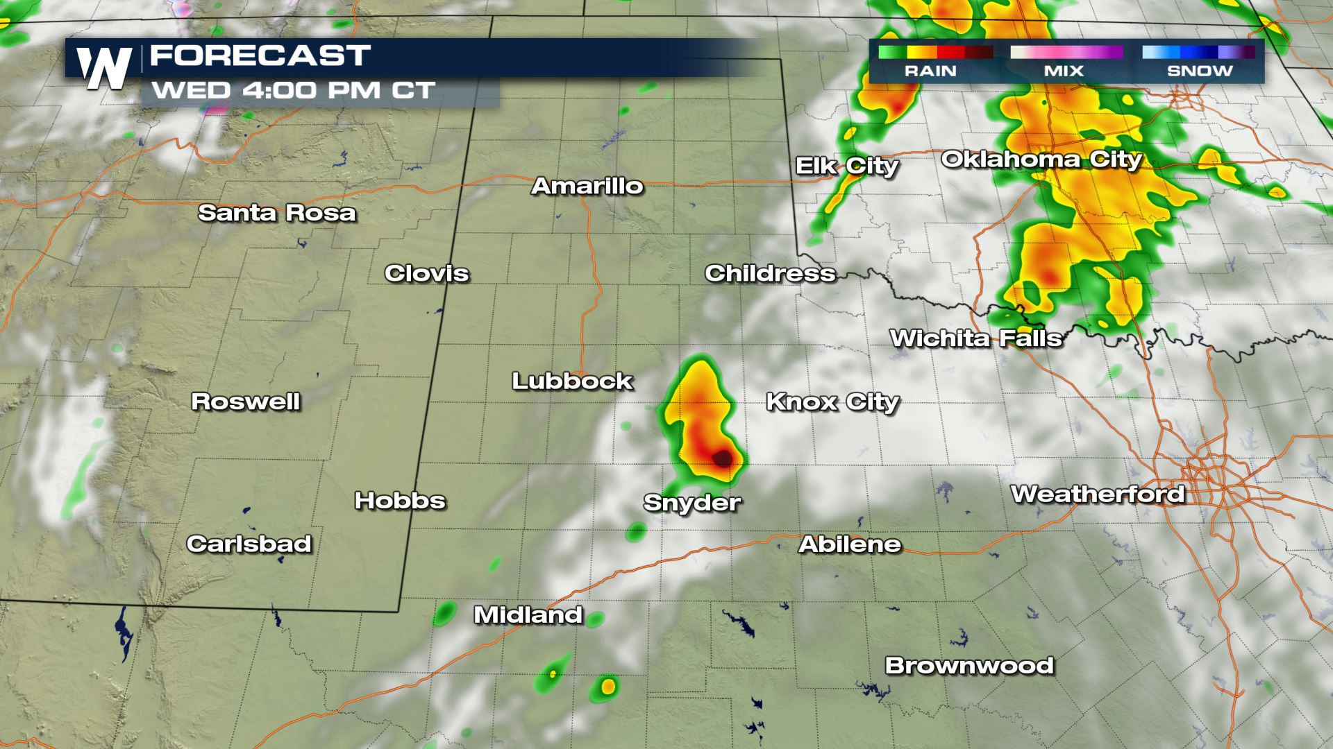 The timing for today's storms will be throughout the morning an into the afternoon. During the peak heating hours today is likely when we could see an isolated severe thunderstorm warning.
Keep checking with WeatherNation for the very latest on today's severe storm chances.
The timing for today's storms will be throughout the morning an into the afternoon. During the peak heating hours today is likely when we could see an isolated severe thunderstorm warning.
Keep checking with WeatherNation for the very latest on today's severe storm chances.
Severe Outlook
Showers and storms will be likely in a lot of areas of West Texas today, but across the South Plains there will be an increased risk for severe weather. The severe risk will be isolated into cities like Lubbock and Childress.
Severe Risks
If a severe storm develops it will have large hail and damaging winds associated with it. Wind gusts up to 58 mph and quarter sized hail will be the primary risks. Thankfully the tornado risk will be very low.
Forecast
The timing for today's storms will be throughout the morning an into the afternoon. During the peak heating hours today is likely when we could see an isolated severe thunderstorm warning.
Keep checking with WeatherNation for the very latest on today's severe storm chances.All Weather News
More
East Gears Up for Stormy, Wet Weekend
A low pressure system crashing through the Mi
1 Aug 2026 6:15 PM


Flooding, Severe Storms Target the Midwest Again
After an active week of storms across the nor
1 Aug 2026 1:40 AM

After Reaching Category 5, Genevieve Weakens in the Pacific
PacificFausto is now a post-tropical cyclone.
31 Jul 2026 1:30 AM

Flooding Risk Increases as Heavy Rain Targets the Tri-State Area
Tuesday, heavy rainfall moved across the Nort
30 Jul 2026 12:25 AM

Severe Weather: Energy From the Midwest Now in the Southeast
UPPER MIDWEST - Through Monday, dangerous tor
29 Jul 2026 10:30 PM