Severe Storm Chances for the Florida Panhandle Wednesday
Special Stories
22 Jan 2019 3:06 AM
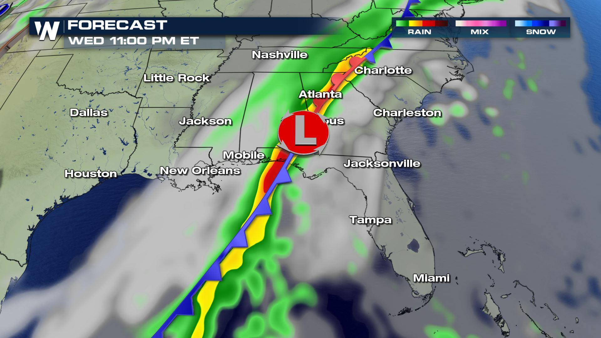
A cold front riding along the Gulf Coast will provide a chance for showers and storms across the Southeast. One particular area could have a very unstable environment to work with and that means the chance for isolated severe storms. Here is the very latest.
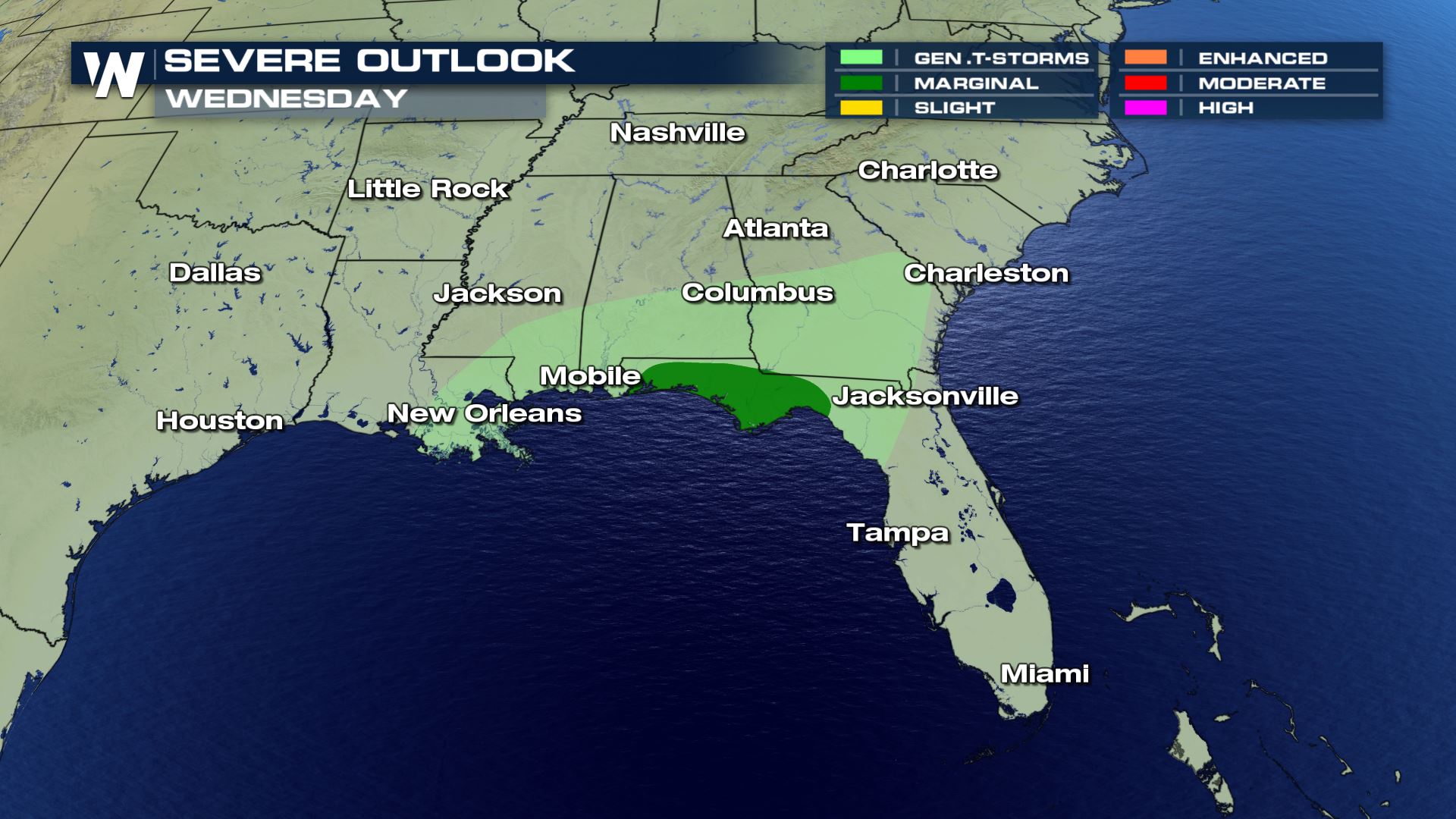 Marginal risk of severe weather over the Florida Panhandle for Wednesday and early Thursday morning. Right now it looks like a damaging wind event, but if things come together there could also be an isolated tornado risk.
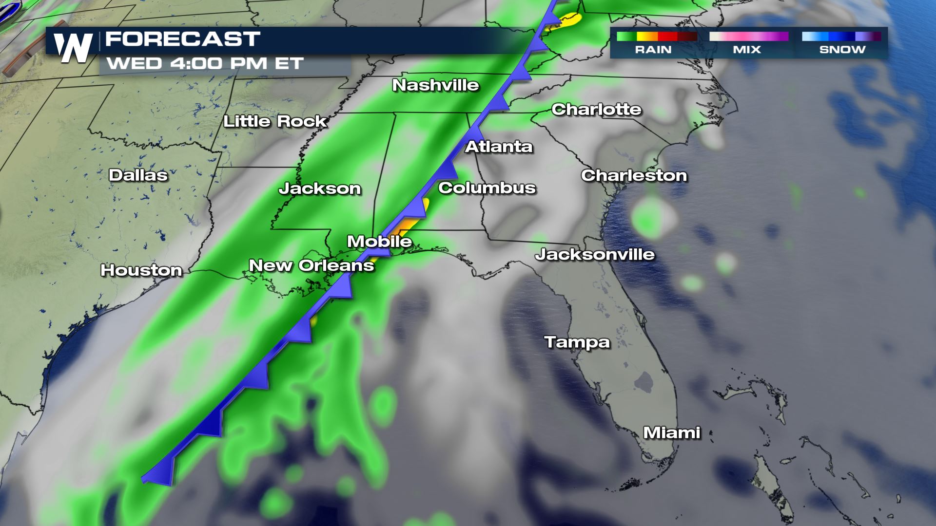
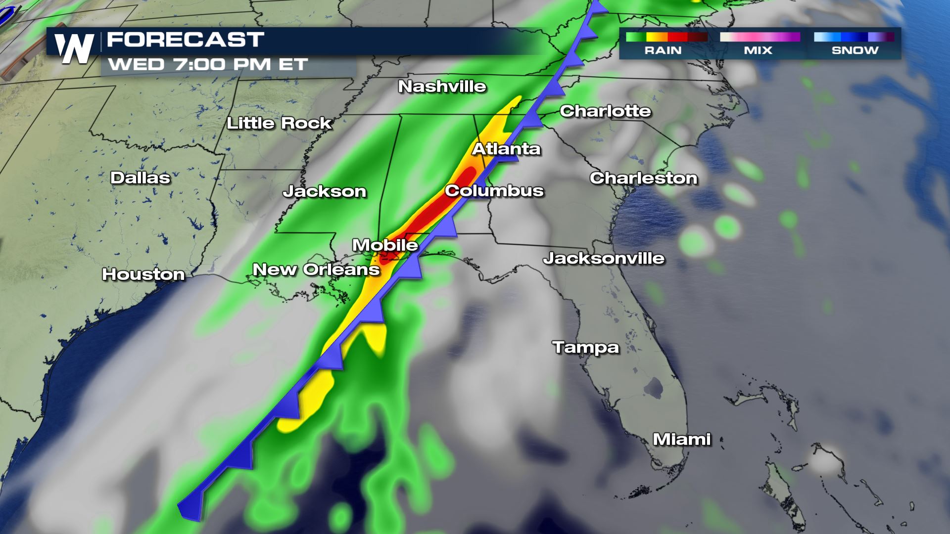

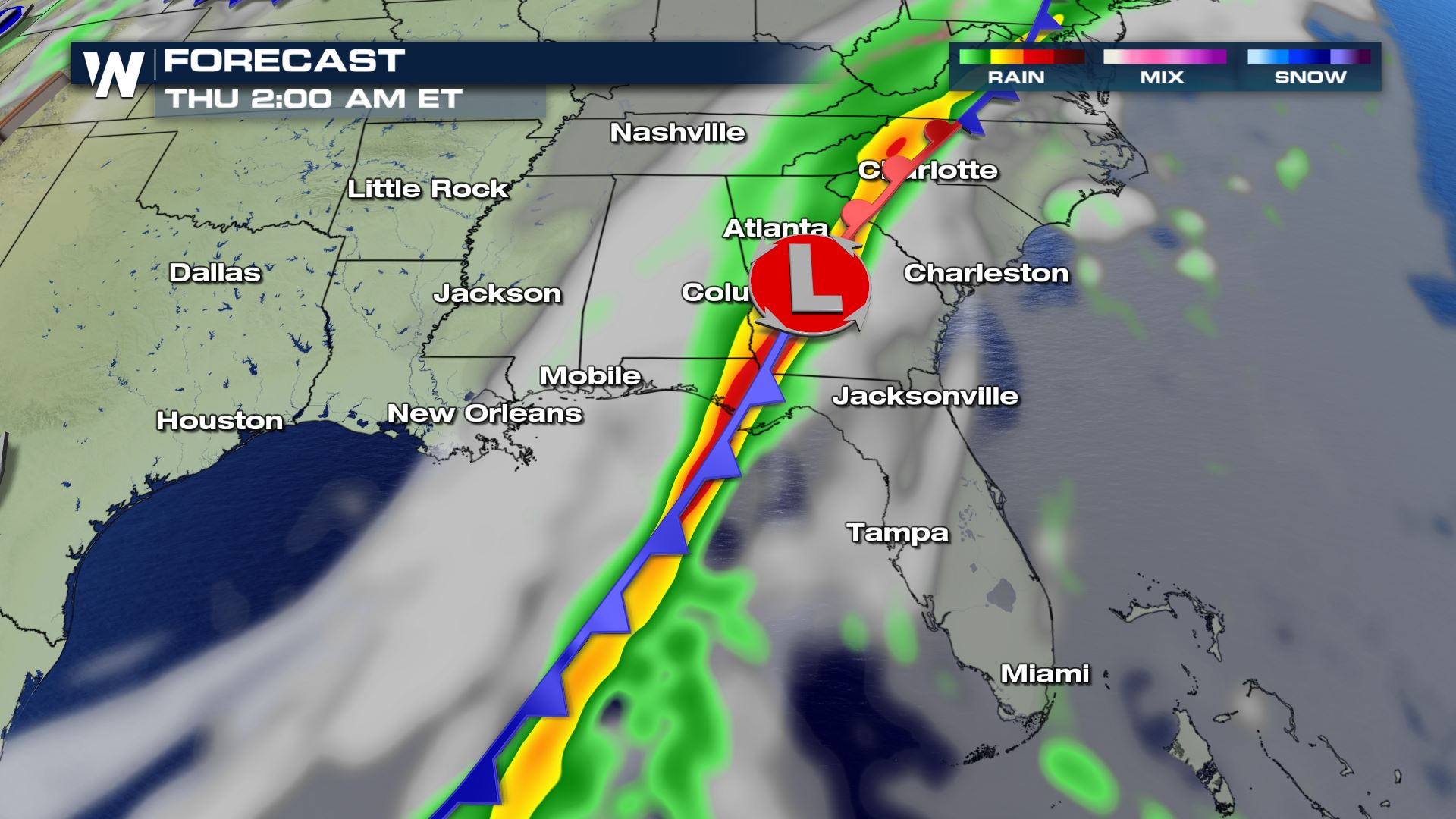 The timing will be Wednesday afternoon through early Thursday morning. With the potential for overnight storms you will want to make sure you have a way to get weather alerts. Especially in cities like Tallahassee and Pensacola.
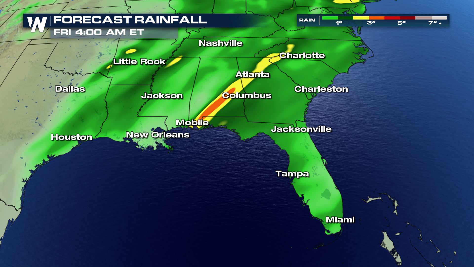 The other risk with this cold front will be heavy rain. Some areas of Alabama and Georgia could see over 3 inches of rain leading to a risk of flash flooding as well.
Stay tuned to WeatherNation for more updates on this severe weather risk.
The other risk with this cold front will be heavy rain. Some areas of Alabama and Georgia could see over 3 inches of rain leading to a risk of flash flooding as well.
Stay tuned to WeatherNation for more updates on this severe weather risk.
Severe Outlook
Marginal risk of severe weather over the Florida Panhandle for Wednesday and early Thursday morning. Right now it looks like a damaging wind event, but if things come together there could also be an isolated tornado risk.
Forecast
The timing will be Wednesday afternoon through early Thursday morning. With the potential for overnight storms you will want to make sure you have a way to get weather alerts. Especially in cities like Tallahassee and Pensacola.
Heavy Rainfall
The other risk with this cold front will be heavy rain. Some areas of Alabama and Georgia could see over 3 inches of rain leading to a risk of flash flooding as well.
Stay tuned to WeatherNation for more updates on this severe weather risk.
All Weather News
More
East Gears Up for Stormy, Wet Weekend
A low pressure system crashing through the Mi
1 Aug 2026 6:15 PM


Flooding, Severe Storms Target the Midwest Again
After an active week of storms across the nor
1 Aug 2026 1:40 AM

After Reaching Category 5, Genevieve Weakens in the Pacific
PacificFausto is now a post-tropical cyclone.
31 Jul 2026 1:30 AM

Flooding Risk Increases as Heavy Rain Targets the Tri-State Area
Tuesday, heavy rainfall moved across the Nort
30 Jul 2026 12:25 AM

Severe Weather: Energy From the Midwest Now in the Southeast
UPPER MIDWEST - Through Monday, dangerous tor
29 Jul 2026 10:30 PM