Tornado Spotted Monday in California!
Special Stories
4 Jan 2021 8:31 AM
A strong storm system moved through Northern California on Monday, dropping through a strong enough cold front that produced a tornado!

 https://twitter.com/i/status/1346253370554785793
 For more details on the snow chances in the Sierra Nevada mountain range and northern California we have another article write up here: More Snow to Add to Sierra Snowpack.
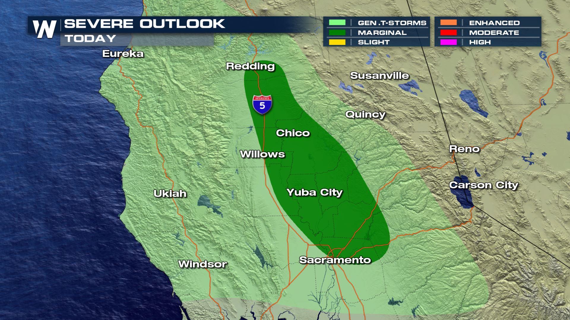
Severe Outlook
Earlier today, Northern California was under a marginal risk (level 1, on a scale of 1 to 5) for severe storms.
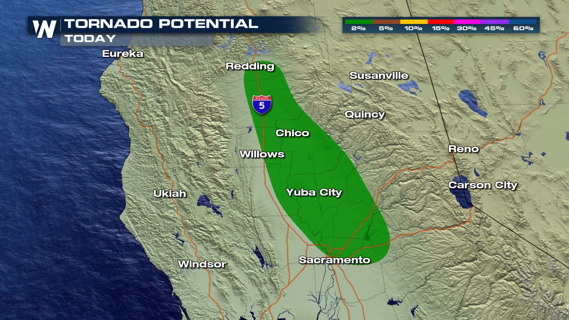
Tornado Potential
As storms developed, there was enough spin in the atmosphere to produce some rotation in a thunderstorm.
https://twitter.com/i/status/1346253370554785793
Forecast
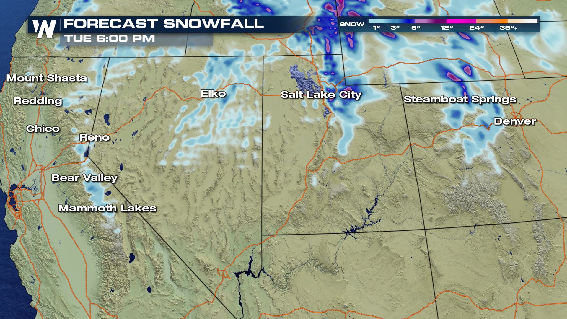
As our cold front continues to push onshore, precipitation is expected to continue overnight. But most of the heavier storms will weaken, and most of the notable precipitation will fall as snow in the Sierra Nevadas and into Northern Utah and Northern Colorado.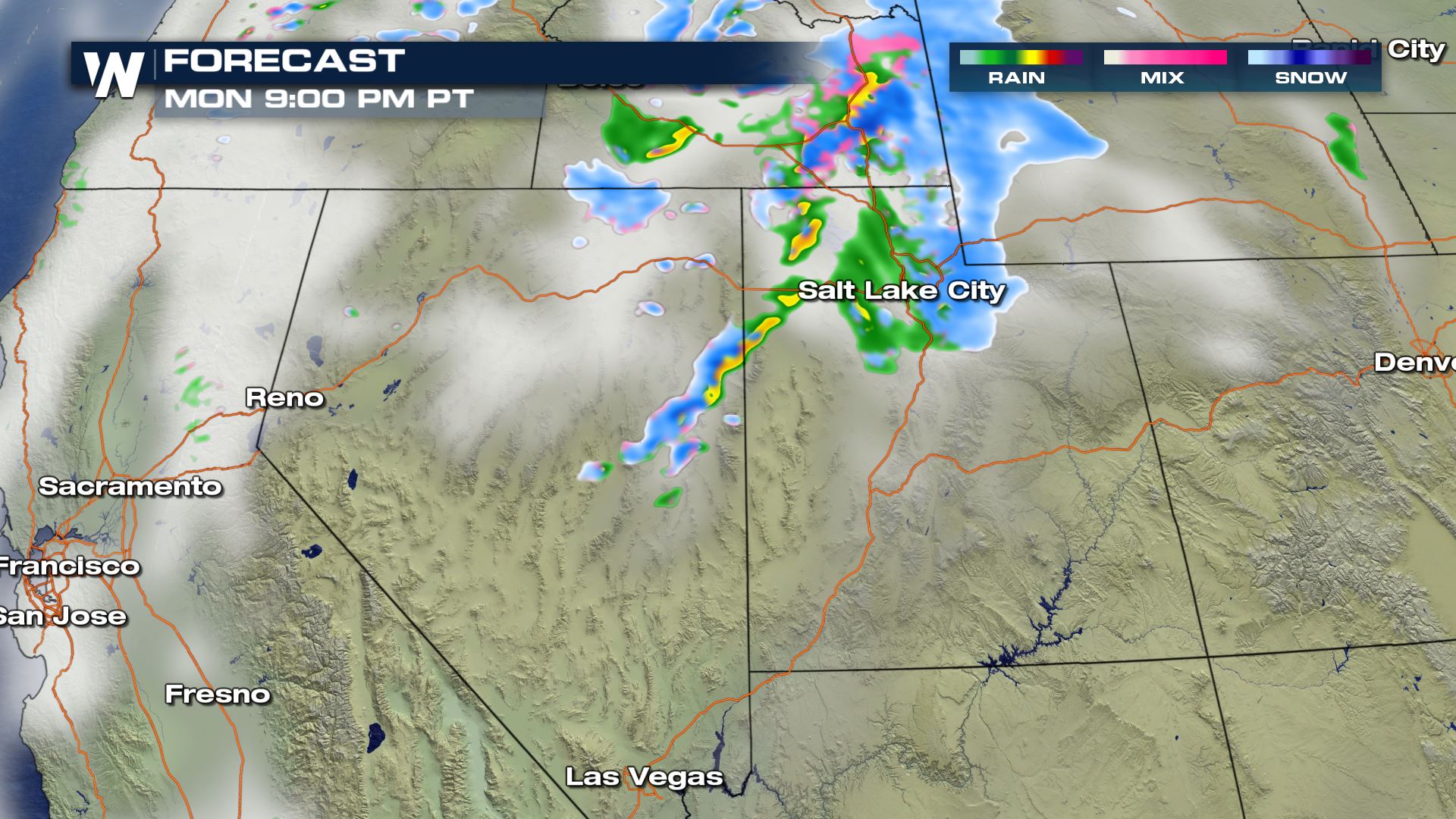
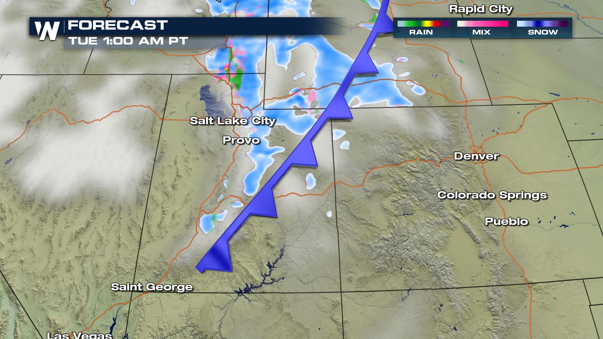
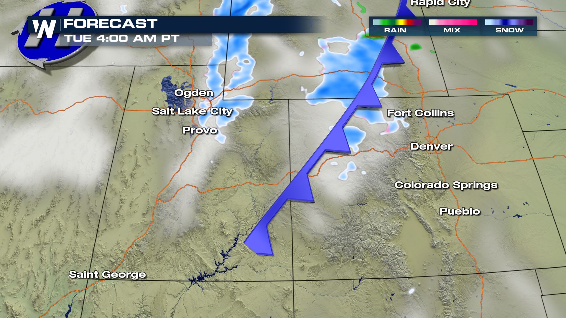
Forecast Snowfall
Snowfall over the Wasatch and Uinta mountain ranges in Utah could be on the order of 5"-10" with locally higher amounts. The same forecast holds for around Steamboat Springs, CO too.
For more details on the snow chances in the Sierra Nevada mountain range and northern California we have another article write up here: More Snow to Add to Sierra Snowpack.All Weather News
More
More Storms for the East Through Monday
A low-pressure system that moved through the
2 Aug 2026 10:40 PM

Wildfire Outbreak in the Pacific Northwest
SPOKANE, WA - On Saturday, August 1st, the Ol
2 Aug 2026 10:35 PM


After Reaching Category 5, Genevieve Weakens in the Pacific
PacificGenevieve formed on last Friday south
2 Aug 2026 6:25 PM

Flooding, Severe Storms Target the Midwest Again
After an active week of storms across the nor
1 Aug 2026 1:40 AM

Flooding Risk Increases as Heavy Rain Targets the Tri-State Area
Tuesday, heavy rainfall moved across the Nort
30 Jul 2026 12:25 AM

Severe Weather: Energy From the Midwest Now in the Southeast
UPPER MIDWEST - Through Monday, dangerous tor
29 Jul 2026 10:30 PM