Serious Storm Threat in the Deep South Overnight

A severe weather outbreak on Wednesday left thousands of residents without power in the Deep South and Southeast Thursday morning. This comes after several tornadoes were reported in Georgia, but mainly from the widespread wind and hail damage.
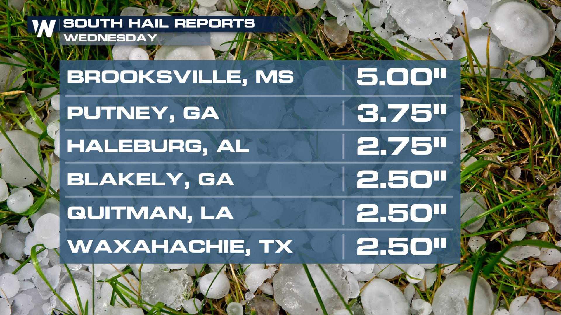
Hail was absolutely MASSIVE in Mississippi on Wednesday, comparing to the size of Grapefruits in Brooksville.
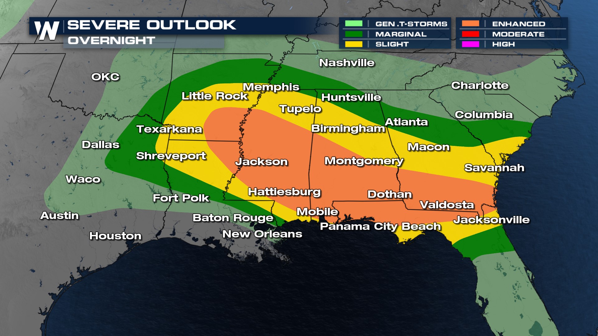
Storms continue to stay intense in Louisiana, Mississippi, and Alabama through early Thursday morning. With the storms continuing overnight, please have multiple ways to get alerts. Storms will also be moving quickly meaning you have little time to get to your safe space. Please have multiple ways to get alerts if you live within 2 hours of the I-20 corridor.
The severe threat includes metropolitan areas of Jackson, MS, Montgomery, AL, and Columbus, GA. Storms will continue overnight, in between the I-10 and I-20 corridors for the most part with some of these storms reaching severe limits. Again, have a way to get weather alerts before you go to bed that can wake you up!
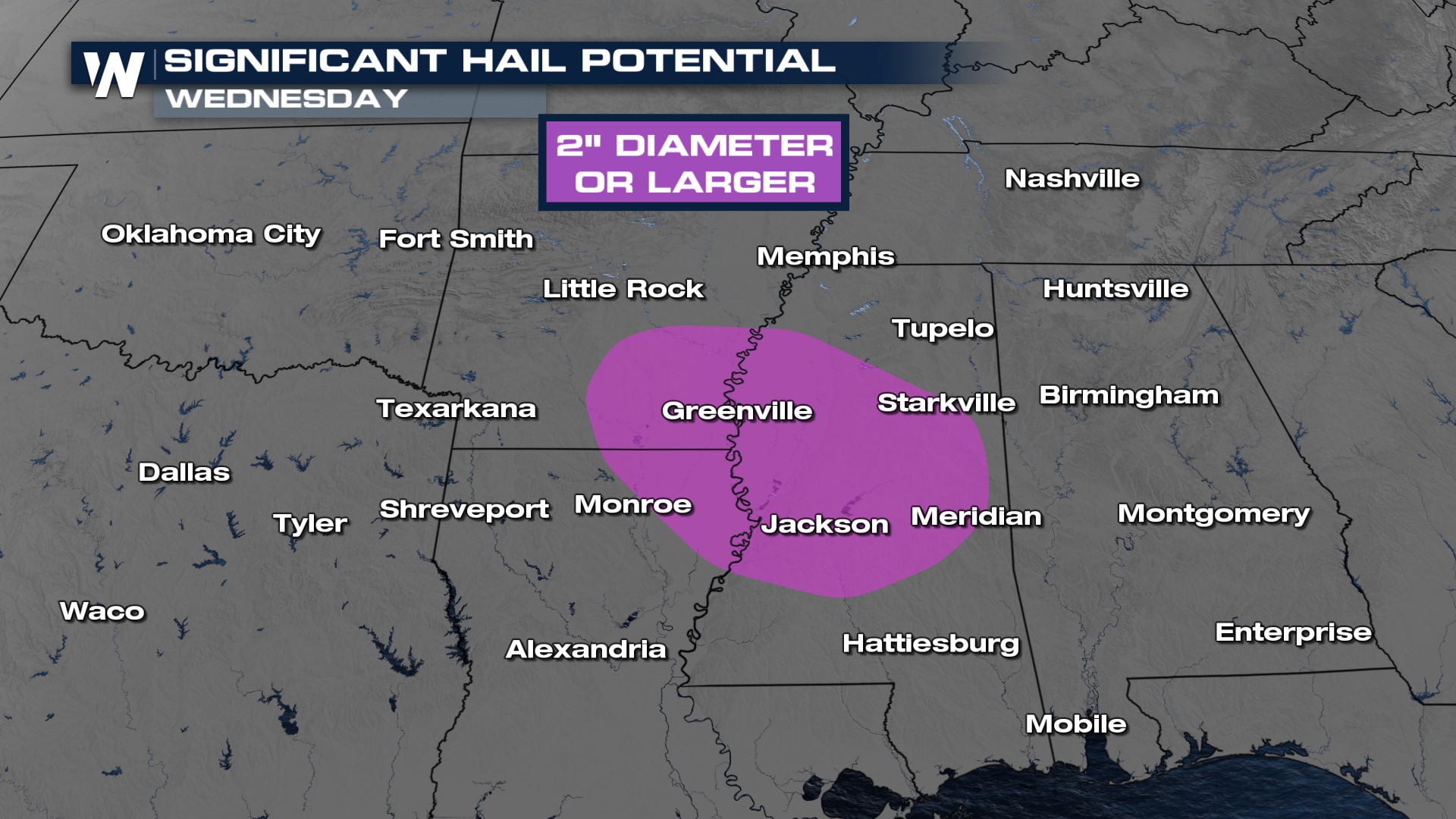
 Significant hail, meaning 2" in diameter or larger, some greater than 3", will be one of the primary threats overnight from eastern Arkansas through central Mississippi.
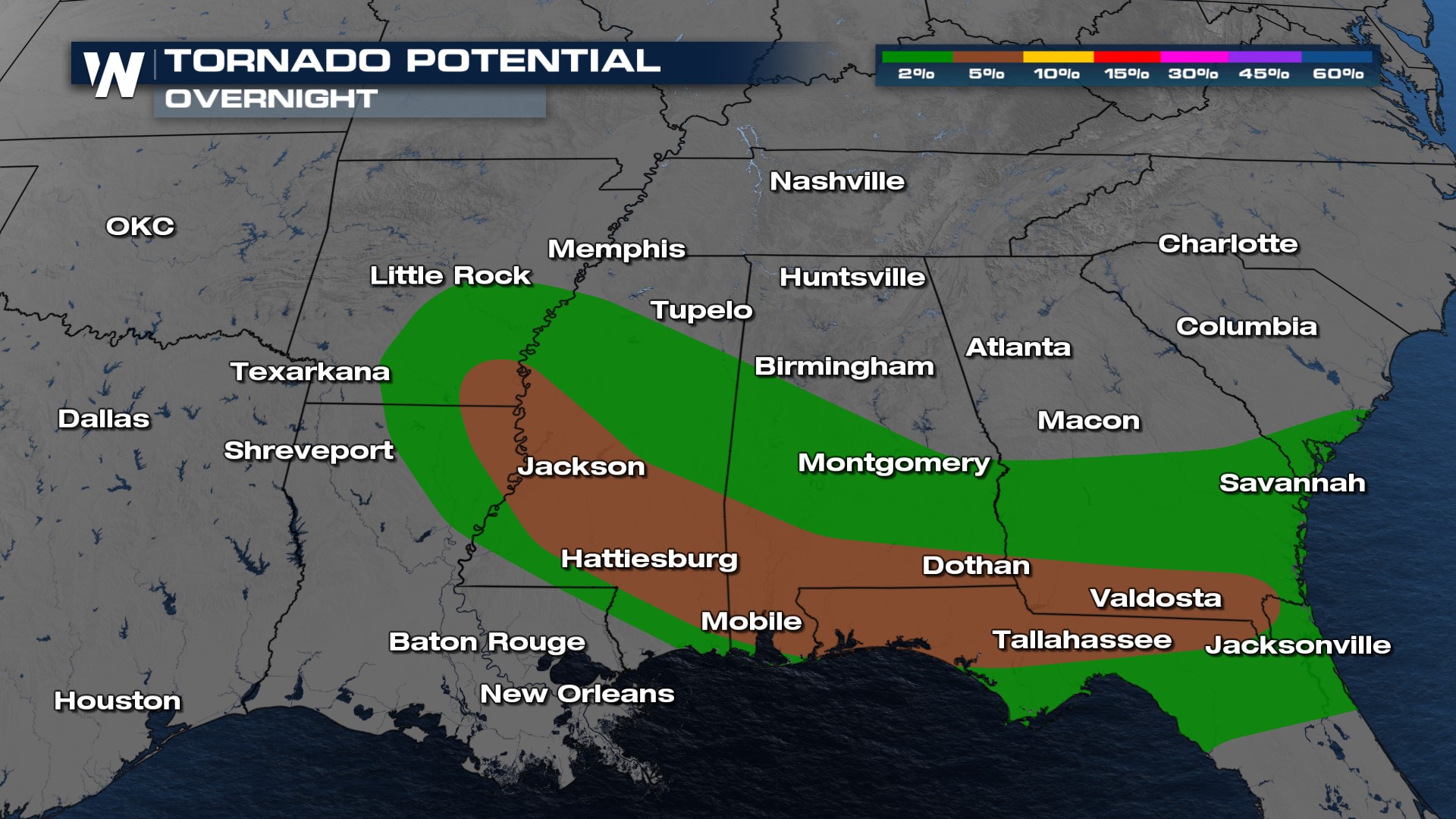
 The tornado risk overnight lies across southeastern Arkansas through the I-10 corridor from south Mississippi through the Florida Panhandle. Tornadoes touched down on Wednesday afternoon in Eufaula and Abbeville in SE Alabama, producing damage.
 Storms could also produce damaging winds 75 mph or greater through much of the South too. Extensive building, tree and power line damage happened earlier in the day as rounds of storms blew through, with winds as high as 82 mph!

Stay with WeatherNation for the latest forecast overnight.


