Severe Storms in the Forecast for Saturday
Special Stories
9 Jun 2018 3:55 AM
We have more severe weather chances in the forecast today and again it looks like the High Plains could see the worst of today's weather. All severe weather modes will need to be monitored with the storm chances today with large hail, damaging winds and tornadoes will all be possible.

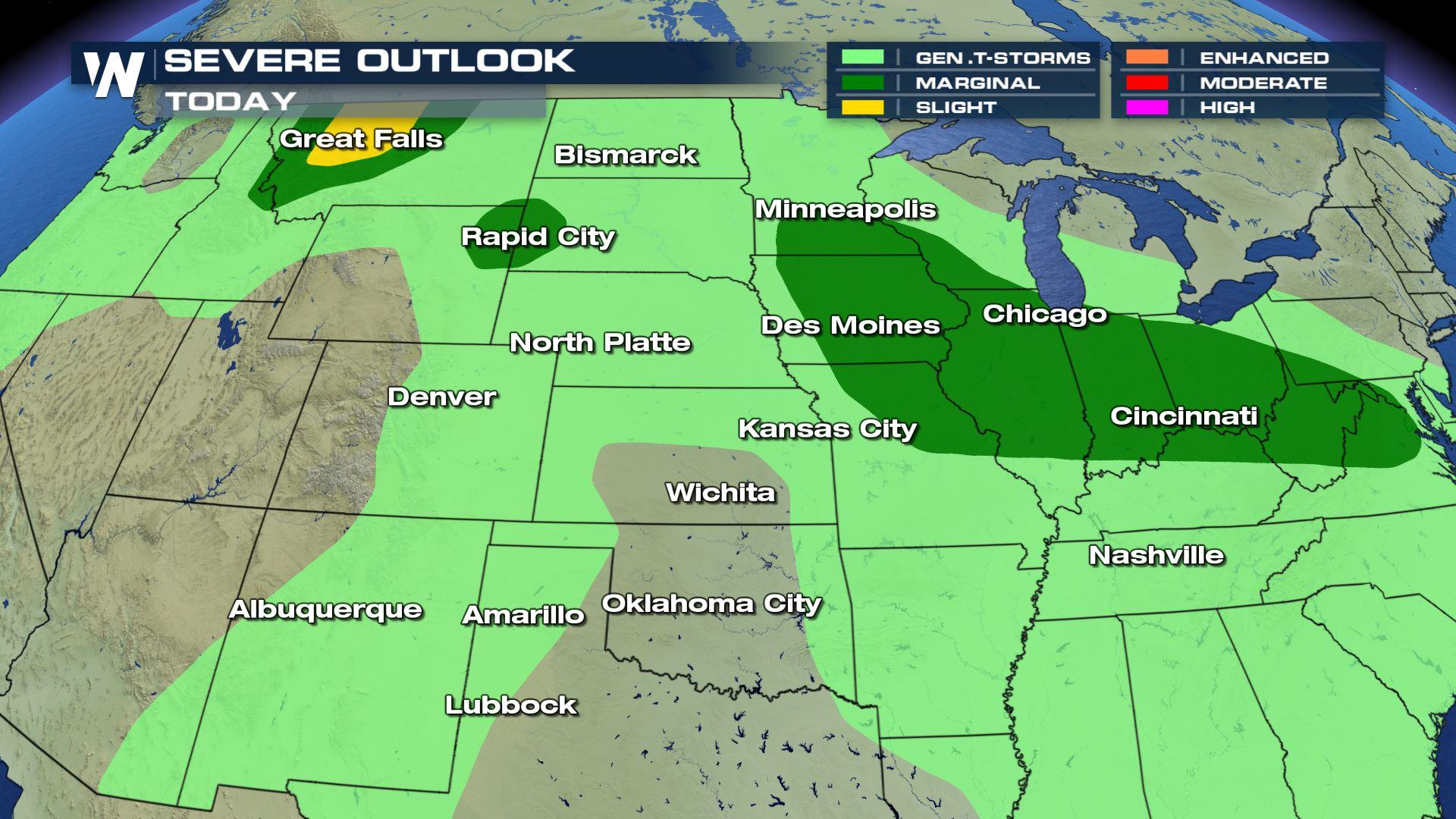
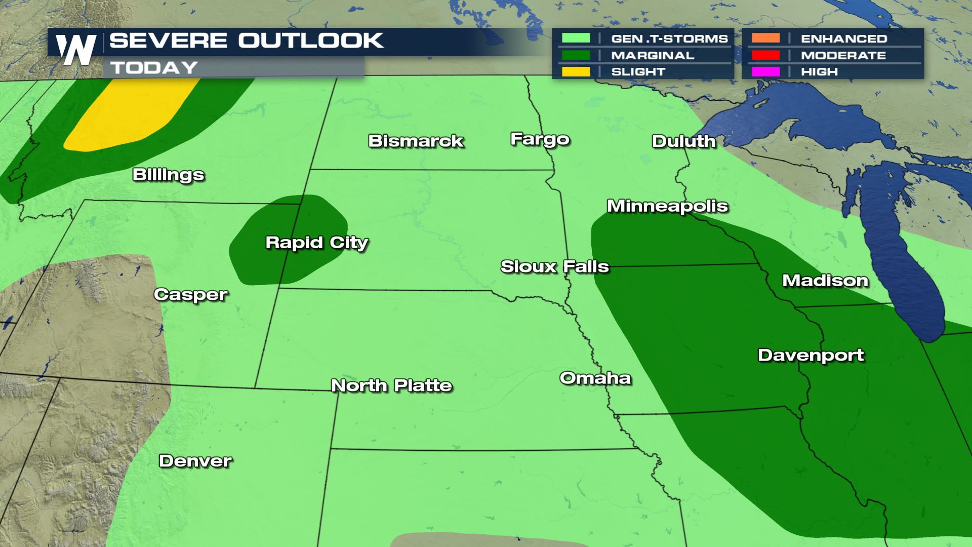 You can see the "Slight" risk of severe weather over Montana, but a "Marginal" risk of severe weather (Isolated) will be possible from the Plains all the way through the Ohio Valley.
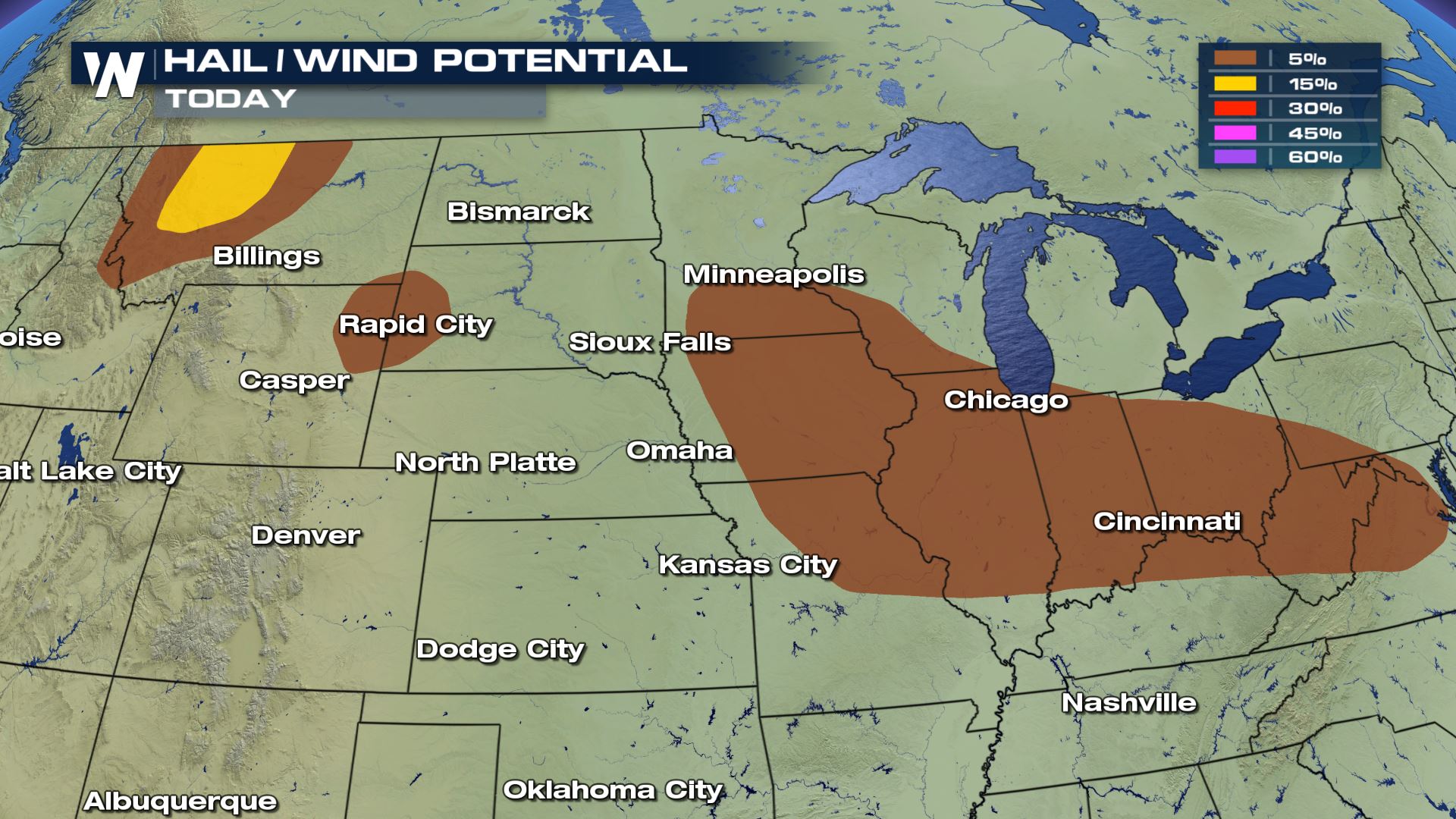
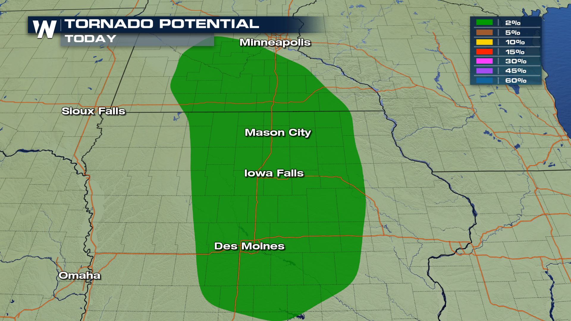 The damaging wind and hail threat will line up with those areas under the severe weather risk. The tornado risk will be confined to Minnesota and Iowa for Saturday. Des Moines up to Minneapolis will all need to watch out for the threat of tornadoes.
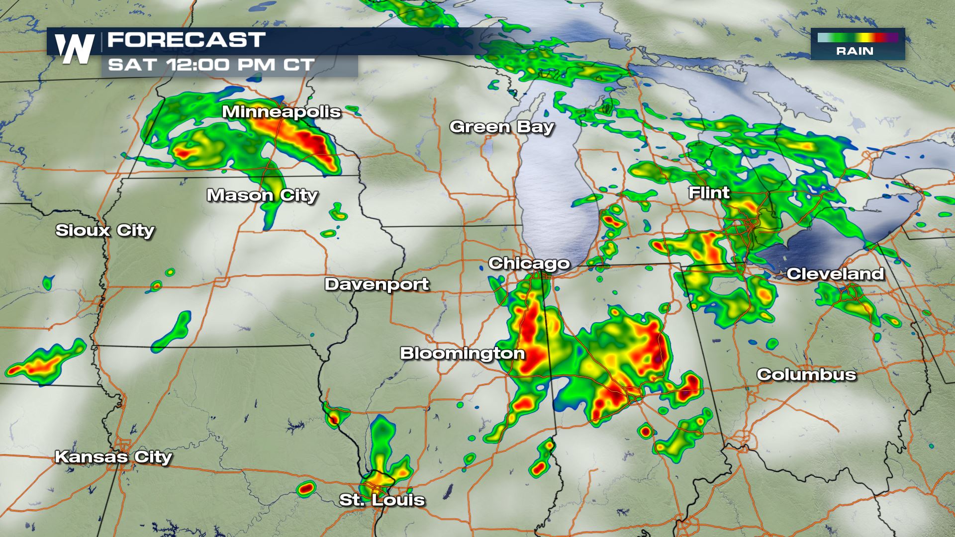
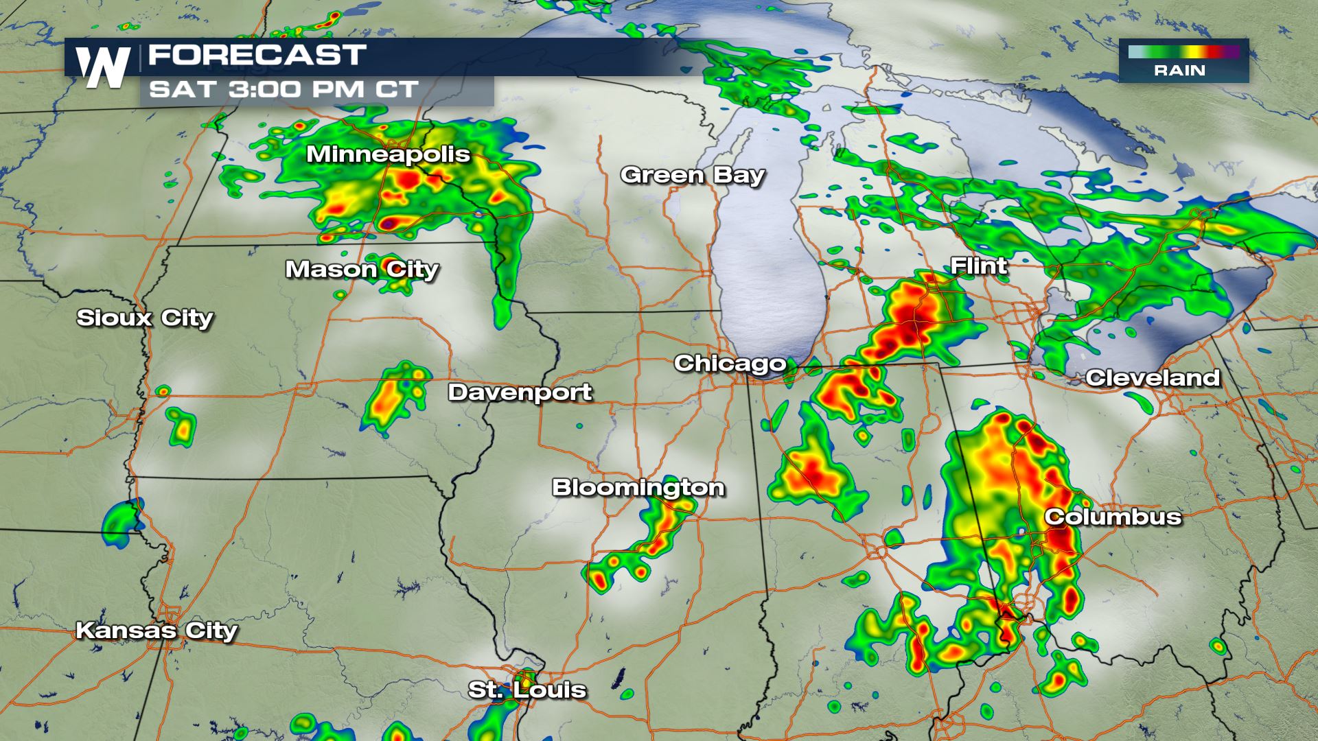
 You can see the timing for today's severe storms will be during the afternoon and evening hours. Keep checking WeatherNation for the very latest updates.
Meteorologist Patrick Crawford
You can see the timing for today's severe storms will be during the afternoon and evening hours. Keep checking WeatherNation for the very latest updates.
Meteorologist Patrick Crawford
Severe Outlook
You can see the "Slight" risk of severe weather over Montana, but a "Marginal" risk of severe weather (Isolated) will be possible from the Plains all the way through the Ohio Valley.
Severe Risks
The damaging wind and hail threat will line up with those areas under the severe weather risk. The tornado risk will be confined to Minnesota and Iowa for Saturday. Des Moines up to Minneapolis will all need to watch out for the threat of tornadoes.
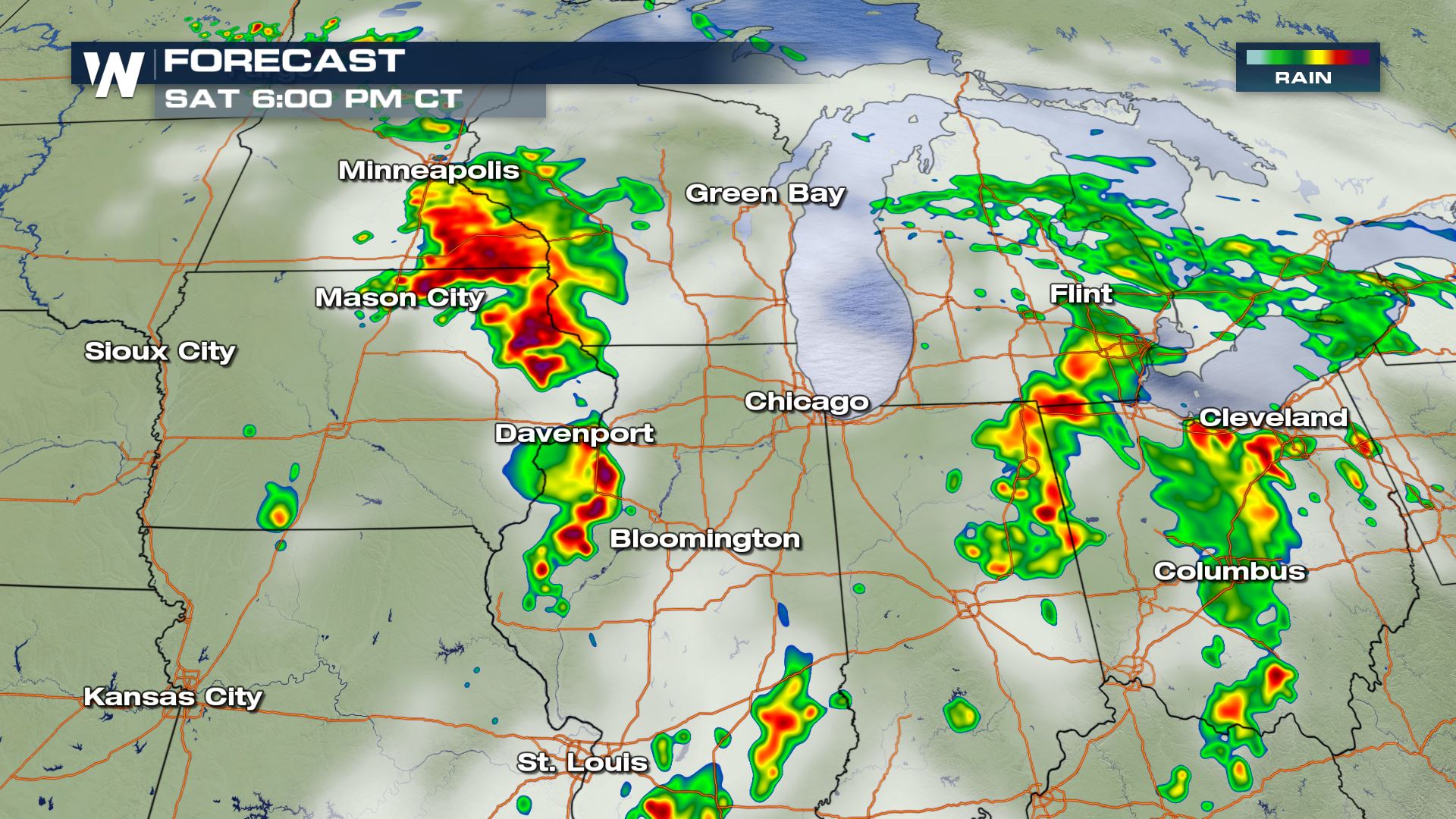
Forecast
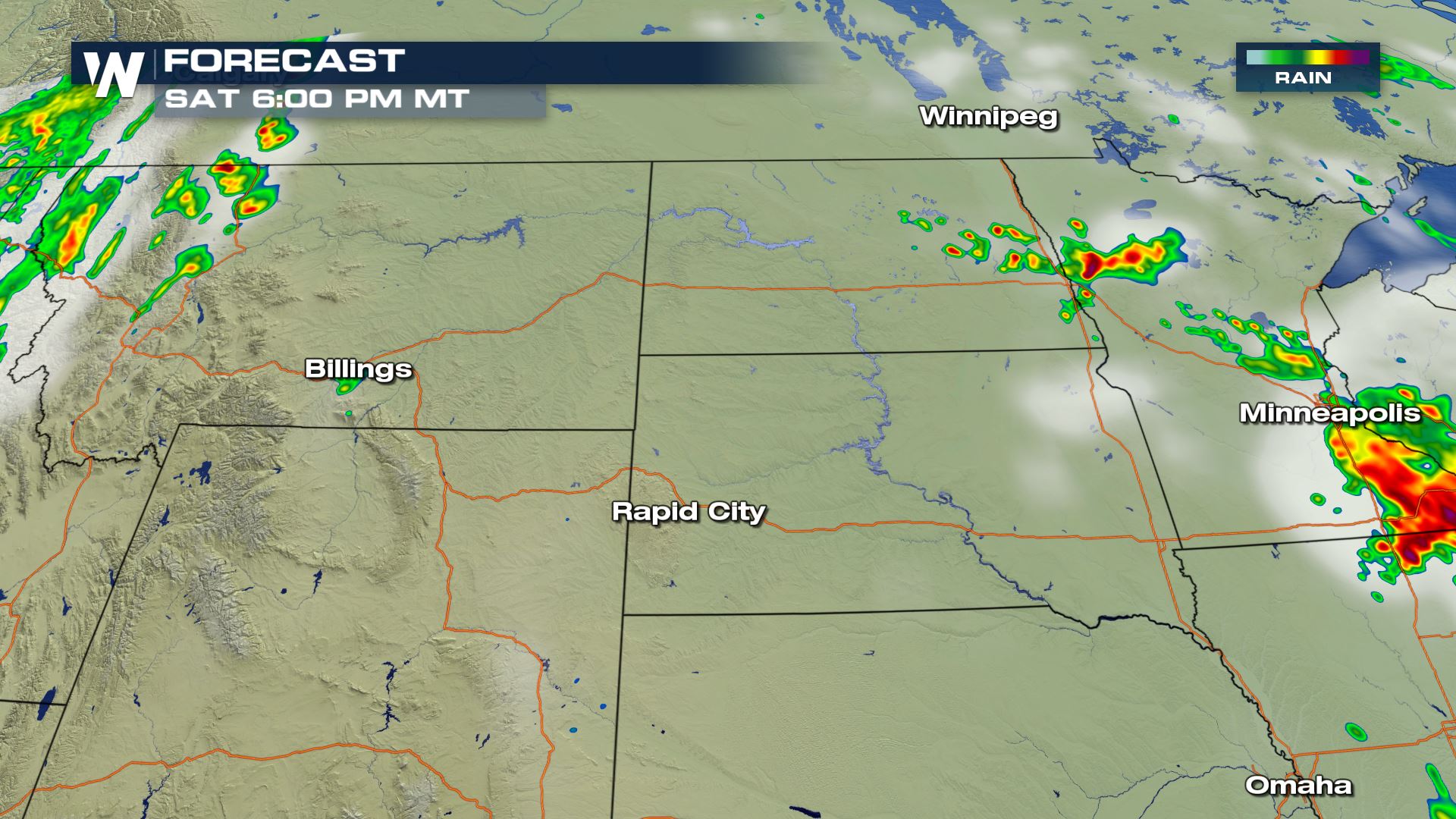
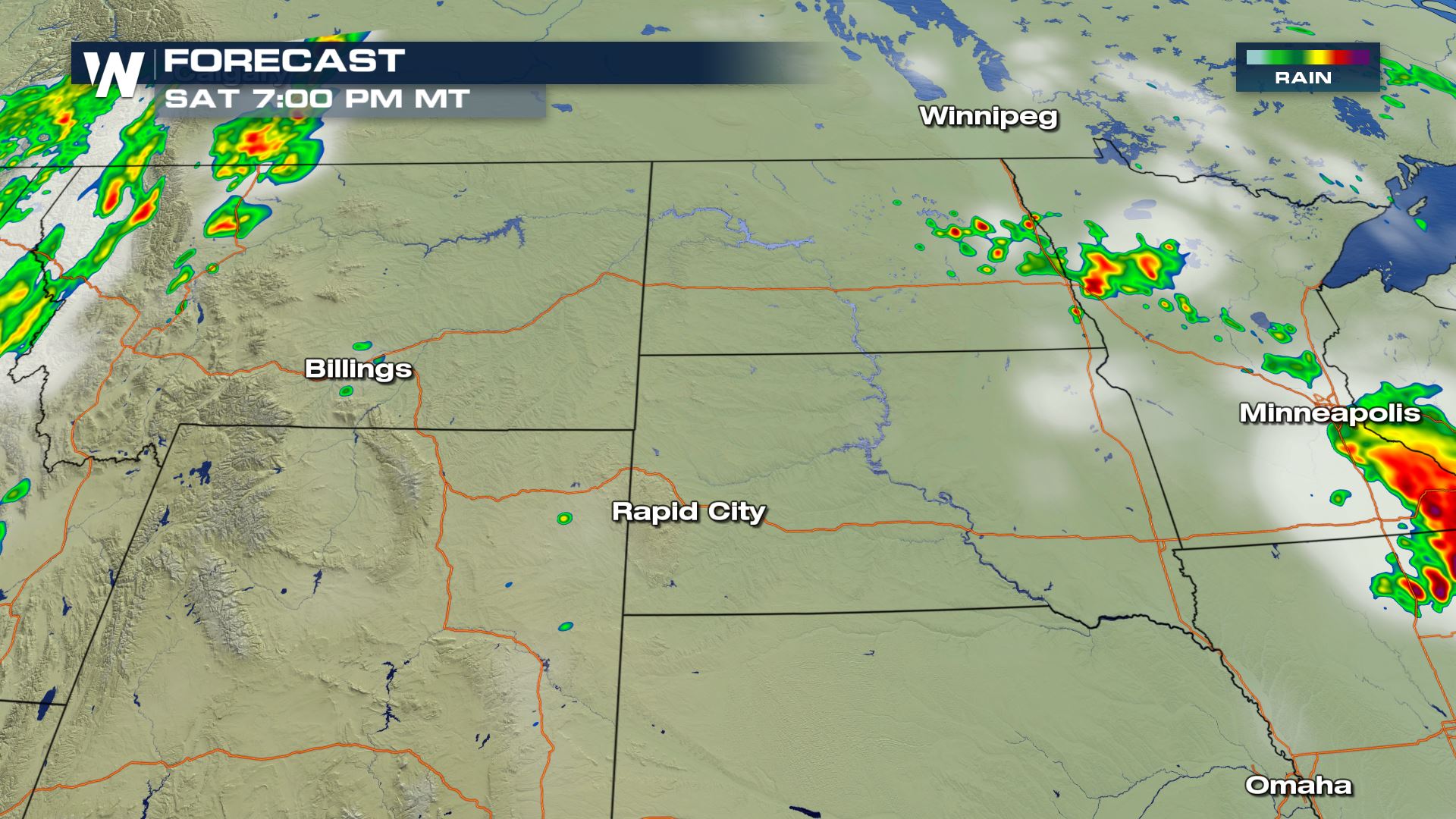
Here is a look at the latest timing for storms today with a focus on the "Slight" risk and where the tornado risk will be high.High Plains
Upper Midwest
You can see the timing for today's severe storms will be during the afternoon and evening hours. Keep checking WeatherNation for the very latest updates.
Meteorologist Patrick CrawfordAll Weather News
More
Severe Storms Target the Midwest to the Northeast
UPPER MIDWEST - Dangerous tornadoes have alre
28 Jul 2026 1:45 AM

Tropics: Fausto Heads towards Hawaii; Genevieve Cat 4 Hurricane
PacificHurricane Fausto continues to track we
28 Jul 2026 1:45 AM


Southeast Flood Risk Lingers Near Stalled Front
A stalled boundary over the Southeast will ke
25 Jul 2026 10:55 AM

Another Round of Storms Targets the Northeast
Tuesday brought severe weather again across p
23 Jul 2026 1:15 AM

Another Round of Severe Weather for the Upper Midwest and Great Lakes
The upper-level low train continues to keep t
21 Jul 2026 1:45 AM