Severe Storms Possible From Carolina to Texas
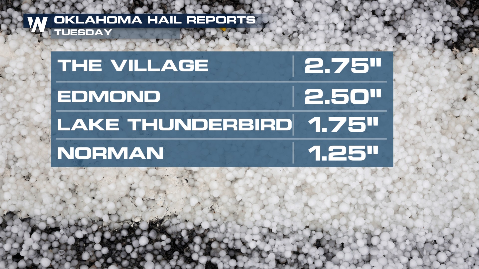
An elongated front has been the cause of severe chances over the past few days. Storms on Tuesday afternoon packed quite a punch, leading to sporadic wind damage reports in the Mid-Atlantic states. But probably the most impressive storms rumbled through the north side of Oklahoma City Tuesday evening, dropping baseball-sized hail!

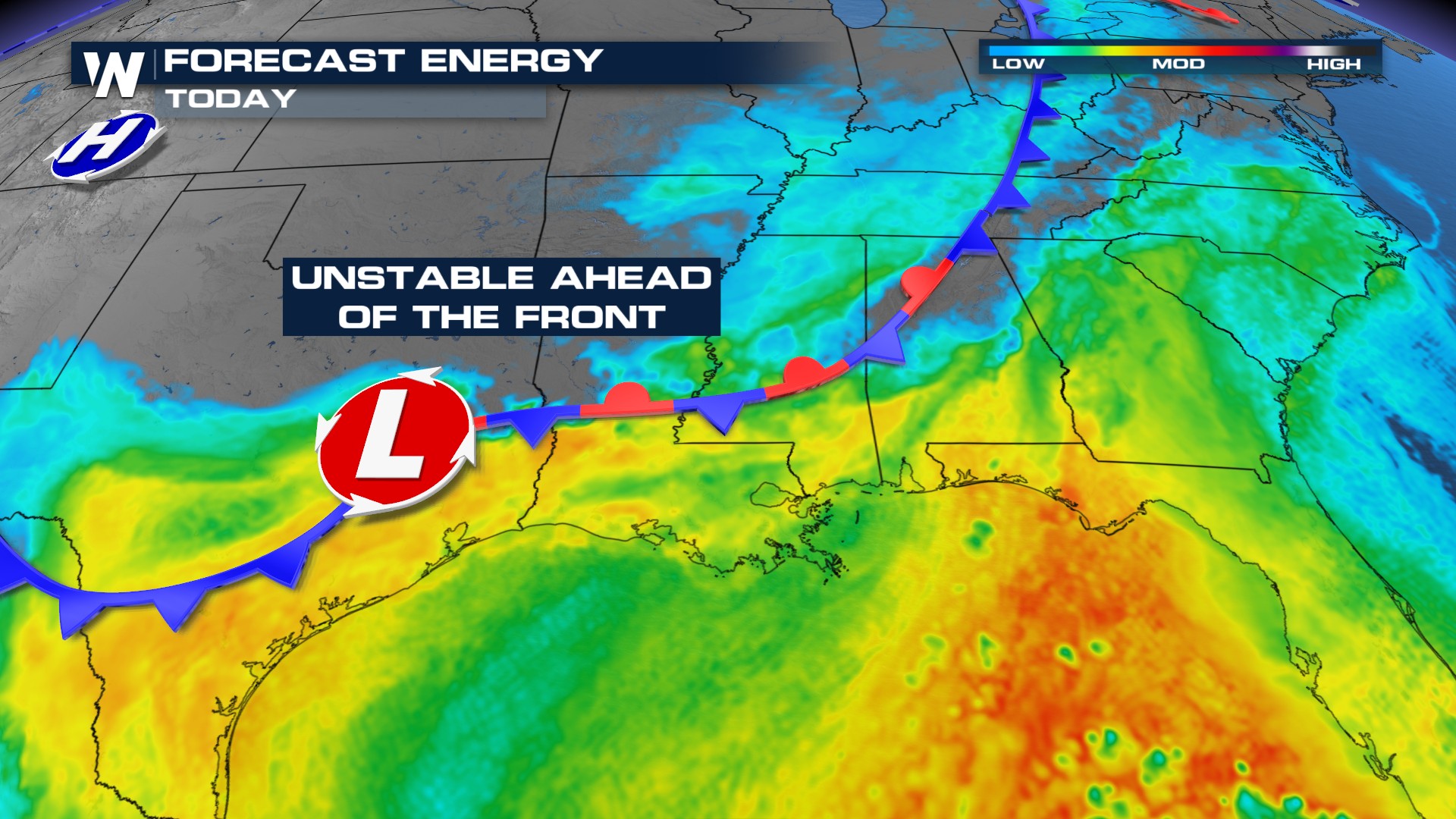
The same front is slowing down Wednesday, but will run into just enough moisture and instability to produce some more problematic storms.

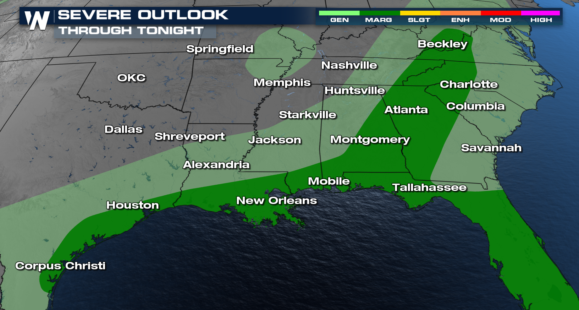
The Storm Prediction Center is highlighting areas from Corpus Christi to Charlotte that could see damaging winds out of storms this afternoon.
As moisture surges north from Helene, the flooding threat will start to sky-rocket in parts of the southeast. Please use good judgements and remember TURN AROUND AND DON'T DROWN!
Related articles:
LATEST ON HELENE