Severe Storms Possible in the Upper Midwest
Special Stories
10 Mar 2021 10:15 AM
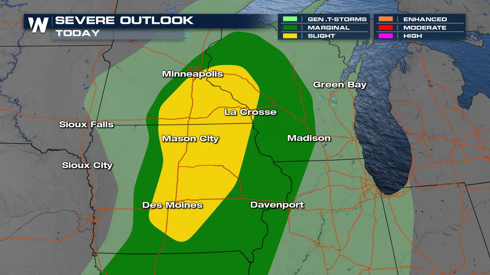
A strong storm system moving into the Upper Midwest may produce a few severe thunderstorms this afternoon and evening. There is a slight risk (level 2 on a scale of 1 to 5) from western Wisconsin to northeastern Iowa. A marginal risk extends down the Mississippi River into Iowa and Missouri.
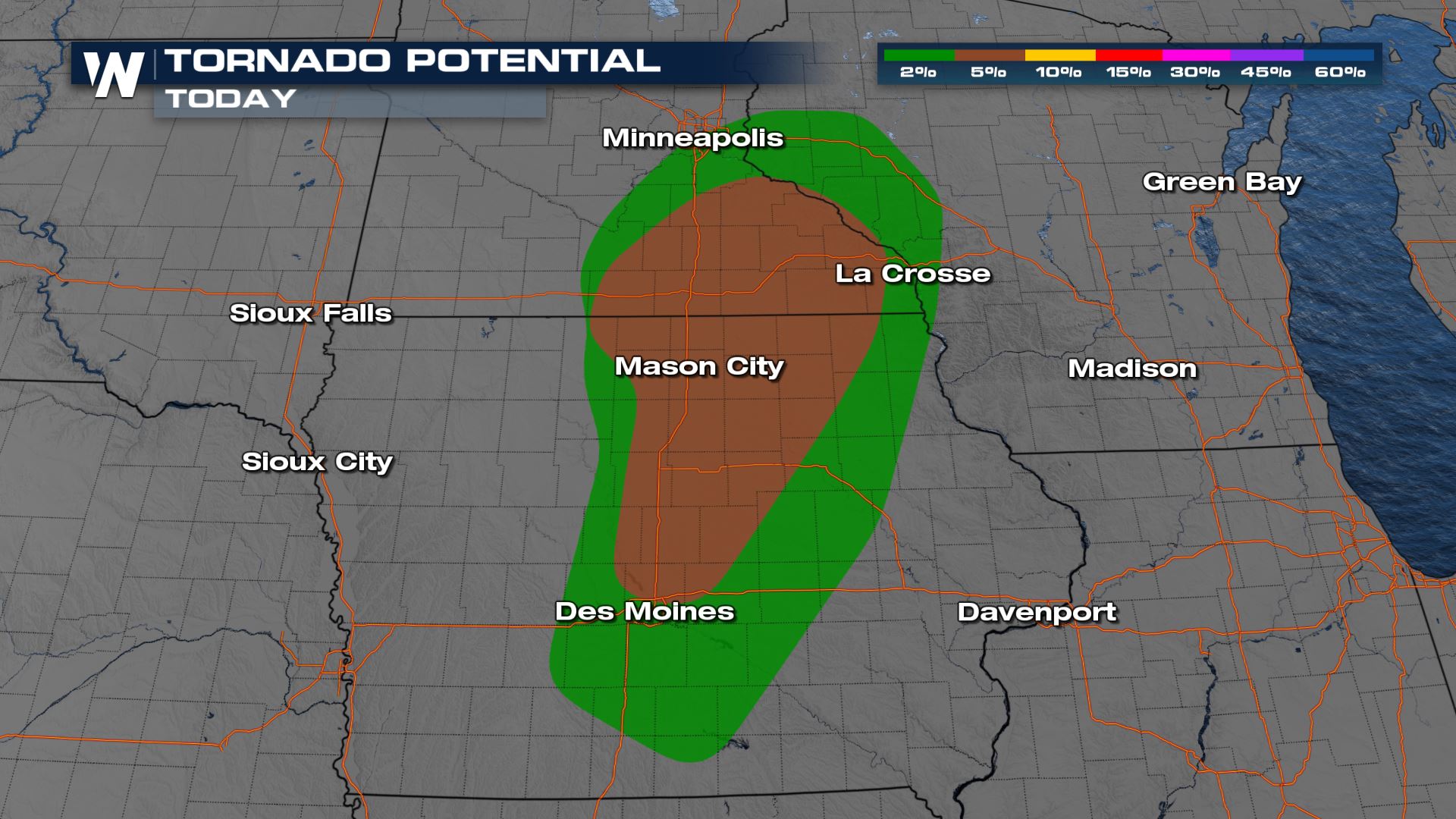
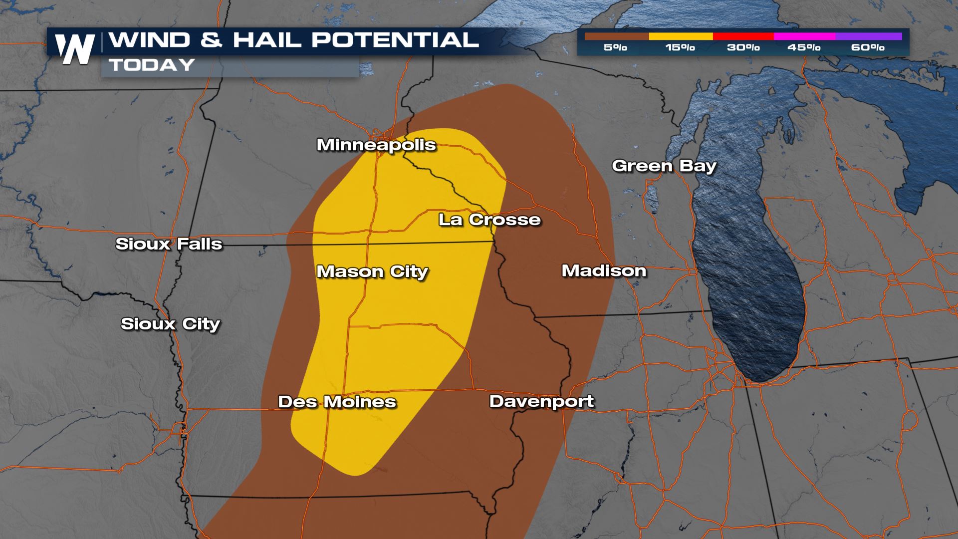 Tornadoes, large hail and damaging wind gusts are possible. The window for severe development is narrow, near peak instability in the later afternoon and early evening. As the low moves from eastern Minnesota into northern Wisconsin, a cold front will move eastward. Areas along the front have the potential to see severe storms.
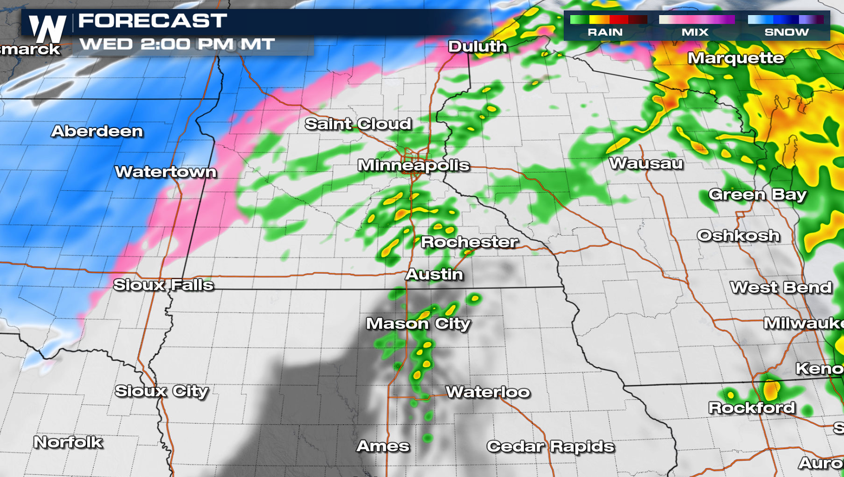
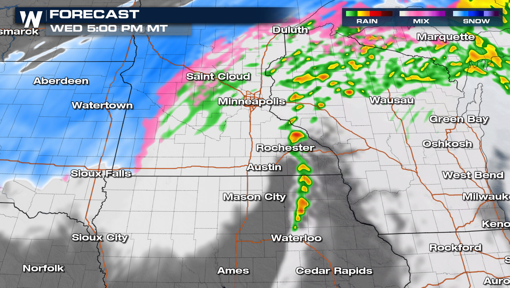
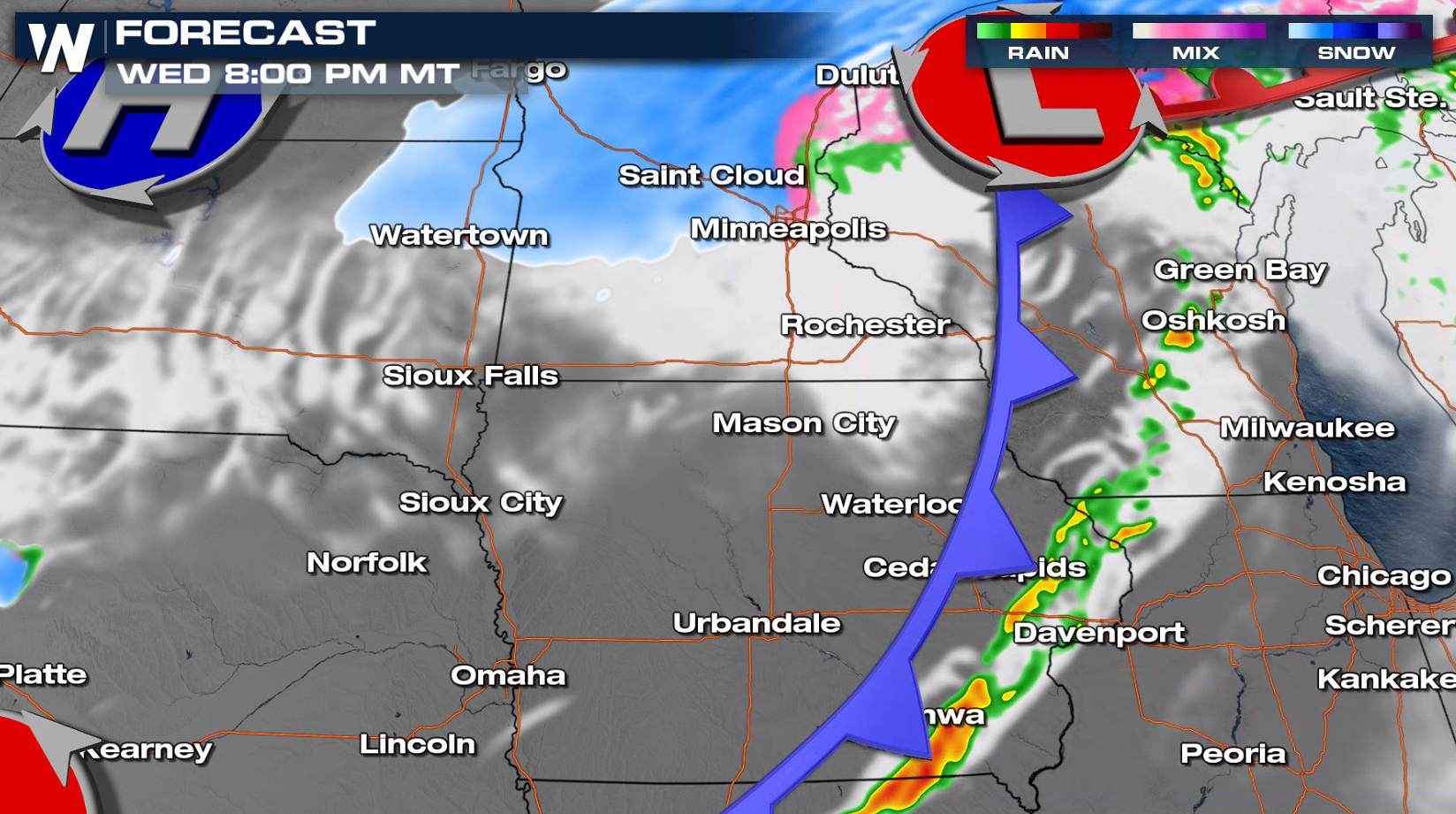 In the much colder air northwest of the low, heavy snow is possible. Stay tuned to WeatherNation on-air and online for the latest updates.
Tornadoes, large hail and damaging wind gusts are possible. The window for severe development is narrow, near peak instability in the later afternoon and early evening. As the low moves from eastern Minnesota into northern Wisconsin, a cold front will move eastward. Areas along the front have the potential to see severe storms.
In the much colder air northwest of the low, heavy snow is possible. Stay tuned to WeatherNation on-air and online for the latest updates.All Weather News
More
Severe Storms Target the Midwest This Weekend
Extreme heat will be a big story this week ac
26 Jul 2026 2:15 AM

Heat Wave Grips Central, Western U.S.
Are you over the summer heat yet? The heat al
26 Jul 2026 2:05 AM

Tropics: Fausto Heads to Hawaii; Genevieve Will Become a Major Hurricane
Atlantic BasinBertha has dissipated after mov
26 Jul 2026 2:00 AM


Southeast Flood Risk Lingers Near Stalled Front
A stalled boundary over the Southeast will ke
25 Jul 2026 10:55 AM

Another Round of Storms Targets the Northeast
Tuesday brought severe weather again across p
23 Jul 2026 1:15 AM

Another Round of Severe Weather for the Upper Midwest and Great Lakes
The upper-level low train continues to keep t
21 Jul 2026 1:45 AM