Severe Storms Push East Easter Sunday

Top Stories
5 Apr 2026 10:55 PM
Several rounds of severe storms have tracked across the Central and Eastern half of the country over the past few days. On Friday, storms in the Central Plains were strong enough to produce hailstones bigger than golf balls! Crews are out to survey damage around Ohio as storms continued to press east on Saturday. The front is exiting the Atlantic coastline tonight. A marginal threat for a few strong storms with damaging winds remains in place.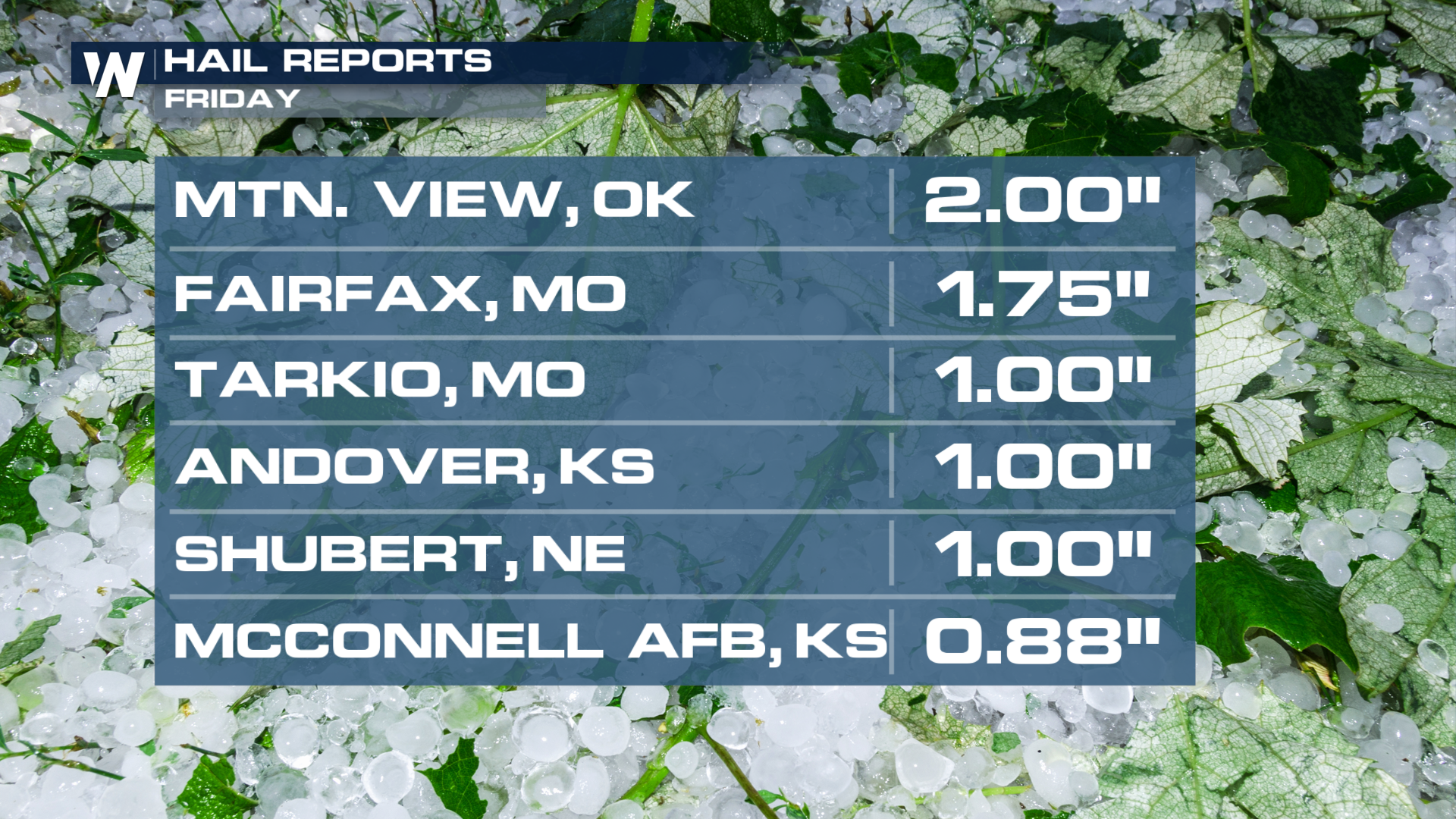 By late Sunday night, many areas will have cleared from the showers and the storms.
All Weather News
More

Severe Storms, Flash Flooding Overnight In Midwest
WHAT TO EXPECTIt was a very active day across
22 Jun 2026 1:50 AM


Summer Solstice Kicks Off Father's Day Sunday
Fathers across the country will have to share
21 Jun 2026 5:20 PM

Flood Risk Continues This Weekend for the Gulf Coast States
Numerous flash flood warnings were issued as
21 Jun 2026 1:15 PM

Dry T-Storms & Fire Danger in the West
A weak low-pressure system moving through the
20 Jun 2026 1:40 PM

Tornadoes Tear Through The Midwest, Isolated Severe Storms in the South
EARLIER THIS WEEKMONTROSE, IL - A dangerous t
20 Jun 2026 1:30 AM