Severe Storms Target the Front Range & Great Plains

Severe storms will continue to fire up off the Rocky Mountains, pushing east into the western Plains for the next few days. Large hail and damaging wind are the primary threats.
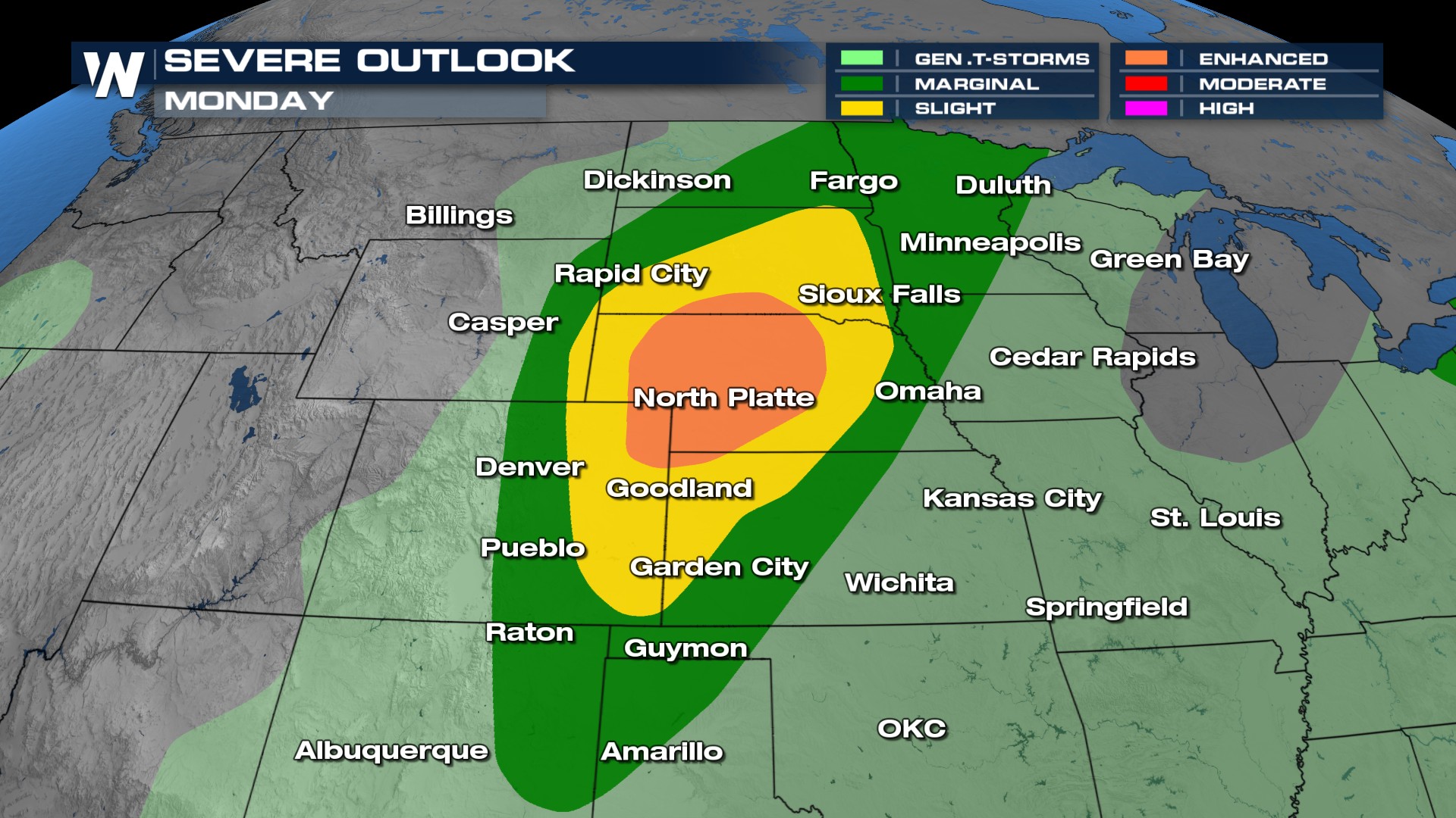
Outlooks
Outlooks overnight Sunday into Monday include a slight and an enhanced risk, with wind and hail as the primary hazards each day. Isolated tornadoes are possible, but significant wind and hail potential have been outlined.

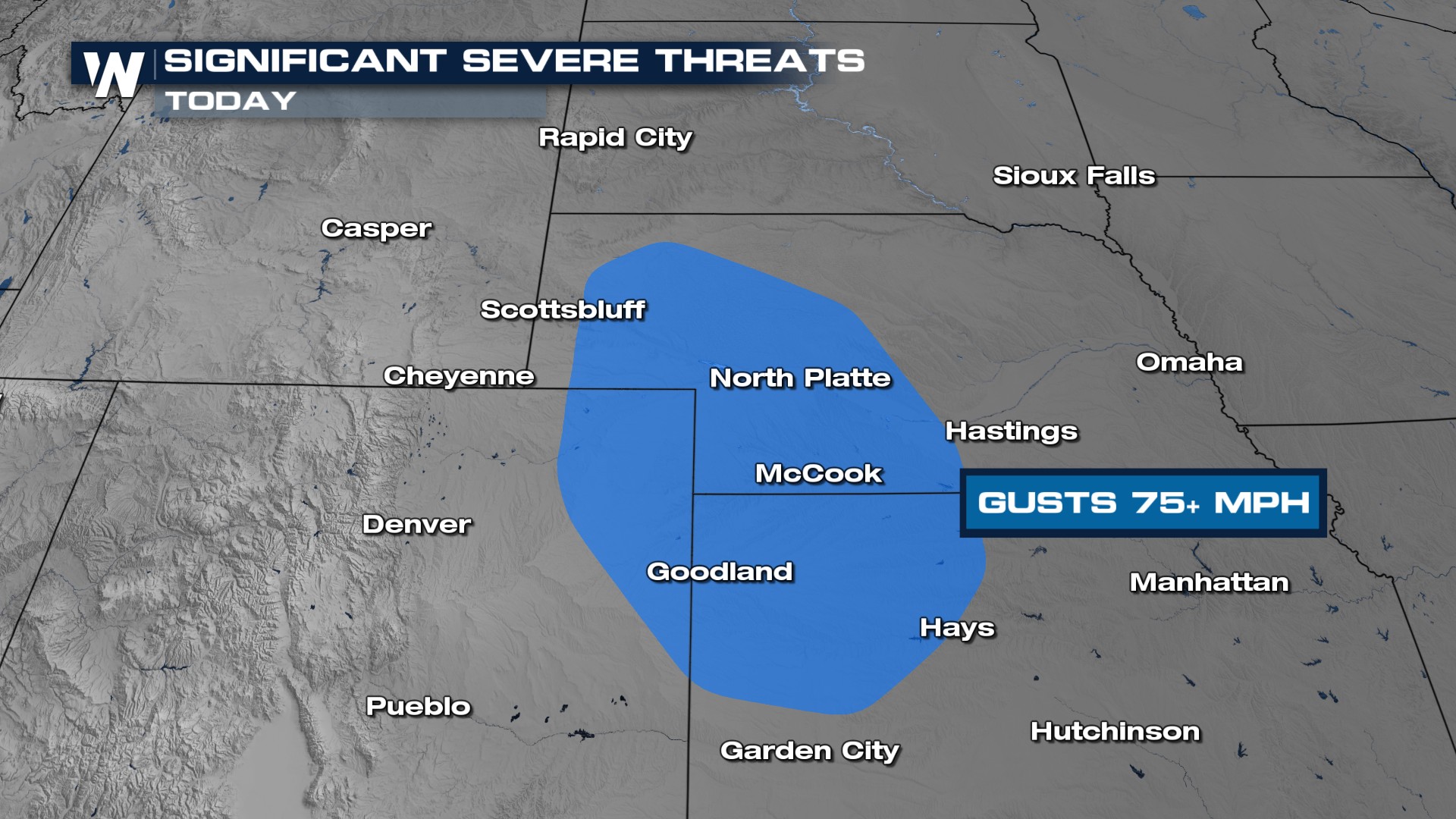
Significant wind gusts (75mph+) are possible in the blue shaded area through Sunday night.
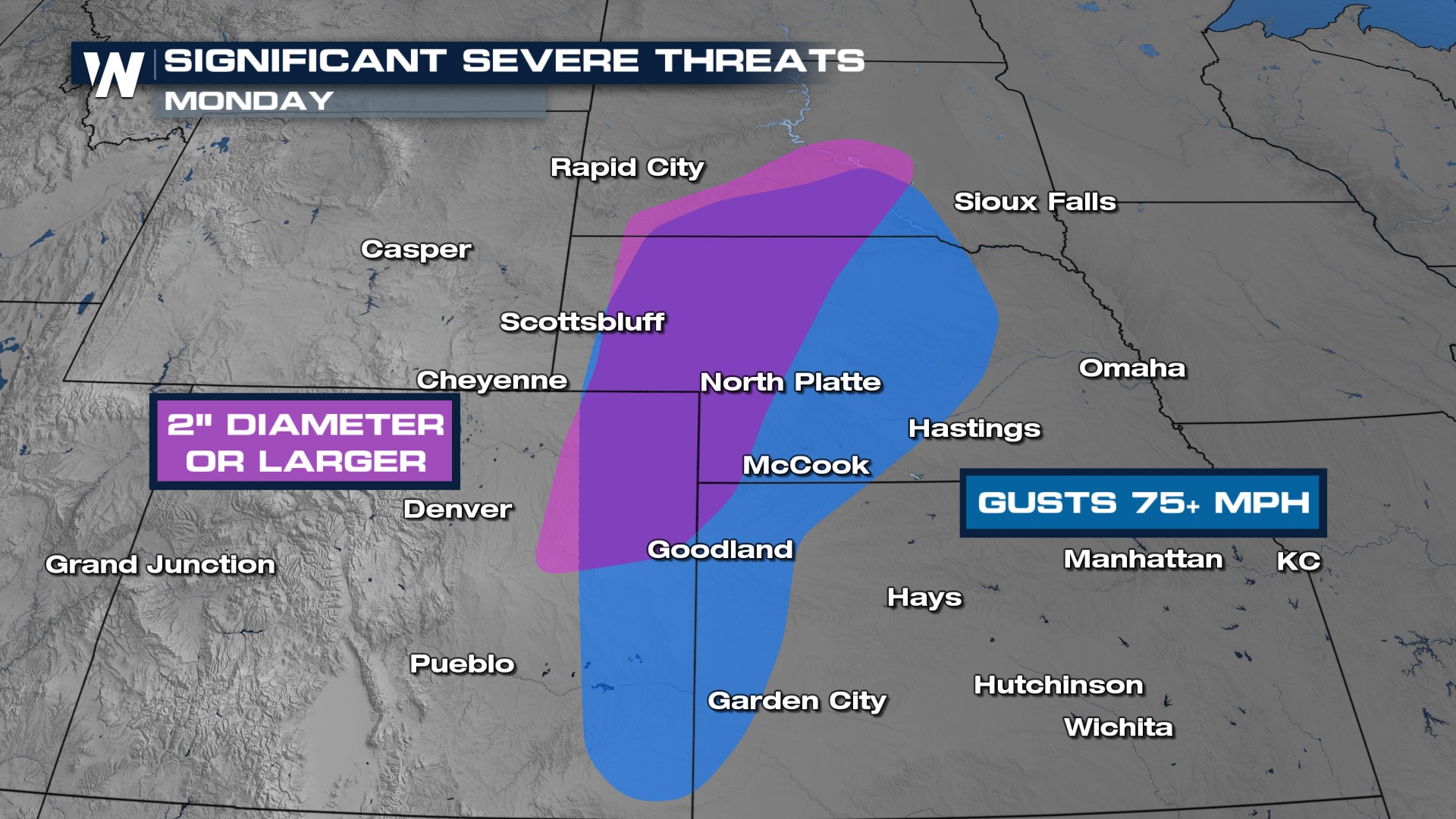
 The risk level increases on Monday in Western Nebraska as the significant wind and hail threats shift slightly.
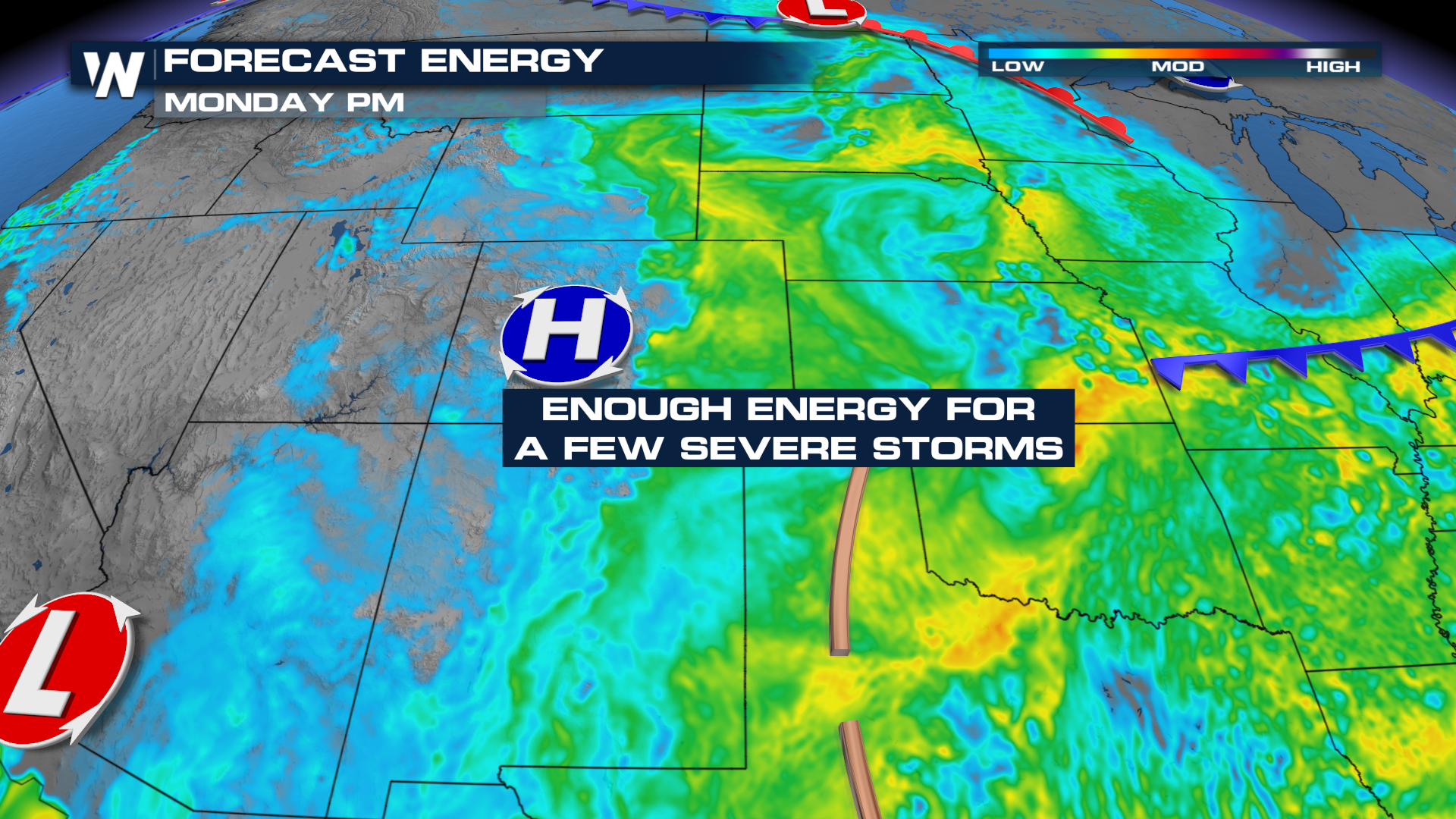
Forecast
Storms will fire up in the early afternoons before pushing east into the Plains. The Great Plains will likely see storms persist overnight, possibly congealing into big thunderstorm complexes known as an MCS. Have ways to get severe weather warnings overnight in case severe weather persists after dark.


