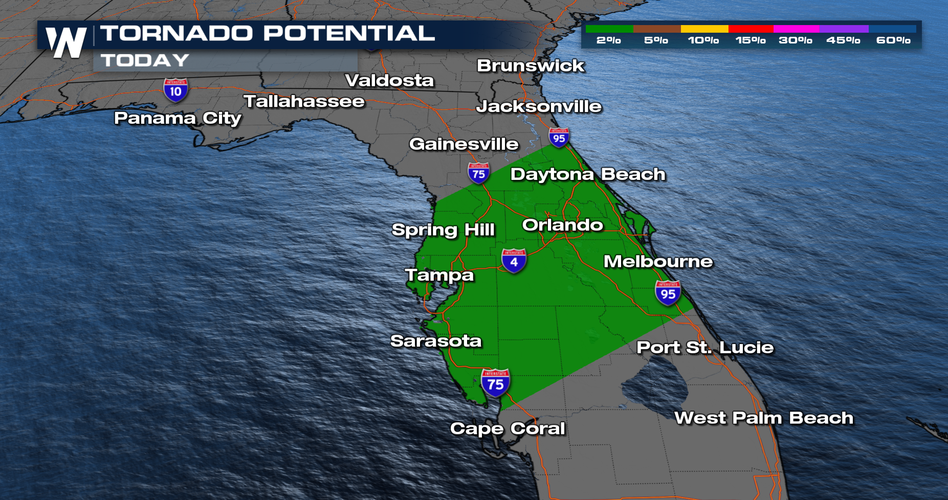
Isolated Severe Potential for Central Florida

A strong cold front will bring heavy showers and strong storms to the Southeast this weekend, with a severe weather threat-focused in portions of Florida. Strong shear and limited instability will likely to lead to a few damaging wind gusts and a tornado or two, mainly Sunday morning into Sunday afternoon.

Forecast
A line of isolated storms along a cold front boundary drops into this morning and continues south into Central Florida around midday today. This line of showers will be our biggest severe weather risk with the skies drying out quickly after the front pushes past. A few showers will linger across southern Florida into Monday but the whole sunshine state will feel the temperature impacts behind this rain.
Rainfall & Flood Potential
Heavy rain is likely in northern Florida and south Georgia, with totals surpassing 2-5 inches for Saturday and Sunday totals. Rain is expected to clear in these areas by midday Sunday. 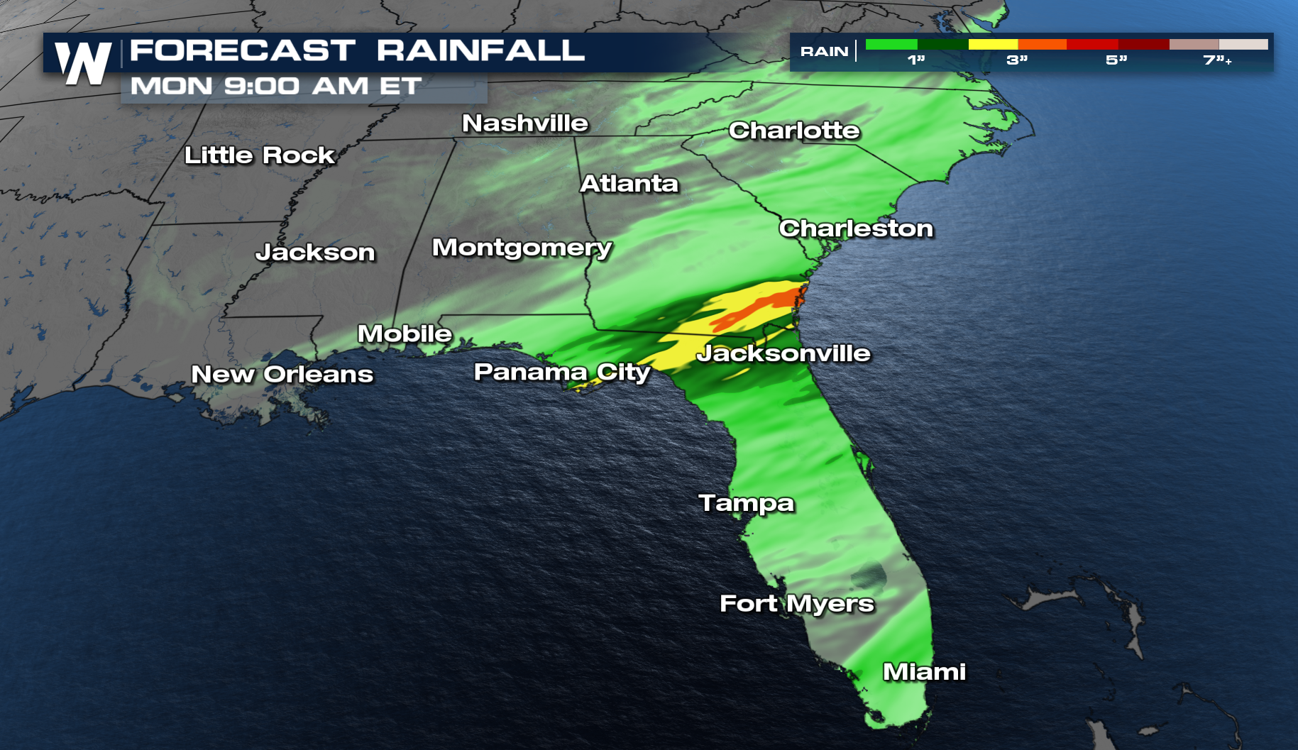
Temperatures will drop drastically behind this cold front. This cold air is impacting over 100 million across the country. Read more about the cold: Dangerous Wind Chills This Week
Updates for the Eastern Regional Forecast are on air at :10 past the hour, or get that forecast anytime with the WeatherNaiton app.


