Severe Threat Shifts to the Eastern Seaboard Today

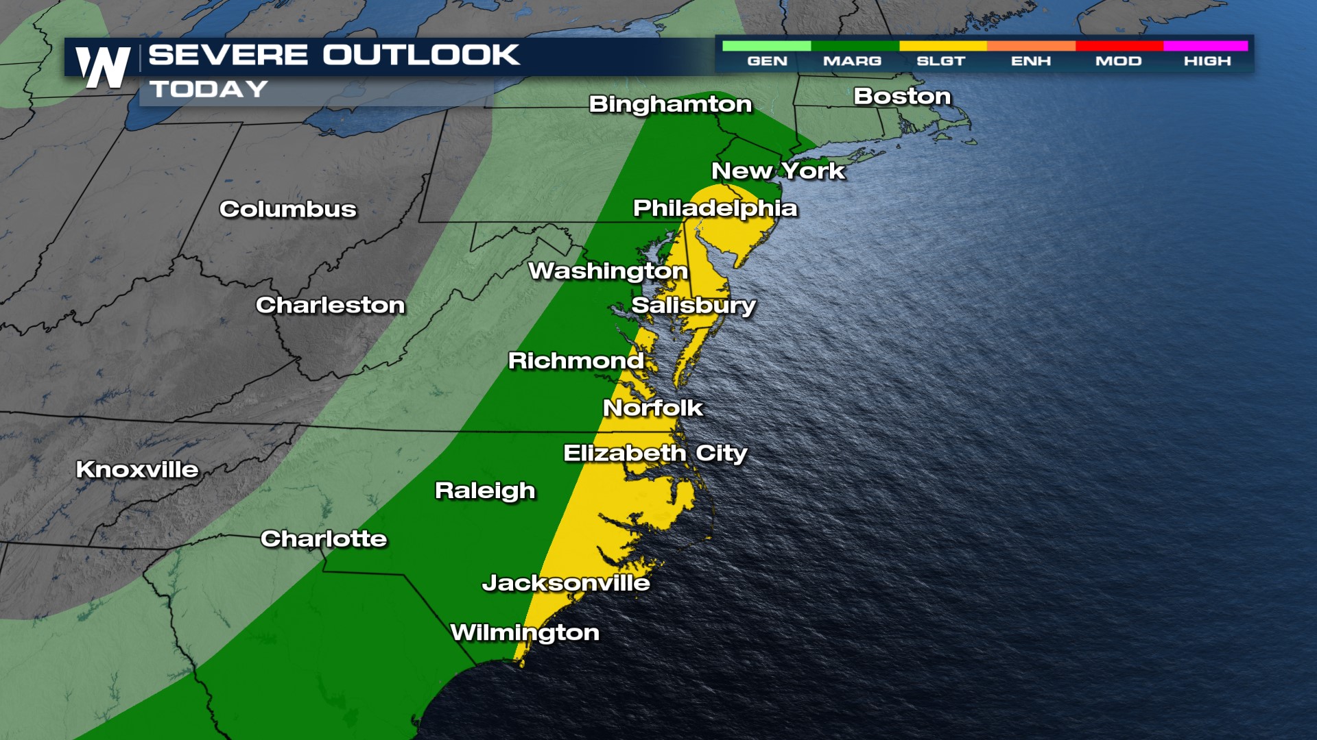
A frontal boundary swinging into the eastern U.S. will prompt the severe weather threat for much of the I-95 corridor including NYC, Philly, D.C. south into Raleigh. We will be concerned for damaging winds and an isolated tornado (above) for the immediate coastline through this afternoon and evening. Additionally heavy rainfall will be a threat for flooding, especially into New York.
 Showers and storms really blossom through the evening hours before the frontal boundary pushes offshore. Individual storms will have to be watched for the risk of rotation and tornadic activity, however, we may see embedded pockets of rotation as storms become more organized later tonight.
Heavy rainfall will be possible with any storm that develops, however, up to 3" of rainfall will be possible in central and southern New York along with PA, creating the risk of flooding here through the next few days.
 Stay with WeatherNation for the latest for the coast to coast severe weather threats. Your Eastern Regional Forecast is always :10 past the hour.


