Severe Threat Shifts to the Southeast for Wednesday and Thursday
Special Stories
29 Apr 2020 6:00 AM
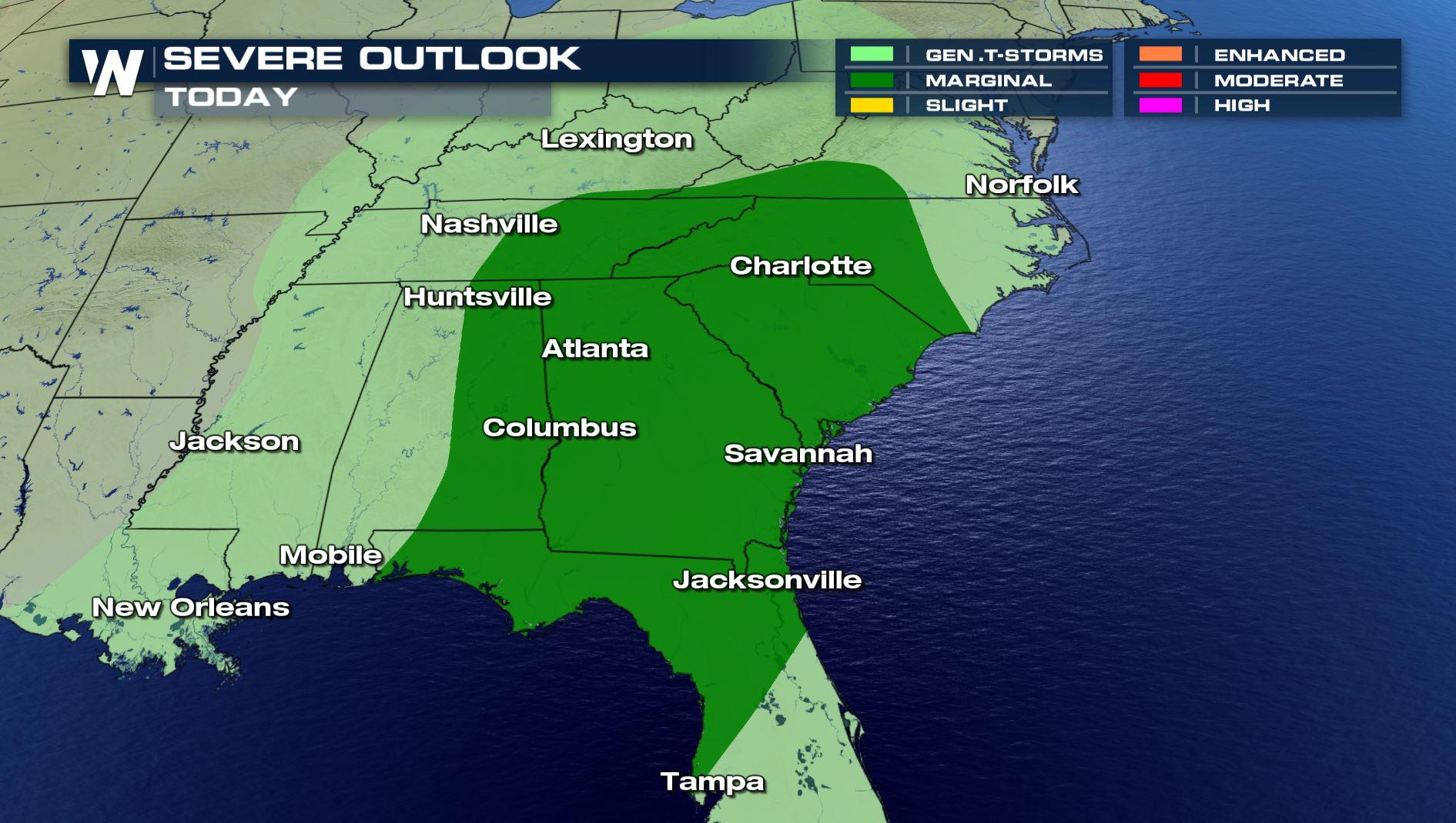
A storm system bringing severe storms to the Plains will move into the Southeast for Wednesday and Thursday, keeping the threat of severe weather in the forecast. The Wednesday marginal risk extends along the Gulf of Mexico coastline from Texas to Florida, and northward to extreme Southern Virginia.
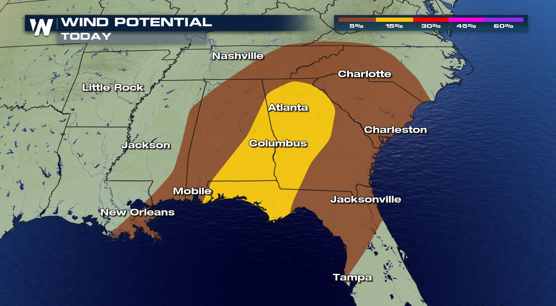
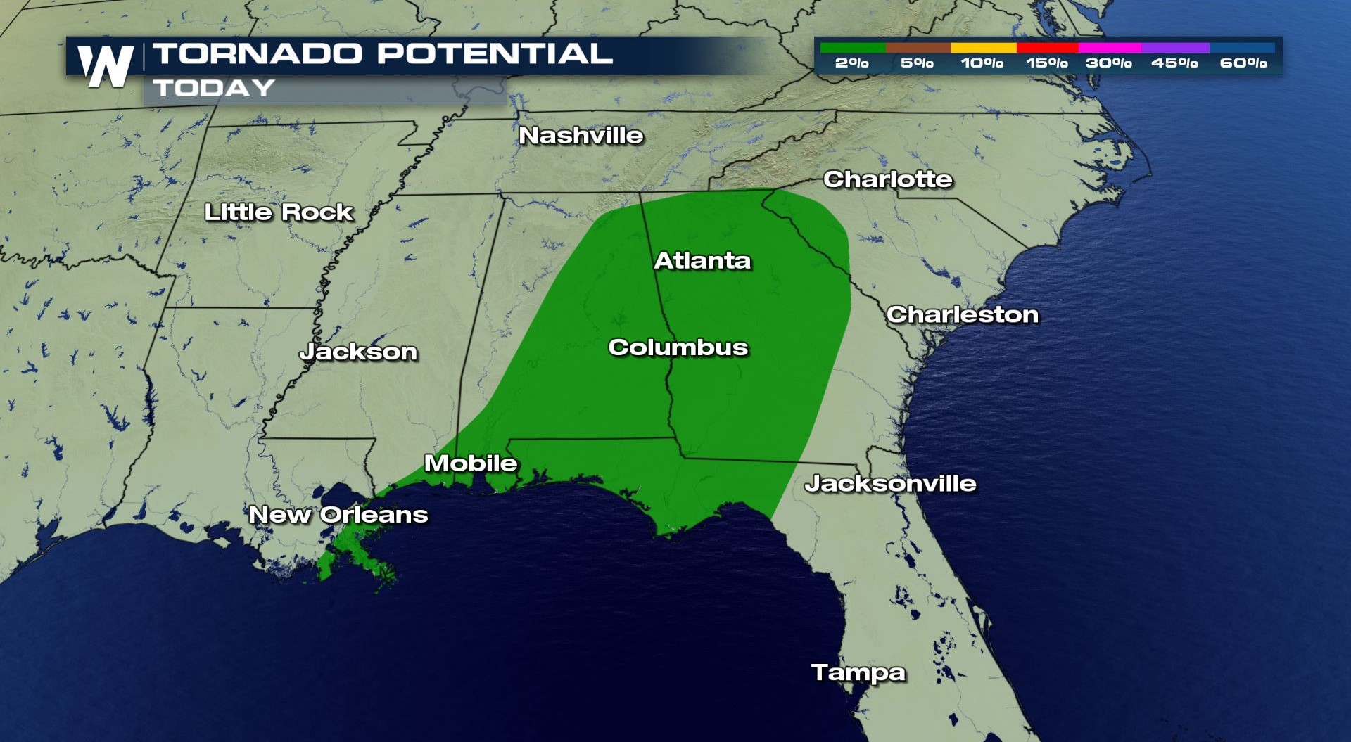
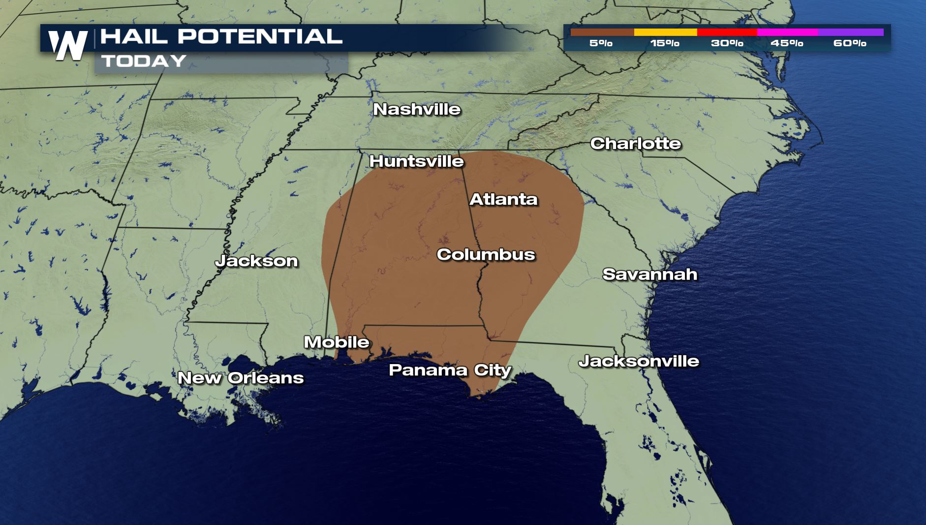 Large hail, greater than the size of a quarter, is the biggest concern for Wednesday. Isolated tornadoes and damaging wind gusts are also possible.
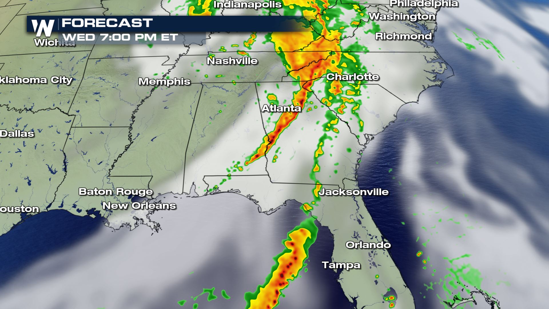
 Storms may be ongoing in the morning and midday along a trough of low pressure ahead of the cold front. In the afternoon and evening, this line of storms will likely increase in intensity and coverage, with a few severe storms likely. Additional development is possible along the cold front.
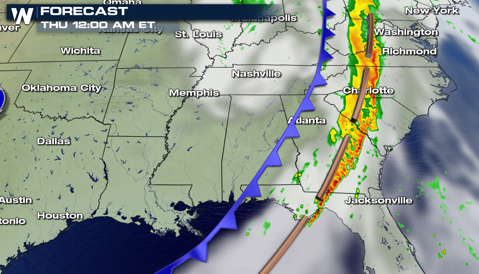
 The strongest jet stream energy is expected to move offshore by Thursday, however, the cold front will lingering across Florida and into North and South Carolina, keeping a marginal severe weather threat in the forecast.
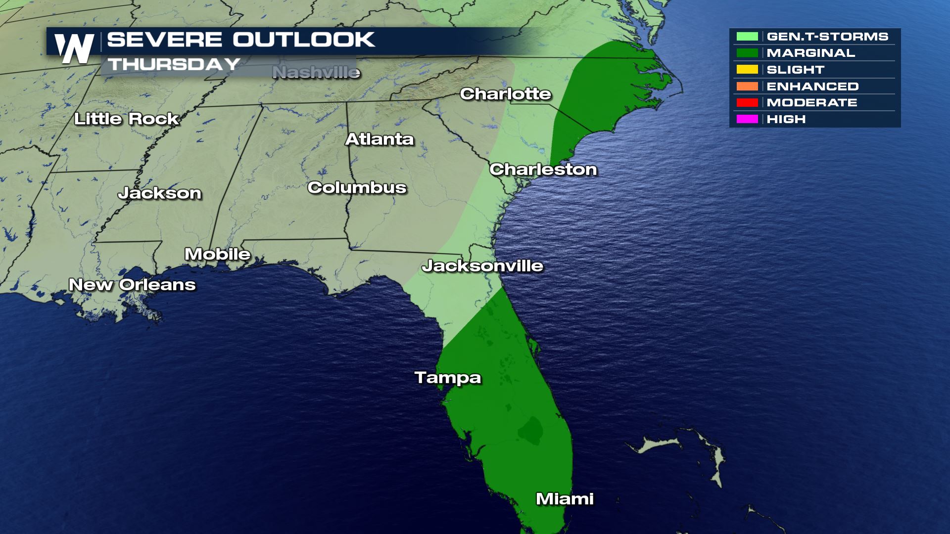
 The chance for strong or isolated severe storms will gradually push southeast across the Florida Peninsula Thursday morning through the mid-afternoon hours. Hail and wind damage will likely be the main threats, although isolated waterspouts or a brief tornado is possible.
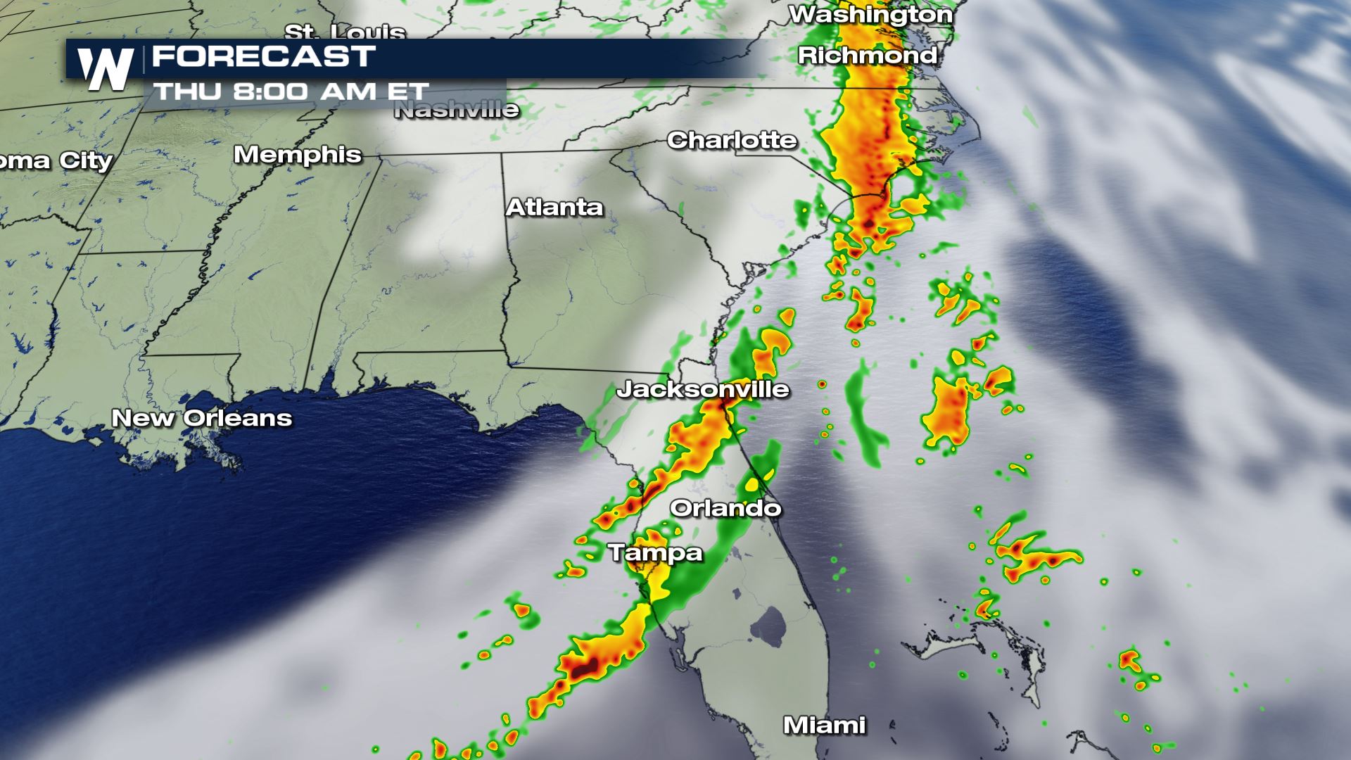
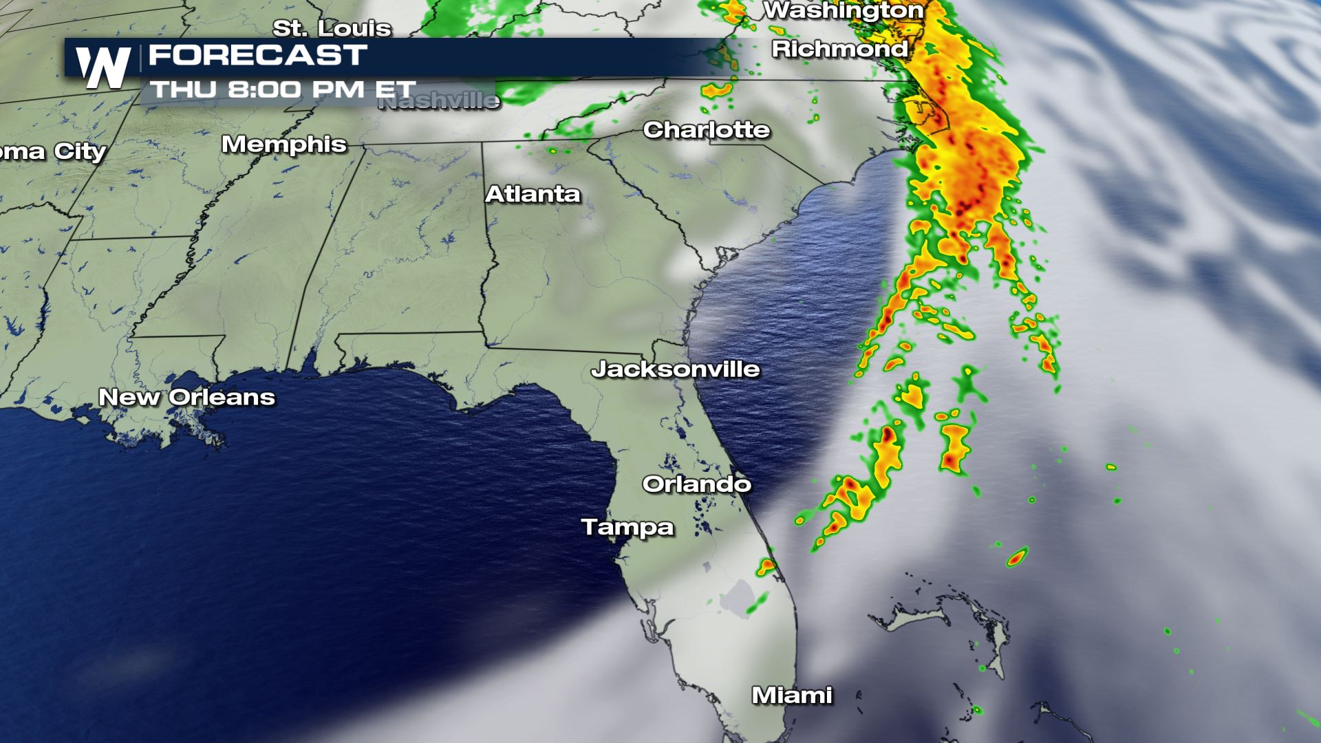 By Thursday evening, the threat for severe weather is expected to come to an end, however, some storms may continue to impact the Outer Banks until 8 or 9 pm Eastern.
Large hail, greater than the size of a quarter, is the biggest concern for Wednesday. Isolated tornadoes and damaging wind gusts are also possible.
Storms may be ongoing in the morning and midday along a trough of low pressure ahead of the cold front. In the afternoon and evening, this line of storms will likely increase in intensity and coverage, with a few severe storms likely. Additional development is possible along the cold front.
The strongest jet stream energy is expected to move offshore by Thursday, however, the cold front will lingering across Florida and into North and South Carolina, keeping a marginal severe weather threat in the forecast.
The chance for strong or isolated severe storms will gradually push southeast across the Florida Peninsula Thursday morning through the mid-afternoon hours. Hail and wind damage will likely be the main threats, although isolated waterspouts or a brief tornado is possible.
By Thursday evening, the threat for severe weather is expected to come to an end, however, some storms may continue to impact the Outer Banks until 8 or 9 pm Eastern.All Weather News
More
Severe Chances Return for the Midwest
The upcoming stretch of hot temperatures will
24 Jul 2026 8:10 PM

Southeast Flood Risk Lingers Near Stalled Front
A stalled boundary over the Carolinas will ke
24 Jul 2026 8:00 PM

Tropics: Fausto Heads to Hawaii, Bertha Breaks Apart
BerthaBertha has dissipated after moving inla
24 Jul 2026 11:50 AM

Hot & Smoky w/ a Chance of Lightning
Conditions have been really dry out west. We'
24 Jul 2026 11:15 AM

Very Hot Temperatures For the Western and Central United States
Are you over the summer heat yet? Well, more
24 Jul 2026 9:20 AM

Another Round of Storms Targets the Northeast
Tuesday brought severe weather again across p
23 Jul 2026 1:15 AM

Another Round of Severe Weather for the Upper Midwest and Great Lakes
The upper-level low train continues to keep t
21 Jul 2026 1:45 AM