Carolinas Storms Move North Monday

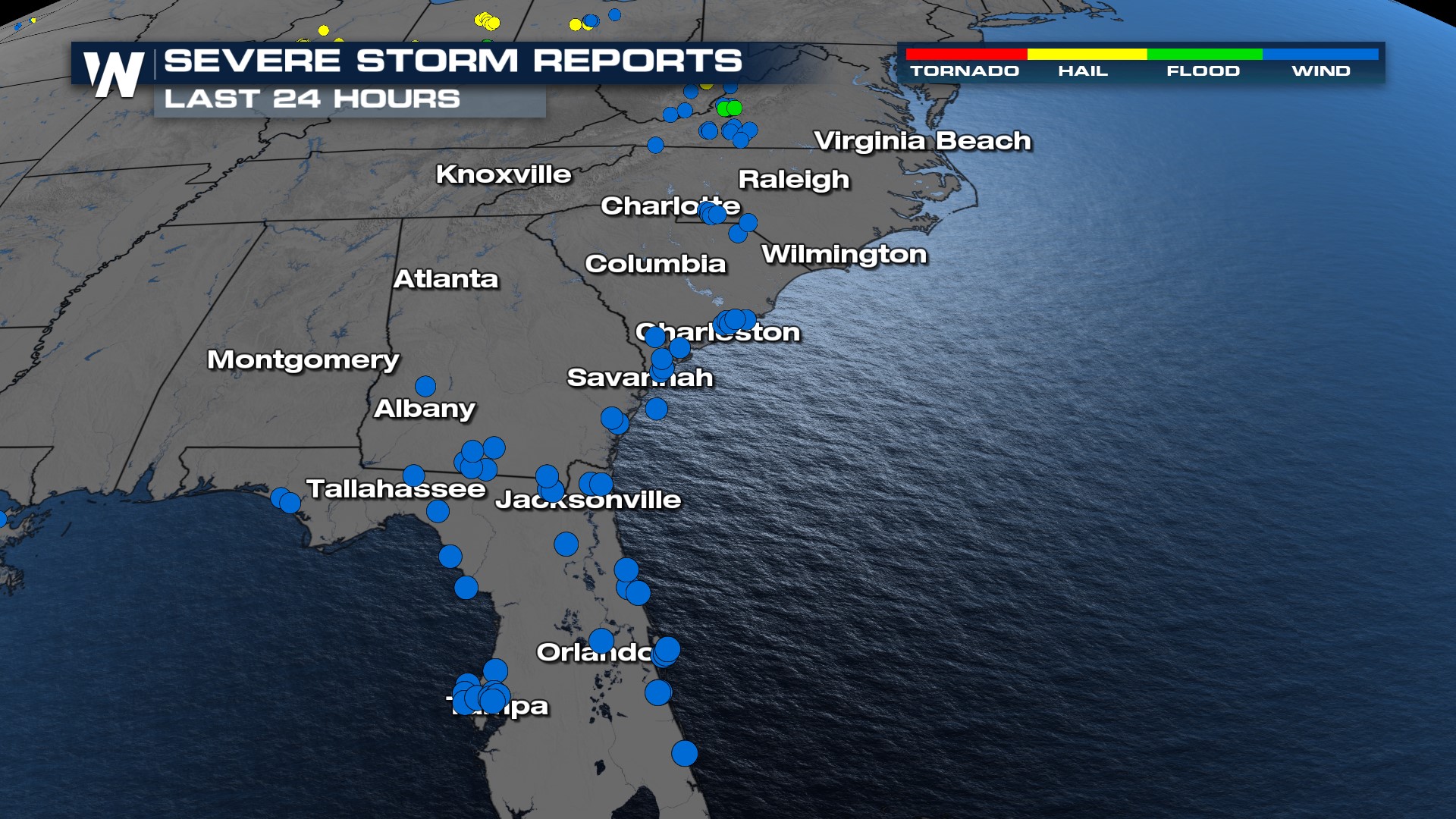
Over the past several days, there have been multiple days of torrential rain and severe storms each day in the Southeast. Damage reports vary from downed trees and power lines to roof and shingle damage and major flooding. The stormy pattern continues through Monday as a slow-moving front interacts with moisture and warm air near the surface.
Overnight
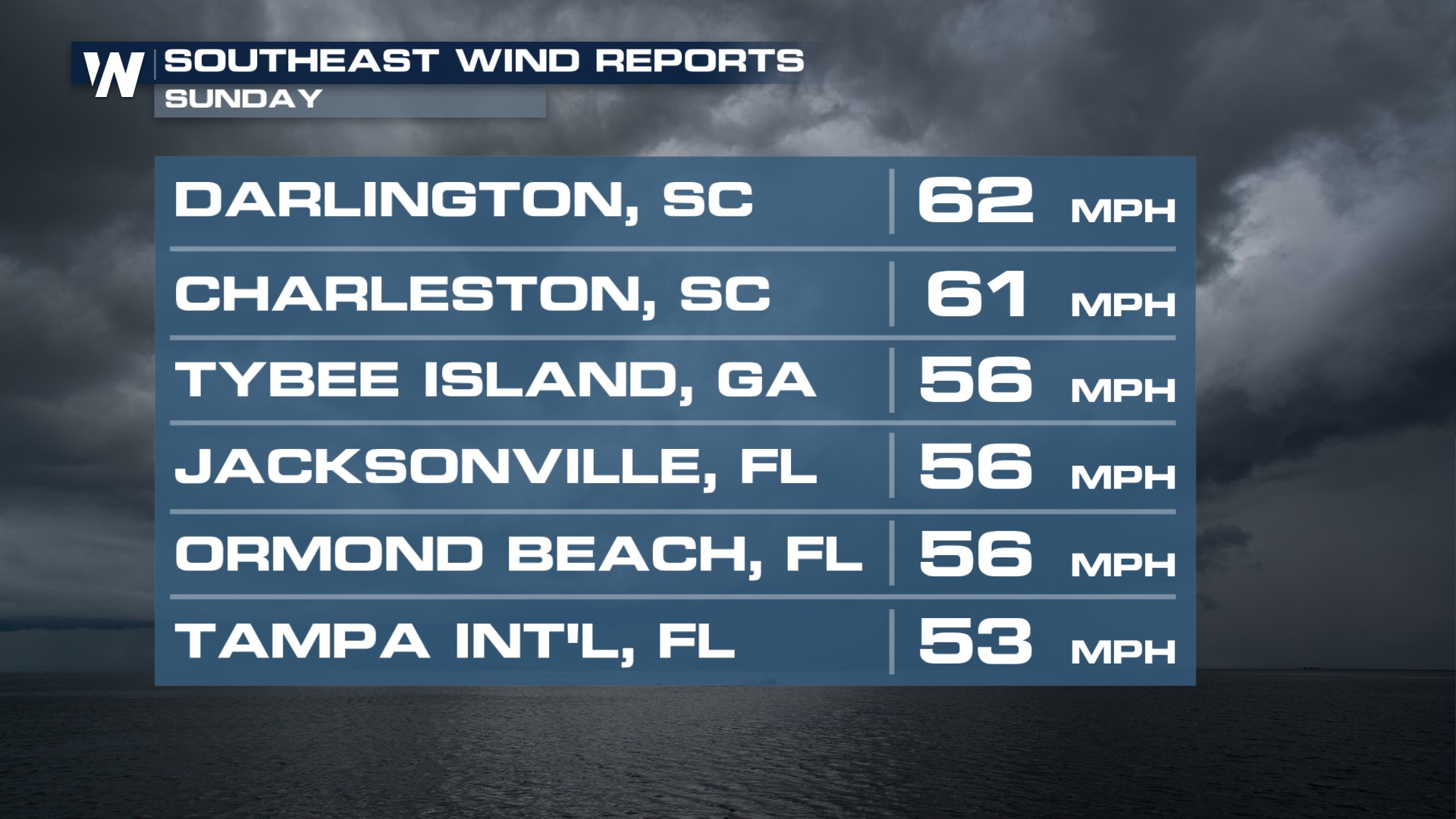
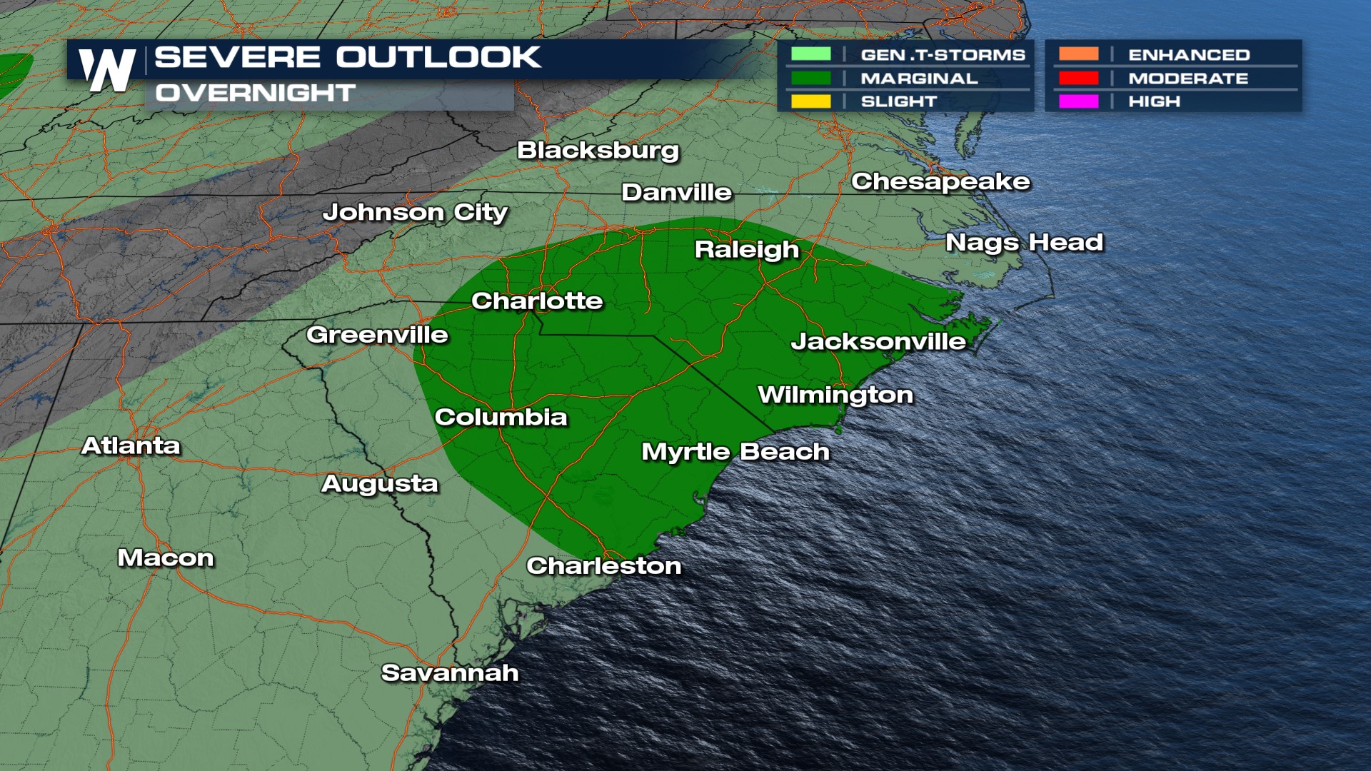
The severe threat continues for the Southeast coast as the front parallels the coast. All storms will have gusty winds and hail as hazards, along with lightning and flash flooding. Storms will be capable of damaging gusts near 60 mph. As we take a closer look at the Carolinas region, the SPC has a MARGINAL risk (level 1 out of 5) through tonight for severe weather.
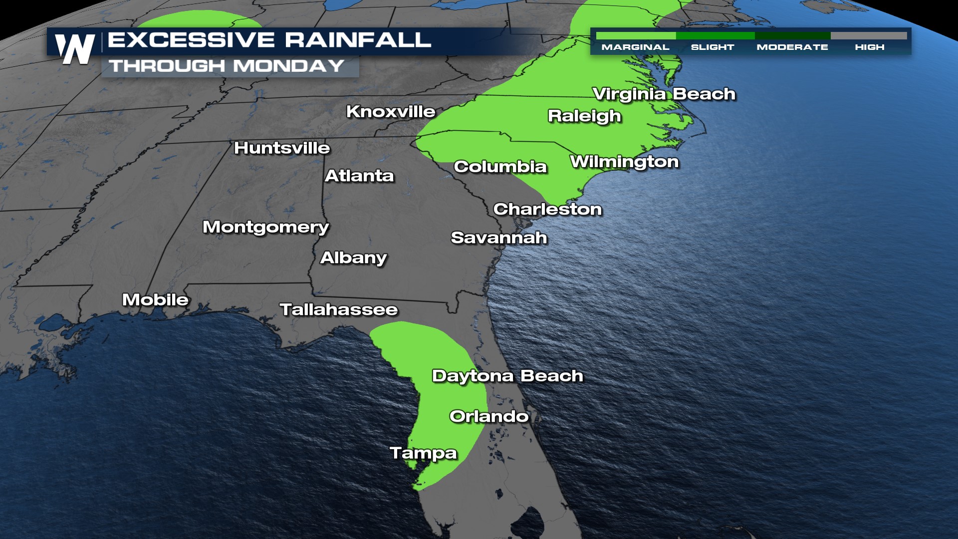
 Overnight storms will move through the Atlantic Coast, but as the incoming cold front moves in through Monday, additional storms will move into the Big Bend of Florida off the Gulf Coast and bring stormy conditions through Monday.
Pockets of 1-3" of rain are likely along and south of I-10 and along the coastal Carolinas, with flash flooding possible. This is especially for storms that develop along the frontal boundary where multiple rounds of storms could train over the same area. Please remember turn around, don't drown!

 Stay with WeatherNation for the latest in the severe weather forecast & flood potential, always streaming 24/7.


