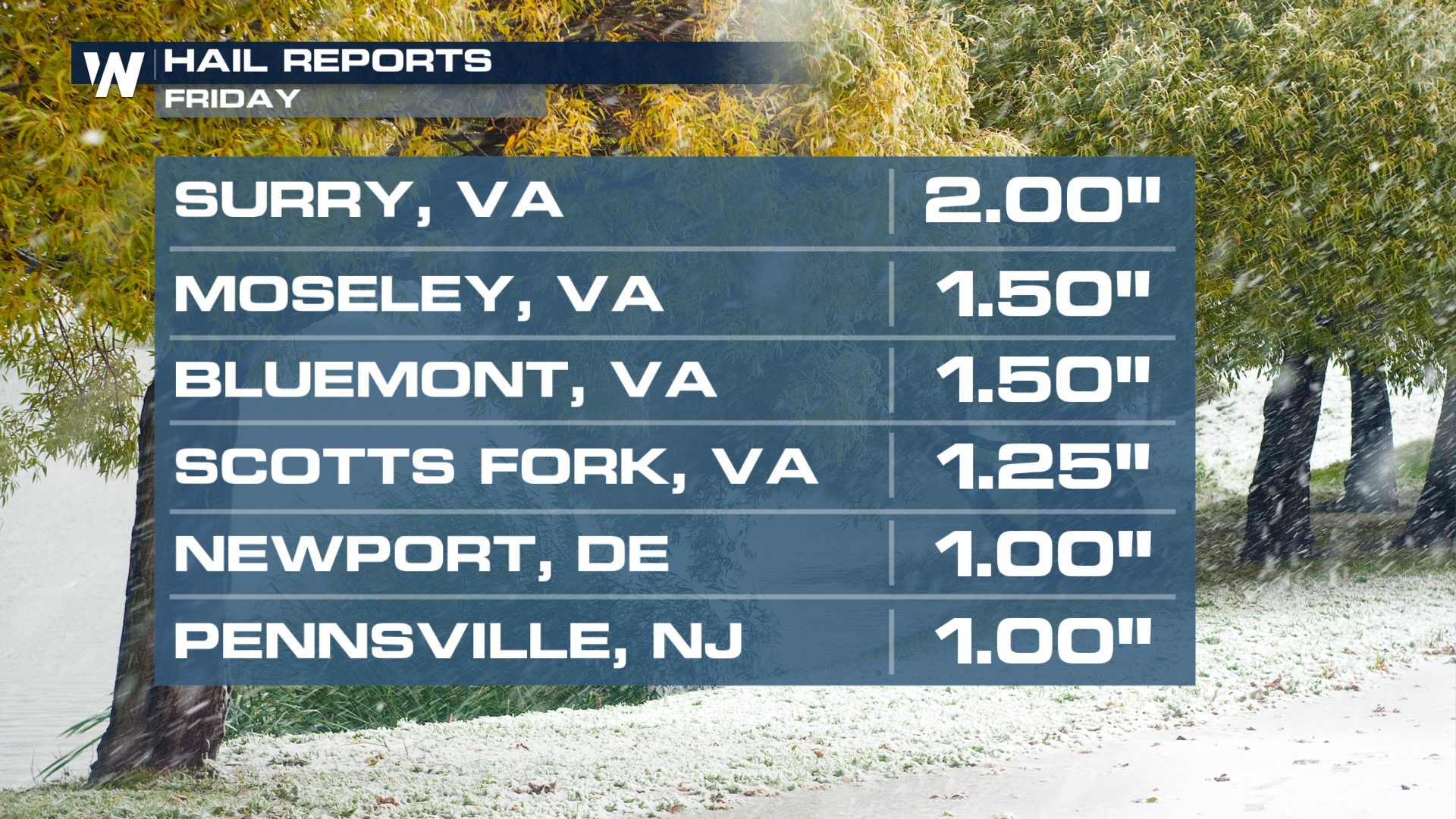
Mid-Atlantic at Risk for Strong Storms Today

Storms ripped through the Northeast today, prompting severe thunderstorm warnings and even a tornado warning in New Jersey. All severe modes were seen today across the Northeast including some decent sized hail! Virginia saw up to 2 inch hail, with is the size of a lime or a hen egg. As the low pressure system lifts north, we see an isolated severe threat for this evening.
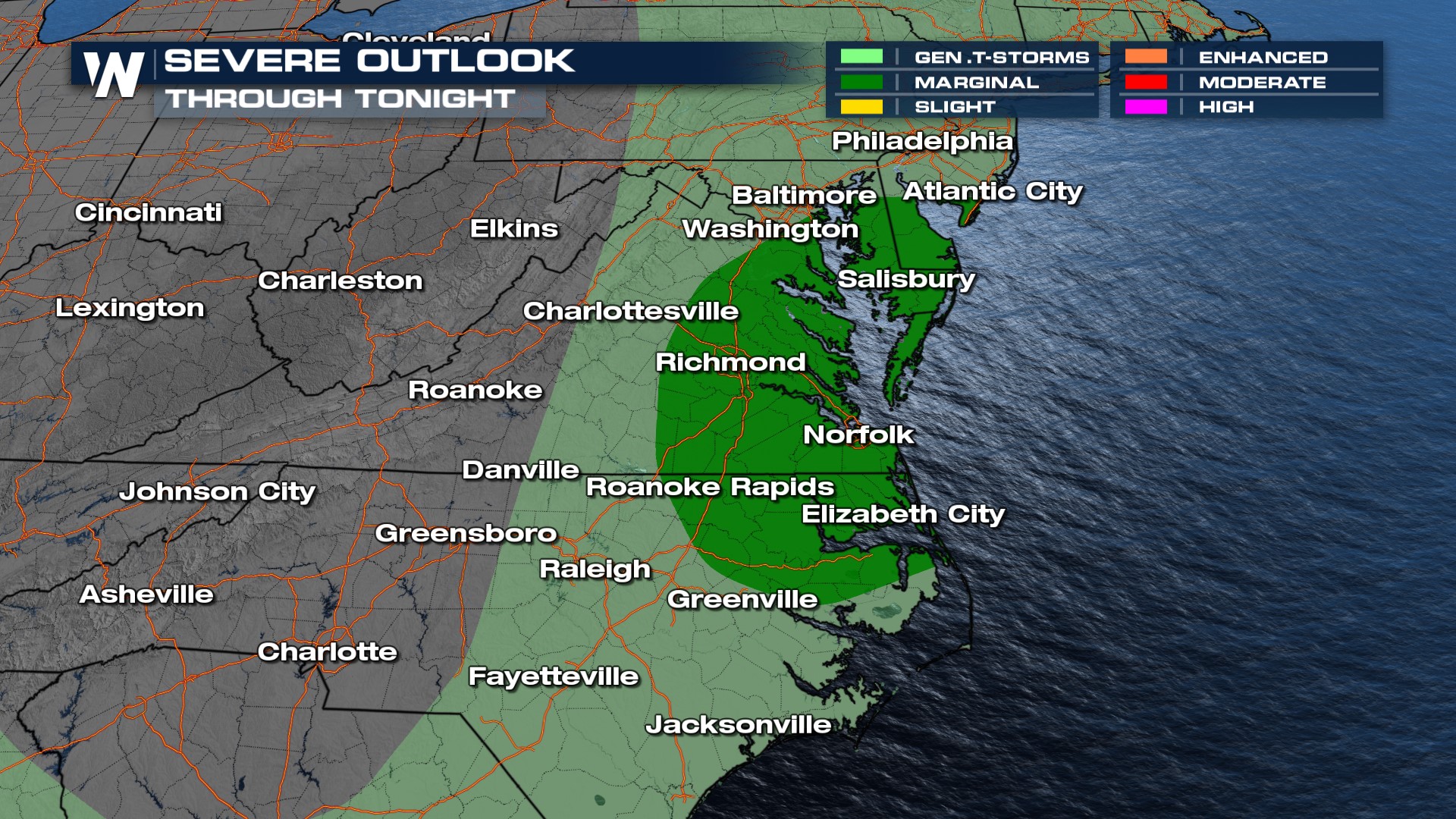
 The severe threat this evening runs from southern Maryland into eastern Virginia. Instability has decreased with loss of daytime heating, and the atmosphere being worked over early, but a marginally severe damaging gust or isolated hail will be possible.
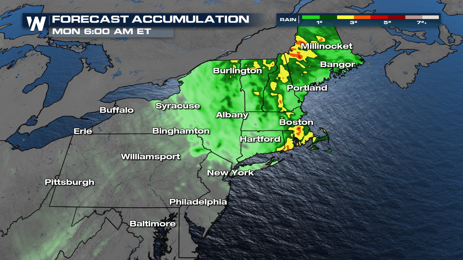
The low pressure system that brought the strong storms will continue to the northeast bringing rain and cooler temps as it heads north. Saturday will be a wet day for New Hampshire, Vermont and Maine, and a few showers will linger into Sunday morning. Isolated heavy rain of up to 3 o 4 inches will be possible with this system, through Monday.
Stay with WeatherNation for the latest in storm development, forecasts and alerts. We are streaming 24/7 and your Eastern Regional Forecast is always :10 past the hour.


