Severe Thunderstorm Threat in the Southern Plains
Special Stories
18 Mar 2020 10:30 AM
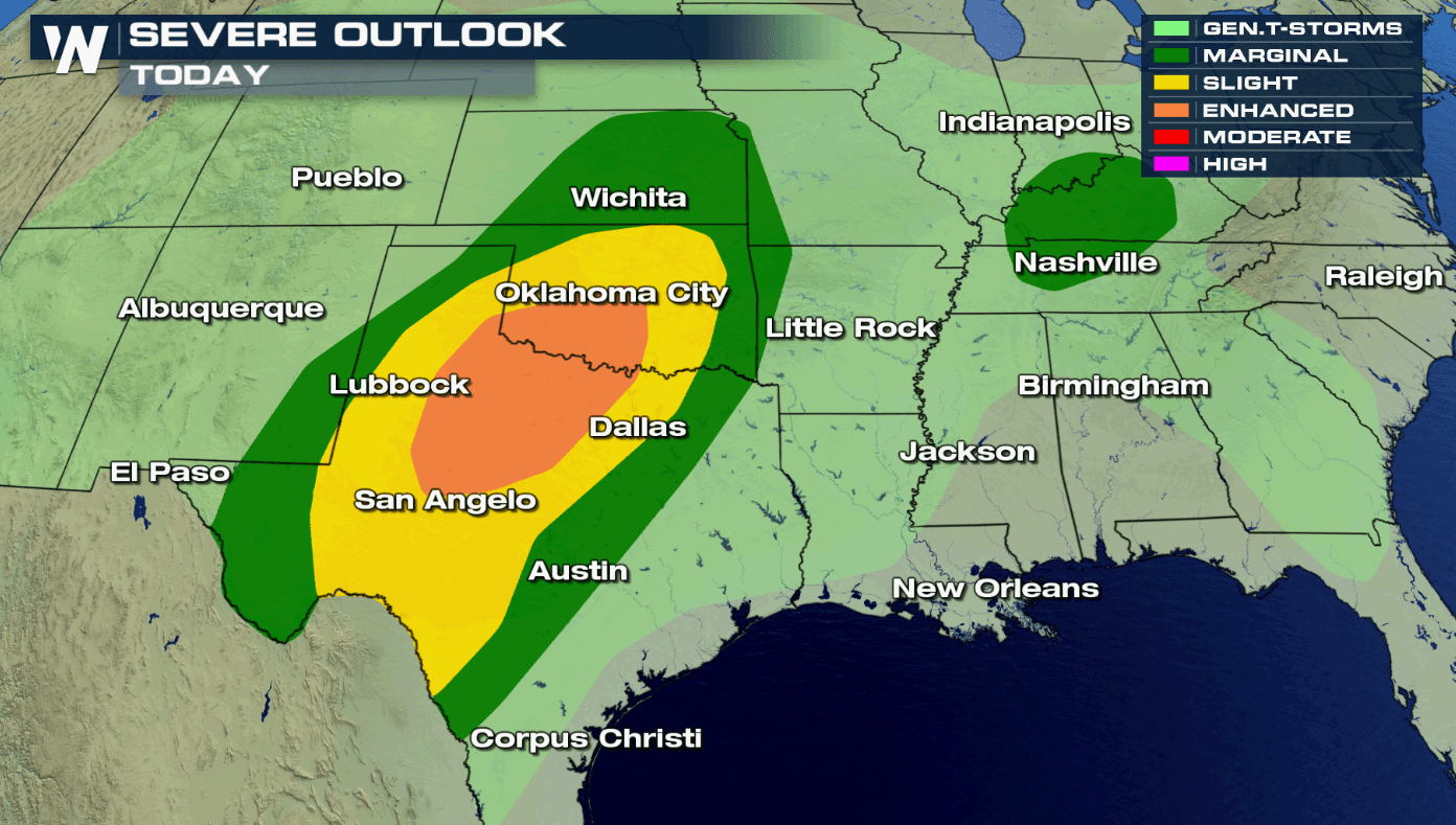
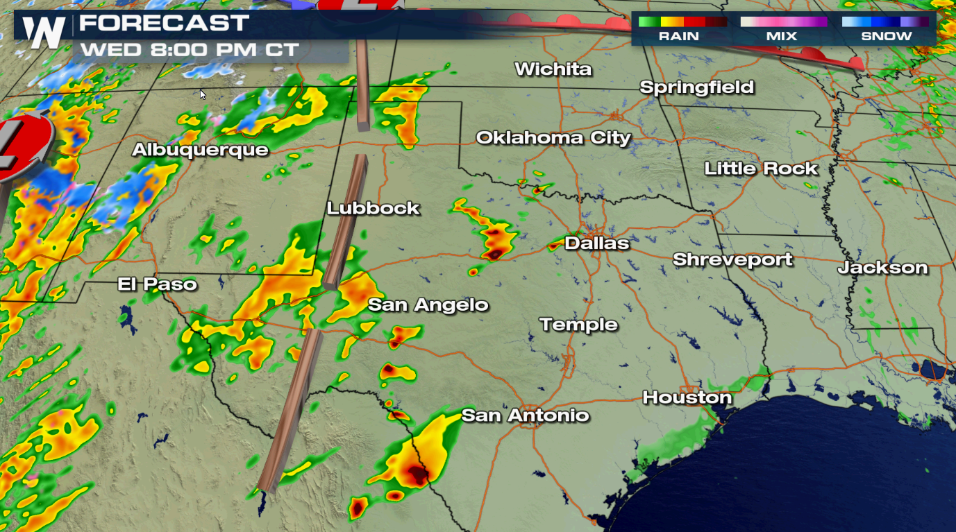
There is a risk for severe thunderstorms today (Wednesday) across most of the Southern Plains. The risk extends from near Kansas City to the Mexican border. An enhanced risk includes ares from Oklahoma City southward through the Red River to near San Angelo and Lubbock.
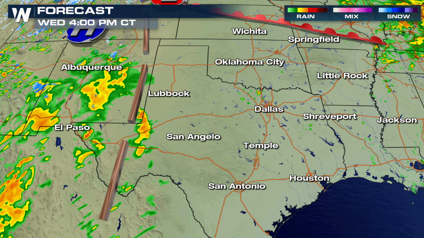
 A rich flow of high humidity from the Gulf of Mexico is pushing across the region, ahead of a dryline. With temperatures climbing throughout the day, instability will increase, aiding in severe thunderstorm development. Multiple episodes and areas of severe thunderstorms are possible into the night (Wednesday).
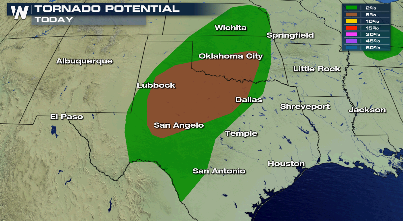
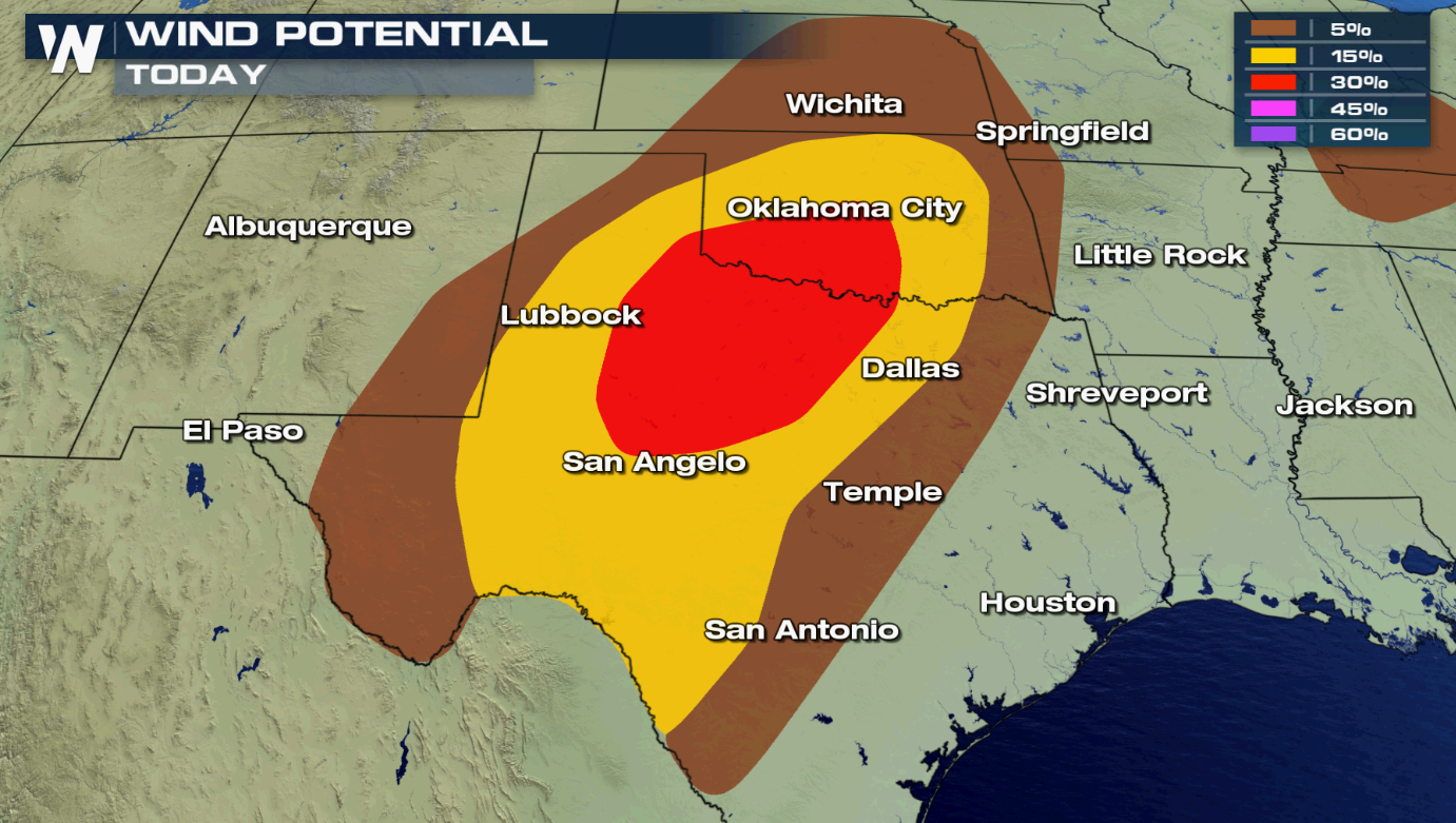
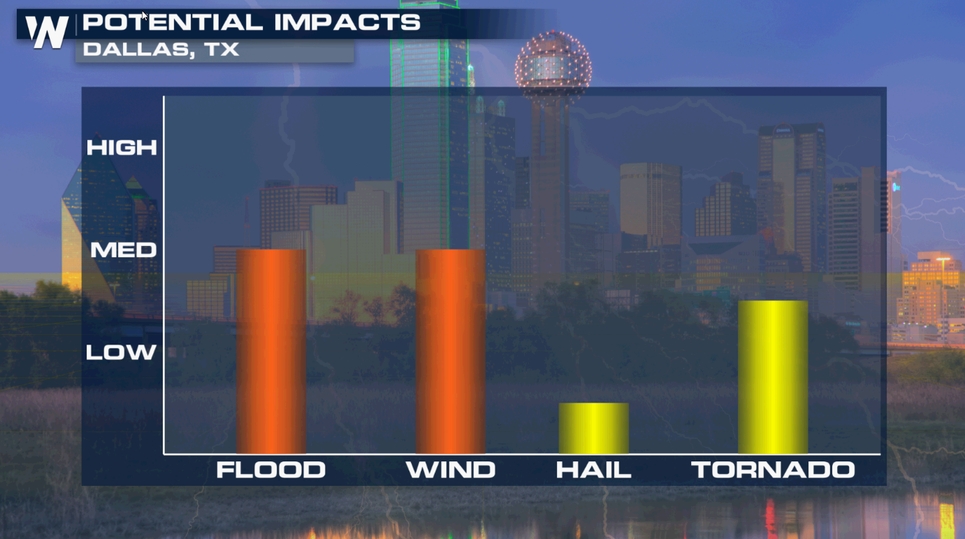
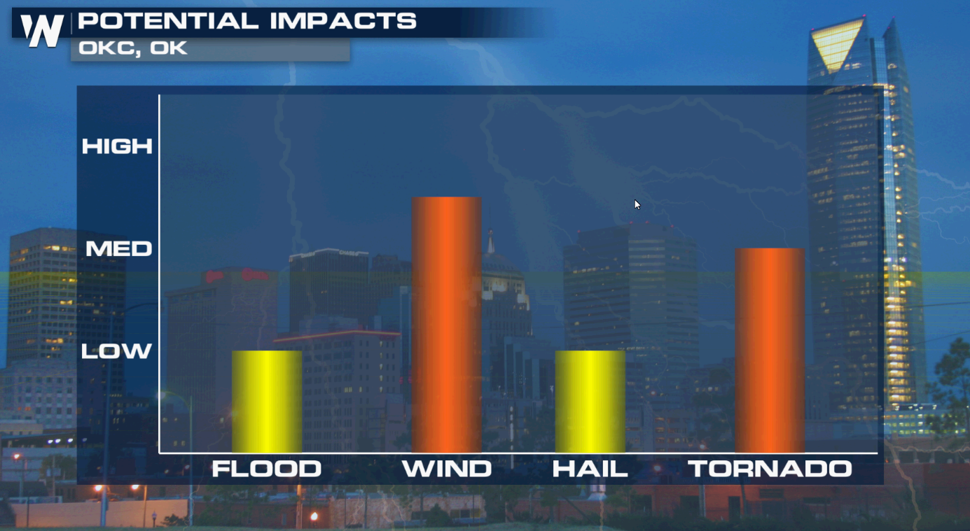
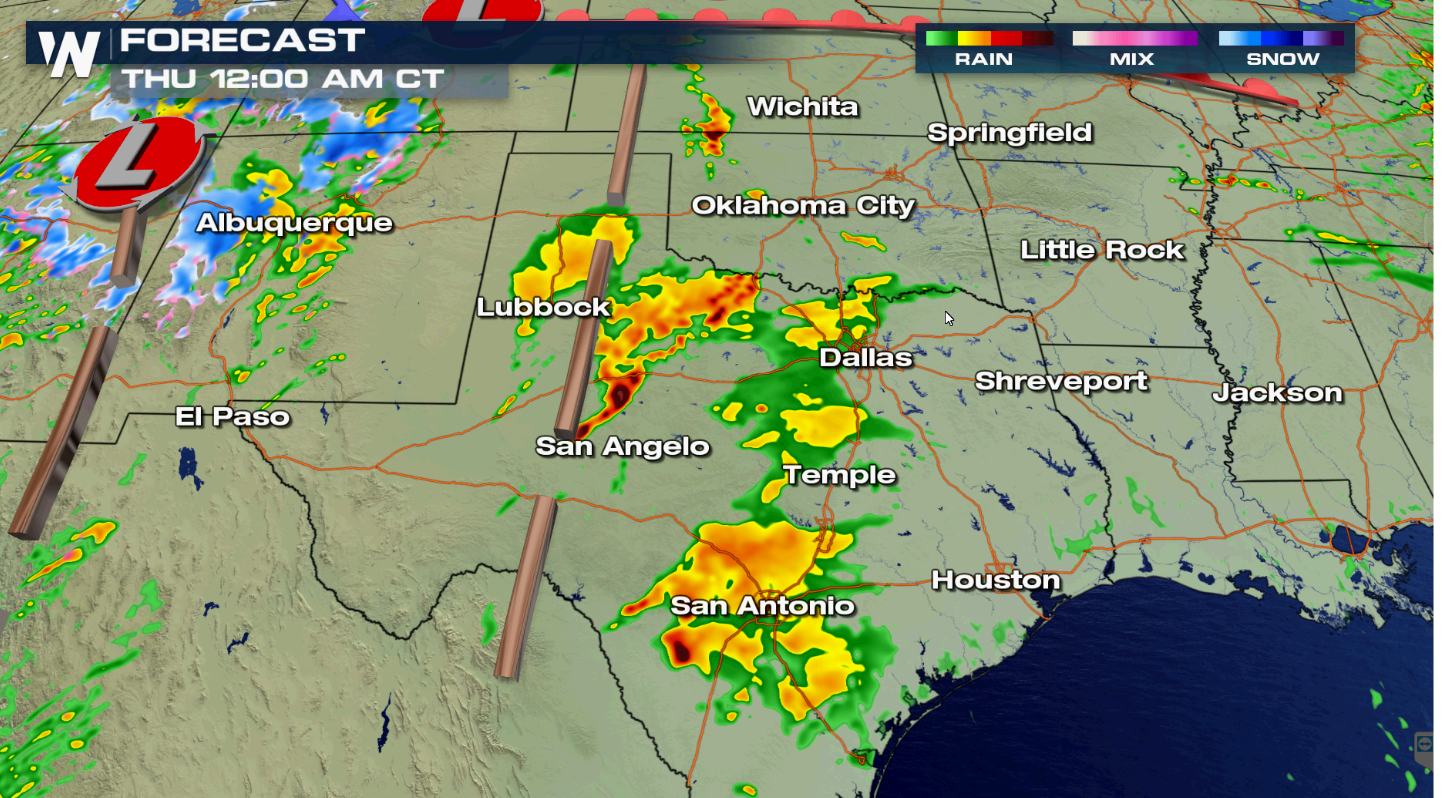 Oklahoma City and the Dallas-Fort Worth metroplex may see severe thunderstorms. Heavy rain, strong wind gusts and isolated tornadoes are all possible.
 Watches and warnings will likely be issued throughout the day. Be prepared for severe weather later today (Wednesday) if you are in the risk areas. WeatherNation will keep you up-to-date on-air and online with the latest severe weather information.
A rich flow of high humidity from the Gulf of Mexico is pushing across the region, ahead of a dryline. With temperatures climbing throughout the day, instability will increase, aiding in severe thunderstorm development. Multiple episodes and areas of severe thunderstorms are possible into the night (Wednesday).
Oklahoma City and the Dallas-Fort Worth metroplex may see severe thunderstorms. Heavy rain, strong wind gusts and isolated tornadoes are all possible.
Watches and warnings will likely be issued throughout the day. Be prepared for severe weather later today (Wednesday) if you are in the risk areas. WeatherNation will keep you up-to-date on-air and online with the latest severe weather information.All Weather News
More

Flooding, Severe Storms Target the Midwest Again
After an active week of storms across the nor
1 Aug 2026 1:40 AM


After Reaching Category 5, Genevieve Weakens in the Pacific
PacificFausto is now a post-tropical cyclone.
31 Jul 2026 1:30 AM

Flooding Risk Increases as Heavy Rain Targets the Tri-State Area
Tuesday, heavy rainfall moved across the Nort
30 Jul 2026 12:25 AM

Severe Weather: Energy From the Midwest Now in the Southeast
UPPER MIDWEST - Through Monday, dangerous tor
29 Jul 2026 10:30 PM