Severe Thunderstorm Watch Issued for Western Plains
Top Stories
11 May 2018 2:45 PM
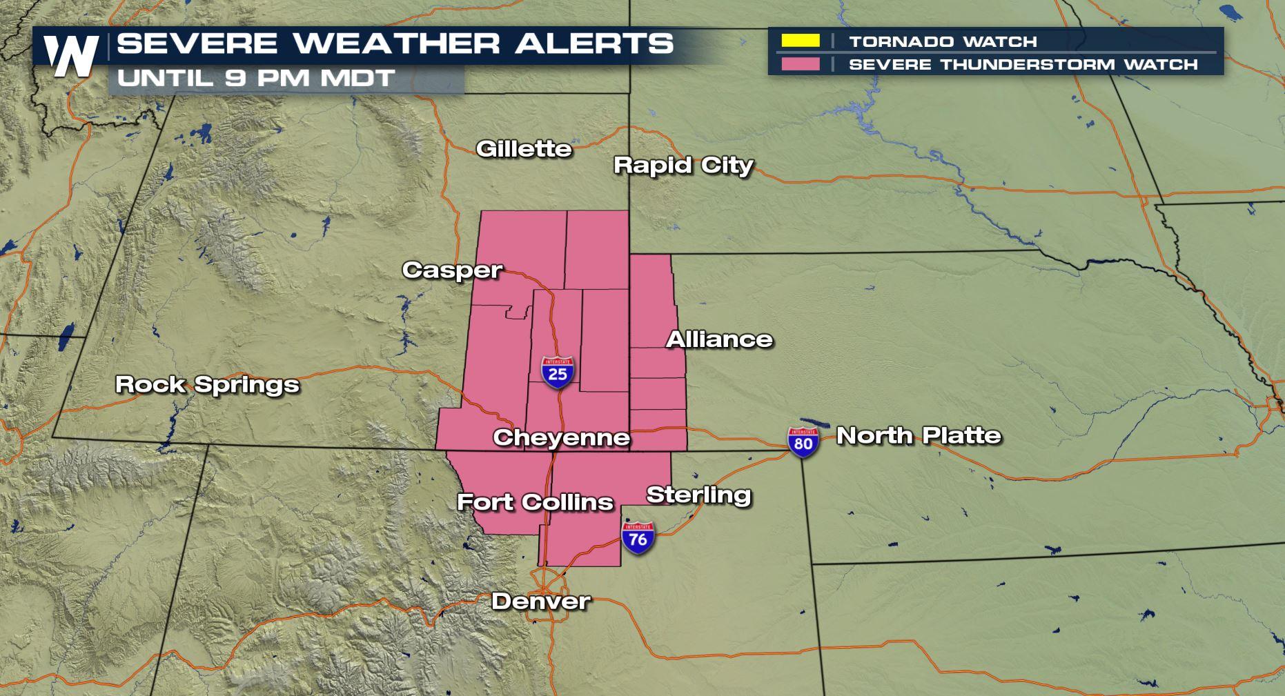
Folks in the Casper, Wyoming to Fort Collins, Colorado area need to watch the weather closely this afternoon and evening because a few severe thunderstorms are expected.
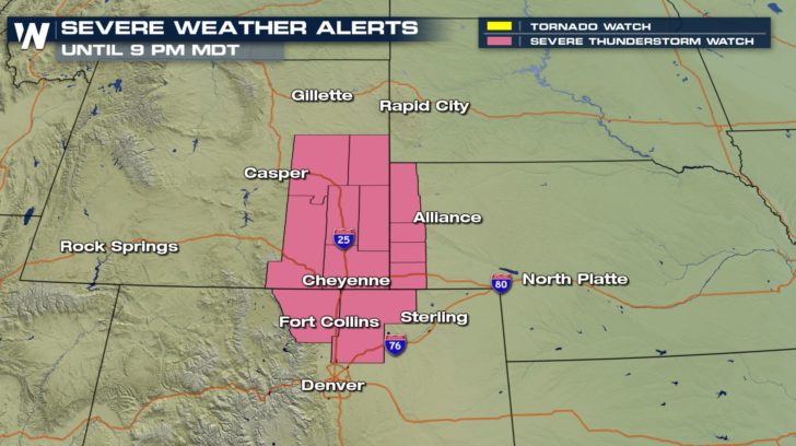 *Severe thunderstorm watch valid for Friday, May 11.*
We are most concerned about big hail and big wind today.
https://twitter.com/WeatherNation/status/995031727134265344
When the watch was originally issued by the Storm Prediction Center, it covered a population of more than 800,000 people. Those in the watch area need to keep an eye to the sky, keep an ear out for thunder, and adhere to instructions within weather alerts!
*Severe thunderstorm watch valid for Friday, May 11.*
We are most concerned about big hail and big wind today.
https://twitter.com/WeatherNation/status/995031727134265344
When the watch was originally issued by the Storm Prediction Center, it covered a population of more than 800,000 people. Those in the watch area need to keep an eye to the sky, keep an ear out for thunder, and adhere to instructions within weather alerts!
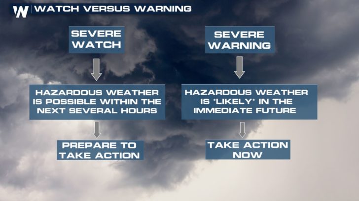 ^^Some good take-home-info between a weather watch and warning^^
This is just one of a couple of areas with the potential of severe weather today.
^^Some good take-home-info between a weather watch and warning^^
This is just one of a couple of areas with the potential of severe weather today.
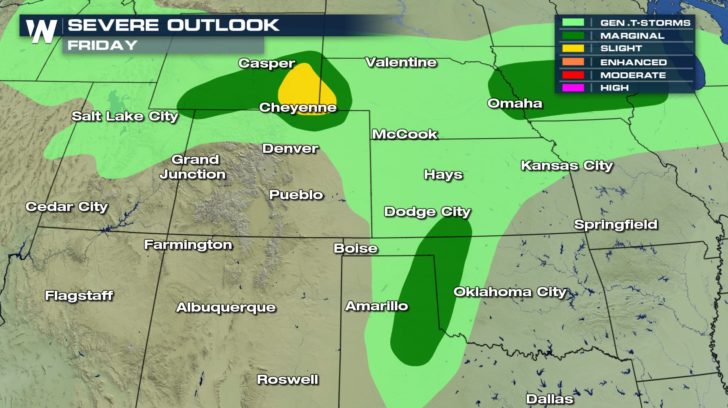 Severe weather outlook for Friday, May 11 where dark green shows a marginal risk of severe weather and yellow means a slight risk (higher than marginal).
Marginal Risk = Isolated severe thunderstorms are expected, however limited in coverage and/or duration
Slight Risk = Scattered severe thunderstorms are expected, some more intense and longer-lasting
Severe weather outlook for Friday, May 11 where dark green shows a marginal risk of severe weather and yellow means a slight risk (higher than marginal).
Marginal Risk = Isolated severe thunderstorms are expected, however limited in coverage and/or duration
Slight Risk = Scattered severe thunderstorms are expected, some more intense and longer-lasting
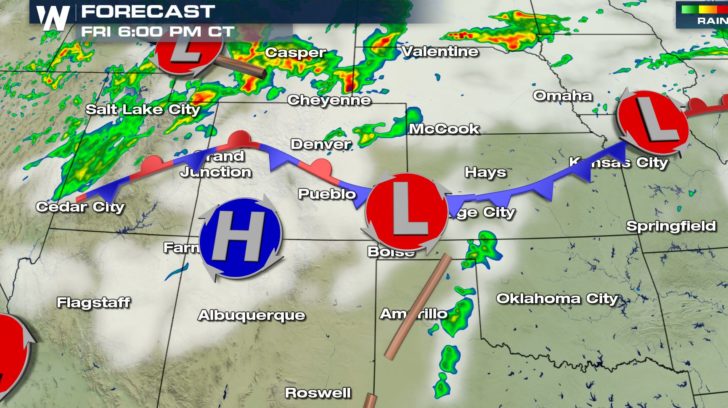 The forecast radar (colors) and clouds (white) for 6 p.m. central and 5 p.m. mountain time Friday, May 11
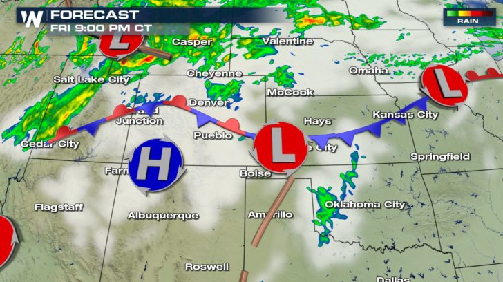 The forecast radar and clouds for the rest of today shows these slow-moving thunderstorms (mainly yellow and red here) moving to the east-northeast. Notice the yellow and reds aren't widespread, meaning these thunderstorms will be here and there, not everywhere.
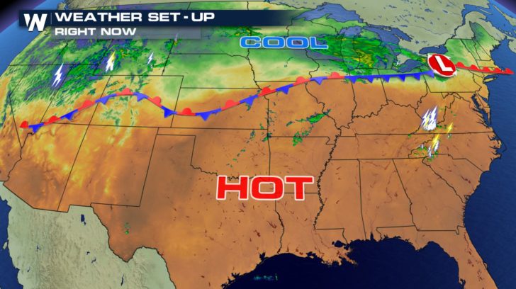 The thunderstorms are popping up along a long boundary separating hot and cool air. Record heat is likely across much of the South, while winter storm warnings are in effect for parts of Wyoming!
For WeatherNation, Meteorologist Steve Glazier
The thunderstorms are popping up along a long boundary separating hot and cool air. Record heat is likely across much of the South, while winter storm warnings are in effect for parts of Wyoming!
For WeatherNation, Meteorologist Steve Glazier
*Severe thunderstorm watch valid for Friday, May 11.*
We are most concerned about big hail and big wind today.
https://twitter.com/WeatherNation/status/995031727134265344
When the watch was originally issued by the Storm Prediction Center, it covered a population of more than 800,000 people. Those in the watch area need to keep an eye to the sky, keep an ear out for thunder, and adhere to instructions within weather alerts!
^^Some good take-home-info between a weather watch and warning^^
This is just one of a couple of areas with the potential of severe weather today.
Severe weather outlook for Friday, May 11 where dark green shows a marginal risk of severe weather and yellow means a slight risk (higher than marginal).
Marginal Risk = Isolated severe thunderstorms are expected, however limited in coverage and/or duration
Slight Risk = Scattered severe thunderstorms are expected, some more intense and longer-lasting
The forecast radar (colors) and clouds (white) for 6 p.m. central and 5 p.m. mountain time Friday, May 11
The forecast radar and clouds for the rest of today shows these slow-moving thunderstorms (mainly yellow and red here) moving to the east-northeast. Notice the yellow and reds aren't widespread, meaning these thunderstorms will be here and there, not everywhere.
The thunderstorms are popping up along a long boundary separating hot and cool air. Record heat is likely across much of the South, while winter storm warnings are in effect for parts of Wyoming!
For WeatherNation, Meteorologist Steve GlazierAll Weather News
More
Wildfire Outbreak in the Pacific Northwest
SPOKANE, WA - On Saturday, August 1st, the Ol
3 Aug 2026 1:55 AM

More Storms for the East Through Monday
A low-pressure system that moved through the
3 Aug 2026 1:50 AM


After Reaching Category 5, Genevieve Weakens in the Pacific
PacificGenevieve formed last Friday south of
3 Aug 2026 12:30 AM

Flooding, Severe Storms Target the Midwest Again
After an active week of storms across the nor
1 Aug 2026 1:40 AM

Flooding Risk Increases as Heavy Rain Targets the Tri-State Area
Tuesday, heavy rainfall moved across the Nort
30 Jul 2026 12:25 AM

Severe Weather: Energy From the Midwest Now in the Southeast
UPPER MIDWEST - Through Monday, dangerous tor
29 Jul 2026 10:30 PM