Severe Weather Chances for the Central U.S.

Special Stories
8 Sep 2019 7:01 AM
SEVERE OUTLOOK
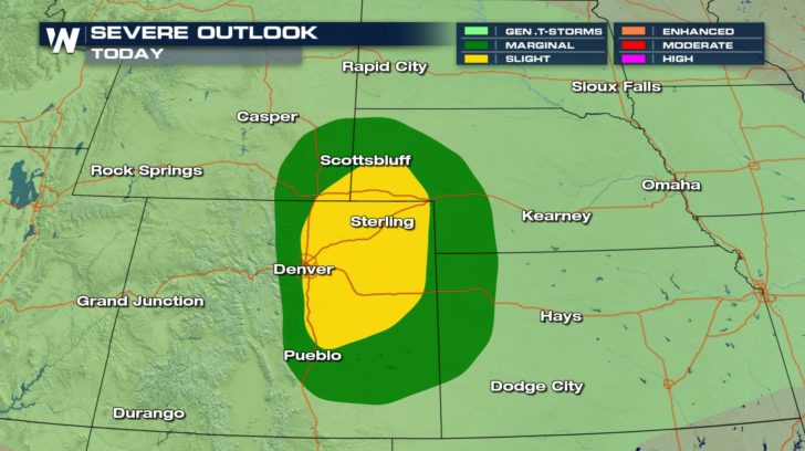
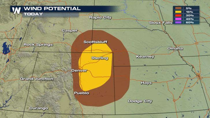
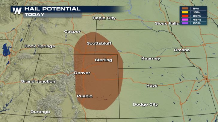 A chance of severe thunderstorms exists for areas of Colorado, Wyoming, Nebraska, and Kansas, today.
Possible isolated to scattered severe thunderstorms could bring damaging winds and small hail to these areas. Winds could reach anywhere from 58 mph to 70 mph within some of these storms, and hail could reach up to an inch in diameter.
There is no tornado risk as of now.
A chance of severe thunderstorms exists for areas of Colorado, Wyoming, Nebraska, and Kansas, today.
Possible isolated to scattered severe thunderstorms could bring damaging winds and small hail to these areas. Winds could reach anywhere from 58 mph to 70 mph within some of these storms, and hail could reach up to an inch in diameter.
There is no tornado risk as of now.
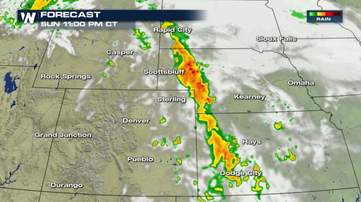
FORECAST
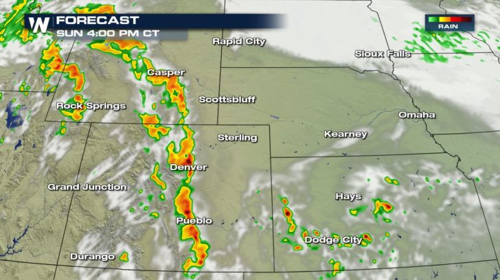
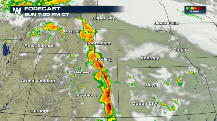
 Rain chances across the Rockies will start early afternoon. The storms will intensify around 3 PM to 4 PM near the Denver and Pueblo areas. These storms will continue to move across eastern Colorado towards the end of the day.
As we head into our Monday morning, some areas in Nebraska might wake up to a few strong thunderstorms for the start to the work week.
Rain chances across the Rockies will start early afternoon. The storms will intensify around 3 PM to 4 PM near the Denver and Pueblo areas. These storms will continue to move across eastern Colorado towards the end of the day.
As we head into our Monday morning, some areas in Nebraska might wake up to a few strong thunderstorms for the start to the work week.
All Weather News
More
East Gears Up for Stormy, Wet Weekend
A low pressure system crashing through the Mi
1 Aug 2026 11:35 AM


Flooding, Severe Storms Target the Midwest Again
After an active week of storms across the nor
1 Aug 2026 1:40 AM


After Reaching Category 5, Genevieve Weakens in the Pacific
PacificFausto is now a post-tropical cyclone.
31 Jul 2026 1:30 AM

Flooding Risk Increases as Heavy Rain Targets the Tri-State Area
Tuesday, heavy rainfall moved across the Nort
30 Jul 2026 12:25 AM

Severe Weather: Energy From the Midwest Now in the Southeast
UPPER MIDWEST - Through Monday, dangerous tor
29 Jul 2026 10:30 PM