Severe Weather Continues to Plague Upper Midwest
Special Stories
3 Sep 2018 6:45 PM
We have continued to see back to back to back days of severe weather across much of the same region. That includes states like Iowa and Wisconsin. The risk for isolated severe storms is once again across the Upper Midwest on Tuesday.
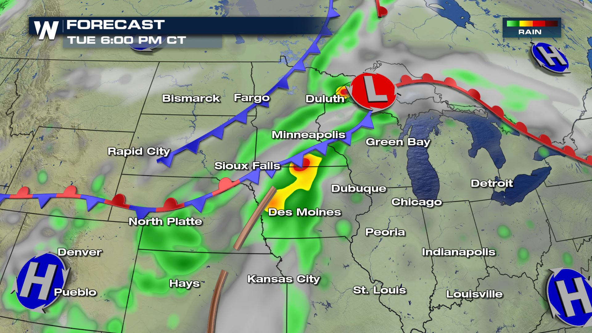
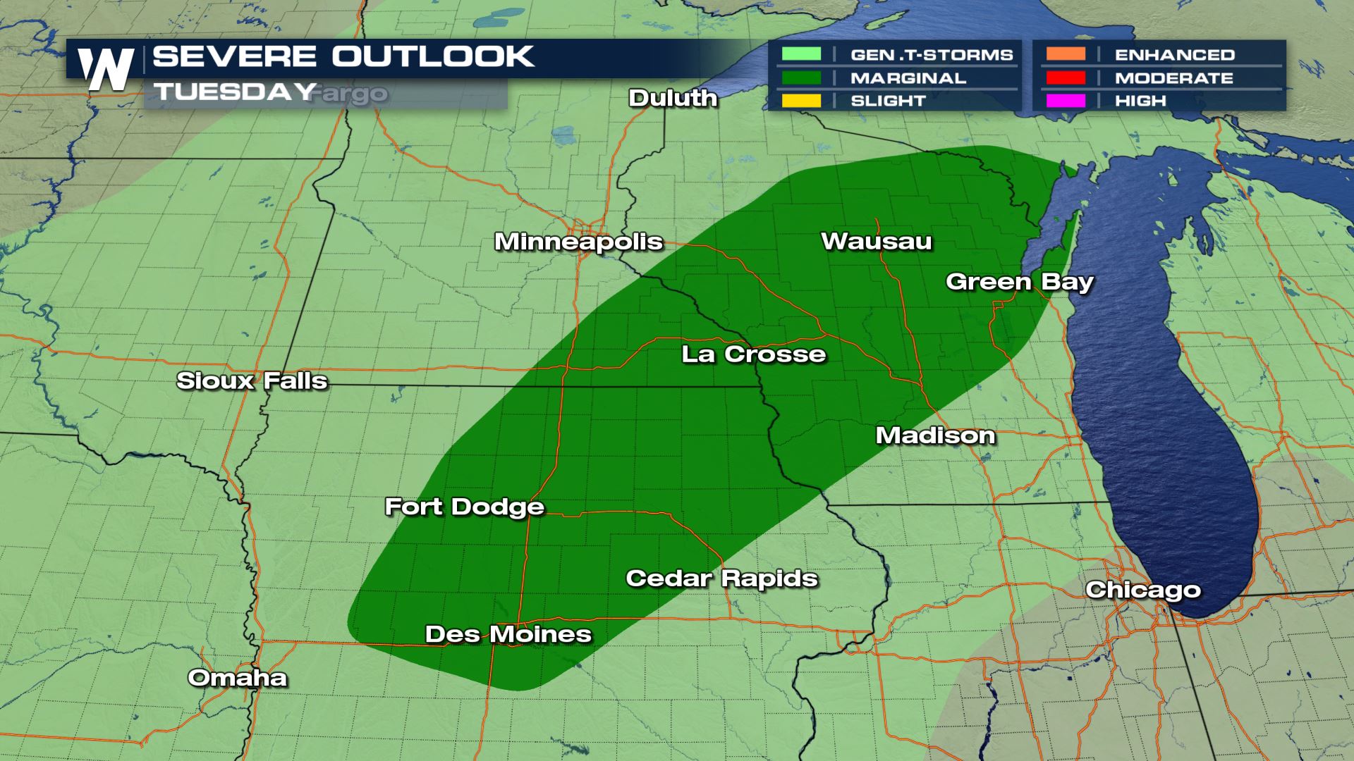 The reason for the threat for severe is because of another low pressure system pulling across the area. Out ahead of the cold front, warm, humid air will be pumped into the region. This will help to make the atmosphere more buoyant. Strong to severe storms will be possible along the cold front into the afternoon and evening hours. Since there will be ample moisture in the atmosphere as well, any of these storms can produce heavy downpours.
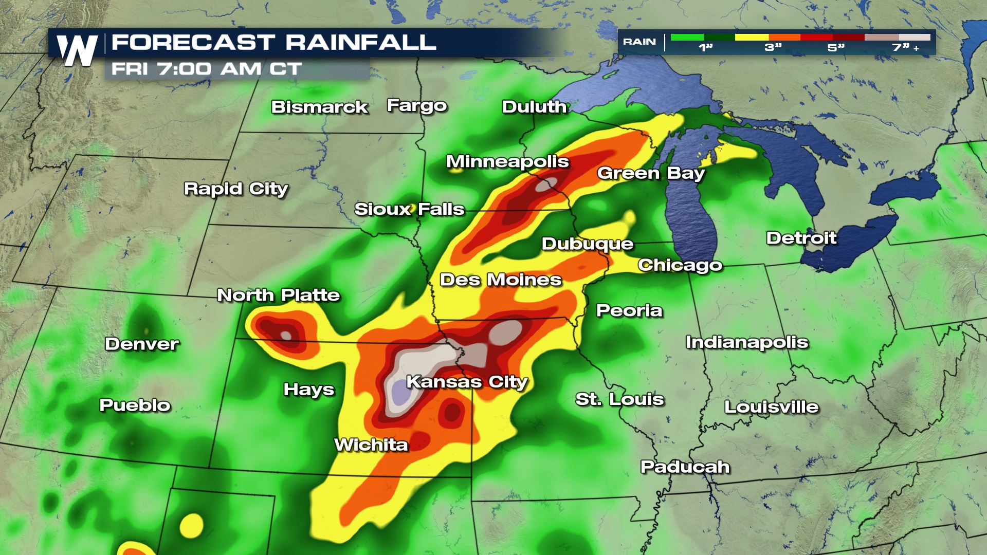
 Since we will see another few days of showers and storms, rain totals could be adding up to several inches in some spots. This heavy rain coupled with the already saturated ground means that flash flooding is a major concern for the first half of this week.
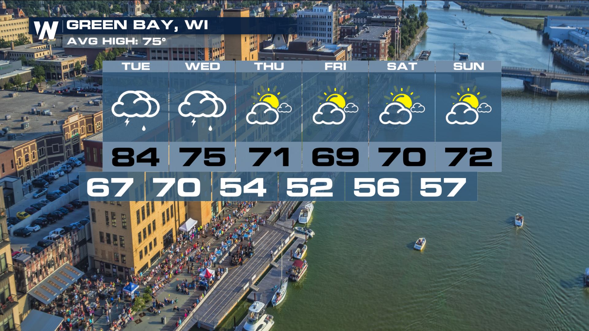
 Much of southern Wisconsin will receive more heavy rain Tuesday and Wednesday before high pressure slides in and gives the area a break from the constant showers and storms.
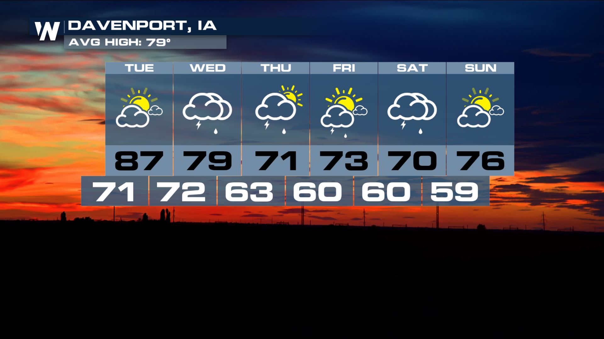
 Areas like Davenport however could see more heavy rain Wednesday then a break more or less to end the week. The region could potentially see more heavy rain with the remnants of what is now Tropical Storm Gordon. You can read the latest about Tropical Gordon here.
 For WeatherNation, Meteorologist Kate Mantych
 The reason for the threat for severe is because of another low pressure system pulling across the area. Out ahead of the cold front, warm, humid air will be pumped into the region. This will help to make the atmosphere more buoyant. Strong to severe storms will be possible along the cold front into the afternoon and evening hours. Since there will be ample moisture in the atmosphere as well, any of these storms can produce heavy downpours.
 Since we will see another few days of showers and storms, rain totals could be adding up to several inches in some spots. This heavy rain coupled with the already saturated ground means that flash flooding is a major concern for the first half of this week.
 Much of southern Wisconsin will receive more heavy rain Tuesday and Wednesday before high pressure slides in and gives the area a break from the constant showers and storms.
 Areas like Davenport however could see more heavy rain Wednesday then a break more or less to end the week. The region could potentially see more heavy rain with the remnants of what is now Tropical Storm Gordon. You can read the latest about Tropical Gordon here.
 For WeatherNation, Meteorologist Kate Mantych
All Weather News
More