Eclipse Over, Hail and Tornado Threat as People Head Home
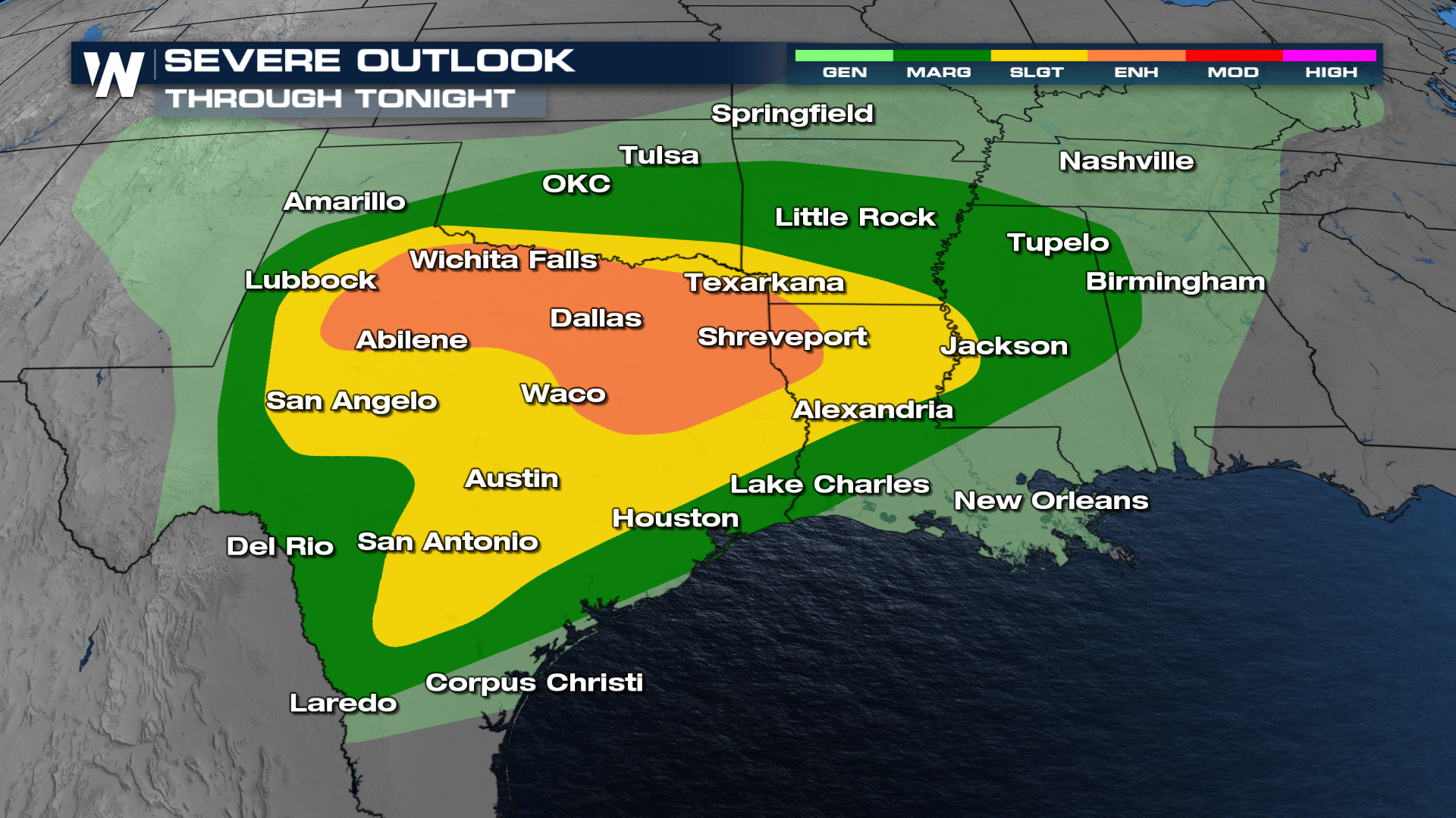
The Storm Prediction Center has highlighted an ENHANCED risk (level 3 out of 5) overnight for strong to severe thunderstorms for cities including Wichita Falls, Abilene, Dallas, and Fort Worth, Texas. Surrounding the orange enhanced risk we have a yellow SLIGHT risk (level 2 out of 5).
 Within this enhanced risk, the SPC's greatest threat for the Texoma area - Wichita Falls, Lawton, Bowie - is the potential for large and damaging hail. In addition to the standard hail threat, there is a significant threat of large hail. This means hail could grow as large as 2" in diameter. This is also where we find our tornado threat as the same updrafts that support large hail also produce the tornado potential.
 Storms, for the most part, waited until the eclipse had moved through the area, but the threat increases tonight as people travel back home. There will be heavy rain in Oklahoma and Arkansas, which will make travel home from the eclipse a challenge. The heaviest rain will be north of I-20 with individual supercells and severe weather the focus around I-20 west of the DFW metroplex.
For more details on the longevity of this severe weather risk be sure to check our our related website article: Severe Storms in the South This Week