Severe Weather Likely for the Southeast and East Coast Monday
Special Stories
30 Nov 2020 9:00 AM
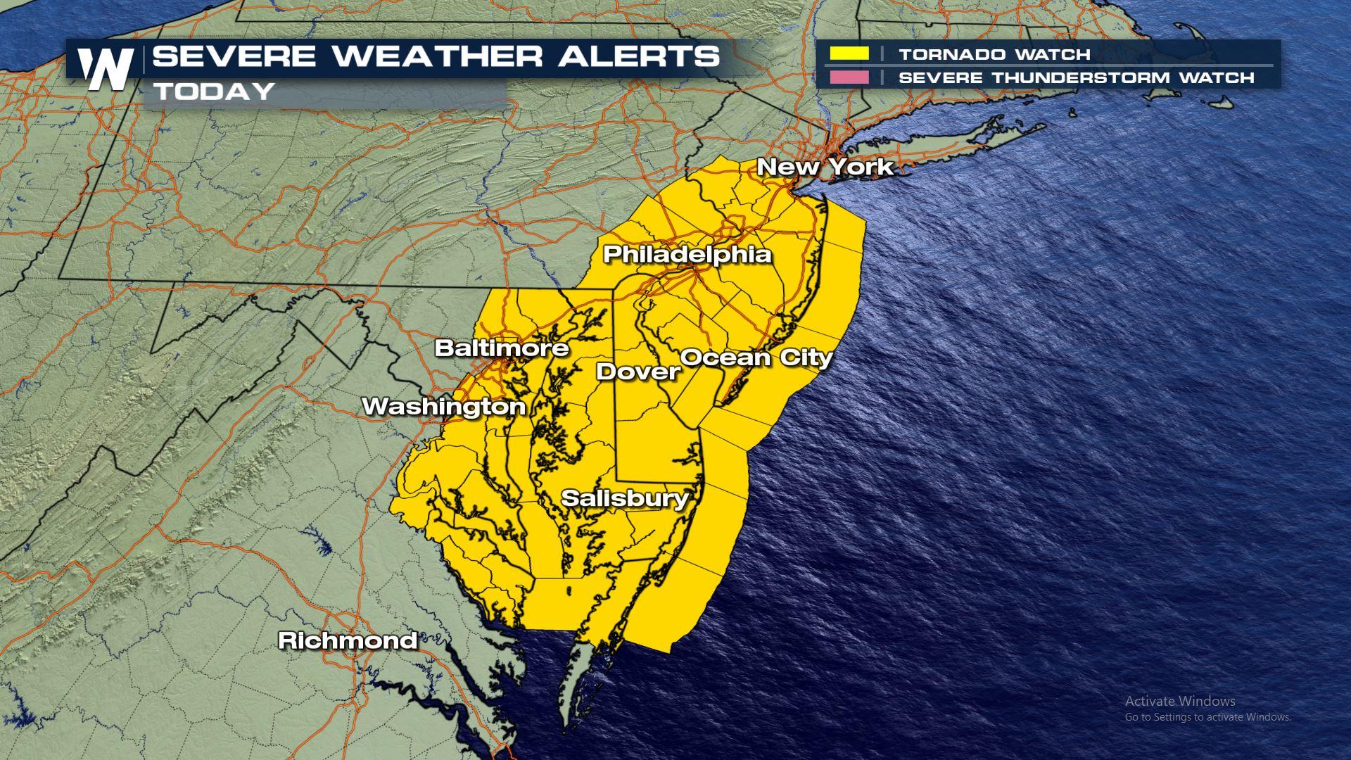
*Breaking* A tornado watch has been issued for parts of Maryland, Delaware, New Jersey and Pennsylvania through Monday evening.
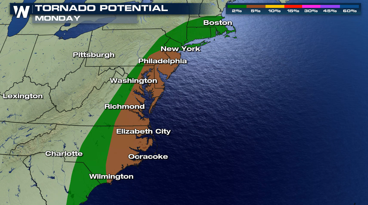
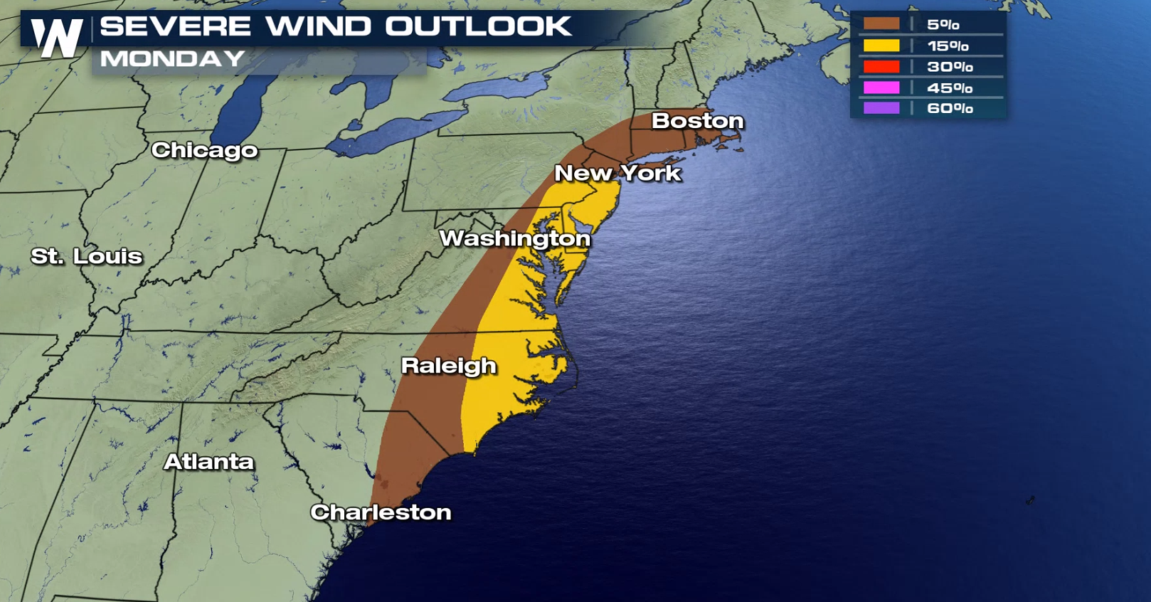
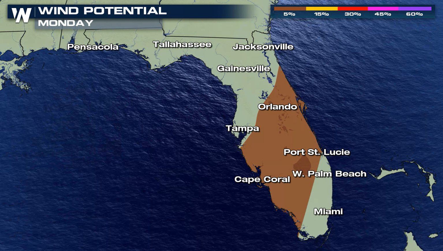
 Jet stream energy will allow for a severe set-up and create deep and strong wind shear across the Middle Atlantic, leading to the potential for storms to create damaging wind gusts and perhaps a few isolated tornadoes.
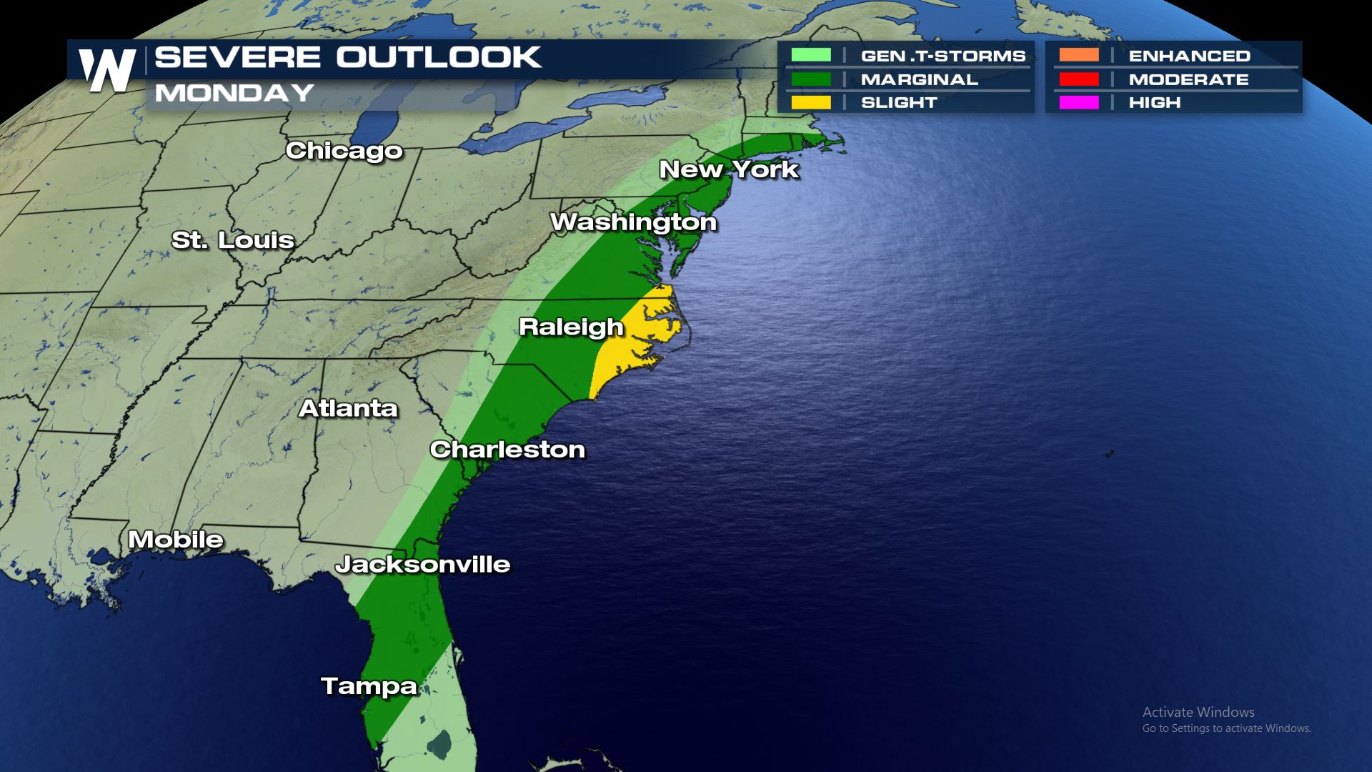 Tornadoes and damaging winds will be the primary weather risks with this severe set-up. The hail potential is low.
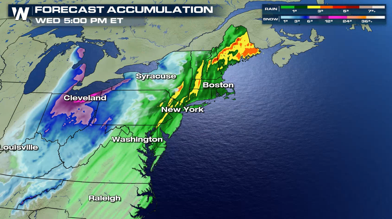
 The cold front will sweep through the Middle Atlantic during the day, bringing a few severe thunderstorms. Heavy rain and isolated severe storms into the Northeast.
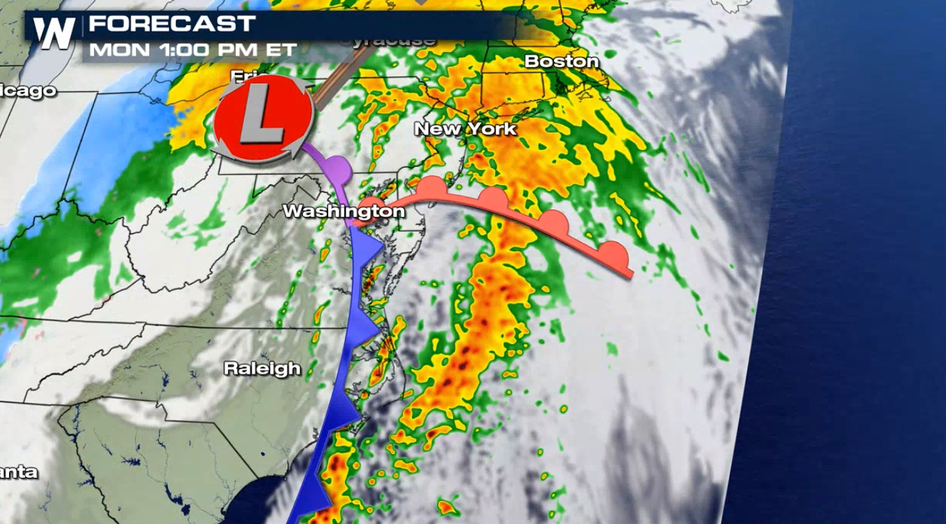
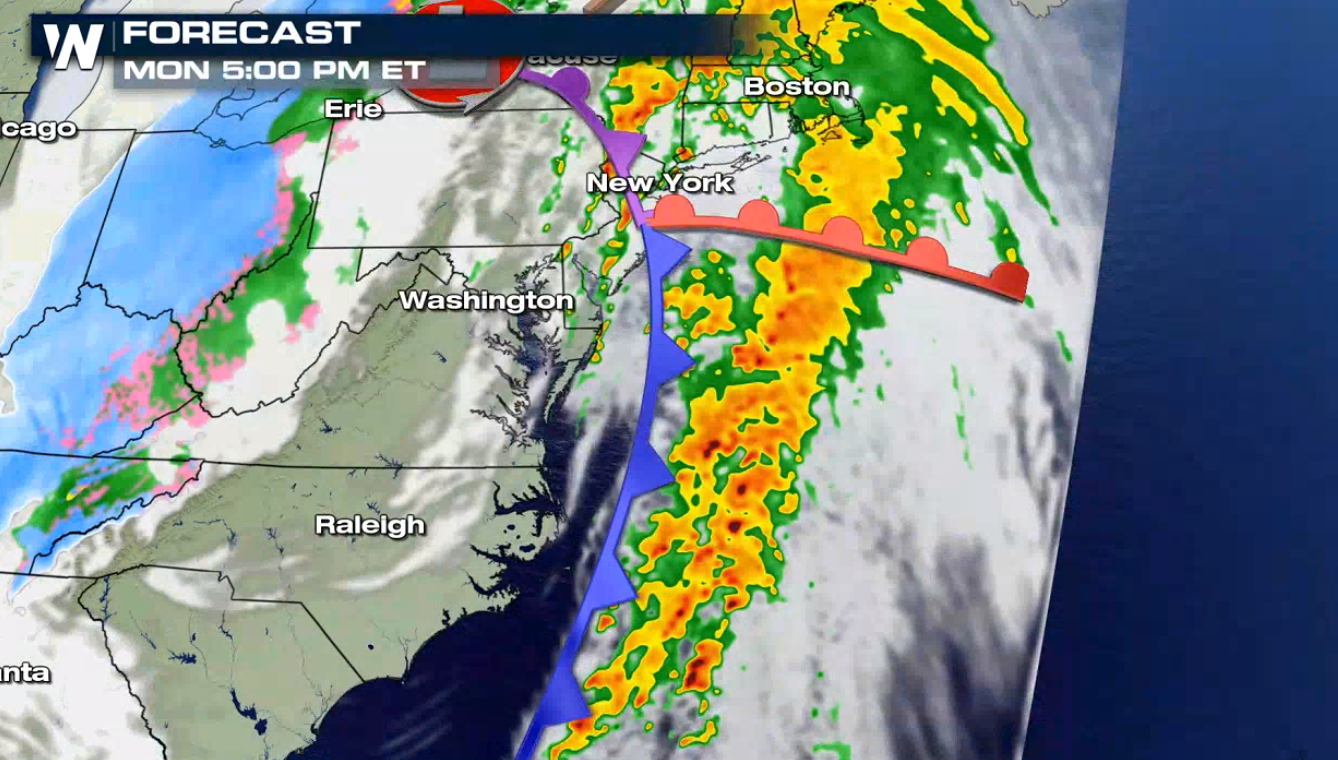
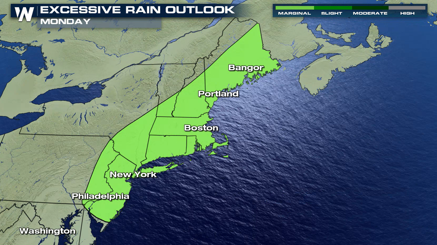
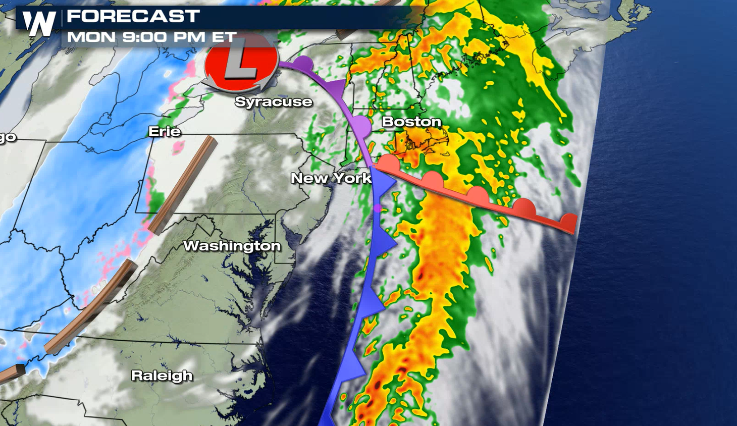 Rain totals will be anywhere from 1-4" with locally higher amounts possible. Flooding from heavy rain will be another hazard, especially in flood prone areas.
 Stay with WeatherNation for the latest on this powerful system and other top weather headlines.
Jet stream energy will allow for a severe set-up and create deep and strong wind shear across the Middle Atlantic, leading to the potential for storms to create damaging wind gusts and perhaps a few isolated tornadoes.
Tornadoes and damaging winds will be the primary weather risks with this severe set-up. The hail potential is low.
The cold front will sweep through the Middle Atlantic during the day, bringing a few severe thunderstorms. Heavy rain and isolated severe storms into the Northeast.
Rain totals will be anywhere from 1-4" with locally higher amounts possible. Flooding from heavy rain will be another hazard, especially in flood prone areas.
Stay with WeatherNation for the latest on this powerful system and other top weather headlines.All Weather News
More
Severe Storm Threat Returns to the Midwest
After several tornadoes ripped through the Mi
31 Jul 2026 2:20 AM


After Reaching Category 5, Genevieve Weakens in the Pacific
PacificFausto is now a post-tropical cyclone.
31 Jul 2026 1:30 AM

Flooding Risk Increases as Heavy Rain Targets the Tri-State Area
Tuesday, heavy rainfall moved across the Nort
30 Jul 2026 12:25 AM

Severe Weather: Energy From the Midwest Now in the Southeast
UPPER MIDWEST - Through Monday, dangerous tor
29 Jul 2026 10:30 PM

Southeast Flood Risk Lingers Near Stalled Front
A stalled boundary over the Southeast will ke
25 Jul 2026 10:55 AM