Severe Weather Continues Thursday
Special Stories
13 Mar 2019 10:12 AM
SEVERE POTENTIAL
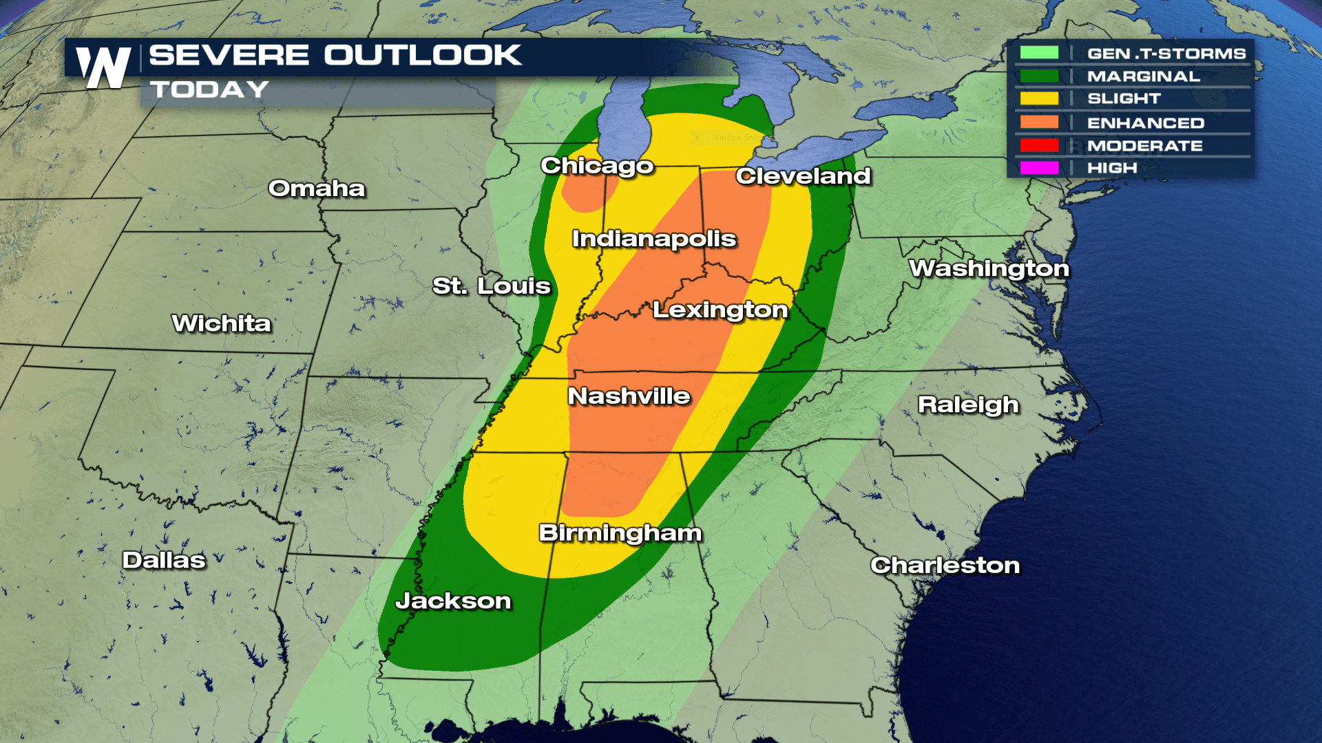
 Severe weather is in the forecast for today.
An enhanced risk of severe weather is already in place for areas like Nashville, Lexington and Chicago. This means scattered severe thunderstorms will be possible.
FORECAST
Severe weather is in the forecast for today.
An enhanced risk of severe weather is already in place for areas like Nashville, Lexington and Chicago. This means scattered severe thunderstorms will be possible.
FORECAST
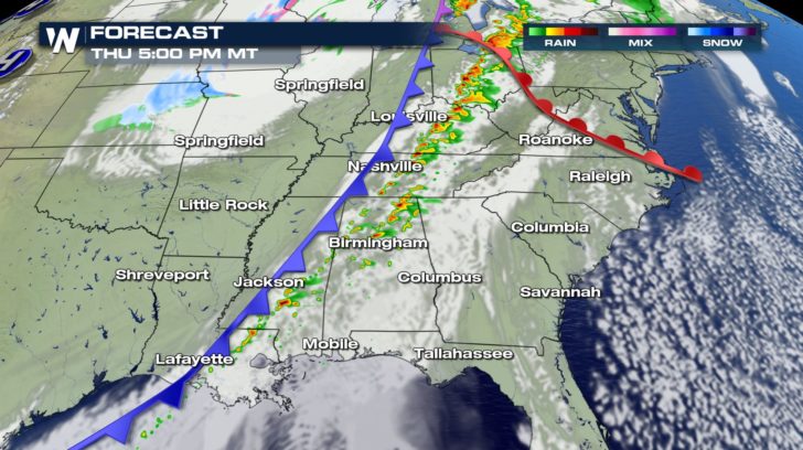

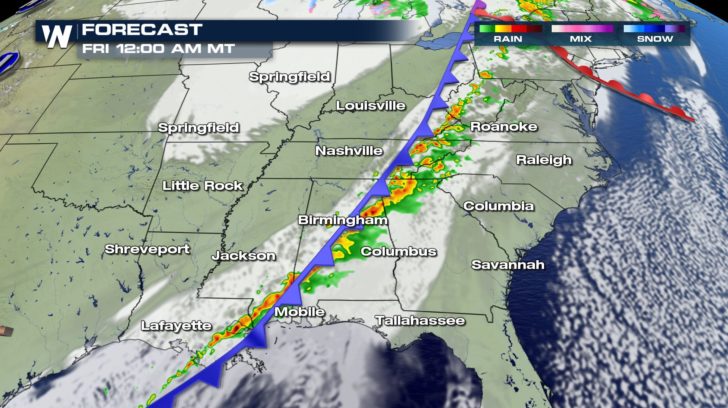 Once we roll into Thursday afternoon, the chance of severe weather sparks back up. A line of strong storms starts to form again, and everything from damaging winds to isolated tornadoes will be possible.
This line of storms will stay organized until Friday morning.
RAINFALL FORECAST
Once we roll into Thursday afternoon, the chance of severe weather sparks back up. A line of strong storms starts to form again, and everything from damaging winds to isolated tornadoes will be possible.
This line of storms will stay organized until Friday morning.
RAINFALL FORECAST
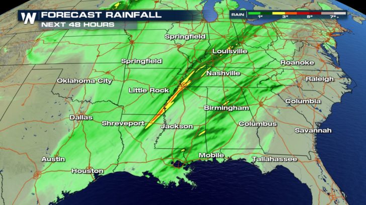 Heavy rain will also accompany these strong storms. Up to 4 inches of rain will be possible for some cities over the next 24 hours.
Expect minor river flooding and ponding on roads to be occurring throughout the day.
For WeatherNation, I'm Meteorologist Greg Rule
Heavy rain will also accompany these strong storms. Up to 4 inches of rain will be possible for some cities over the next 24 hours.
Expect minor river flooding and ponding on roads to be occurring throughout the day.
For WeatherNation, I'm Meteorologist Greg Rule
Severe weather is in the forecast for today.
An enhanced risk of severe weather is already in place for areas like Nashville, Lexington and Chicago. This means scattered severe thunderstorms will be possible.
FORECAST
Once we roll into Thursday afternoon, the chance of severe weather sparks back up. A line of strong storms starts to form again, and everything from damaging winds to isolated tornadoes will be possible.
This line of storms will stay organized until Friday morning.
RAINFALL FORECAST
Heavy rain will also accompany these strong storms. Up to 4 inches of rain will be possible for some cities over the next 24 hours.
Expect minor river flooding and ponding on roads to be occurring throughout the day.
For WeatherNation, I'm Meteorologist Greg RuleAll Weather News
More
Flooding Risk Increases as Heavy Rain Targets the Tri-State Area
Tuesday, heavy rainfall moved across the nort
29 Jul 2026 6:00 PM


Severe Weather: Energy From the Midwest Now in the Southeast
UPPER MIDWEST - Through Monday, dangerous tor
29 Jul 2026 5:30 PM

Tropics: Fausto Heads towards Hawaii; Genevieve a Major Hurricane
PacificTropical Depression Fausto continues t
29 Jul 2026 10:15 AM


Southeast Flood Risk Lingers Near Stalled Front
A stalled boundary over the Southeast will ke
25 Jul 2026 10:55 AM

Another Round of Storms Targets the Northeast
Tuesday brought severe weather again across p
23 Jul 2026 1:15 AM