Severe Weather Threat Across the Southeast
Top Stories
5 Mar 2020 8:30 AM
An energetic upper-level trough will move out of the Southwest and across the South, bringing the potential for severe storms today (Thursday) into the Southeast.
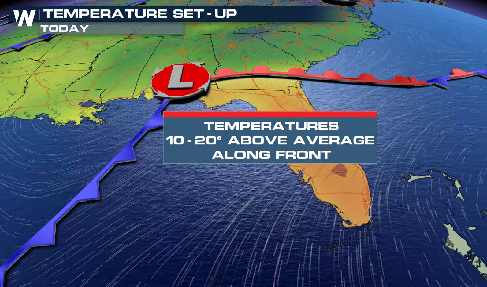 Warm air and plenty of moisture from the Gulf of Mexico will be pulled in ahead of the associated surface front, bringing temperatures up to 10-20° above average to provide plenty of energy for strong to severe thunderstorms.
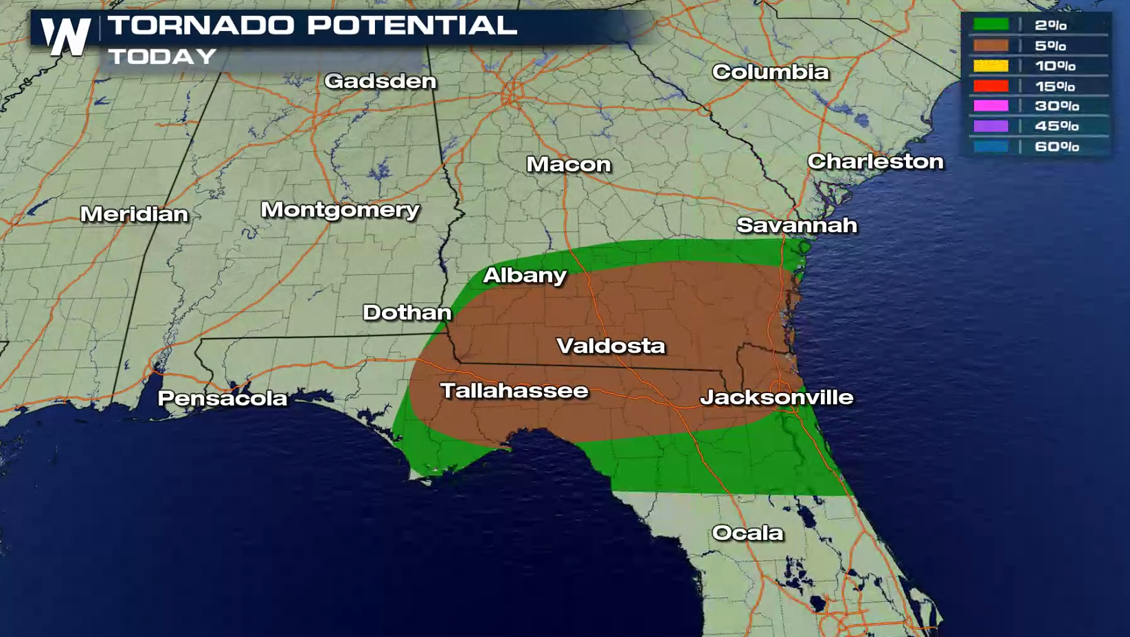
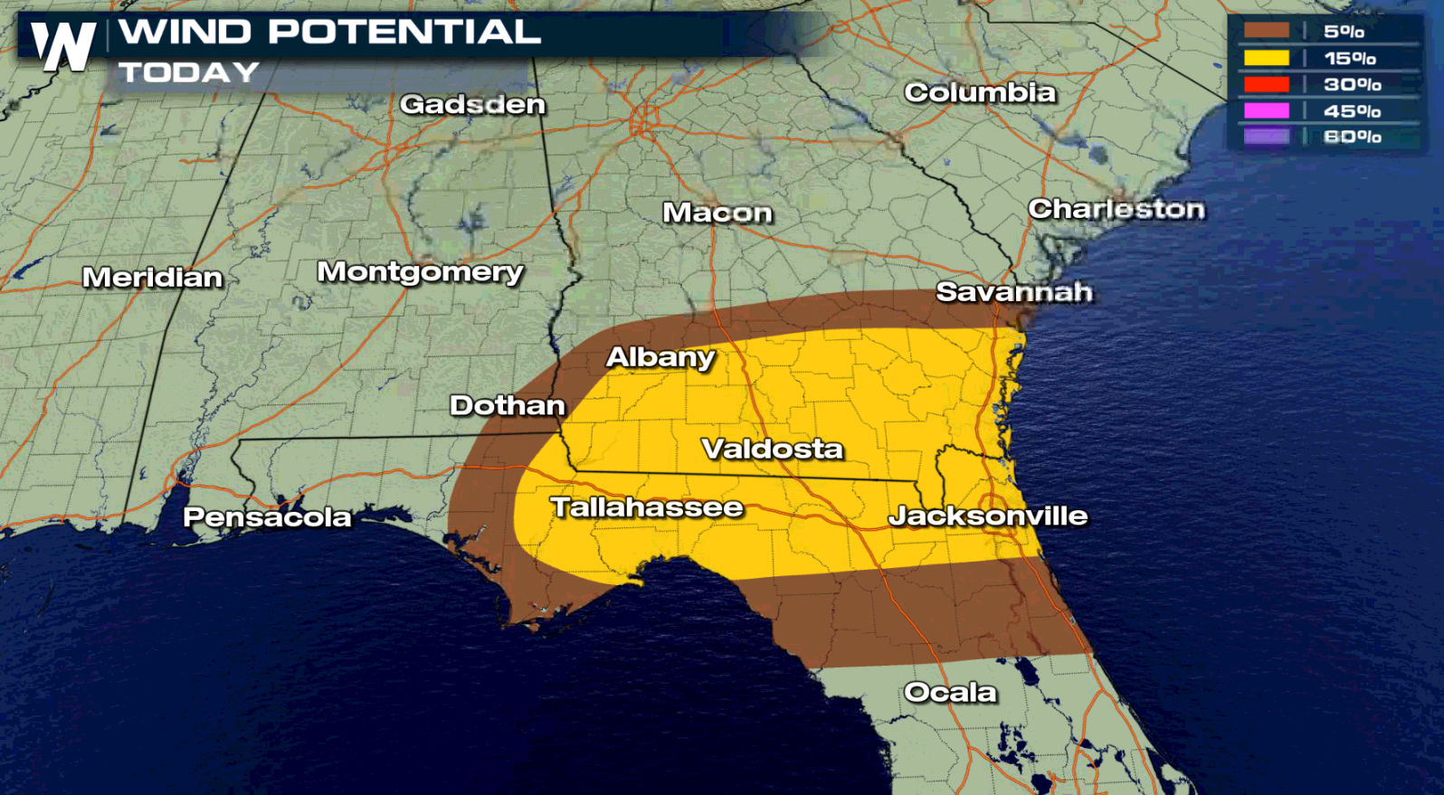
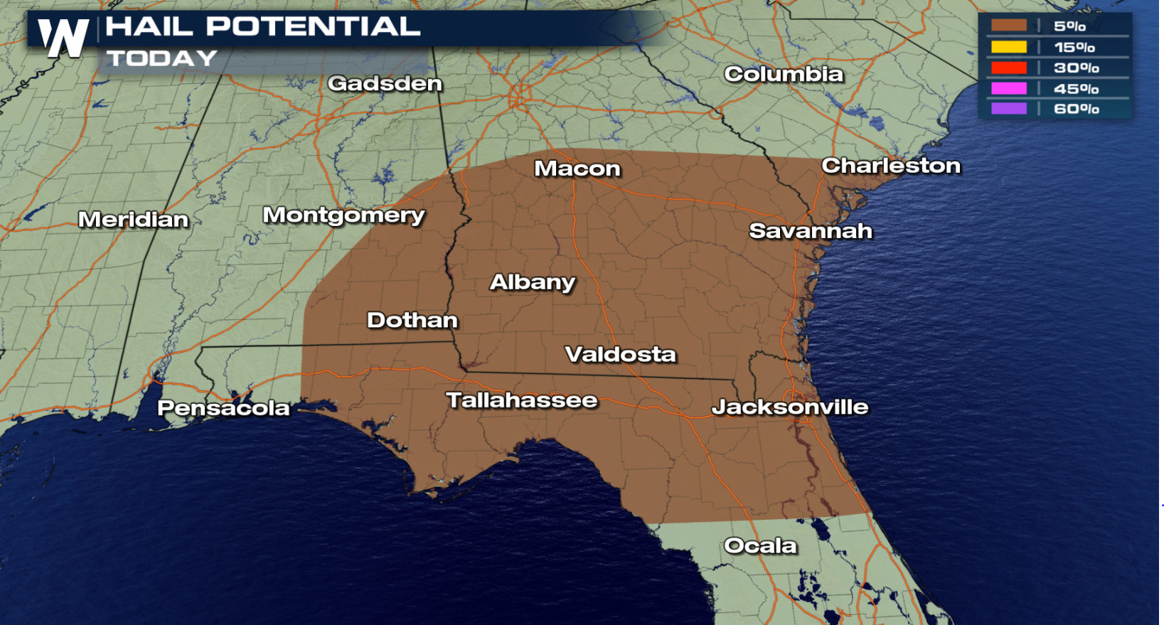
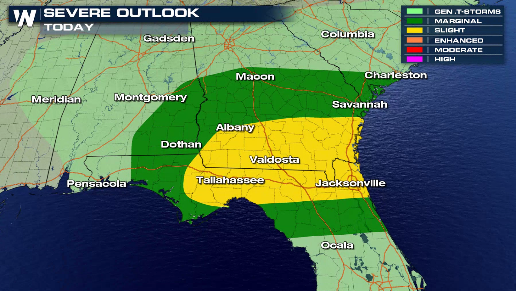 The threat for severe storms extends from Charleston to Florida's Big Bend. Strong wind gusts and isolated tornadoes are the biggest concerns.
 If you live in the risk areas, be sure to check in with WeatherNation on-air and online for the latest forecast, watches, and warnings. Severe thunderstorms are particularly dangerous at night, as already shown this week in Nashville. Meteorologist Meredith Garofalo has a closer look on how you can prepare and protect yourself for nocturnal severe weather in the videos below:
https://youtu.be/_1E7aTHO6nQ
https://www.facebook.com/WeatherNation/videos/450961339119740/
 Warm air and plenty of moisture from the Gulf of Mexico will be pulled in ahead of the associated surface front, bringing temperatures up to 10-20° above average to provide plenty of energy for strong to severe thunderstorms.
 The threat for severe storms extends from Charleston to Florida's Big Bend. Strong wind gusts and isolated tornadoes are the biggest concerns.


 If you live in the risk areas, be sure to check in with WeatherNation on-air and online for the latest forecast, watches, and warnings. Severe thunderstorms are particularly dangerous at night, as already shown this week in Nashville. Meteorologist Meredith Garofalo has a closer look on how you can prepare and protect yourself for nocturnal severe weather in the videos below:
https://youtu.be/_1E7aTHO6nQ
https://www.facebook.com/WeatherNation/videos/450961339119740/
All Weather News
More